Huntsville, AL
Weather Forecast Office
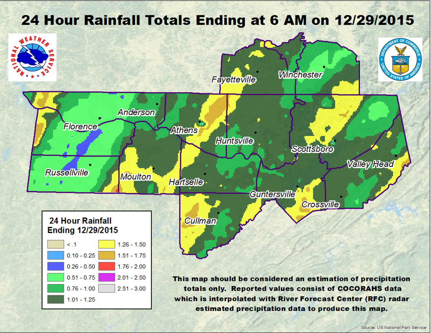
| 1-2 Inches of Rainfall fell December 28 to Prolong Minor Flooding | ||||
 |
||||
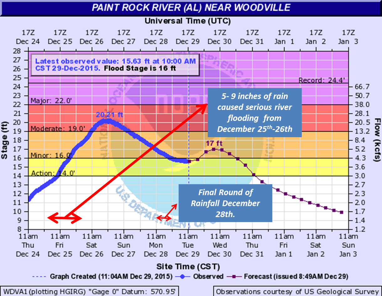
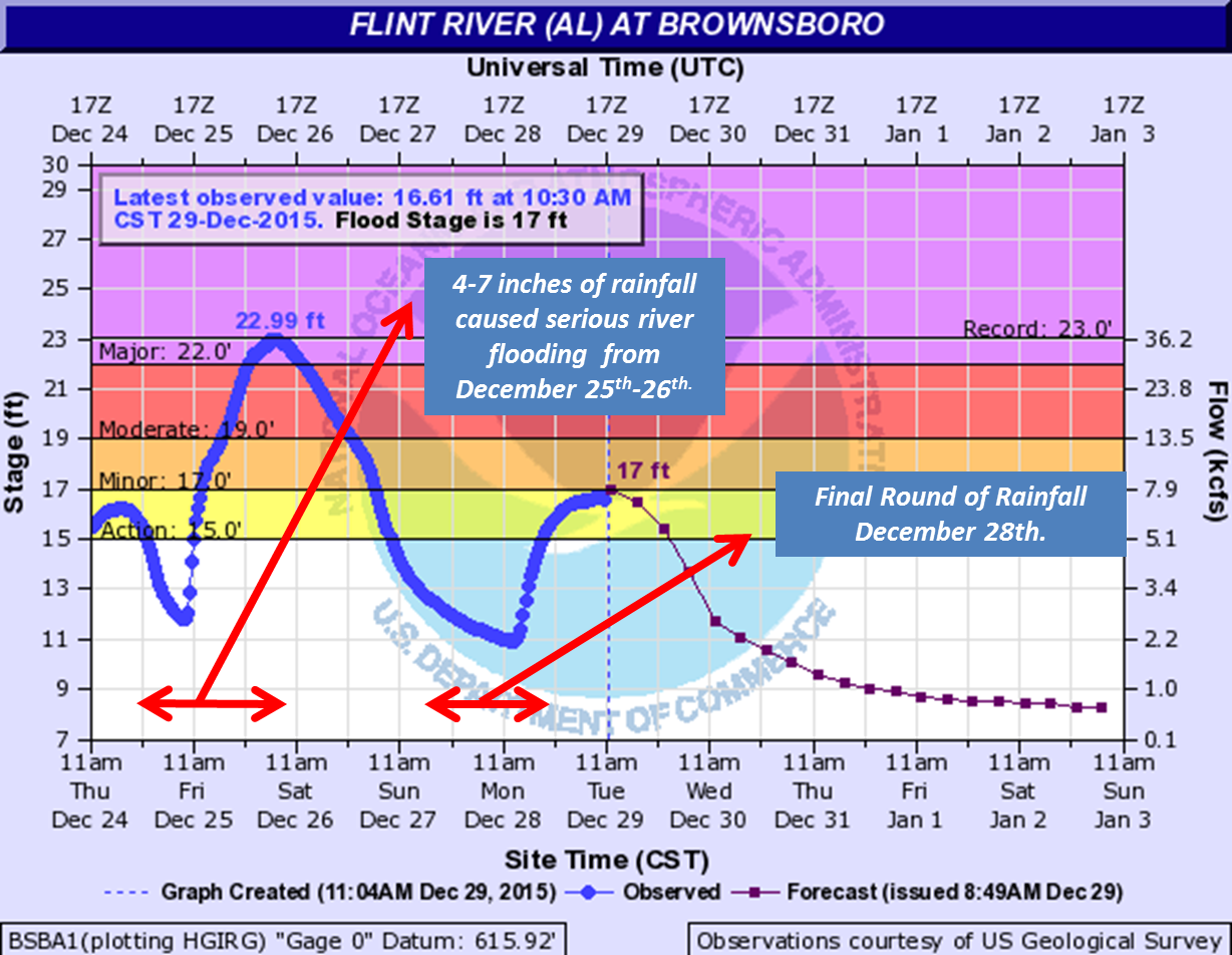
| Heavy Rainfall that fell on December 28 setup major river flooding across the Huntsville forecast area. | ||||
|
||||
 |
||||
| This second shot of heavy rainfall caused rivers to rise above flood stage again along the Tennessee River at Whitesburg | ||||

US Dept of Commerce
National Oceanic and Atmospheric Administration
National Weather Service
Huntsville, AL
320A Sparkman Drive
Huntsville, AL 35805
256-890-8503
Comments? Questions? Please Contact Us.


 Local Radar
 Weather Map
 NWS Huntsville SitRep
 Follow us on X
 Follow us on Facebook
 Follow us on YouTube
 HUN RSS Feed