Huntsville, AL
Weather Forecast Office
|
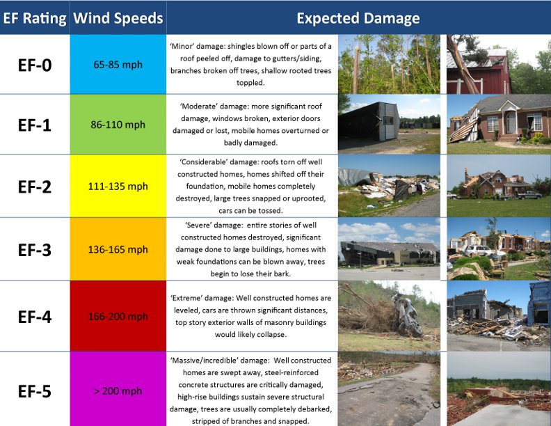
Over the course of April 27th, 2011, damage across the entire range of the EF scale was sustained in some portion of the Huntsville County Warning Forecast Area. Below is a chart that explains what type of damage is associated with each ranking on the EF scale, including example photographs from the April 27th event.
|

US Dept of Commerce
National Oceanic and Atmospheric Administration
National Weather Service
Huntsville, AL
320A Sparkman Drive
Huntsville, AL 35805
256-890-8503
Comments? Questions? Please Contact Us.


 Local Radar
 Weather Map
 NWS Huntsville SitRep
 Follow us on X
 Follow us on Facebook
 Follow us on YouTube
 HUN RSS Feed