
Tropical system in the Gulf expected to gradually strengthen the next couple of days off the Florida Panhandle and Alabama coasts. Instances of flash flooding will be possible through Thursday along the eastern and central Gulf Coast. Severe thunderstorms will develop and move along a cold front crossing the Upper Midwest, and through the Ohio Valley/Mid-Atlantic on Tuesday. Read More >
February 29, 1952 Tornadoes |
||
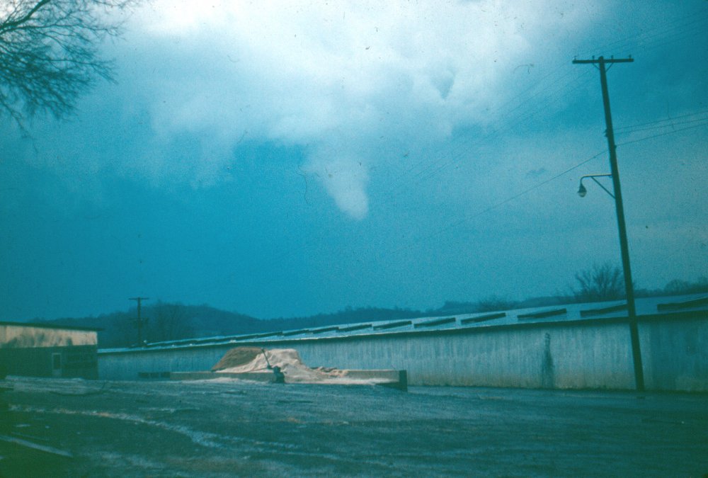
A picture of the destructive F4 Fayetteville Tornado after lifting on the east side of downtown Fayetteville. |
||
| (For more information on the individual tornadoes click one of the images below) | ||
|
||
|
Weather Conditions Surface Conditions
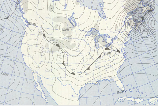
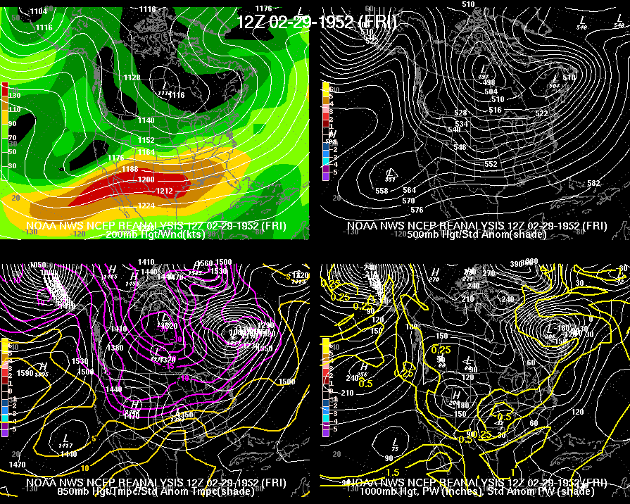
Conditions Aloft The above surface prognostic chart for 1200 UTC (6 a.m. cst) on February 29, 1952 indicated that a strong cold front was extending northeast out of north Texas through central Arkansas into southern Indiana and central Ohio. The 1200 UTC (6 a.m.) re-analyzed upper air charts below indicated at 200 millibars that a strong upper level jet stream was moving northeast out of Texas into the Tennesse valley region with winds ranging from 110 to greater than 130 mph noted by the upper air sounding information collected from area Weather Bureau observation sites. A strong upper level trough at 500 millibars was noted in the second chart below. The trough extended southeast through the central and southern plains states behind the surface cold front. The combination of the strong cold front and the unusually strong jet stream at 200 millibars led to the development of severe thunderstorms and tornadoes across portions of the Tennessee valley in southern middle Tennessee and northeast Alabama.
|


 Local Radar
 Weather Map