|
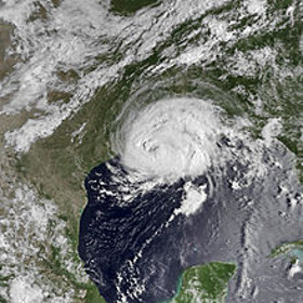
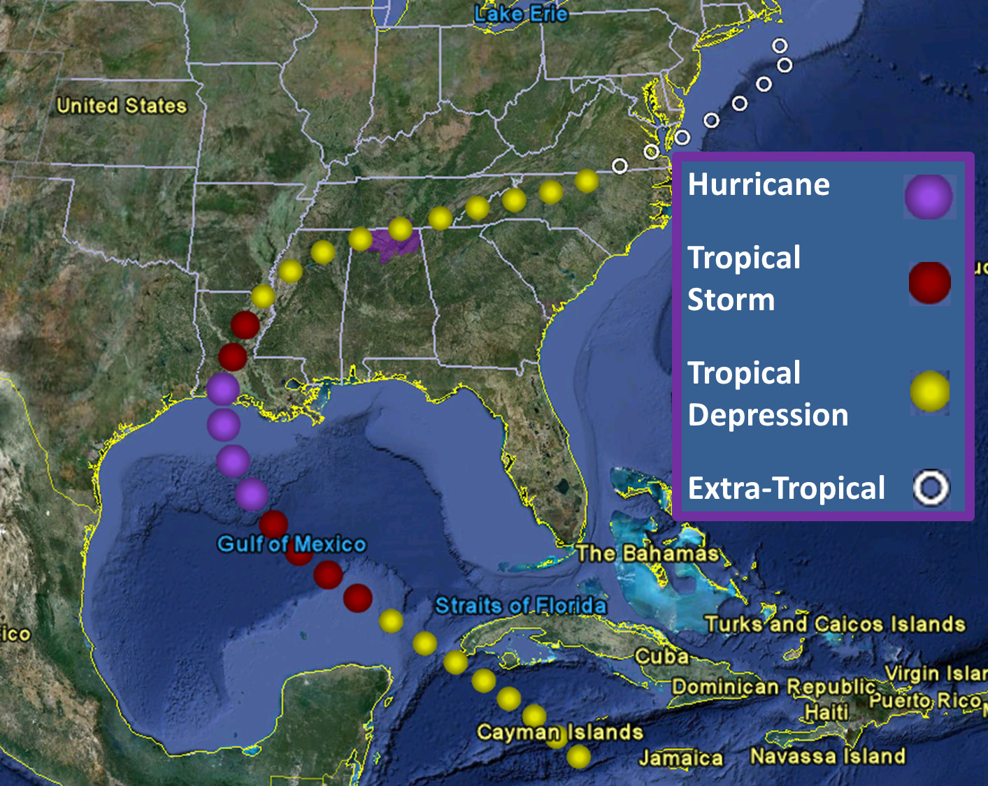
On August 15, 1985, Hurricane Danny approached the southwestern Louisiana coast as a category 1 hurricane packing sustained winds of 90 kts with higher gusts and a central minimum pressure of 987 mb. It made landfall as it was undergoing rapid intensification indicated by aircraft reconnaissance, with central pressure decreasing by 12 hPa in the 12 hour period just before making landfall just southeast of Lake Charles, LA. Below on the right is an image of the track of Danny as it moves into the Louisiana coast just southeast of Lake Charles and it's subsequent path through the remainder of its life cycle. On the left below is a visible satellite imagery shot of Hurricane Danny as it nears the Louisiana coast. |
||
|
||
|
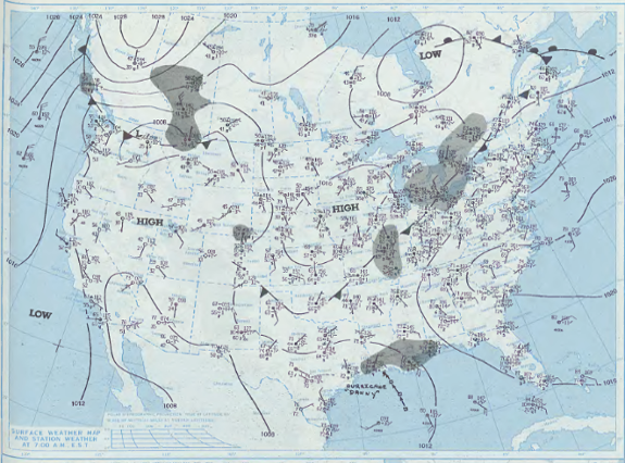
At the same time, a cold front was pushing southeast into northern Arkansas, northern Kentucky, and into the northeastern U.S, as can be seen in the image below. This frontal boundary steered the remnants of Hurricane Danny to the east-northeast as it pushed from northern Mississippi into northern Alabama and the Tennessee Valley from August 16th-17th as a Tropical Depression.
|
||
Effects over the Huntsville Forecast Area |
||
|
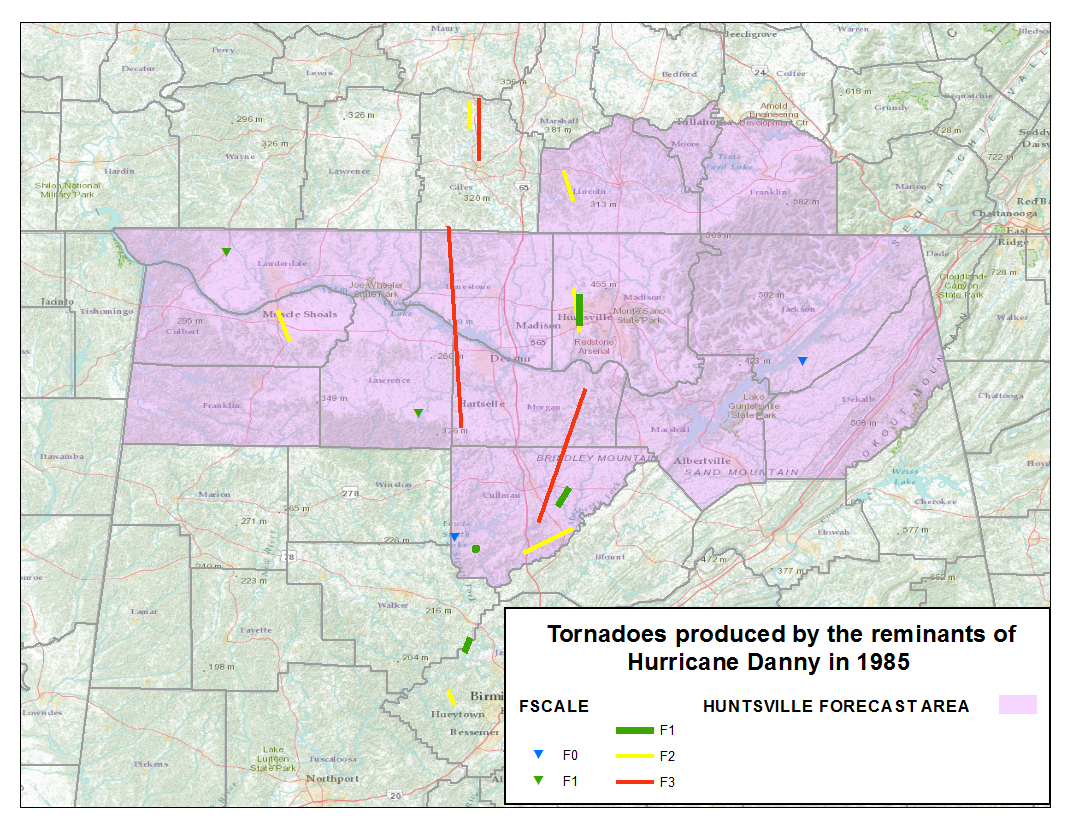
The remnants of Hurricane Danny produced two main effects over northern Alabama and southern Middle Tennessee. The most substantial was the tornado outbreak associated with August 16th when strong shear and ample instability produced 13 tornadoes across Northern Alabama and Southern Middle Tennessee. Two of these were F3 tornadoes with path lengths over 30 miles long. In fact, the F3 tornado that moved through Morgan and Limestone Counties at 1140 AM extended over a 45 mile track. In addition, four of the remaining tornadoes were rated F2's. Below is an image of tornado's that occurred as Tropical Depression Danny moved across the Huntsville Forecast Area.
|
||
Pictures of F2 tornado near Huntsville, AL around 4:38 PM Picture Left: Courtesy of Andrew Junkins, Avionics Supervisor. Source: Observations of the Hurricane Danny Tornado Outbreak of 16 August 1985, by Eugene McCaul, Jr. Picture Right: Courtesy of National Weather Service. |
||
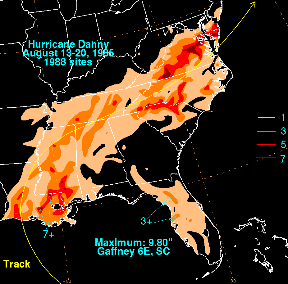
Heavy Rainfall Also OccurredHeavy rainfall also occurred as the tropical system interacted with the approaching frontal boundary. Although the speed of Tropical Depression Danny likely was enhanced by the active jet stream just south of the front. This fast movement likely helped keep flash flooding/flooding impacts lower than they could have been. Despite this though 1 to 3 inches of rainfall fell across the Huntsville Forecast Area. Below is an image of rainfall from the National Center for Environmental Prediction. |
||
 |


 Local Radar
 Weather Map