
Canadian wildfire smoke will push into the Midwest, worsening air quality. A frontal system brings severe storms from the Northern Plains to the Mid‑Atlantic the next few days. Heavy Gulf Coast rain is possible as we closely monitor tropical development, while monsoonal storms persist in the Southwest with heavy rainfall. Hazardous heat expands from the Plains into the Lower Mississippi Valley. Read More >
|
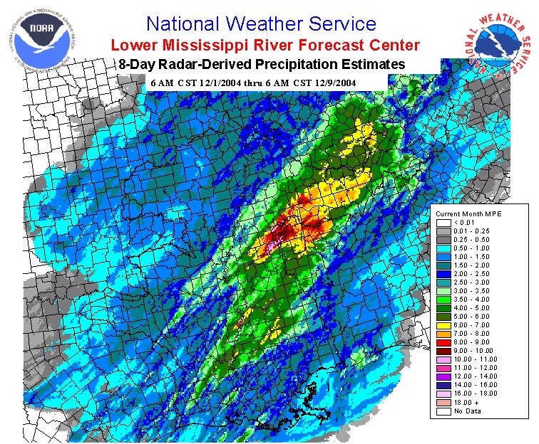
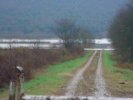
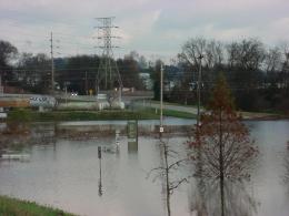
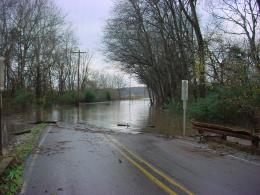
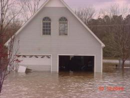
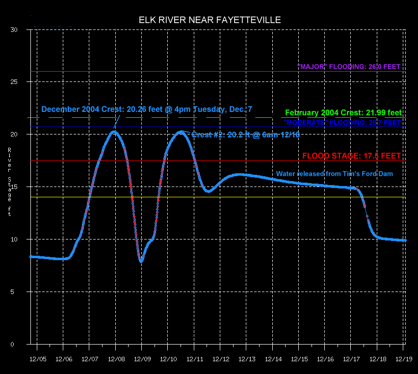
Between December 1 and December 9, 2004, much of the Tennessee Valley received between 8 and 10 inches of rainfall. When combined with a wet November, these heavy rain events caused creeks, streams, and rivers across the area to flood. The heaviest rain fell from December 5th through the 8th, with several locations receiving 6 to 7 inches of rain over the 3-day period (for comparison, 5.59 inches of rain is normal for the entire month of December at Huntsville airport!)
Public Information Statement - Issued on December 8 detailing rainfall totals and river stages from the 5th-8th flooding
|
|||||||||||||||||


 Local Radar
 Weather Map