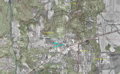
Representatives from the National Weather Service and Morgan County Emergency Management  completed a survey of damage in the city of Trinity on Tuesday afternoon. The damage occurred with a line of showers that moved through the Trinity area at approximately 11 am CDT. The survey found evidence of an EF-0 tornado on the Enhanced Fujita scale, with highest winds of 65 mph. The tornado was approximately 25 yards wide, with a path length of 1/4 mile. The damage was confined mostly to uprooted trees and snapped limbs. One residence sustained some damage, mainly to sheds and fencing at the back of the property. completed a survey of damage in the city of Trinity on Tuesday afternoon. The damage occurred with a line of showers that moved through the Trinity area at approximately 11 am CDT. The survey found evidence of an EF-0 tornado on the Enhanced Fujita scale, with highest winds of 65 mph. The tornado was approximately 25 yards wide, with a path length of 1/4 mile. The damage was confined mostly to uprooted trees and snapped limbs. One residence sustained some damage, mainly to sheds and fencing at the back of the property.
|