|
|
Intense Rainfall Impacts Jackson County
|
| Event Description... |
|
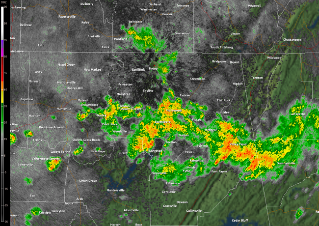
Intense rainfall of 6 to 8 inches occurred during the morning hours of Tuesday, August 17th, producing significant flash flooding within the cities of Scottsboro and Hytop, Alabama. The bulk of the rain fell between 5:00 am CDT and 8:00 am CDT, when rainfall rates of around one quarter inch every five minutes occurred. The NWS cooperative observer at WNNC radio in Scottsboro reported 6.6 inches of rainfall as of 10 am. The NWS Cooperative-N/HCN (Historical Climate Network) site at the Scottsboro airport recorded 4.59 inches before overflowing. The USDA SCAN site at Hytop, AL recorded 3.10 inches of rainfall. Based on this information, along with supporting NWS doppler radar data, initial findings are as follows:
|
| Event Type |
Flash Flooding |
Rainfall |
Up to 6.60 inches measured |
| Time (CDT) |
5:00 - 8:00 am CDT |
Location |
central Jackson County (Scottsboro and Hytop areas) |
These findings are preliminary and are subject to final adjustment. |
| |
| Storm surveys have been completed examining storm damage that occurred during the morning hours of August 17, 2010. Information found in these surveys is described below. |
|
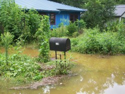
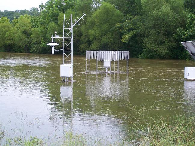
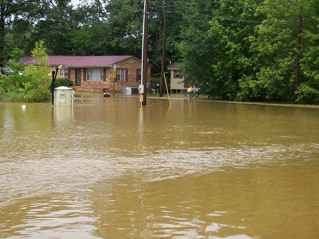
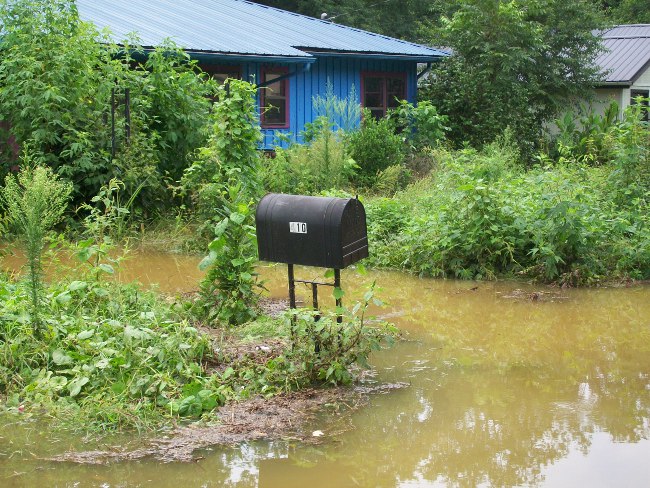
Impacts were most severe in Scottsboro beginning at 7:00 am CDT...when several roads were closed due to high water and several residences and businesses were submerged in water as high as four feet deep. Residents from at least a dozen homes required rescue. City police reported numerous staff had to be dispatched at many locations to close and barridade roads quickly. At least two vehicles were swept into ditches of high flood water, but no injuries have been reported. The Scottsboro Cooperative-N HCN site was partially submerged by flood water at the airport. The flooding also prompted the closure of a runway at the airfield. Status of HCN equipment damage is unknown until staff can safely enter the site. Residences were also flooded in Hytop, but information at this location is limited at this time.
|
|
|
|
A Few Pictures From the Event
|
 |
%201%20block%20north%20of%20willow_thumb.JPG) |
 |
 |
| |
|
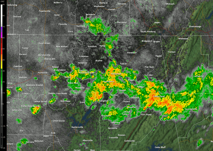
Radar Imagery
|
|
|
|
Click on the image above to view a radar loop (.gif) between 6-10 am CDT. The imagery is centered over Jackson County, AL where the heavy precipitation occurred. (file size ~18.3 Mb)
|
Click here for other storm
damage that was reported
during the event. |


 1 block north of willow_small.JPG)
 Local Radar
 Weather Map