|
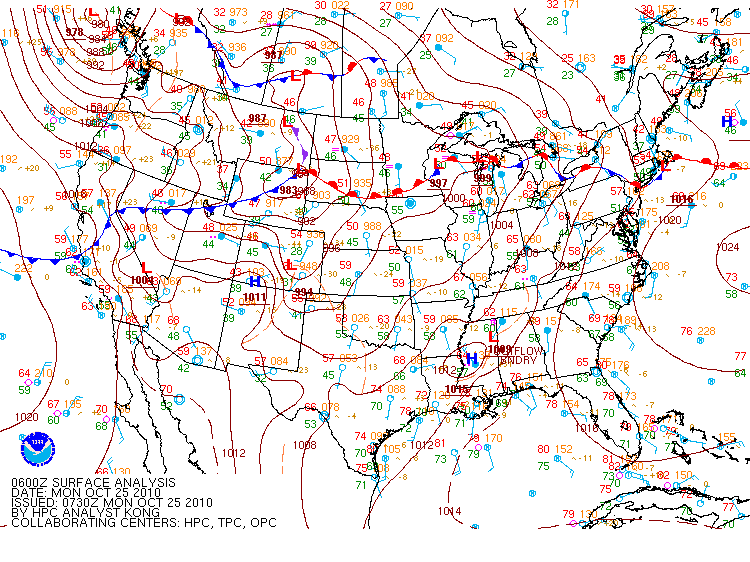
On Sunday (October 24th, 2010) evening at 7 am, a complex and potent weather system was beginning to take shape over the southeastern US. A strong occluded (denoted by the purple frontal symbol) area of low pressure with a central pressure near 994 mb was situated over northern Akansas. Several boundaries intersected with this area of low pressure. However, the most important ones were the cold front extending south through central Louisiana and the warm front extending east into southern Alabama. These later pushed into northern Alabama as the occluded low pushed east northeast into southwestern Kentucky by late Thursday afternoon. |
|
|
|
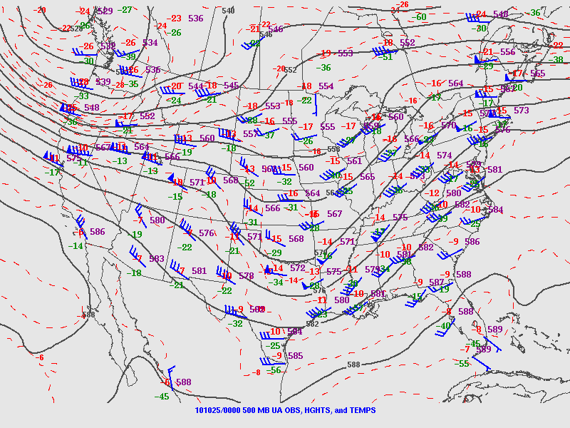
Figure 1. October 24th 2010 - 7 pm CDT 500 mb (Upper Air) Analysis |
|
|
|
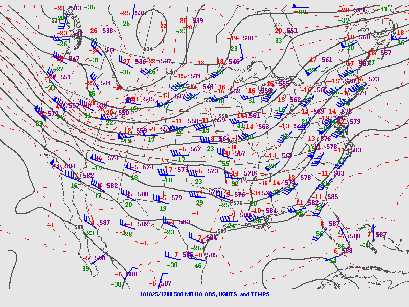
Figure 2. October 25th 2010 - 7 am CDT 500mb (Upper Air) Analysis |
|
|
|
Figure 3. October 25th 2010 - 130 am CDT Surface Map |
|
Two Main Ingredients were in place by the late afternoon hours for severe thunderstorm development capable of producing large hail, damaging winds and isolated tornadoes across the Huntsville Forecast Area. 1. An upper-level trough (or region of relatively colder air) was moving into the southern and mid Mississippi Valley region as shown by the progression of figures 1 and 2. This upper trough contributed to rising motion of air parcels and the subsequent generation of showers and thunderstorms across the region late Sunday and into Monday. Notice that wind flow around this trough across the Tennessee Valley was out of the southwest in the evening and gradually veered to the west overnight. Together with surface winds out of the south, this contributed to deep layer wind shear, which is generally a necessary ingredient for severe weather and tornado development. Additionally, the blue flags indicate that wind speeds on the eastern side of the trough were around 50 to 75 knots. 2. During the day on Sunday, warm southerly flow allowed temperatures to climb into the 80s at many locations, while dew point temperatures rose into the 60s. As the upper trough moved into the region, the warm/moist airmass at the low-levels, combined with colder air aloft to generate increased instability. This lead to further rapid rising motion and the development of thunderstorms. The shear provided the necessary rotation, and severe weather resulted across the area. |


 Local Radar
 Weather Map