Northeastern Lawrence County Tornado(EF-0) |
 |
|
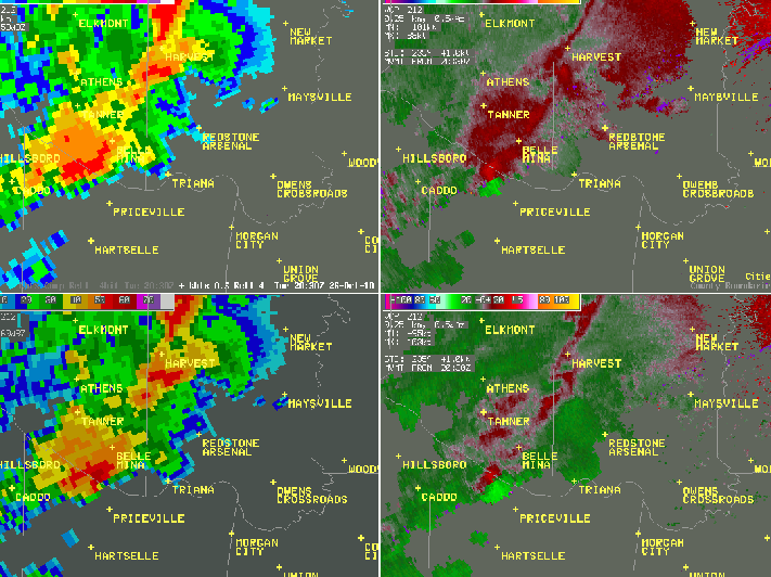
This radar image is from Columbus radar at 1:21 pm CDT shows a strong circulation just south of Hillsboro in Lawrence county (noted by the adjacent pink/green colors in the right two panels, especially the top right (0.5 degree slice)on October 26th, 2010. Click on the image to view a radar loop around this time.
|
Southeastern Limestone County Tornado(EF-0) |
 |
|
This radar image is from Columbus radar at 3:40 pm CDT shows a strong circulation just southeast of Belle Mina in the Greenbrier area of southeastern Limestone county (noted by the adjacent pink/green colors in the right two panels, especially the top right (0.5 degree slice)on October 26th, 2010. Click on the image to view a radar loop around this time.
|
Western Dekalb County Tornado (EF-1) |
|
|
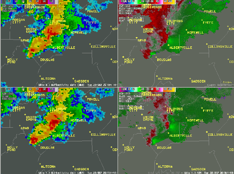
This radar image is from hytop radar at 6:04 pm CDT shows two strong circulations in Marshall and Dekalb Counties . However, the one that struck the Geradline community was the furthest north. It also was the strongest of the day, reaching EF-1 intensity and traveling 4.25 miles. Click on the image to view a radar loop around this time.
|
Eastern Marshall County (Albertville/Mcville Tornado) |
|
|
This radar image is from hytop radar at 6:09 pm CDT shows two strong circulations in Marshall and Dekalb Counties. However, the one that struck the McVille/Albertville communities was the southernmost of the two and produced the tornado as it approached the Marshall/Dekalb county line. The rotation with this storm does not look as impressive as with the Geraldine tornado touchdown throughout the entire radar loop. This particular tornado was an EF-0 and traveled almost one mile. Click on the image to view a radar loop around this time.
|


 Local Radar
 Weather Map