
A significant heat wave is underway for the Intermountain West, Northern Plains, and Upper Great Lakes, peaking in intensity through midweek and lingering across parts of the Northern Plains and Midwest until this weekend. In southwest Texas, excessive rainfall may bring a risk for potentially life-threatening flash and arroyo flooding through Thursday. Read More >
 |
||||||||||||||||||||||||
|
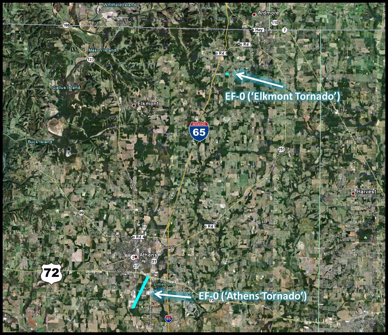
On May 17th, heavy rainfall with some strong and isolated severe storms occurred as a Mesoscale Convective Complex pushed from Mississippi into Northern Alabama and Southern Middle Tennessee. The area of showers and storms moved into northwestern Alabama around 10 AM and a few of the storms intensified as it tracked eastward through the early afternoon hours. The strongest storm of the day produced two tornadoes that briefly touched down, one in the Athens area and another near Elkmont. |
||||||||||||||||||||||||
|
|
||||||||||||||||||||||||
|
|
||||||||||||||||||||||||
|
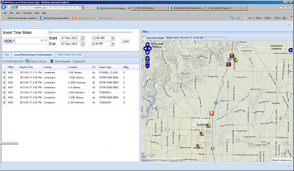
Click the image below for an interactive Storm Report Viewer. |
||||||||||||||||||||||||
 |
||||||||||||||||||||||||
|
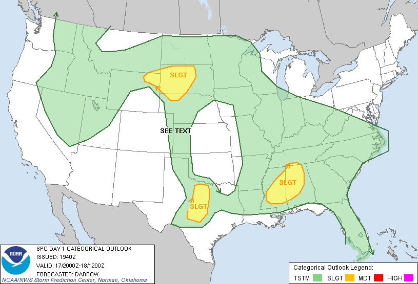
Storm Prediction Center Day 1 Outlook |
||||||||||||||||||||||||
 |
||||||||||||||||||||||||
|
|


 Local Radar
 Weather Map