
Record setting heat is expected over the next several days from the Intermountain West through the northern Plains. Furthermore, fire weather concerns increase with dry and breezy conditions. Meanwhile, heavy rainfall and severe thunderstorm threats for the Ohio/Tennessee Valleys, central Appalachians and Southeast today. The threat shifts to central Gulf Coast and across central Texas this week. Read More >
|
||||||||||||||||||||||||||||||||||||||||||||||||||||||||||||||||||||||||
|
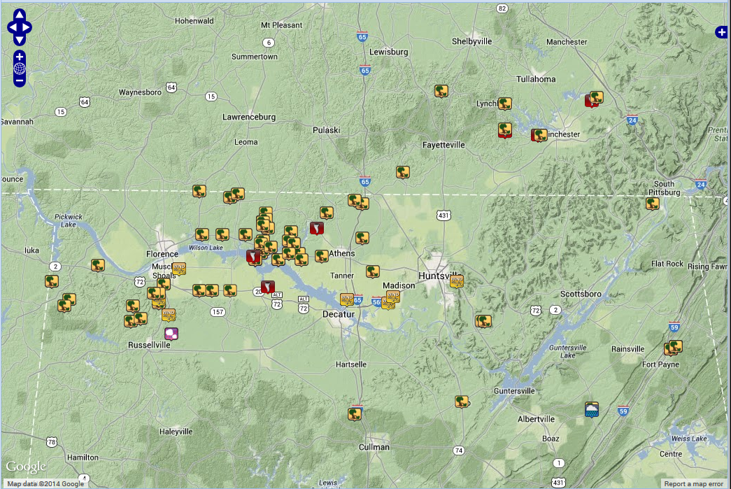
Tornado Surveys Completed (Click on the entries in the first column to see an official storm survey summary. |
||||||||||||||||||||||||||||||||||||||||||||||||||||||||||||||||||||||||
|
|
||||||||||||||||||||||||||||||||||||||||||||||||||||||||||||||||||||||||
|
Click Image Below to see all finalized tornado tracks that occurred during this event. |
||||||||||||||||||||||||||||||||||||||||||||||||||||||||||||||||||||||||
|
|
||||||||||||||||||||||||||||||||||||||||||||||||||||||||||||||||||||||||
|
Event Summary: |
||||||||||||||||||||||||||||||||||||||||||||||||||||||||||||||||||||||||
|
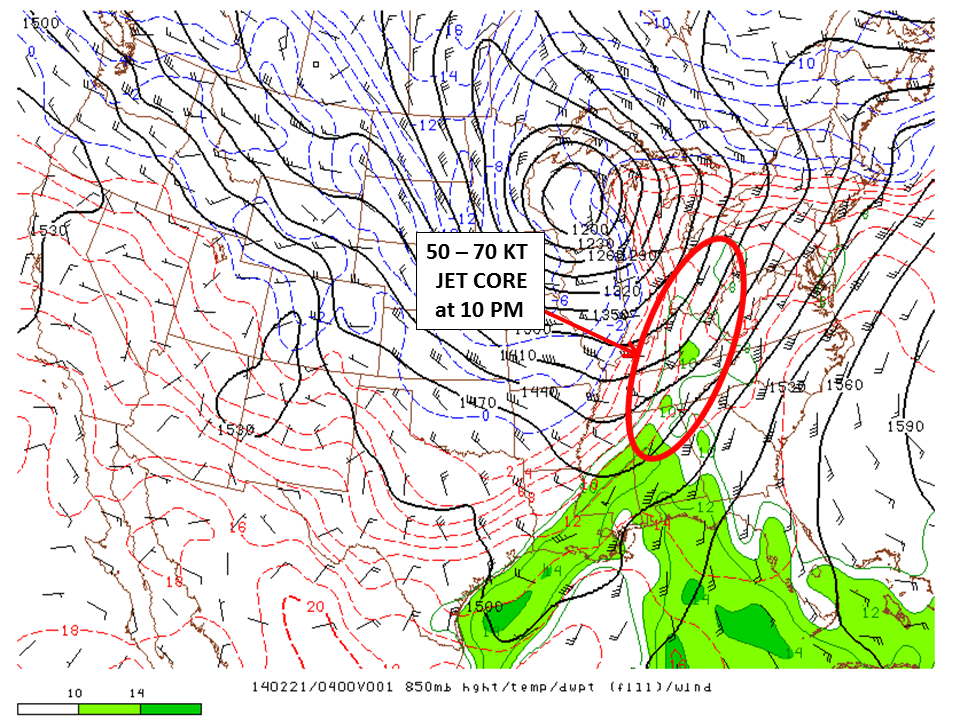
During the early afternoon hours of Thursday, February 20, 2014, a cold front extended south from a developing area of low pressure over north-central Missouri into southwestern Texas. As this low deepened, it moved quickly north-northeast into the Great Lakes region through Friday morning (see the surface analysis loop below on left). Forcing ahead of this cold front pushed into northern Alabama and Southern Middle Tennessee in the late afternoon/early evening hours. Lots of wind energy was in place ahead of this system as the low pressure system deepened from 992 mb to 967 mb. This is evident by the area of 50 to 70 knot winds at the 850mb level, which extended from central Alabama to Ohio (circled in the image below on right - valid at 10 pm on February 20th, 2014). |
||||||||||||||||||||||||||||||||||||||||||||||||||||||||||||||||||||||||
  |
||||||||||||||||||||||||||||||||||||||||||||||||||||||||||||||||||||||||
|
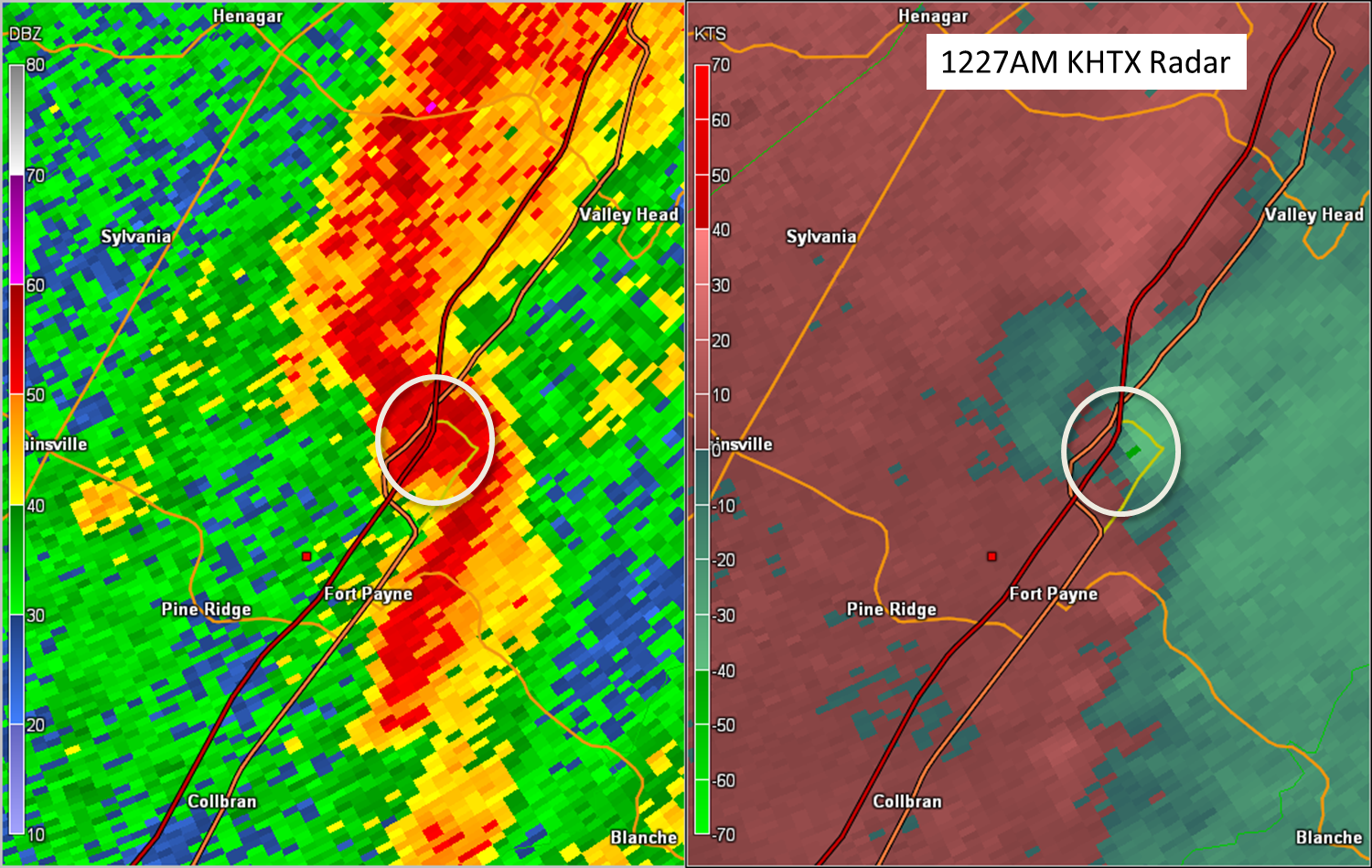
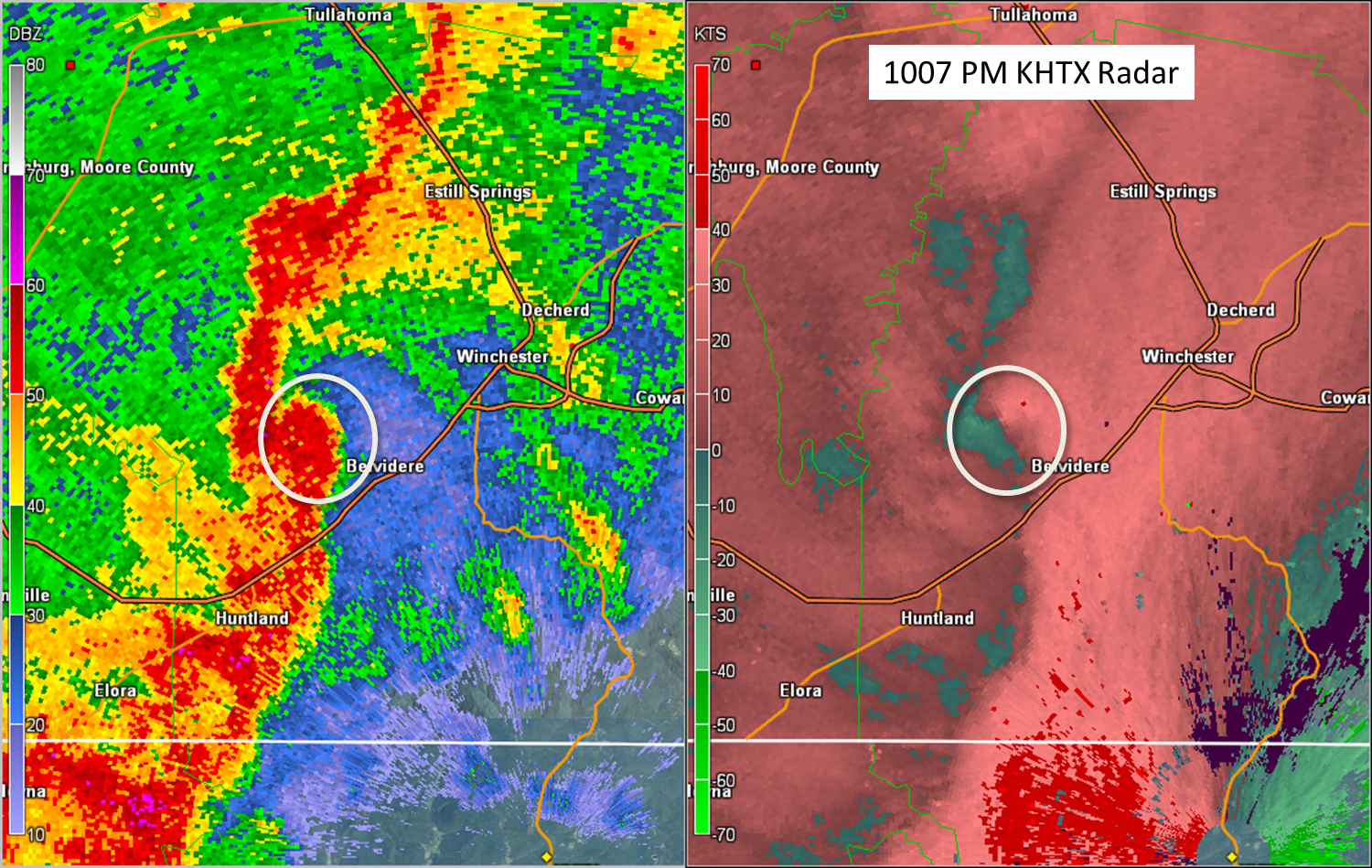
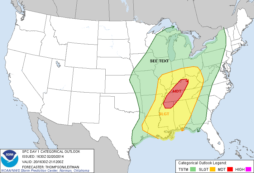
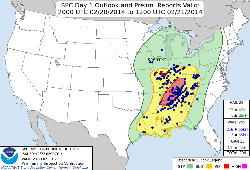
Ahead of this cold front, a line of strong to severe thunderstorms moved from Mississippi and western Tennessee into northern Alabama and Southern Middle Tennessee. This line of storms prompted numerous severe thunderstorm warnings and several tornado warnings. These storms ended up producing damaging straight line winds along with 8 confirmed tornadoes, per official NWS storm surveys. While official survey results are included in the table above, the images below highlight the Day 1 severe weather outlook from the Storm Predicition Center & locations of preliminary storm reports. |
||||||||||||||||||||||||||||||||||||||||||||||||||||||||||||||||||||||||
|
||||||||||||||||||||||||||||||||||||||||||||||||||||||||||||||||||||||||
|
|


 Local Radar
 Weather Map