|
Round 1 - August 18th at 7 AM into August 19th at 7 AM
|
|
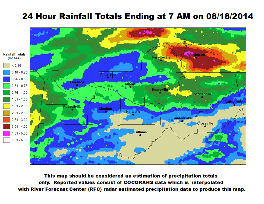
First Round - 7 am August 18th through 7 am August 19th at 7 am.
|
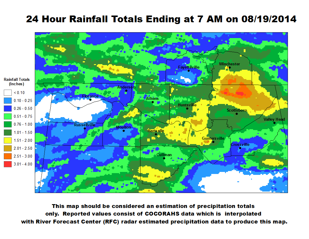
Second Round - 7 am August 19th through August 20th at 7 am.
|
 |
 |
|
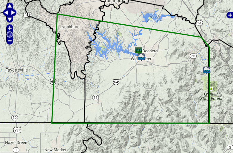
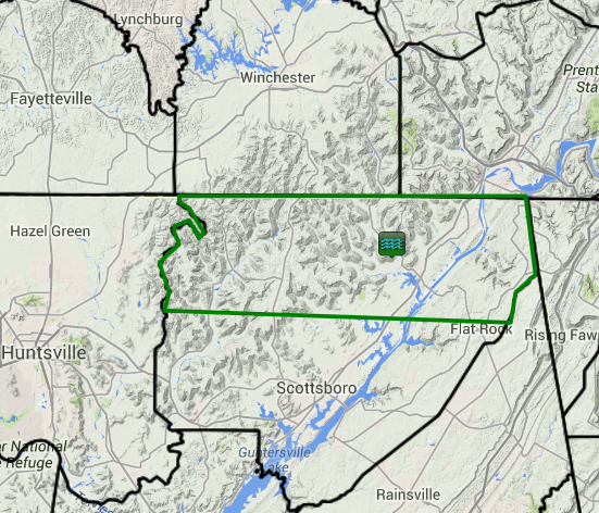
| Heavy rainfall due to training strong thunderstorms began early in the morning on August 18th, around 7 am and continued over Southern Middle Tennessee spreading into Jackson county Alabama through the morning hours on August 18th. Although no severe weather occurred, heavy rainfall reports and some serious flash flooding occurred near the Winchester community in Southern Middle Tennessee and northwest of Stevenson in northeastern Alabama. In these areas three to six inches of rainfall over the course of 3 to 6 hours closed portions of Estill Springs road near Winchester and washed out a road later in the morning northwest of the Stevenson community. The locations of these reports can be seen below. |
|
 |
 |
| The icon that looks like waves is a report of a portion of Estill Springs road being closed near Winchester on August 18th. The other icons of a cloud with rain falling from it are reports of heavy rainfall. |
A picture of flash flooding reports on August 18th. The icon that looks like waves is a report of a road being washed out northwest of Stevenson, AL. |
|
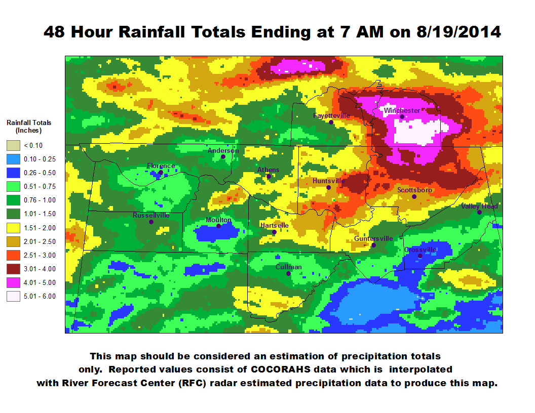
Below is an image of 48 hour rainfall totals from 7 am on 8/18/2014 through 8/19/2014 at 7 am. This heavy rainfall produced isolated flash flooding in the Winchester area in Tennessee and in extreme northern Jackson County in Alabama.
|
|
|
|
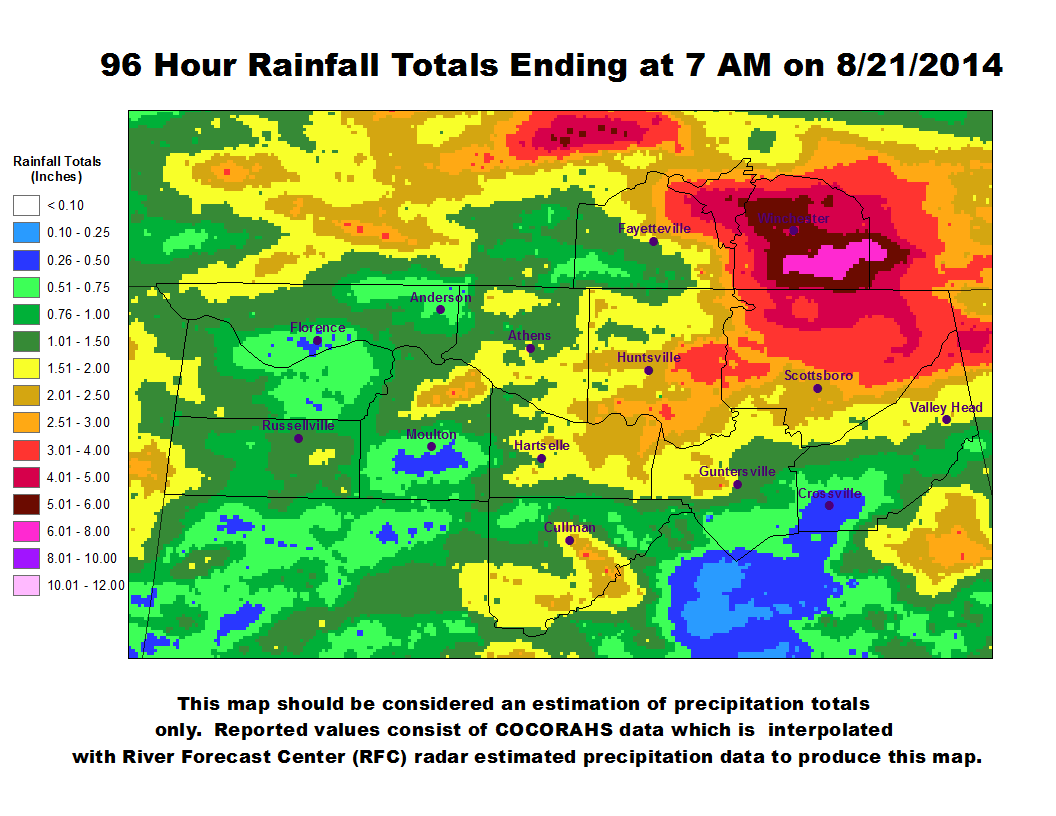
Additonal Rainfall Occurred through 7 am on the 21st producing four day rainfall totals between 5 and 8 inches of rainfall in portions of Southern Middle Tennessee and northeastern Alabama.
|
|
|
|