
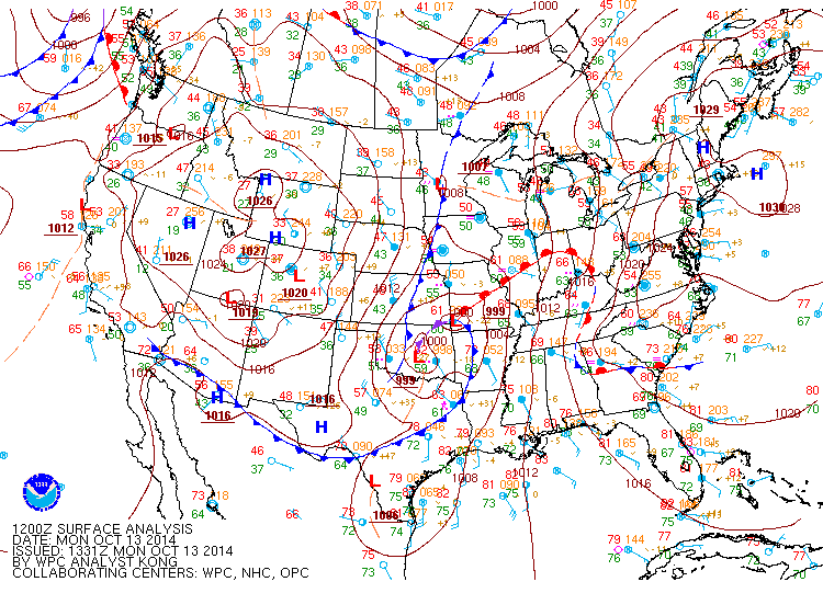
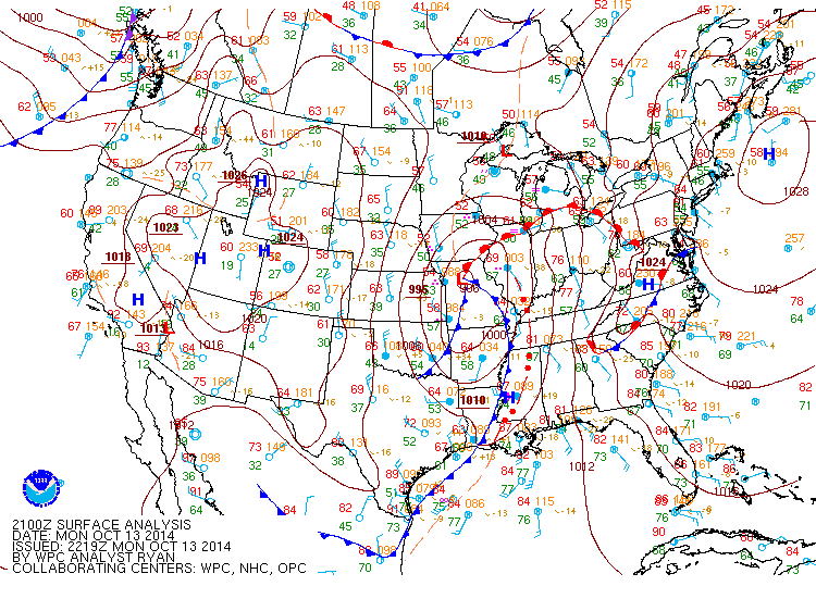
Flash flooding threatens areas from the Tennessee Valley to the Carolinas as storms repeat along a stalled front. Monsoonal storms may trigger flooding in the Southwest. Dangerous heat expands across the Desert Southwest, Plains, mid-Mississippi Valley and Southern Tier. Critical fire weather for interior Pacific Northwest. Cooler, drier air brings brief relief to the Great Lakes and Northeast. Read More >
|
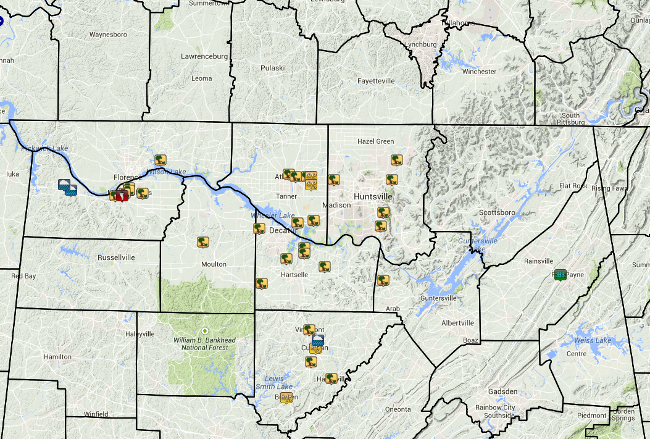
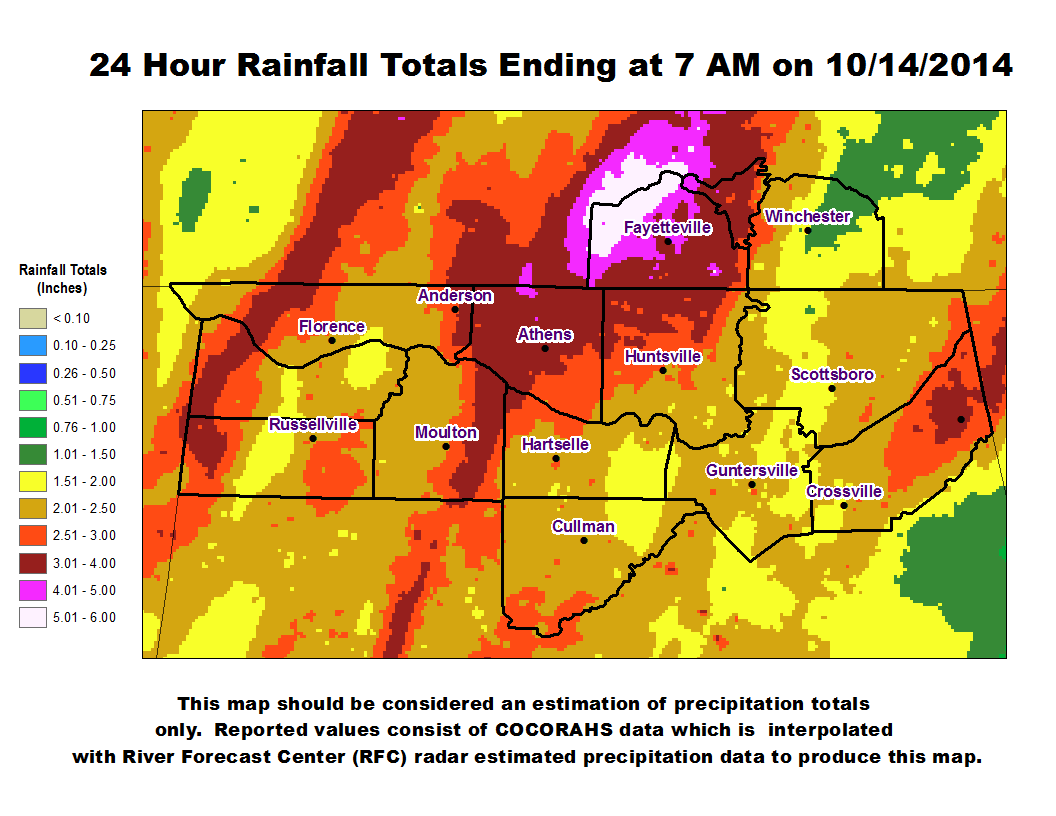
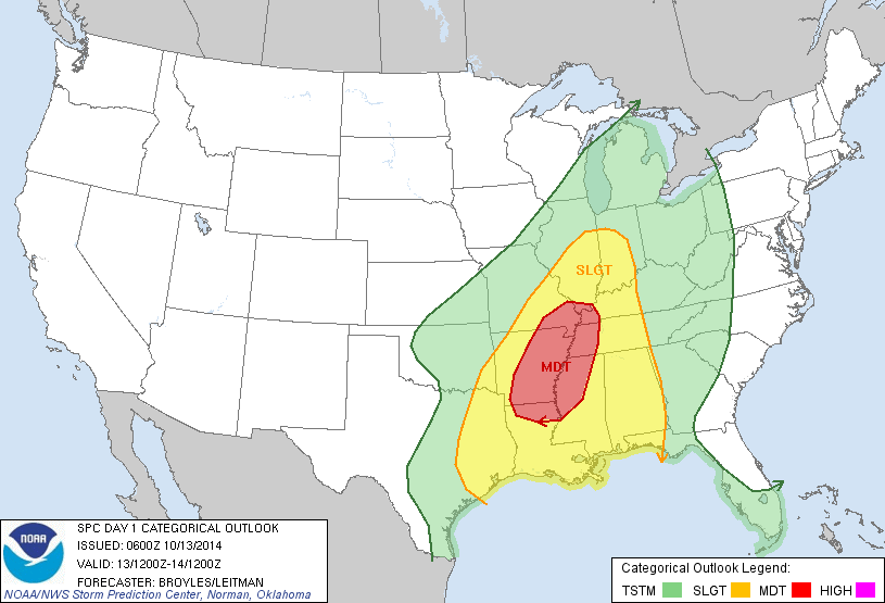
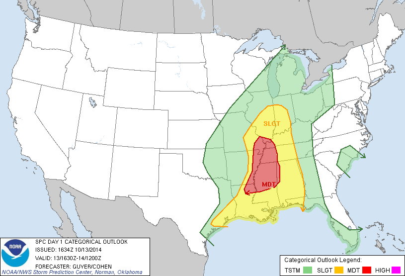
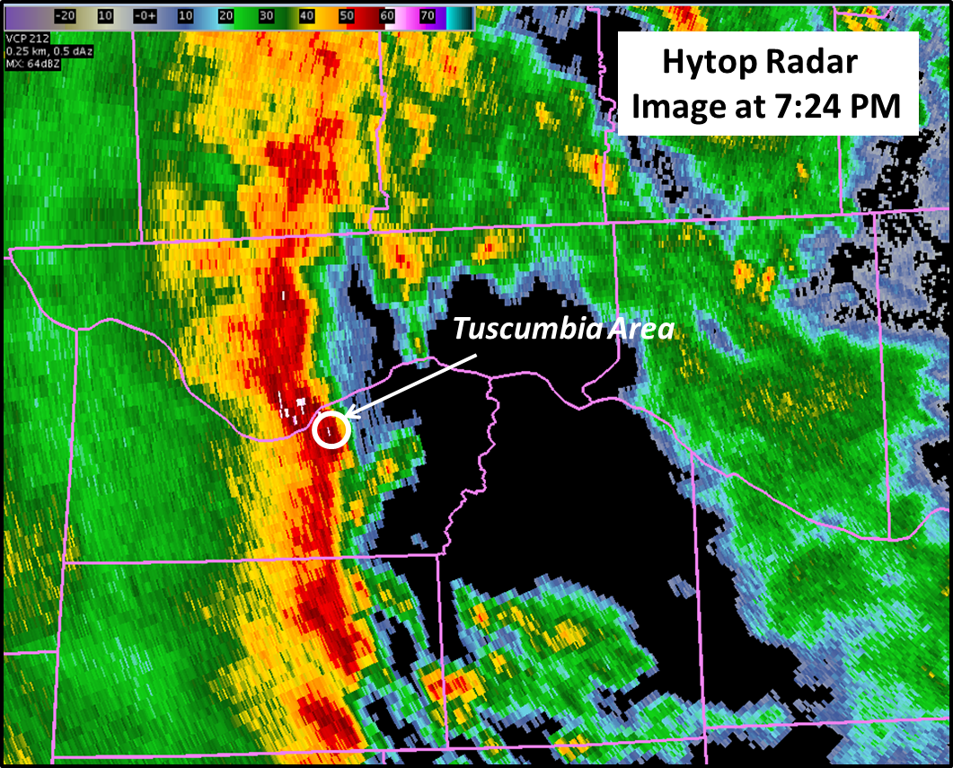
Storm Reports from October 13-14, 2014 (Click on the image to see a list of report descriptions) |
||||||||||||||||||||||
|
|
||||||||||||||||||||||
|
|
||||||||||||||||||||||
|
Tornado Surveys Completed |
||||||||||||||||||||||
|
||||||||||||||||||||||
|
Straight-Line Wind Damage Surveys Completed |
||||||||||||||||||||||
|
||||||||||||||||||||||
|


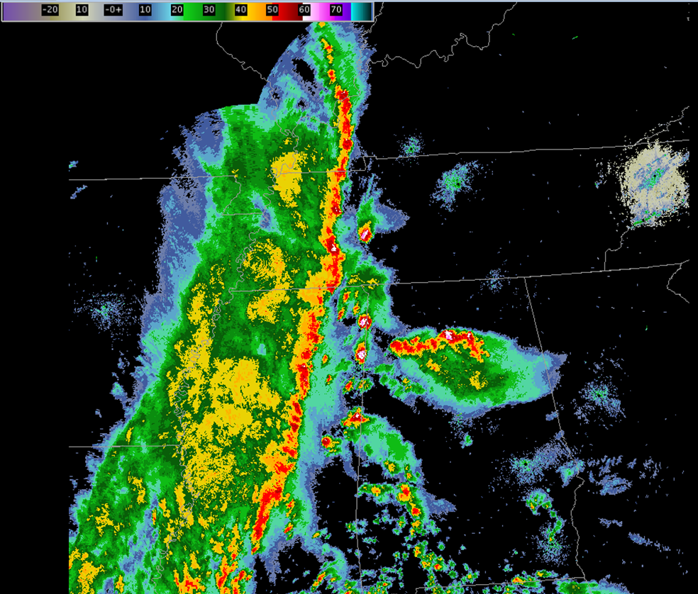
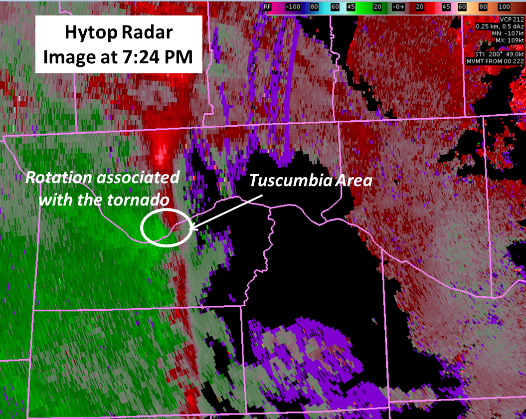
 Local Radar
 Weather Map
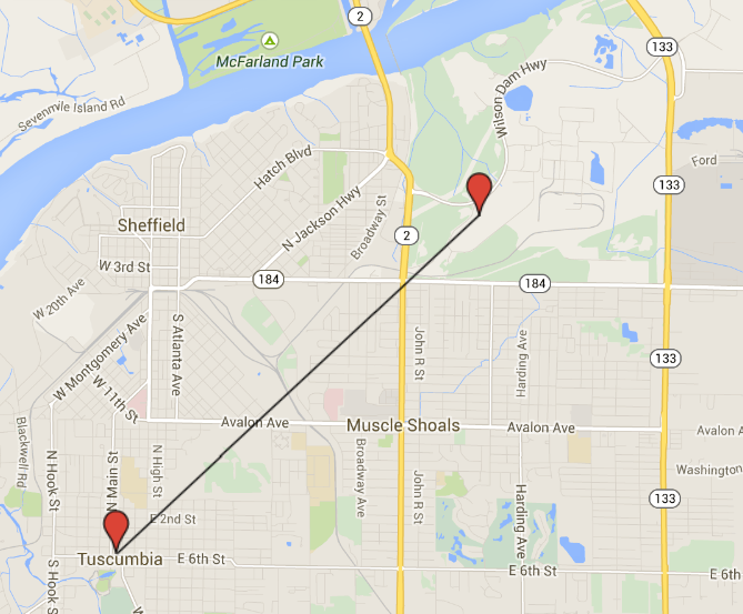