|
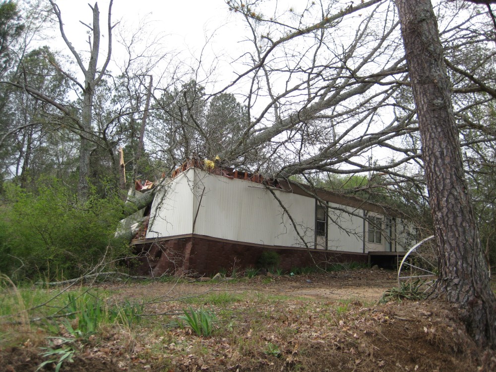
A tornado touched down approximately 2.5 miles south southeast of Grant along Campbell Mill Road. A few houses sustained minor roof damage on the southeast side of Grant, and at least two mobile homes sustained major damage from falling trees. The tornado continued east crossing Old Union Road, Columbus City Road, and Cardessa Lane before descending into the Tennessee River Valley. The tornado crossed Highway 79 at approximately 307 PM CDT at the Baker Mountain Road intersection. At this point, the damage path width was just below a half mile wide. One woman was injured when a tree fell on her car near the Waterfront grocery. Several houses sustained substantial damage on the east side of Highway 79, and many trees were snapped and uprooted. The roof was blown off of one home, and a brick wall collapsed. The tornado crossed a small inlet onto the south side of Preston Island, wiping out several boat docks and boat houses. Several homes sustained significant damage on the island from falling trees. At least two wood homes had complete roof collapse and partial wall collapse.
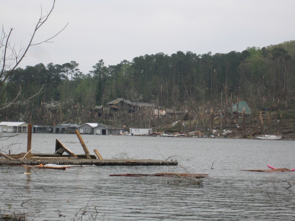
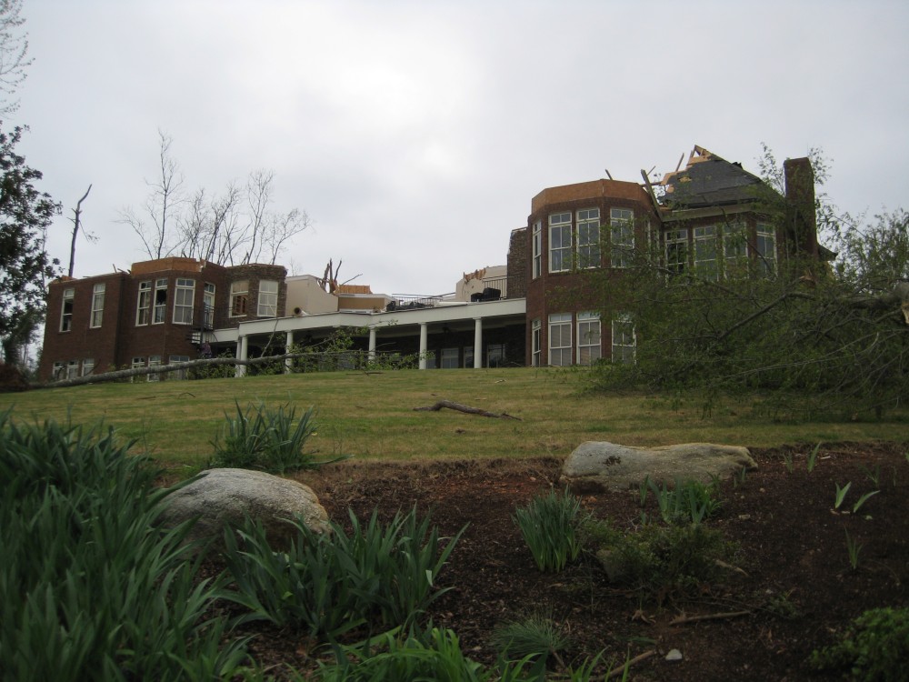
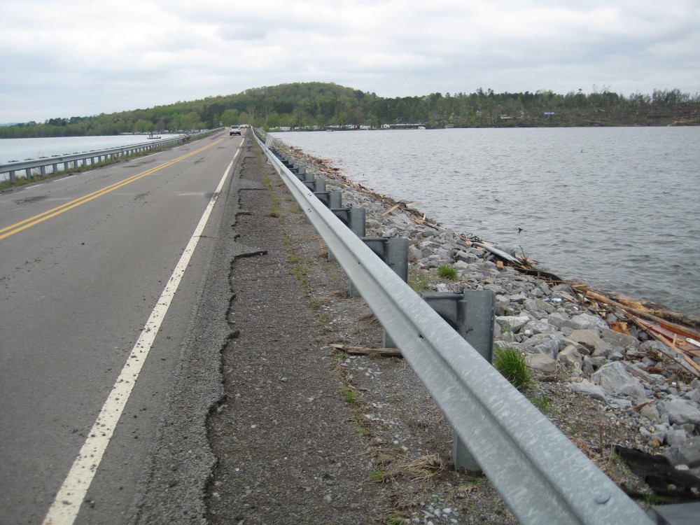
The tornado crossed Lake Guntersville into the South Sauty community. At this point, the damage path width increased to at least a half mile. Several well built homes were damaged by falling trees along Menominee Road. At least 20 boat houses were destroyed in the community. Along Chilcotin Road, a well constructed two story brick house lost its roof, and two large stone walls on the top level were blown over. Falling trees damaged several camper trailers, and some trailers were blown into Lake Guntersville. Thousands of trees were uprooted or snapped along the path of the tornado in Marshall county. The tornado then crossed the CR 67 causeway into Jackson County. On the causeway, tornado winds damaged the shoulder of the roadway as it crossed.
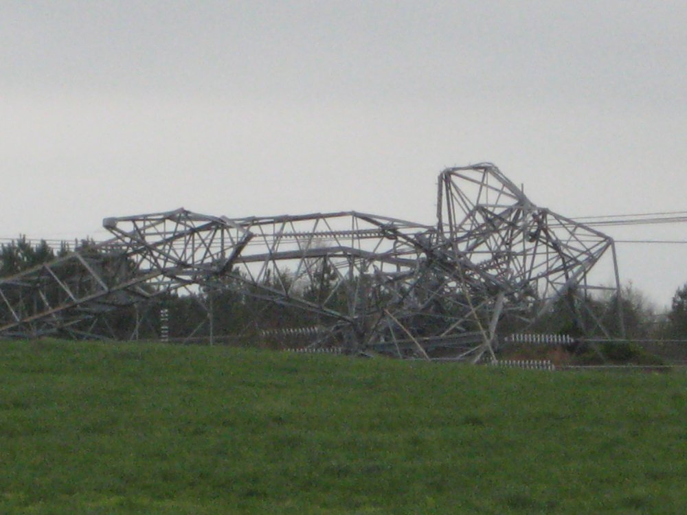
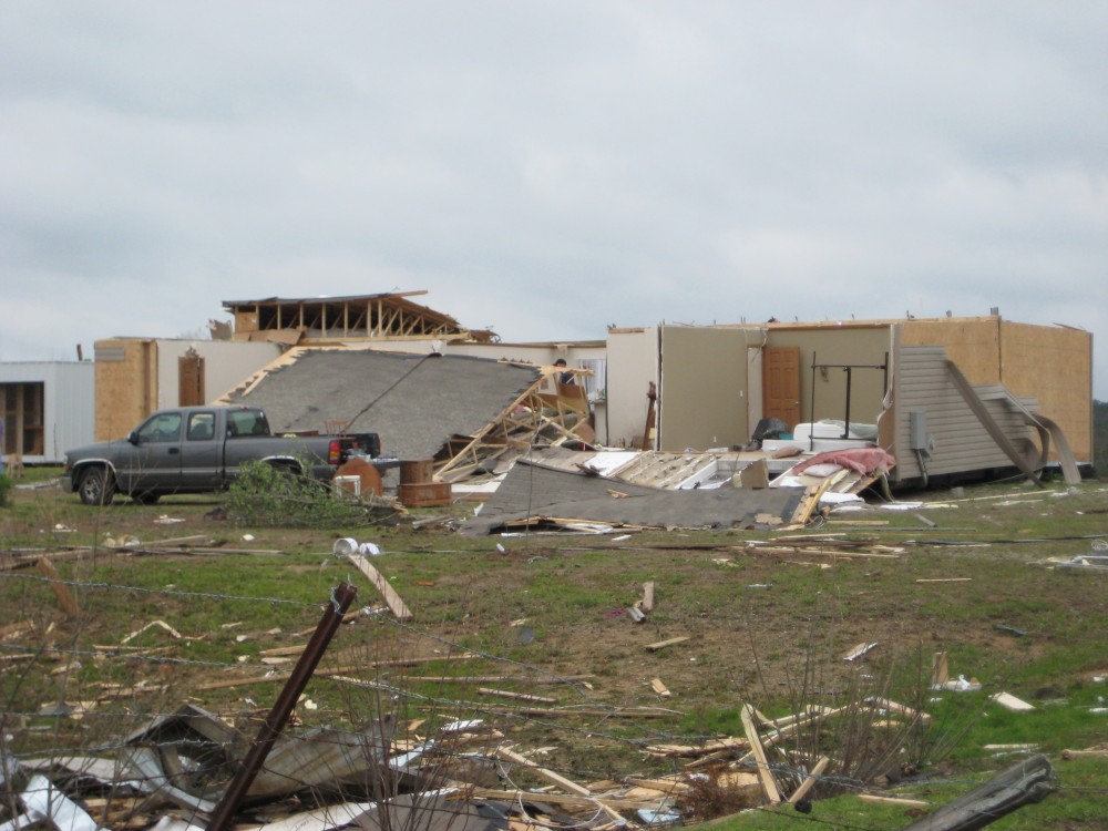
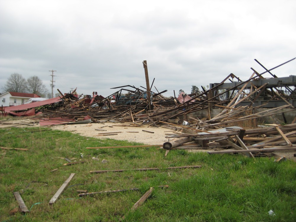
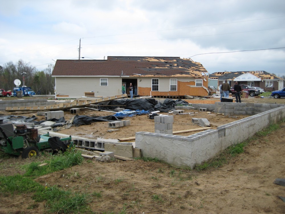
The tornado then continued along a path across southern Jackson county and west central Dekalb county. Several mobile homes were destroyed in the Macedonia community along with numerous large trees uprooted and snapped. Three TVA high voltage powerline towers also collapsed. As the tornado approached Powell, a double wide manufactured home was shifted off its foundation with total roof collapse and complete destruction to the front of the home. Just on the east side of Highway 35, a large metal industrial building that was securely anchored into the ground was completely destroyed. In Sylvania, significant damage occurred to several homes in the Stonebrook subdvision. One home was completely lifted off its foundation and driven nearly 4 feet into the ground. sporadic damage continued just to the east of Sylvania until the tornado apparently lifted between 335 and 340 PM CDT, just south of the Mahan Crossroads community in west central Dekalb County.
Pictures
Below are some pictures that were taken during our damage surveys and that were submitted to us by local citizens. Click any image for the a larger resolution version.

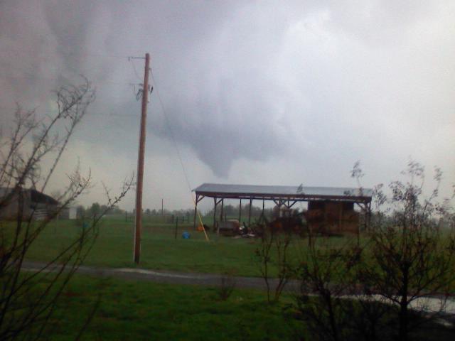
This is the tornado around the time it was moving across the Guntersville Lake area Friday afternoon. This picture was taken from the Swearengin community in northeast Marshall County looking south toward the tornado by Chief Mitch McCullough of the Swearengin Volunteer Fire Department.
|

This picture of the tornado was taken as it was moving across the Tennessee River into the South Sauty area. It was taken from the a boathouse on the river near Piney Point. (Image Courtesy Shawn O'Harra).
|

Two trees fell on this mobile home on the southeast side of Grant near the beginning of the tornado's path.
|
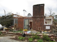
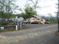
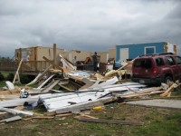
Several structures along AL Highway 79 in the Waterfront community were affected by the tornado. This house on the Tennessee River lost its roof and an entire brick wall (which would have been on the right side of this image).
|
Several trees in the Preston Island area were snapped. In addition, several boats and boat houses on Lake Guntersville were damaged or destroyed.
|
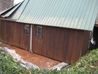
This wooden house at Preston Island was pushed 5 to 10 feet off its block foundation.
|
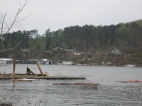
Countless softwood trees and some hardwood trees were snapped in the South Sauty community. Around twenty boathouses were destroyed in the area seen in this picture.
|

This well-built home lost its roof, and two stone walls were blown over. Walls that were supported by brick remained standing at the home.
|
Numerous camper trailers were damaged by falling trees, and some were blown into the nearby lake.
|
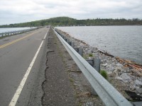
Wind and debris from the tornado eroded the shoulder of the CR 67 causeway near the Marshall-Jackson county line. In the top right portion of the image, you can see where the tornado caused damage at the South Sauty campground.
|
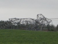
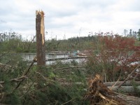
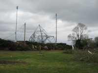
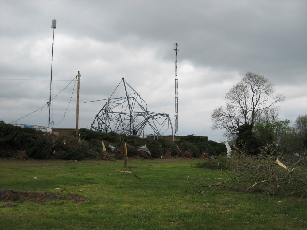
A large metal truss tower was completely toppled by the tornado in southern Jackson County near the Langston community.
|

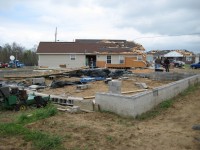
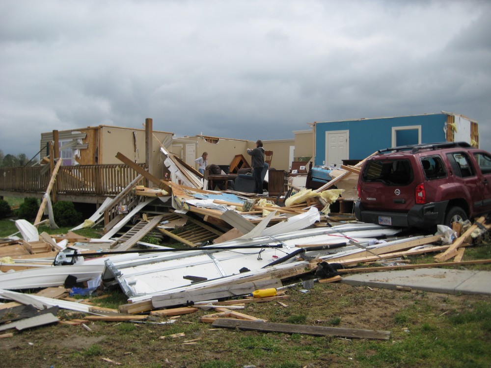
A double-wide manufactured home in the Powell community in western DeKalb County was moved off of its foundation. The roof was completely blown off and some of the exterior walls were knocked down and fell into the structure.
|

This is a metal warehouse building that was used to store farm equipment in the Powell community. The strongest winds of the tornado likely occurred around this area, as the damage indicators here gave us a peak wind estimate of 155 mph winds. The entire structure was completely destroyed.
|
This house in the Stonebrook subdivision in Sylvania was lifted off of its foundation and moved several meters into its front yard. The left side of the house sustained significant damage and portions of the roof were also damaged (but were mostly left attached to the house).
|
The tornado moved across the Stonebrook Subdivision. Significant damage occurred in one and two family residence homes, including the one pictured. The roof was completely blown off the house pictured and exterior walls collapsed with the only some of the interior walls remaining.
|
Strong winds from the tornado crumpled and knocked over a cell phone tower in Sylvania in western DeKalb County.
|
|
Radar Data
To view a radar animation of the Preston Island/South Sauty/Langston/Sylvania tornado, click here. The animation shows imagery from 3:02pm until 3:35pm.
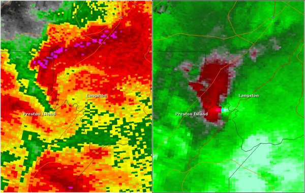
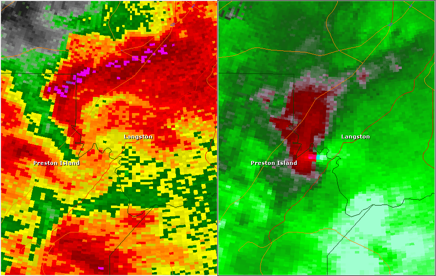
This National Weather Service radar image from 3:11pm shows a very strong and tight velocity couplet between Preston Island and Langston. At this point, the tornado was likely moving off Guntersville Lake into the South Sauty area. The base reflectivity product in the left panel, which shows rainfall intensity, shows a classic hook echo, with the darker red and purple areas likely representing areas that were receiving hail. The storm relative velocity product in the right panel shows winds toward (in green) and away (in red) from the radar at Hytop. This particular image shows winds of around 65 mph relative to the storm inbound toward the radar directly next winds of 65 mph relative to the storm outbound from the radar.

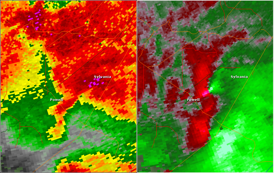
This National Weather Service radar image from 3:30pm shows a strong velocity couplet between Powell and Sylvania. This is around the time the tornado reached its peak intensity. The base reflectivity product in the left panel, which shows rainfall intensity, continues to show an impessive hook echo, with the darker red and purple areas likely representing areas that were receiving hail. The storm relative velocity product in the right panel shows winds toward (in green) and away (in red) from the radar at Hytop.
|


 Local Radar
 Weather Map
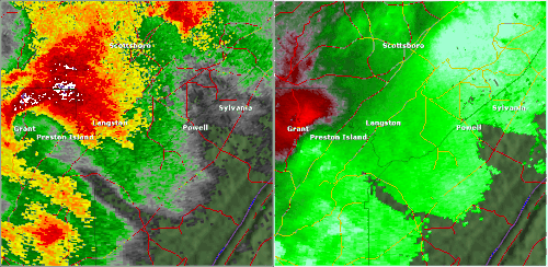