
A significant winter storm will produce a broad area of moderate to heavy snow from the Midwest through the western Great Lakes. Significant snow accumulations of 6-12 inches, and locally more than 1 foot, and gusty wind may cause hazardous travel conditions. Thunderstorms, some severe, and showers may produce locally heavy rain and isolated flash flooding along the western Gulf Coast. Read More >
 |
| Safety & Preparedness | Precipitation & Types | Past Events |
| Products & Criteria | Additional Info |
|
While the frequency of extreme winter weather events is relatively small in north Alabama and southern middle Tennessee, winter weather can cause significant property damage, injury, and even death. With the start of each new season, preparation is the key to lessening the dangers and hazards associated with winter weather. Please join us in promoting winter weather safety during this year's Winter Weather Awareness Week. |
 |
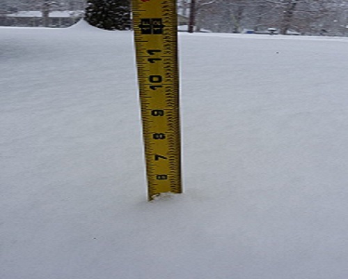 |
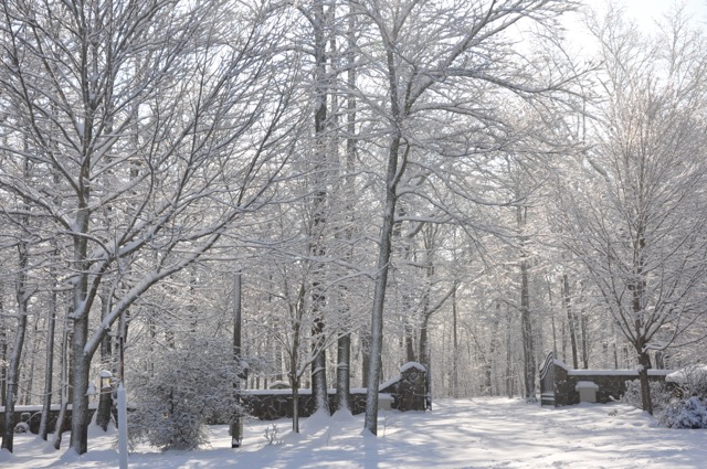
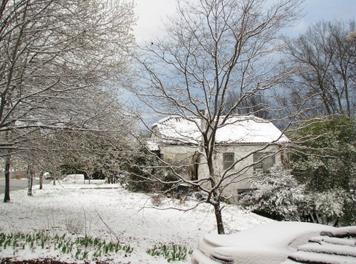
| The snowstorm of February 11th-12th, 2014 dumped 4 to 7 inches of snow across DeKalb county. This is a picture in the Mentone area after the snowfall. | The snowstorm of February 11th-12th, 2014 dumped 4 to 7 inches of snow across DeKalb county. This is a picture in the Rainsville area where 5 inches of snowfall is being measured. |
|
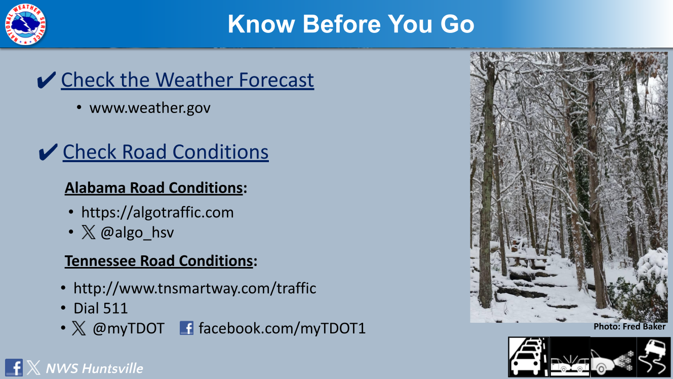
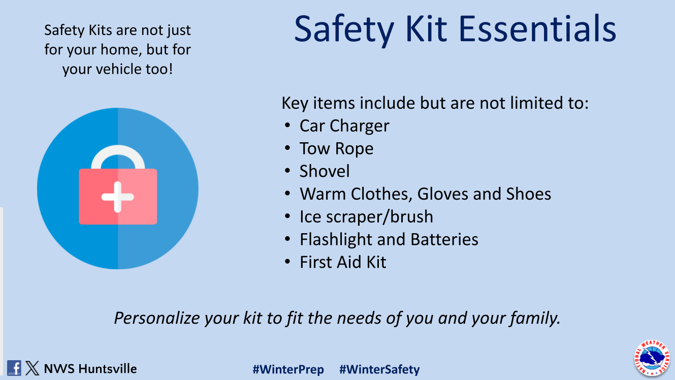
Travel Safety: Many people travel throughout the winter months (around the holidays) so it is very important to check the weather ahead of time and be aware of any potential hazards. In addition, having a travel safety kit could save your life! |
|
 |
 |
|
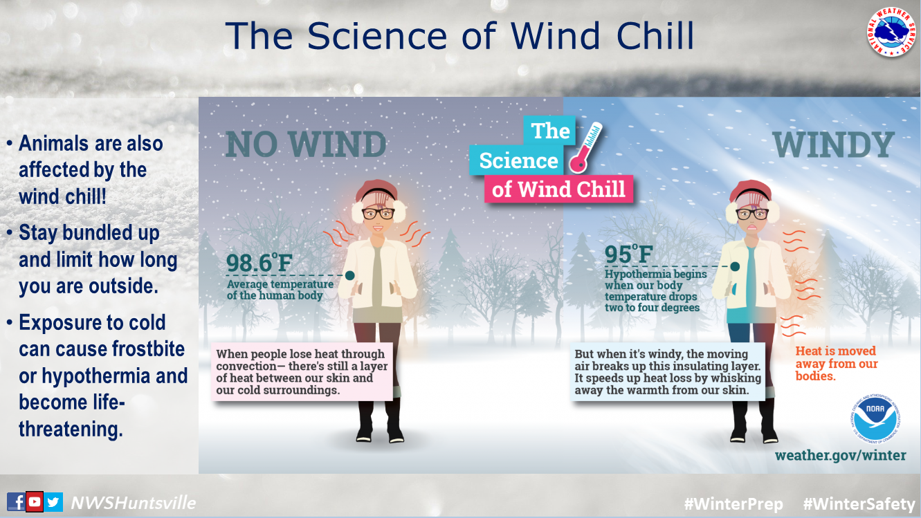
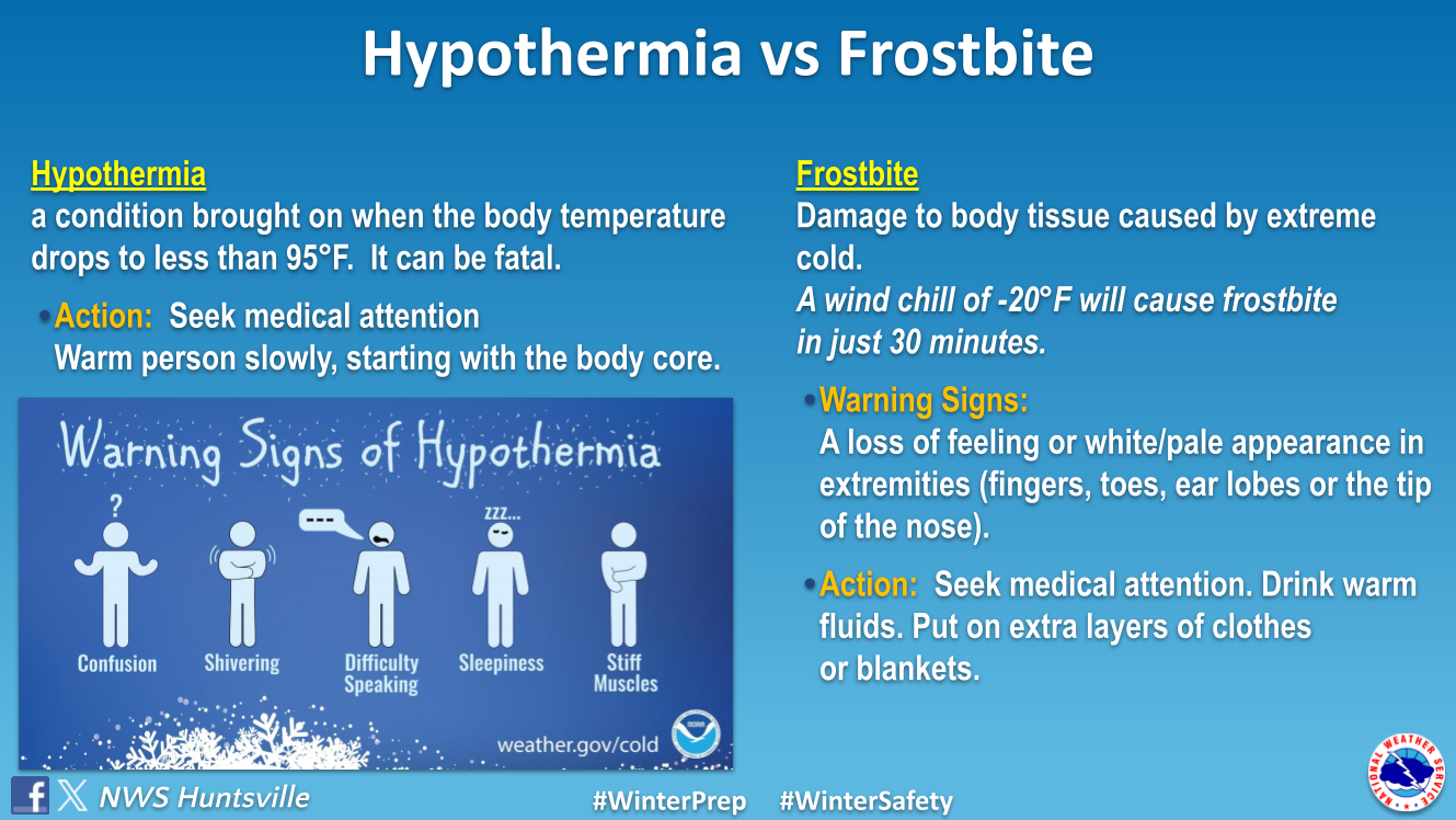
Why are Wind Chill Values Important? Remember, breezy to windy conditions combined with cold temperatures can cause hypothermia within 15 to 30 minutes if no precautions such as layered clothing, gloves, warm hat, etc are used. |
|
|
|
|
The challenges of winter weather forecasting go beyond predicting when it will snow or how much snow will fall. At times, determining the type of precipitation is an even bigger forecast challenge! Precipitation type with winter weather is largely related to the temperature profile in the atmosphere (basically between the ground and ~ 20K feet up). Typically, it gets colder as you go up in elevation but sometimes there can be a “warm layer” of air that gets wedged between the ground and the clouds. This will have an effect on the melting/freezing processes of precipitation. Refer to the graphic below that explains how you can get freezing rain versus sleet versus snow or just all rain. |
.png) |
|
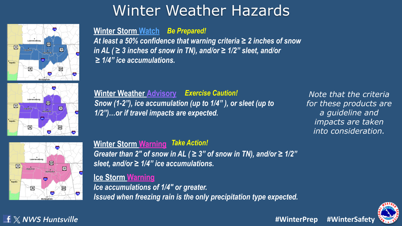
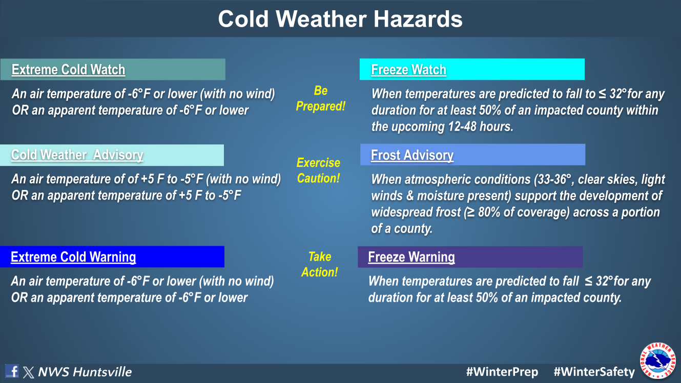
Local Winter Weather Products and Criteria
|
|
|
Other significant storms that have impacted the Tennessee Valley in the past are listed below:
|
|
|


 Local Radar
 Weather Map