Wilmington, OH
Weather Forecast Office
|
|
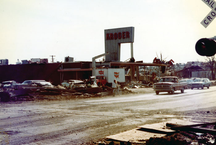
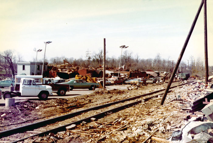
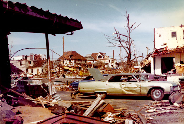
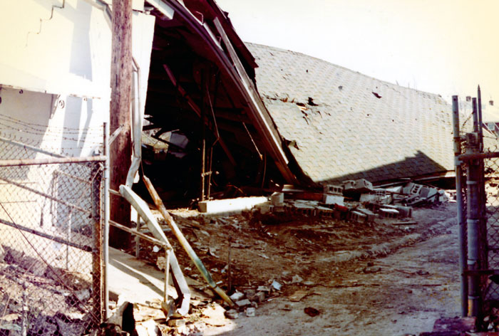
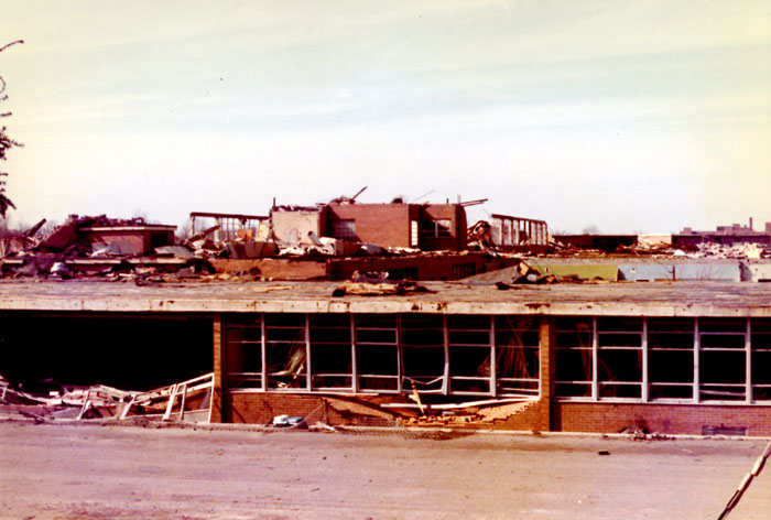
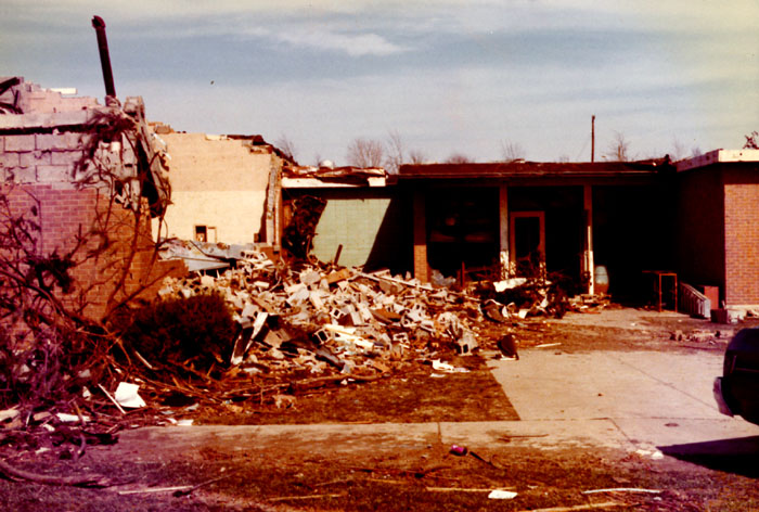
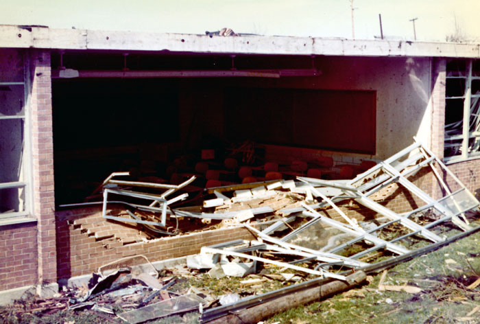
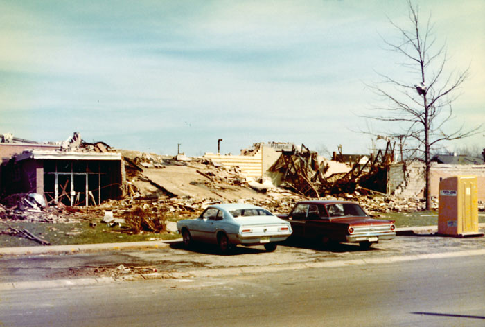
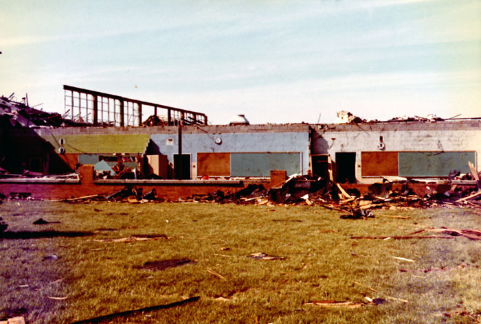
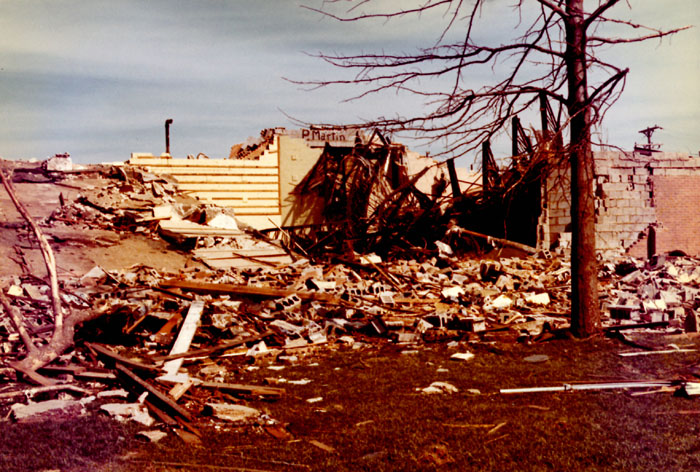
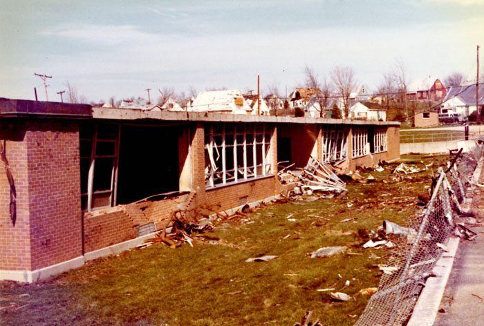
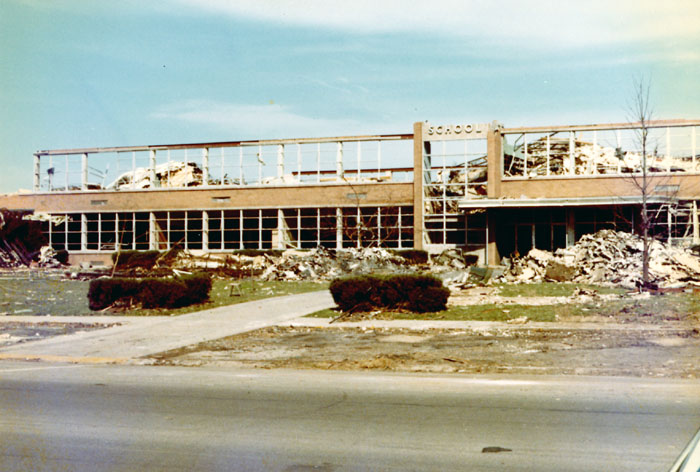
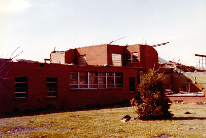
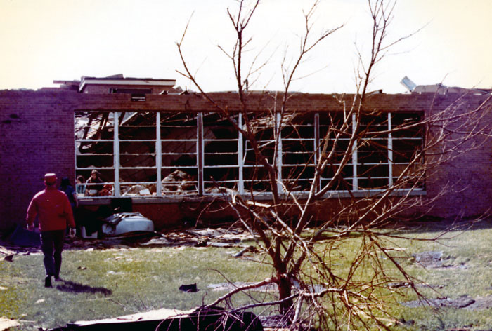
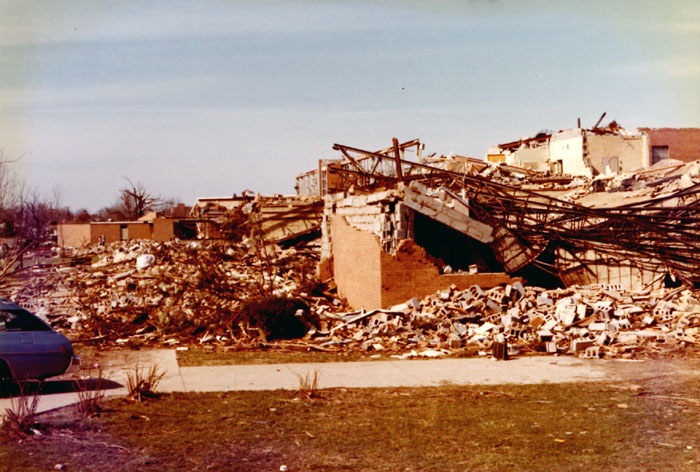
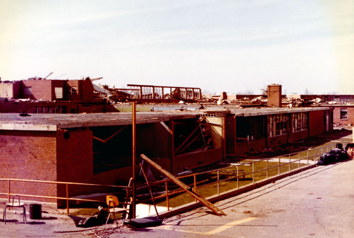
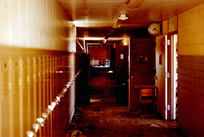
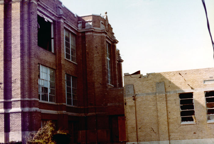
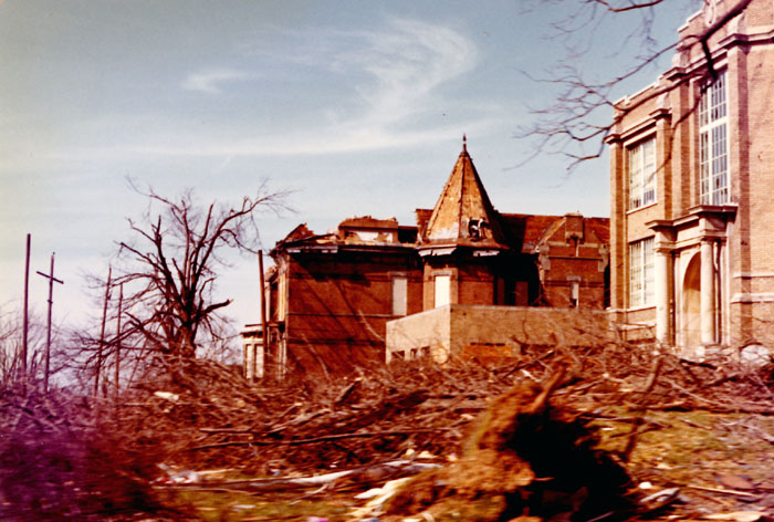
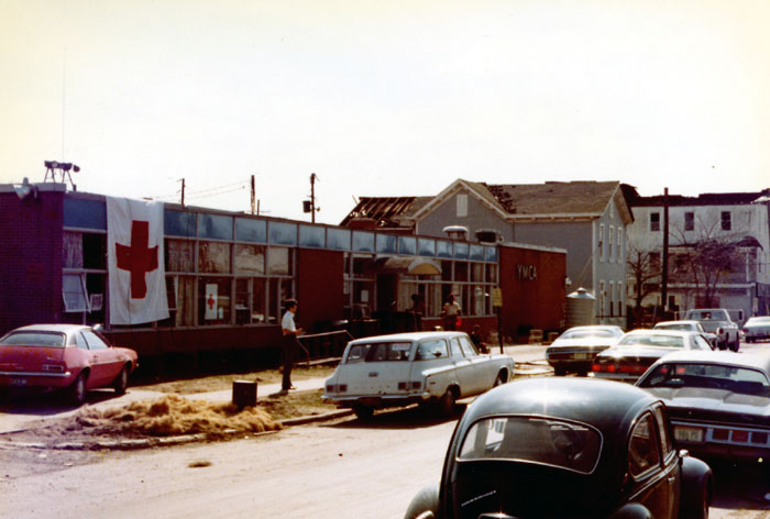
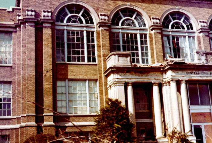
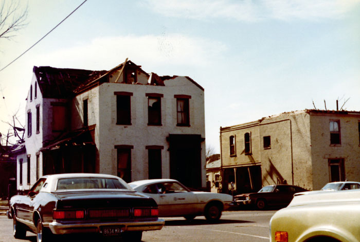
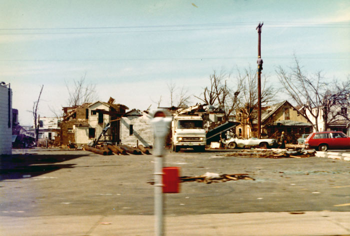
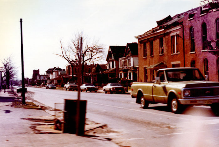
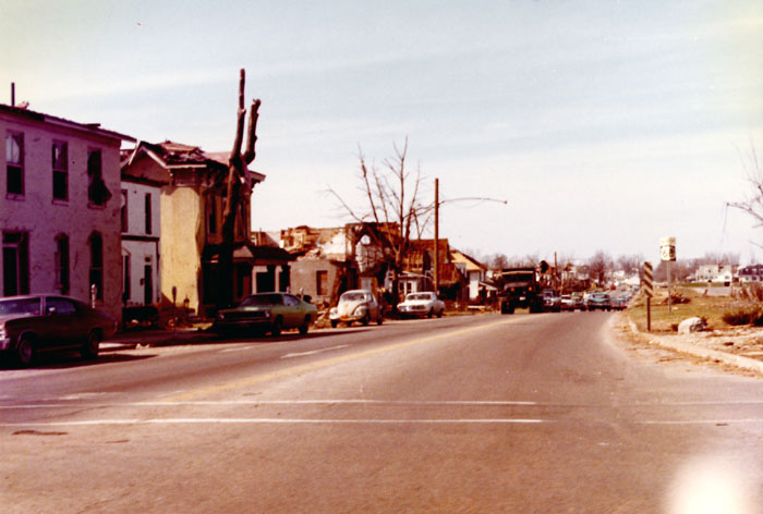
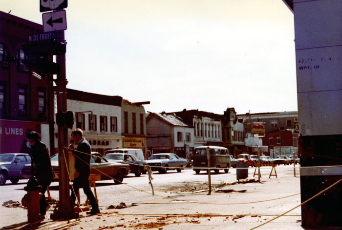
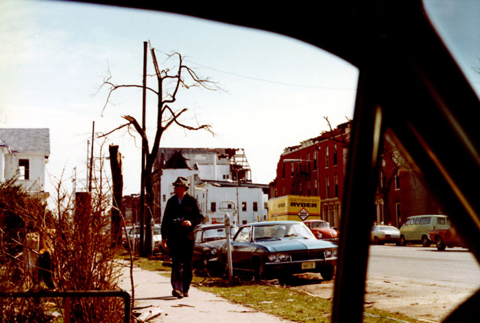
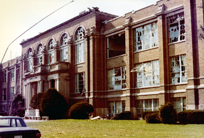
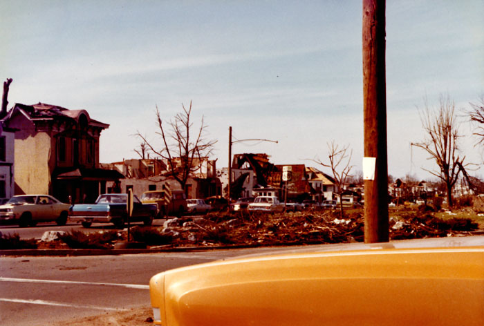
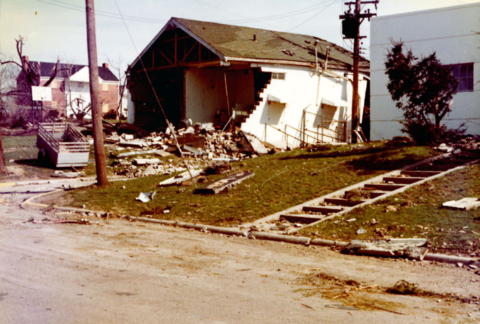
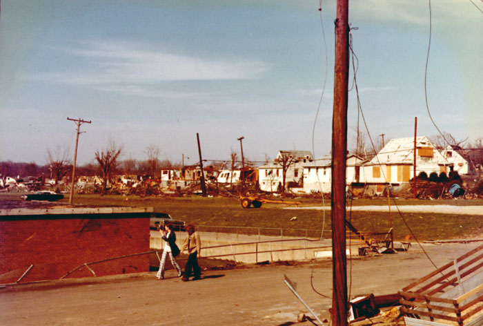
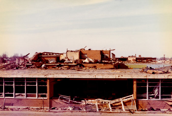
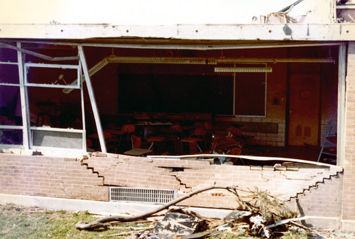
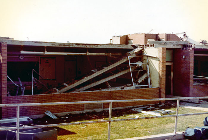
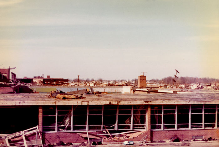
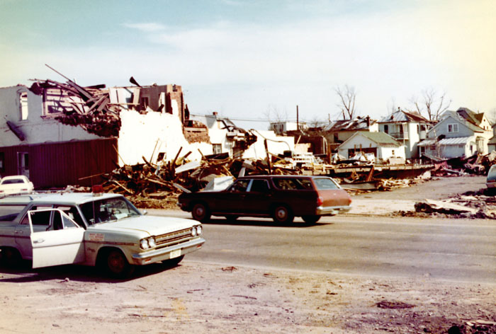
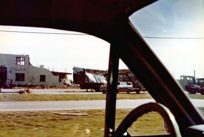
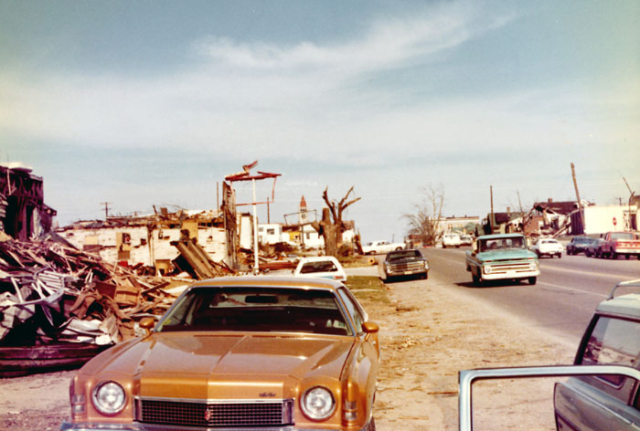
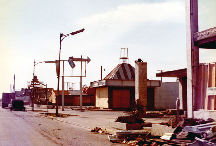
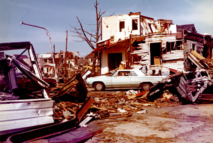
NWS Wilmington acquired these pictures of damage from the 1974 Xenia F5 tornado from the Public Safety Communication Center of Berrien County, Michigan. They were taken by a former Berrien County Emergency Management Coordinator who likely aided in the Xenia recovery efforts. We extend our appreciation to the PSCC for sending us these photographs. Click each thumbnail to view the full-size version (700 x 472 px).
 |
 |
 |
 |
 |
 |
 |
 |
 |
 |
 |
 |
 |
 |
 |
 |
 |
 |
 |
 |
 |
 |
 |
 |
 |
 |
 |
 |
 |
 |
 |
 |
 |
 |
 |
 |
 |
 |
 |
 |
FORECASTS
Hourly Weather Graph
Graphical Forecast
Area Forecast Graphics
Area Forecast Discussion
River Forecasts and Obs
WEATHER HISTORY
Past Observed Weather
Local Climate Graphs
Local Event Summaries
OH / ILN Tornado Climatology
This Day in Weather History
NATIONAL CENTERS
Storm Prediction Center
National Hurricane Center
Weather Prediction Center
Aviation Weather Center
Climate Prediction Center
NCEI
US Dept of Commerce
National Oceanic and Atmospheric Administration
National Weather Service
Wilmington, OH
1901 South State Route 134
Wilmington, OH 45177
937-383-0031
Comments? Questions? Please Contact Us.

