|
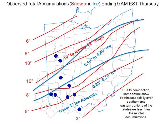
Winter Storm A low pressure system took shape across the southern Plains during the evening of January 26. Ahead of the low, a broad shield of mixed precipitation began to move into the Tri-State area on Monday night. Precipitation at the onset was primarily snow. Sleet and freezing rain began to mix in with the snow overnight, especially along and south of the Ohio River. On Tuesday, a brief break in the precipitation north of the Ohio River took place with sleet and freezing rain continuing for northern Kentucky and south-central Ohio. As the low moved into the Tennessee Valley, the precipitation shield expanded northward into southeast Indiana and central Ohio. Tuesday afternoon, a warm wedge of air aloft began to surge northward into southwest Ohio and even into central Ohio by the evening hours. This brought sleet and freezing rain, with significant ice accumulations to these areas. Meanwhile, west-central Ohio and eastern Indiana began to report significant snowfall accumulations. As the low finally moved along the Ohio River and into the Northeast early on Wednesday, mixed precipitation turned over to a final burst of moderate to heavy snow across the region. Overall, this winter storm has had significant impacts across the region. There have been widespread power outages reported across northern Kentucky, along the Ohio River, and into south-central Ohio with snow and ice covered roads impacting travel across the Ohio Valley.
|