Wilmington, OH
Weather Forecast Office
|
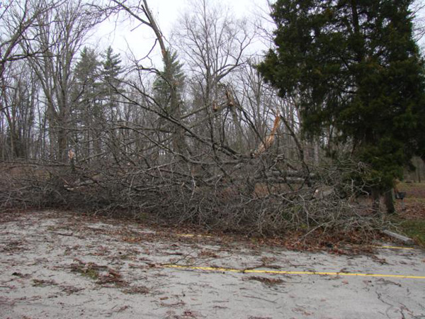
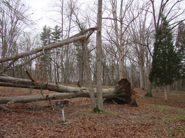
Severe Weather - Hail and Wind An upper level jet stream tracking through the Ohio Valley combined with low pressure at the surface to produce severe thunderstorms during the afternoon of March 23rd. Several supercells developed with hail to golf ball size (1.75" in diameter). There were also a few thunderstorm line segments with damaging wind gusts ahead of drier air rapidly advancing from the west. Later in the afternoon, the surface low pressure over northern Ohio pushed a reinforced cold front through eastern parts of the area in the wake of the storms, resulting in some non-thunderstorm wind gusts to 55 mph. A second round of thunderstorms occurred closer to the main cold front during the evening of March 23rd to just after midnight on March 24th. These storms contained primarily hail with diameters of 0.75"-1". |


|
|
FORECASTS
Hourly Weather Graph
Graphical Forecast
Area Forecast Graphics
Area Forecast Discussion
River Forecasts and Obs
WEATHER HISTORY
Past Observed Weather
Local Climate Graphs
Local Event Summaries
OH / ILN Tornado Climatology
This Day in Weather History
NATIONAL CENTERS
Storm Prediction Center
National Hurricane Center
Weather Prediction Center
Aviation Weather Center
Climate Prediction Center
NCEI
US Dept of Commerce
National Oceanic and Atmospheric Administration
National Weather Service
Wilmington, OH
1901 South State Route 134
Wilmington, OH 45177
937-383-0031
Comments? Questions? Please Contact Us.

