National Weather Service United States Department of Commerce

Heavy Great Lakes Snow through Friday; Extreme Cold and Potential for Major Winter Storm Late Week into this Weekend

Multiple clipper systems will bring cold temperatures and enhance lake-effect snow downwind of the Great Lakes. An arctic blast will bring frigid temperatures accompanied with gusty winds that may lead to dangerous wind chills beginning in the Northern Plains Thursday before expanding to the South and East. An expansive winter storm will start Friday in the Southern Rockies/Plains and Mid-South. Read More >

April 29, 2014
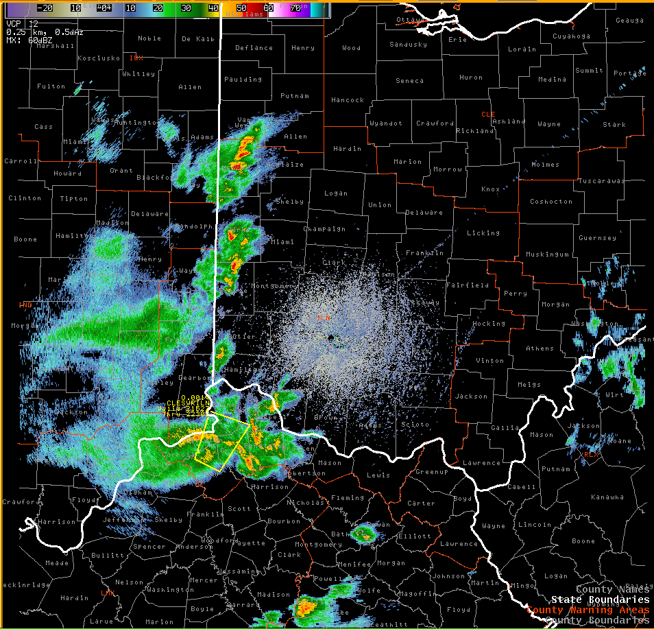
Severe Weather - Damaging Thunderstorm Winds


An area of strong to severe winds associated with a cluster of showers and thunderstorms moved from northern Kentucky to central Ohio during the late afternoon and evening of April 29, 2014. A small bow echo became evident in radar reflectivity with the corridor of strongest winds as the storms traveled northeast.


Radar Imagery:


NWS Wilmington OH (KILN)
0.5° Z -- 5:20-8:30 PM
There are several interesting things to note in this radar imagery:
  • Initially the reflectivity values are fairly weak (more greens and yellows). However, the atmosphere was conducive to strong thunderstorm downdrafts.
  • There is an eastward transfer of the strongest storms over southwest Ohio. This occurred as the thunderstorm cold pool organized and tracked toward a region of higher downdraft instability. Afterward, a more pronounced "bowing" structure develops.
  • An outflow boundary from previous rains existed over the Scioto Valley. As the existing bow intersected this boundary, it strengthened, and new storms fired instantly along the colliding boundaries in Franklin, Pickaway, and Ross Counties. While severe weather was not produced southeast of the existing bow, heavy rainfall occurred as strong thunderstorm updrafts developed.