Public Information Statement
National Weather Service Wilmington OH
234 PM EDT Tue May 30 2017
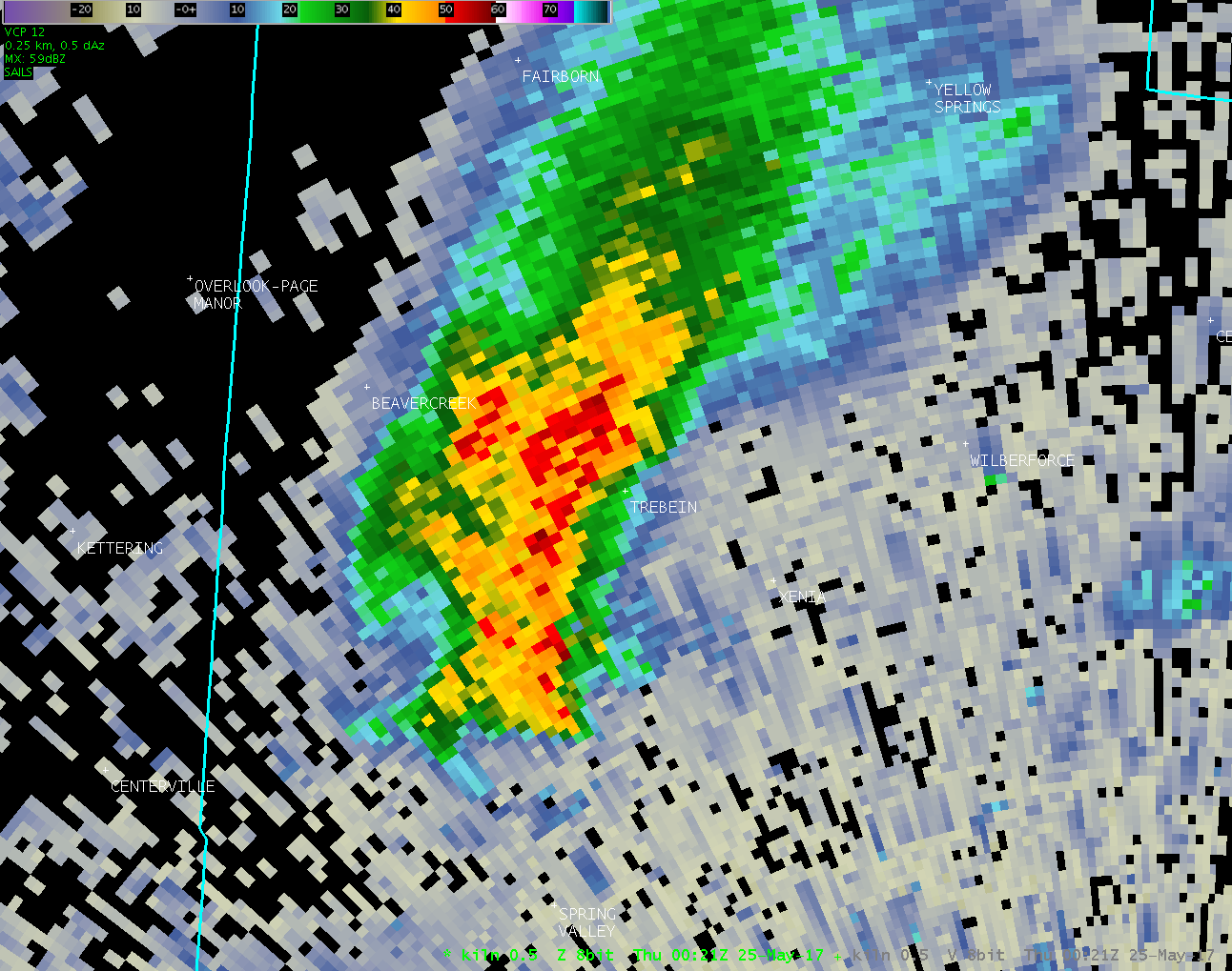
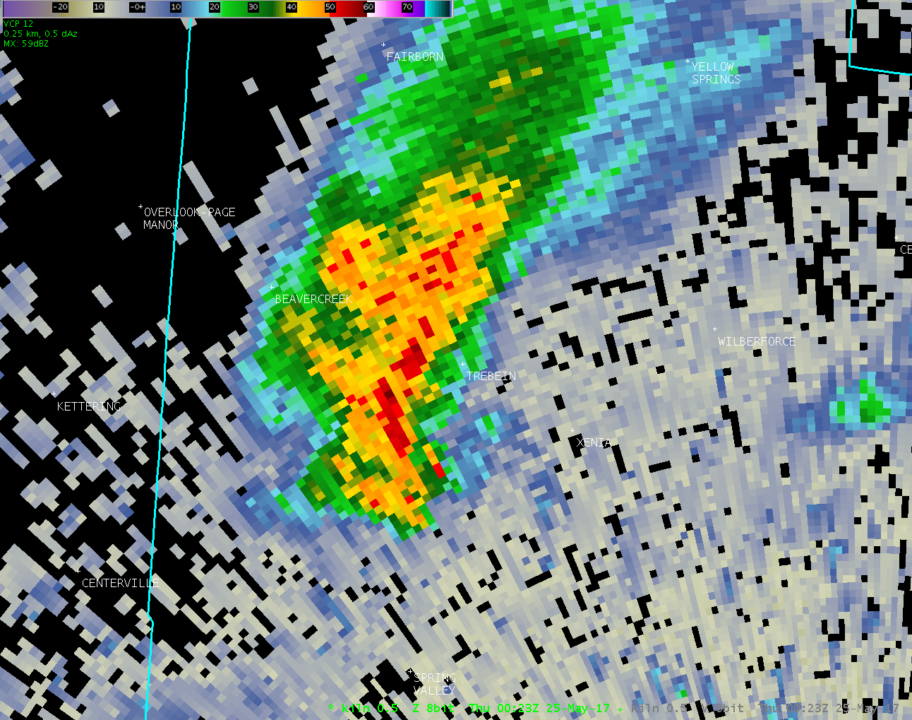
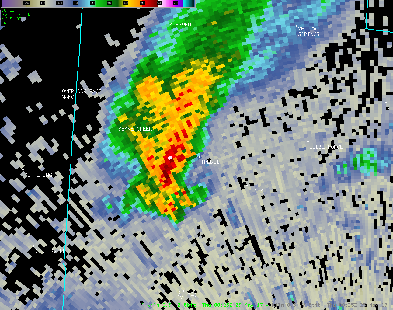
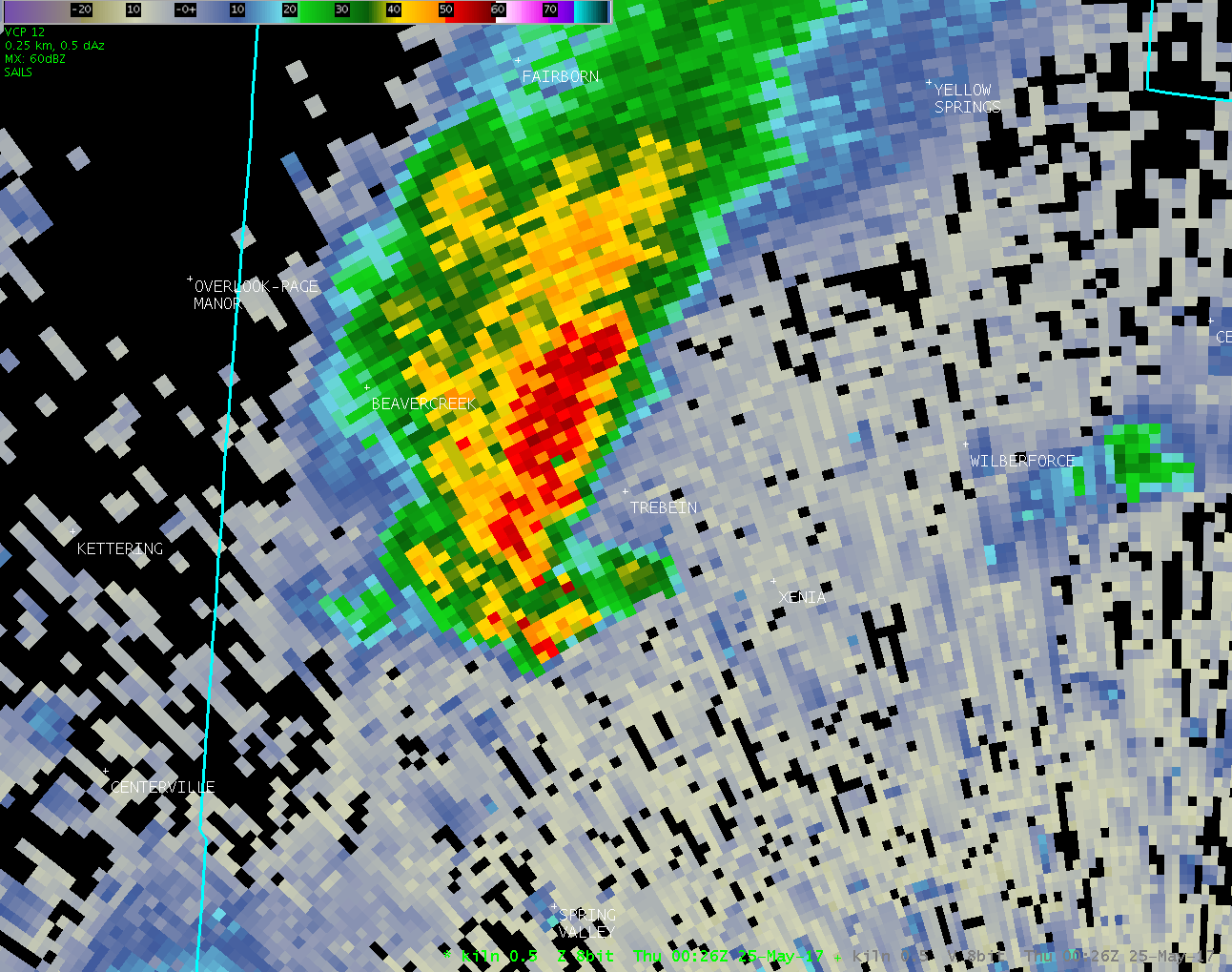
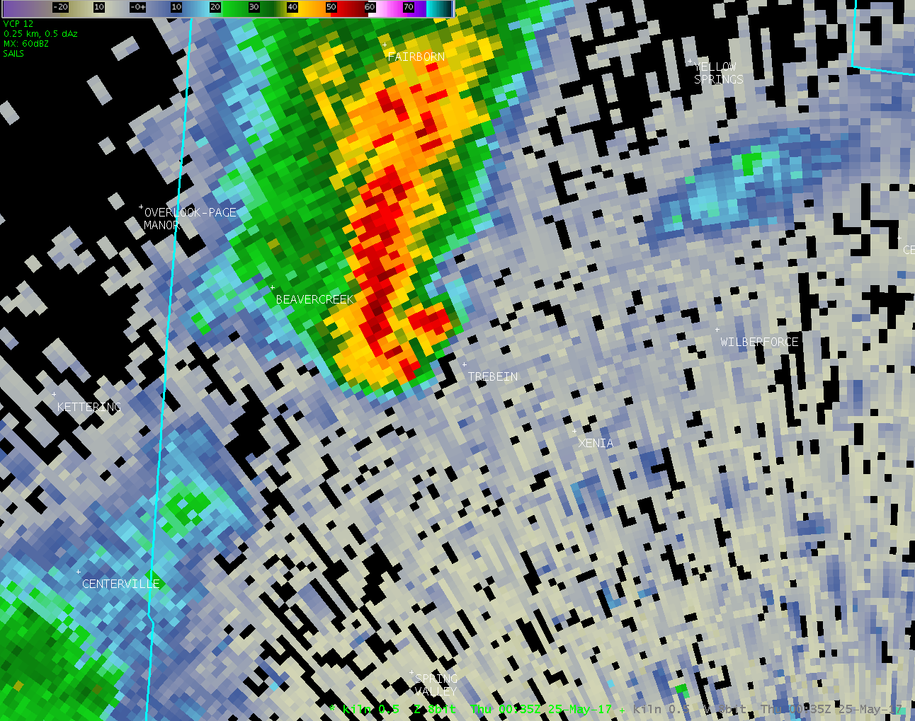
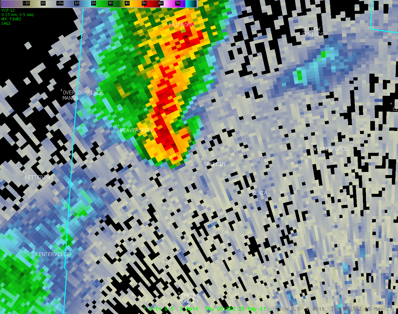
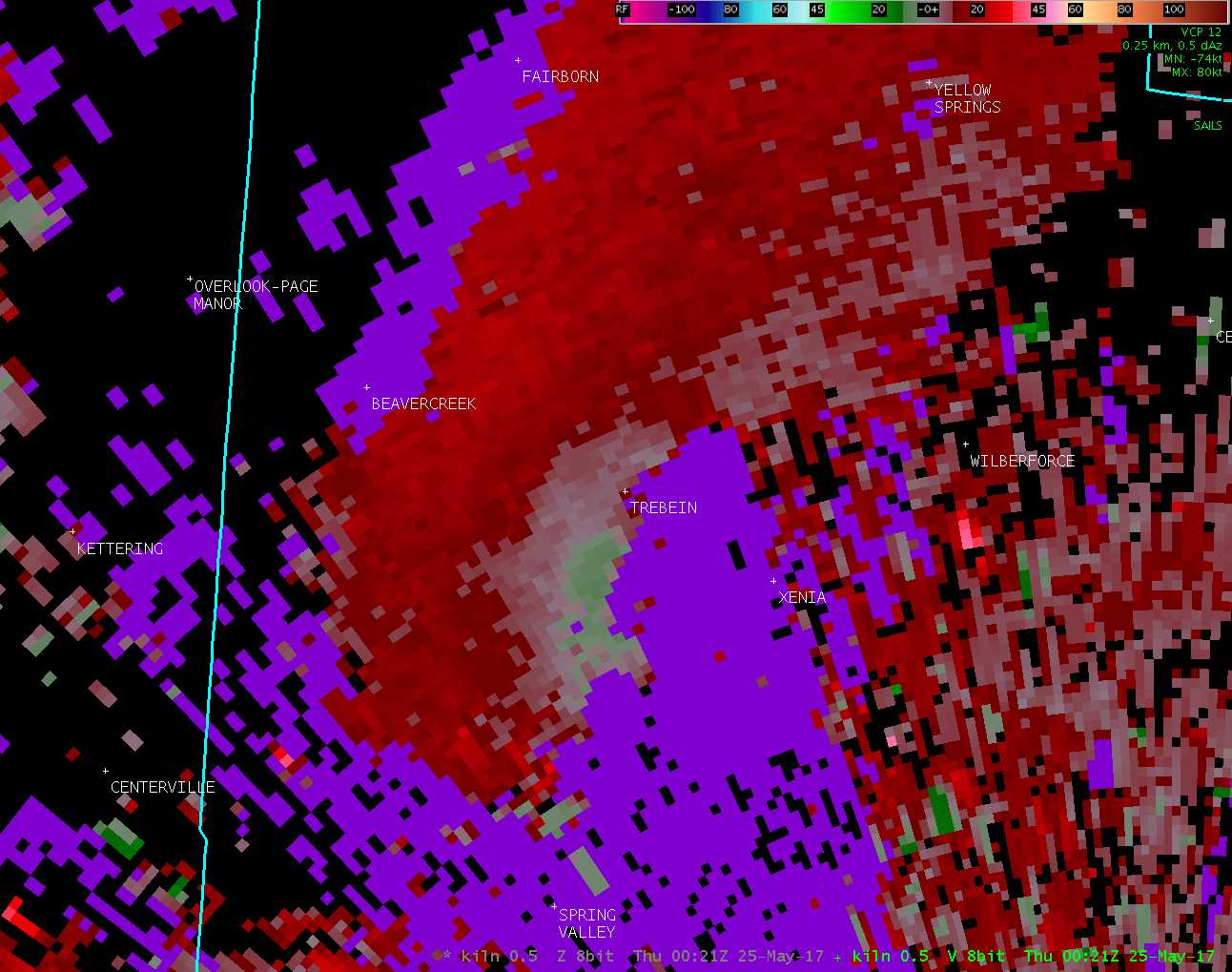
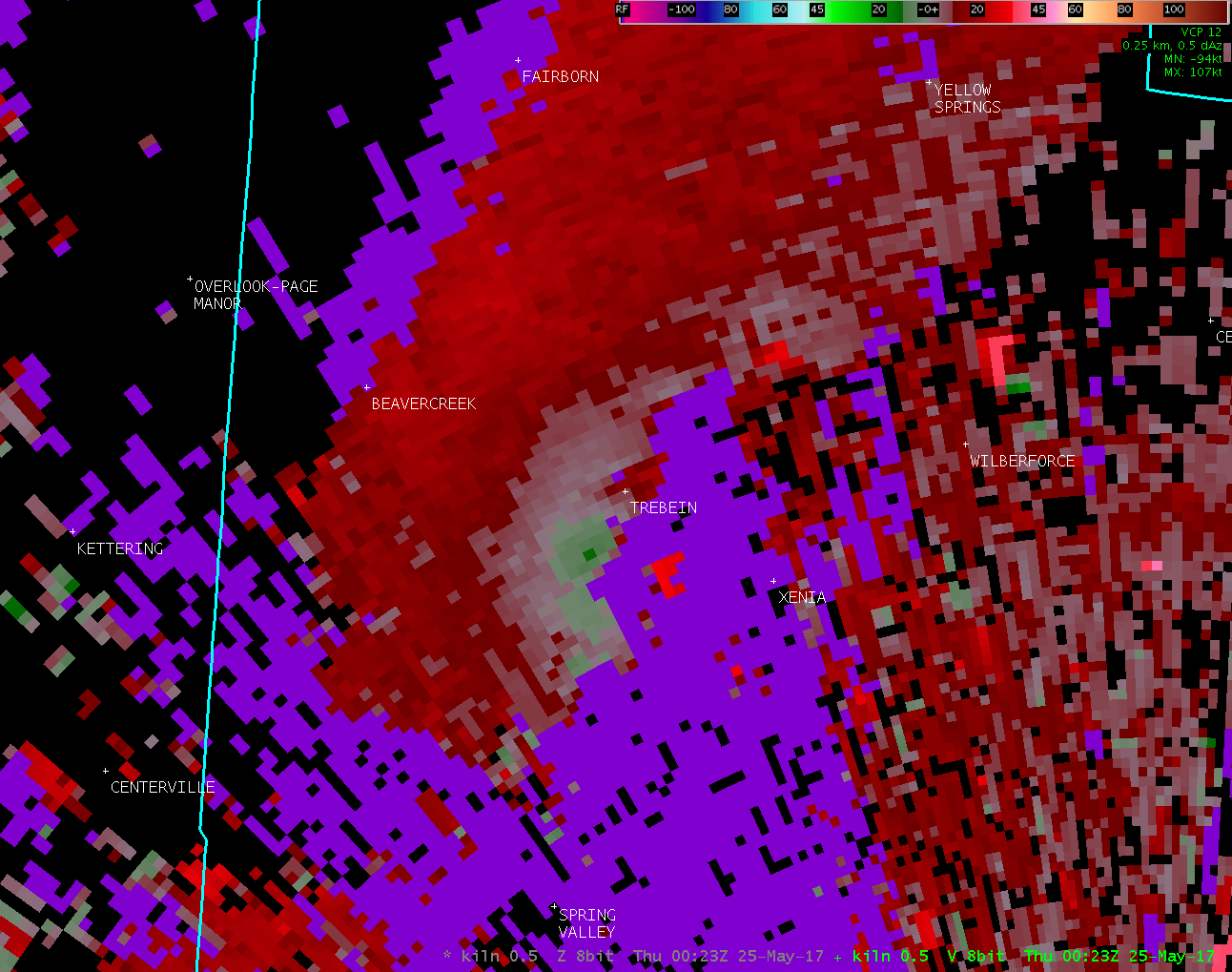
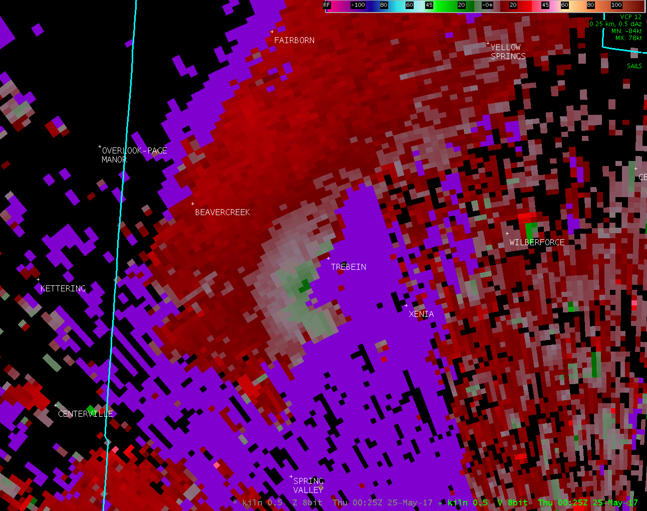
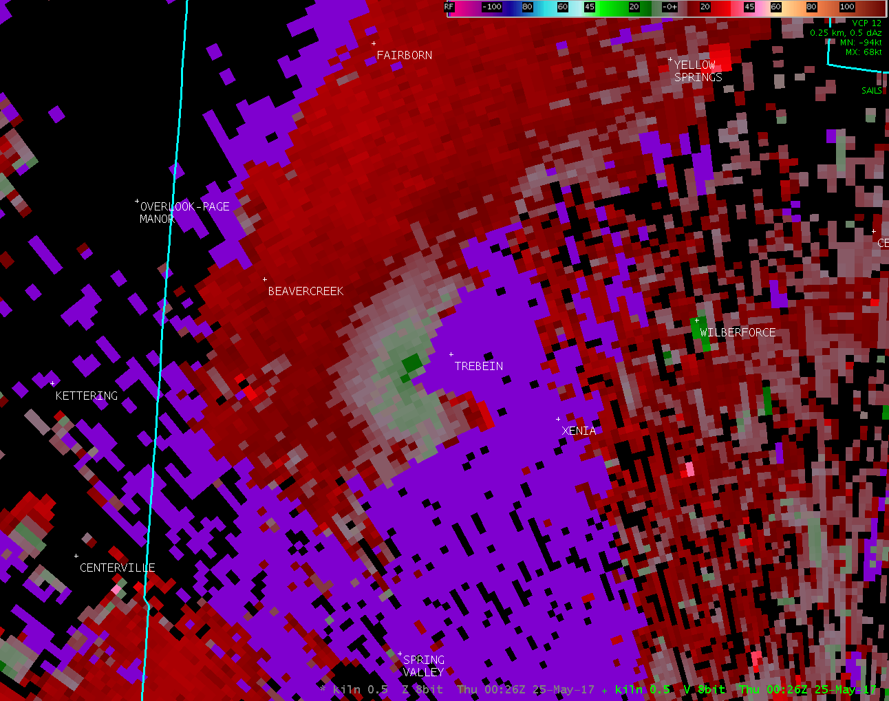
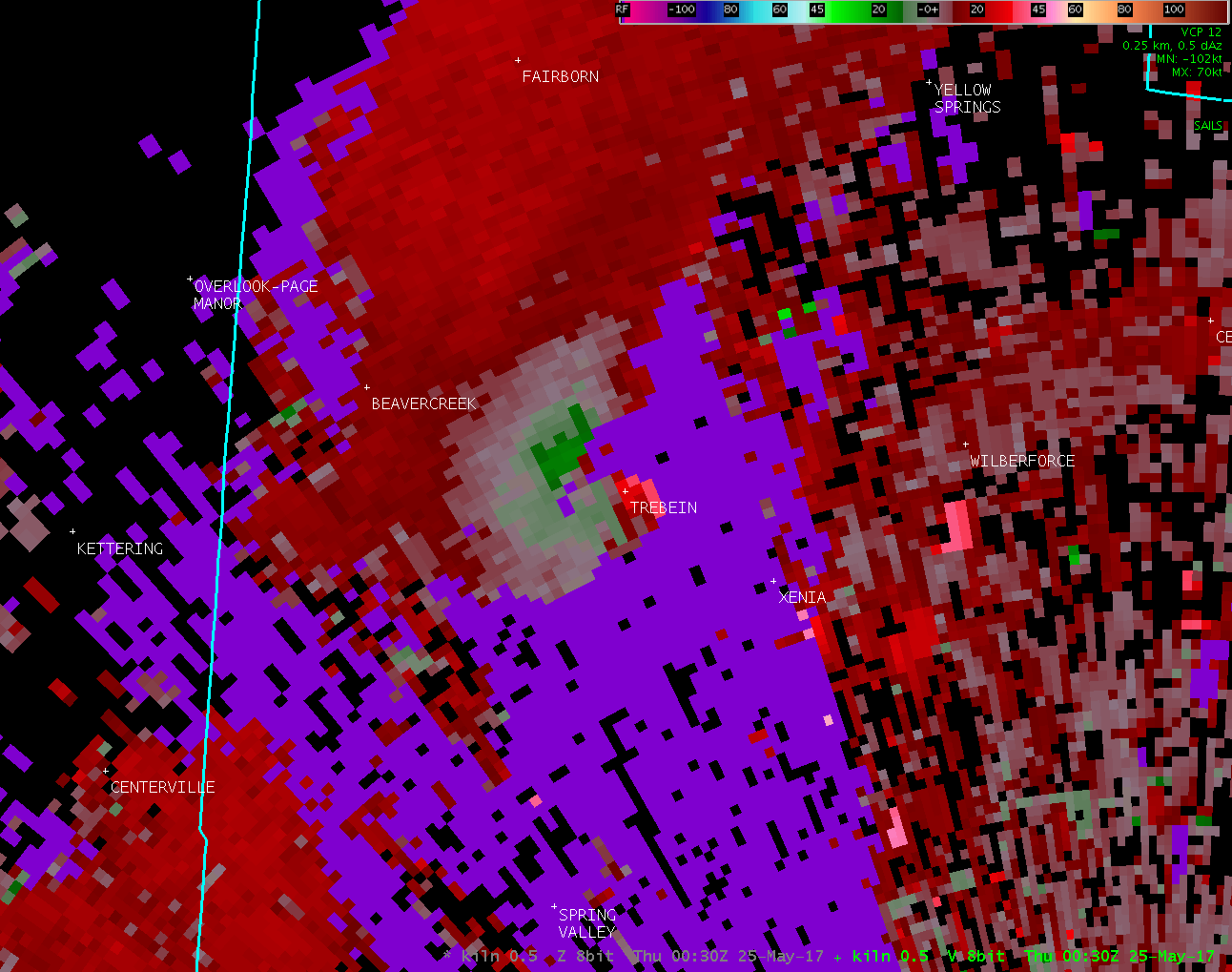
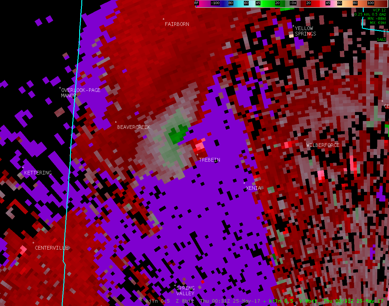
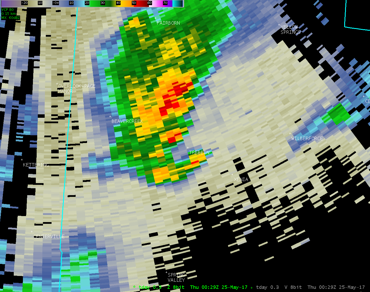
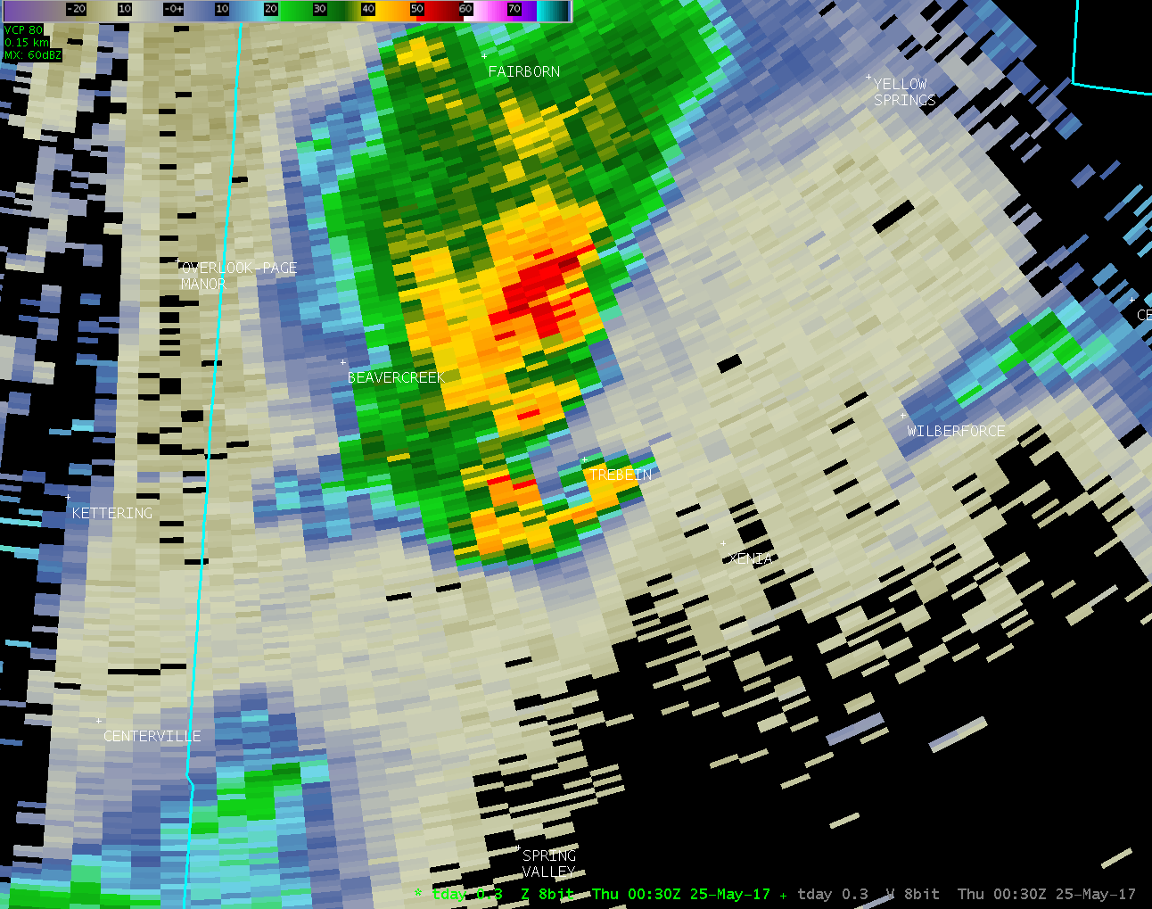
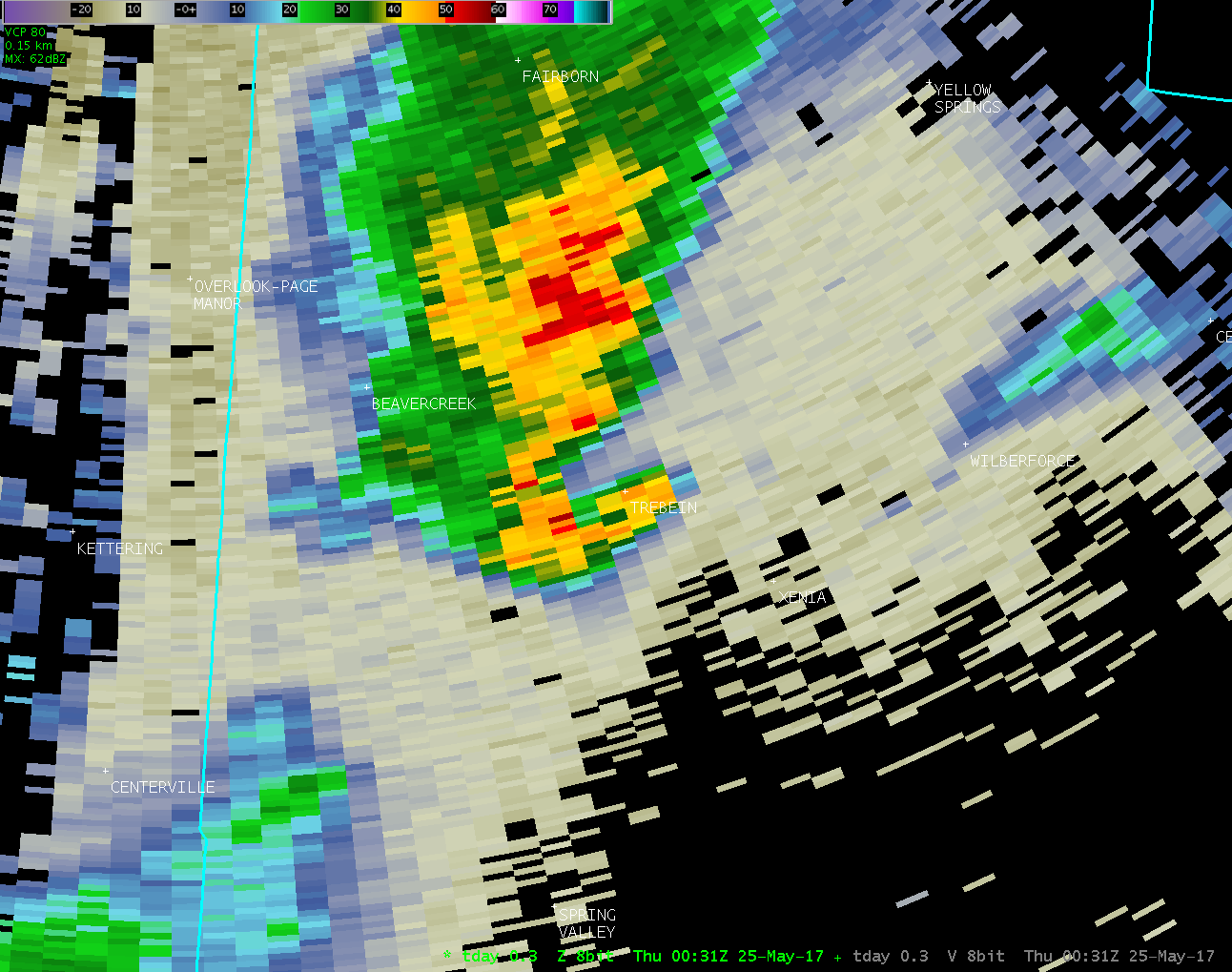
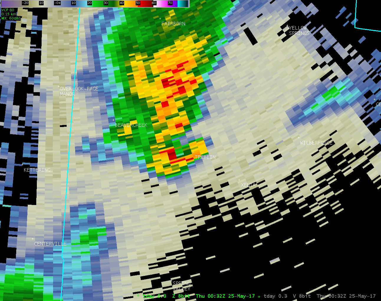
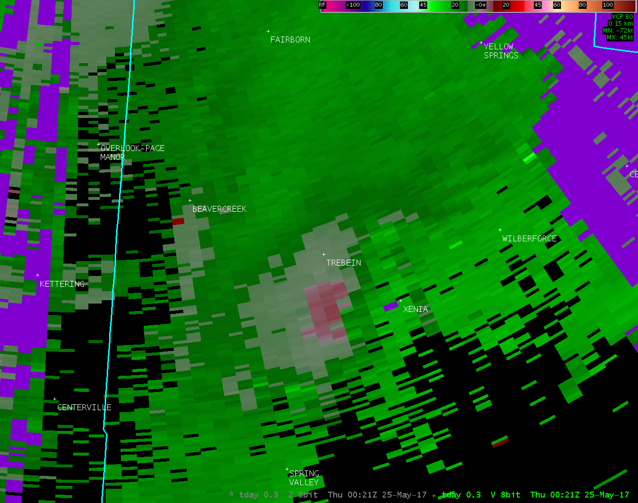
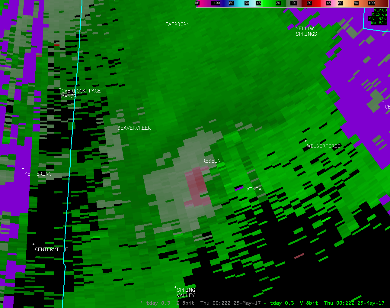
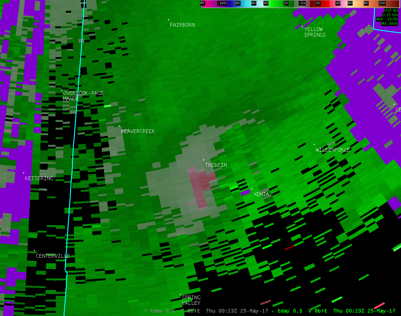
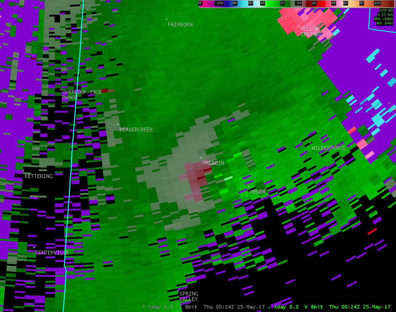
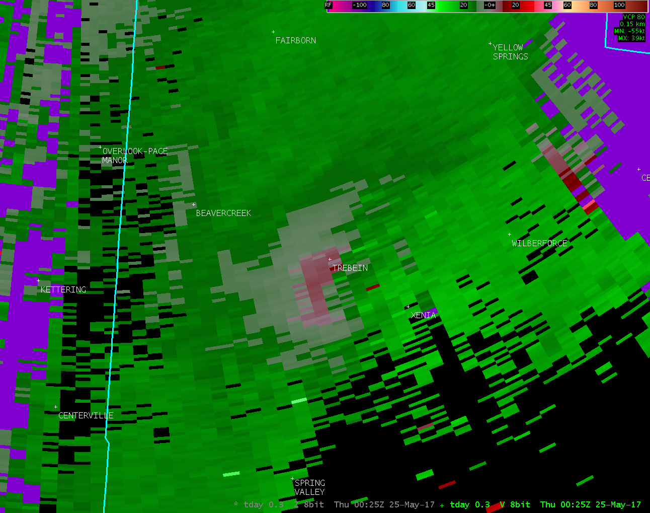
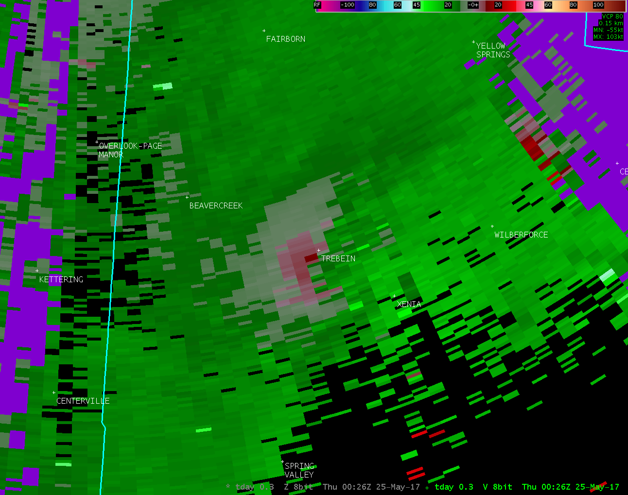
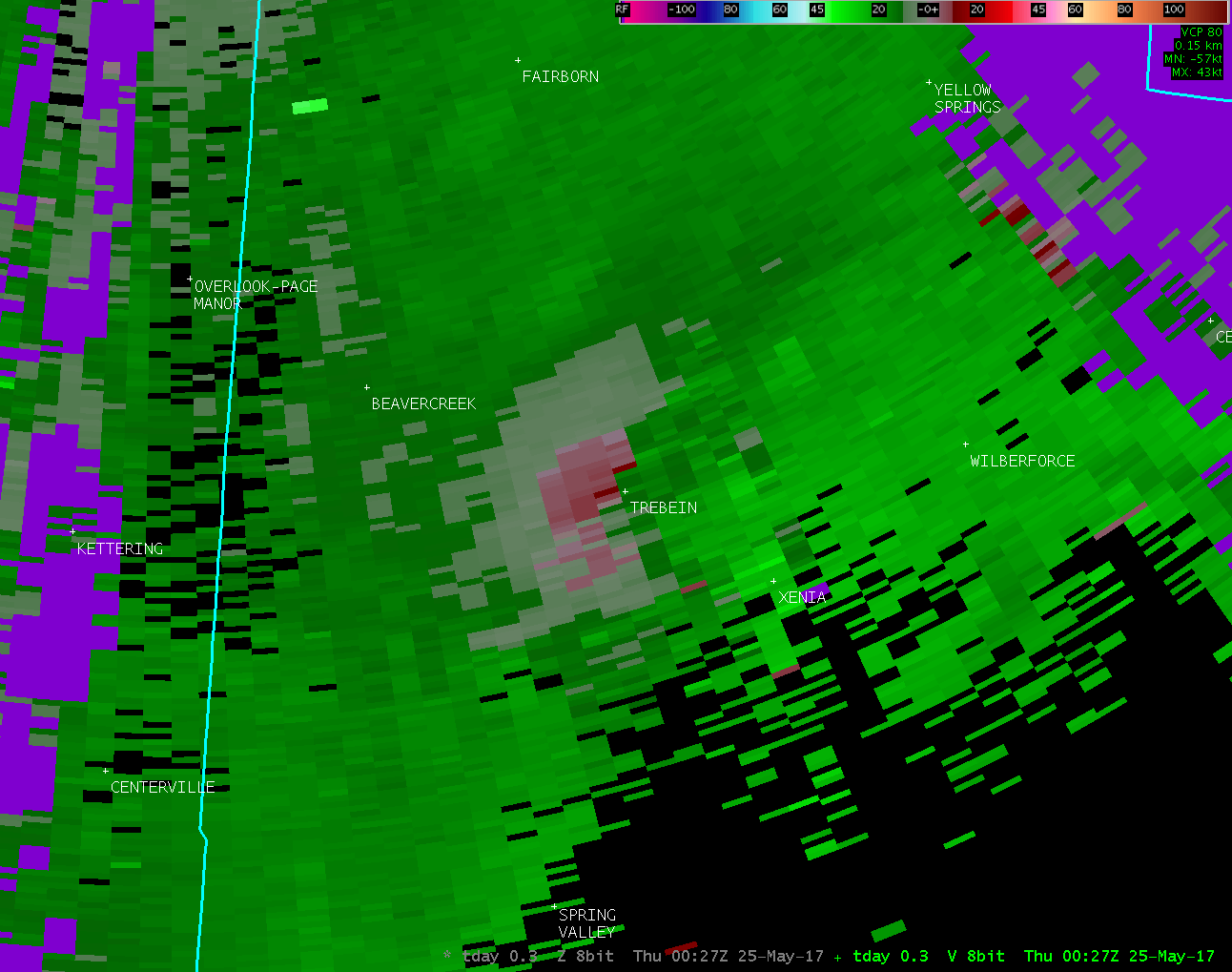
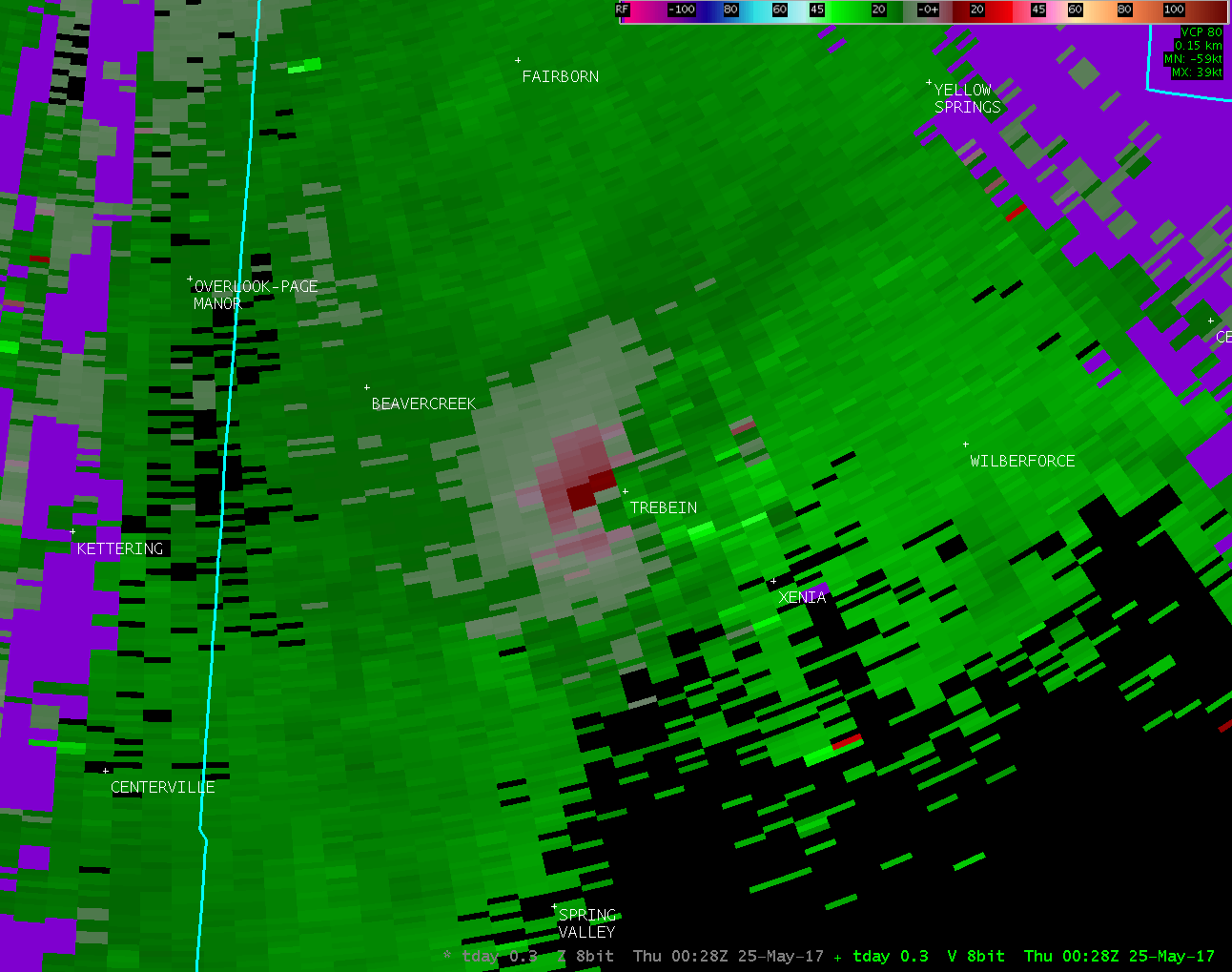
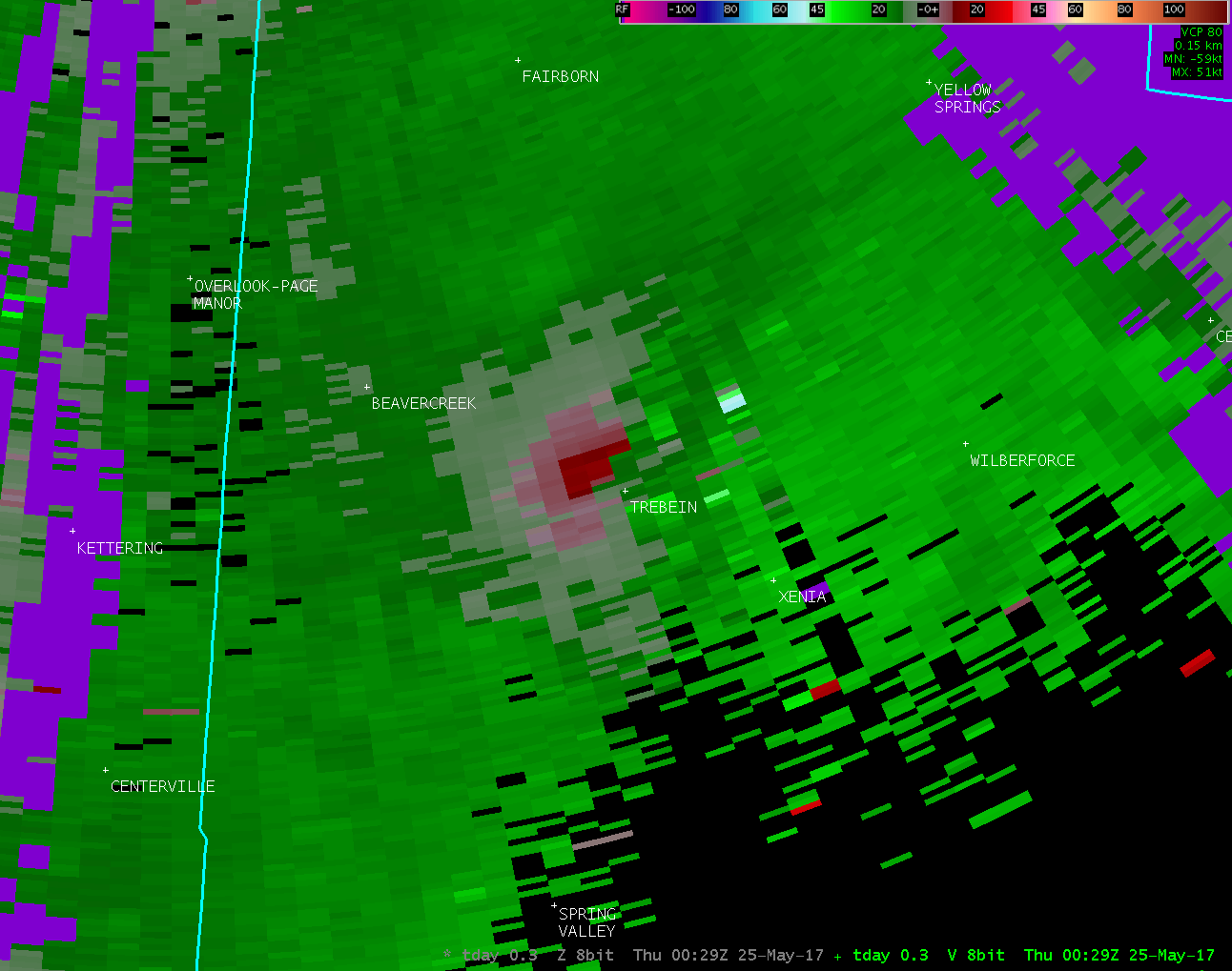
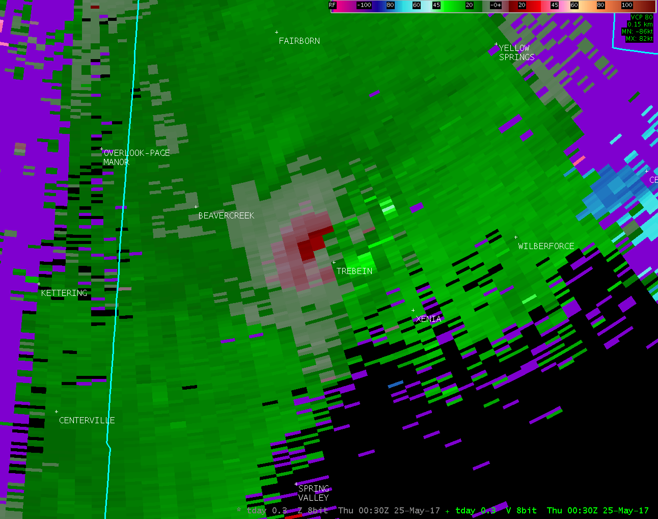
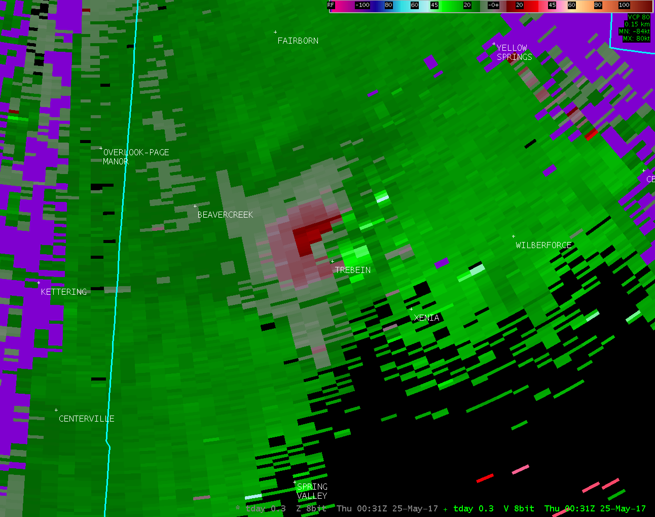
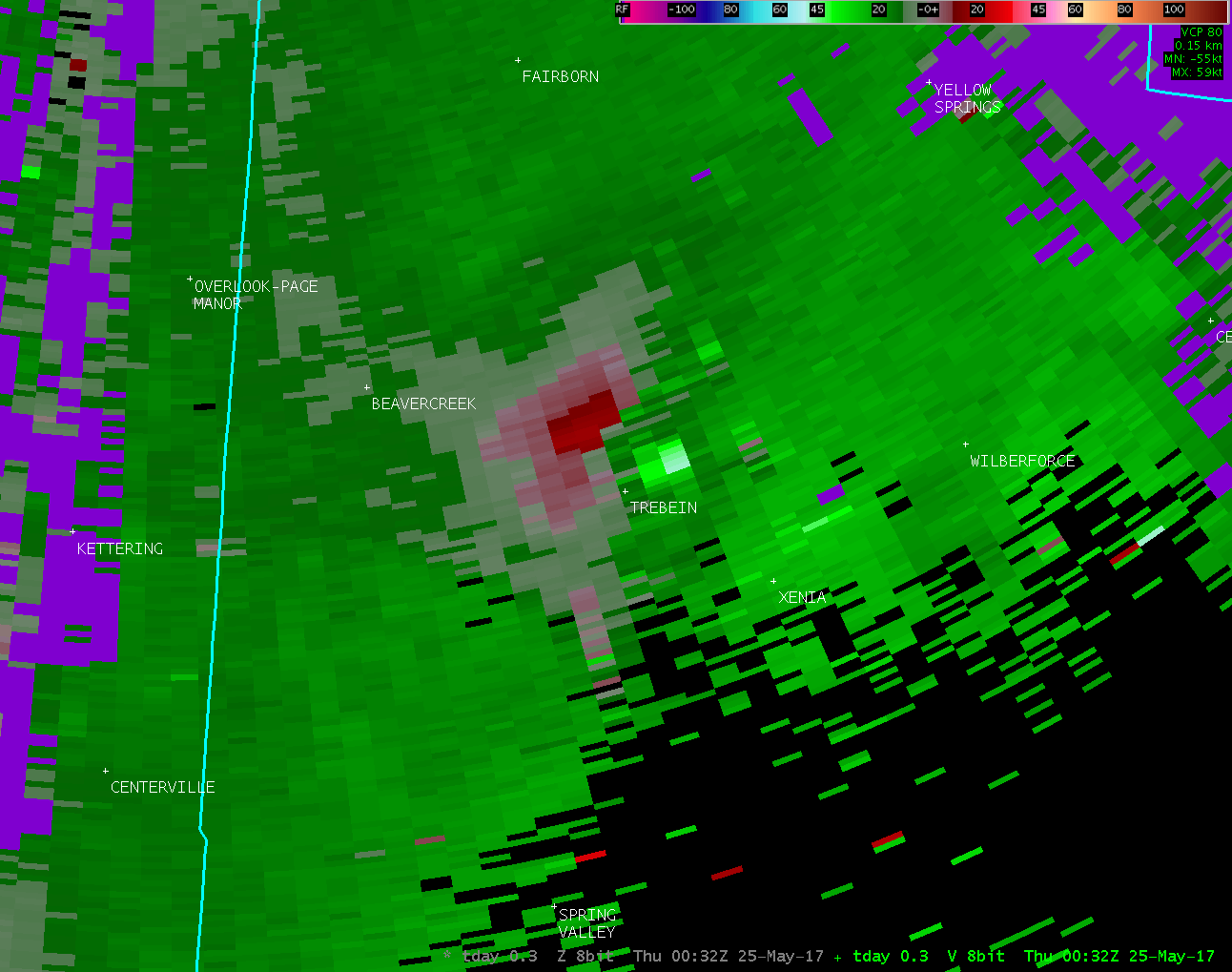
...TORNADO CONFIRMED NEAR 2 WEST OF XENIA IN GREENE COUNTY OHIO...
Location...2 West of Xenia in Greene County Ohio
Date...05/24/2017
Estimated Time...8:26 PM EDT
Maximum EF-Scale Rating...EF0
Estimated Maximum Wind Speed...65 MPH
Maximum Path Width...40 yards
Path Length...2.7 Miles
Beginning Lat/Lon...39.6804N/83.9749W
Ending lat/Lon...39.7165N/83.9894W
* Fatalities...0
* Injuries...0
* The information in this statement is preliminary and subject to
change pending final review of the event(s) and publication in
NWS Storm Data.
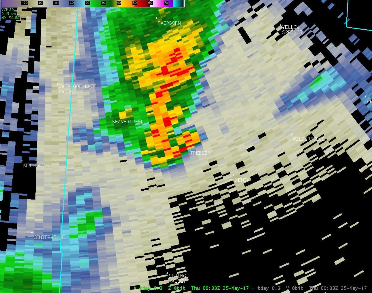
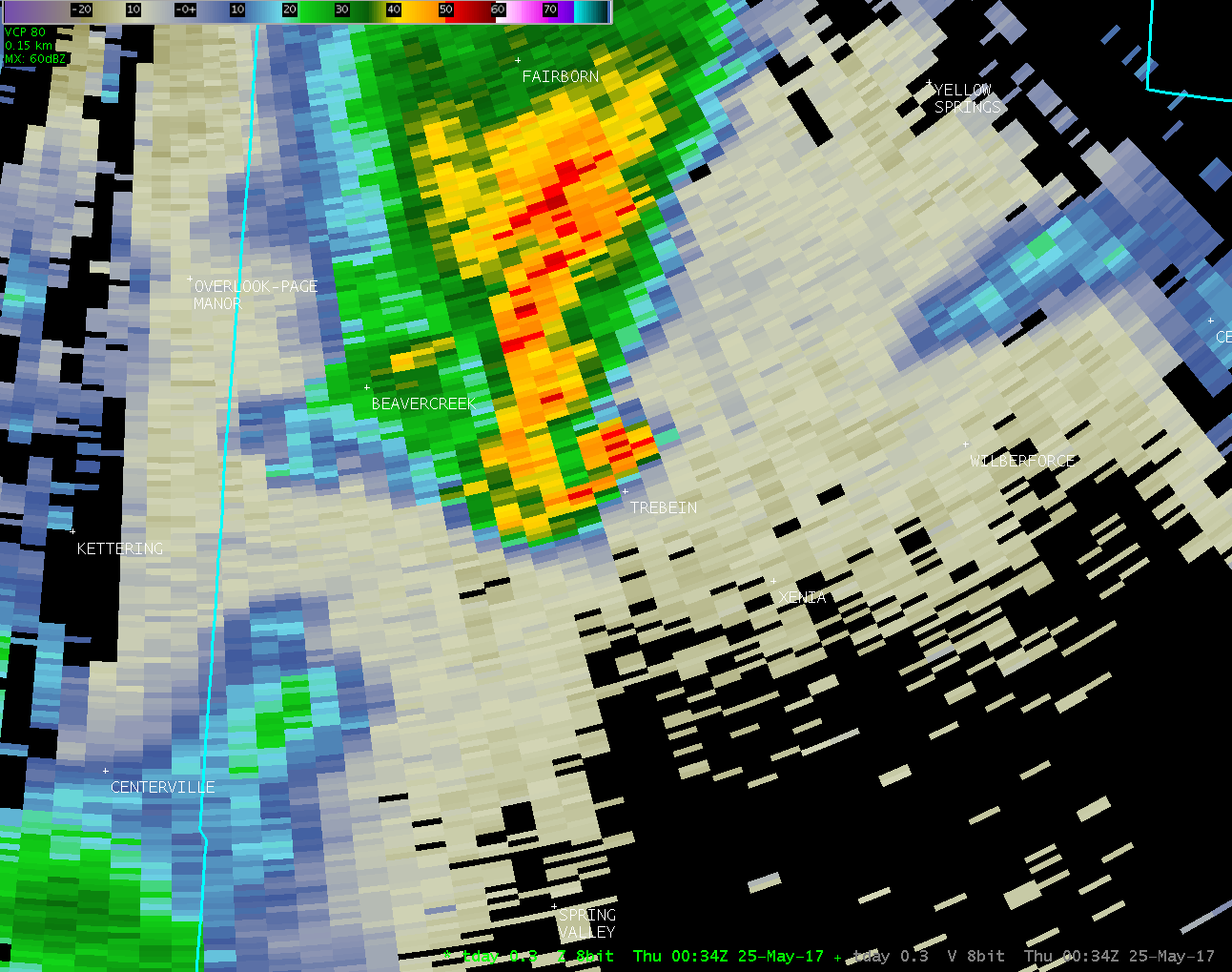
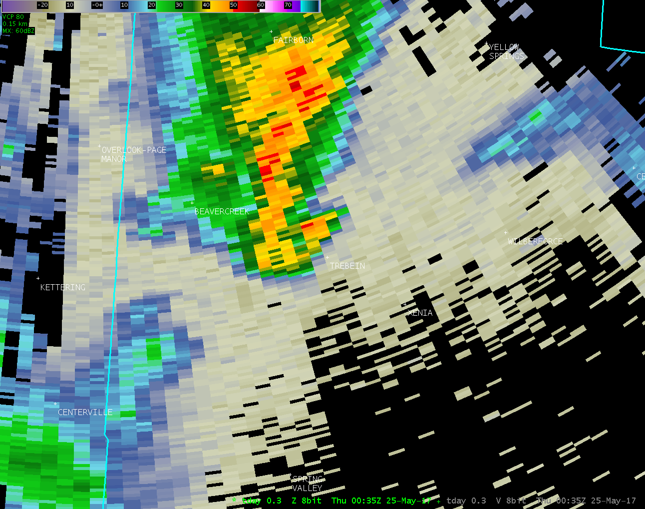
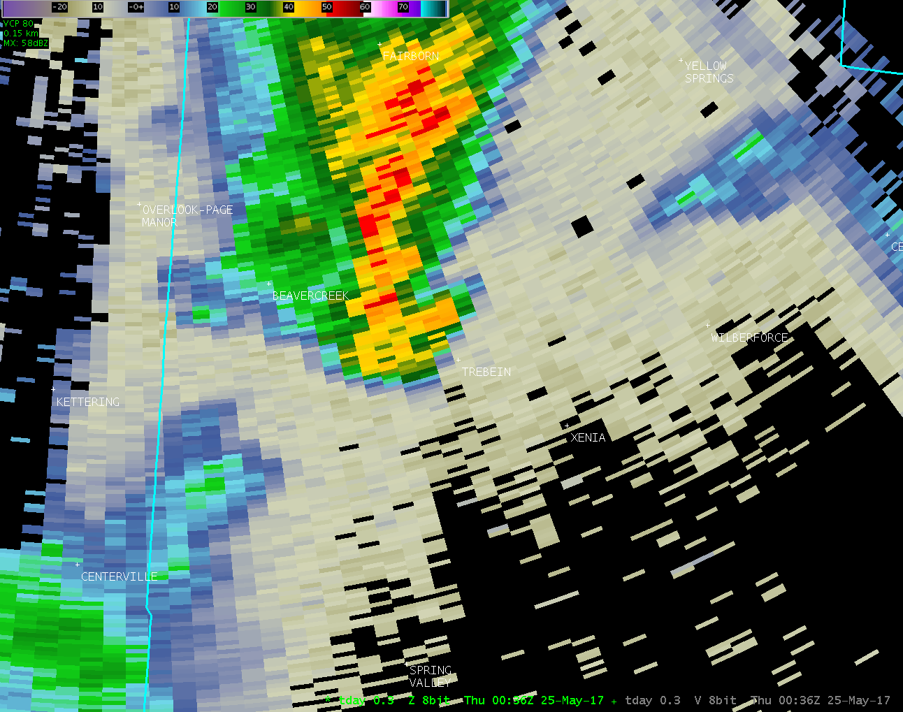
...Summary...
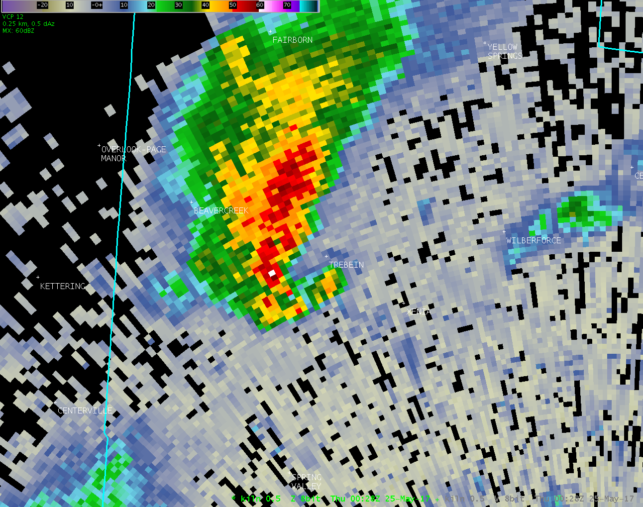
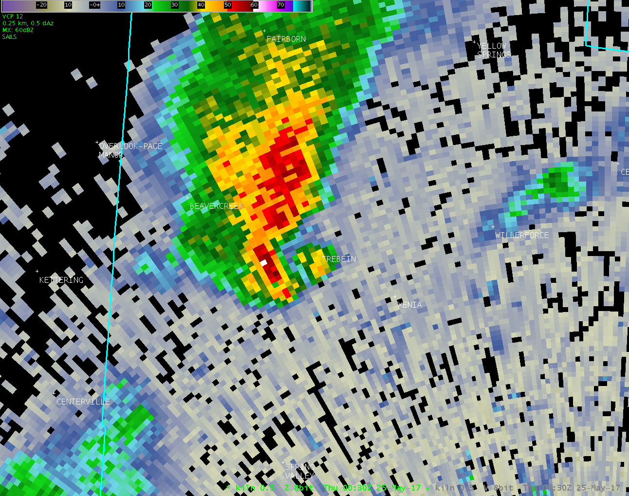
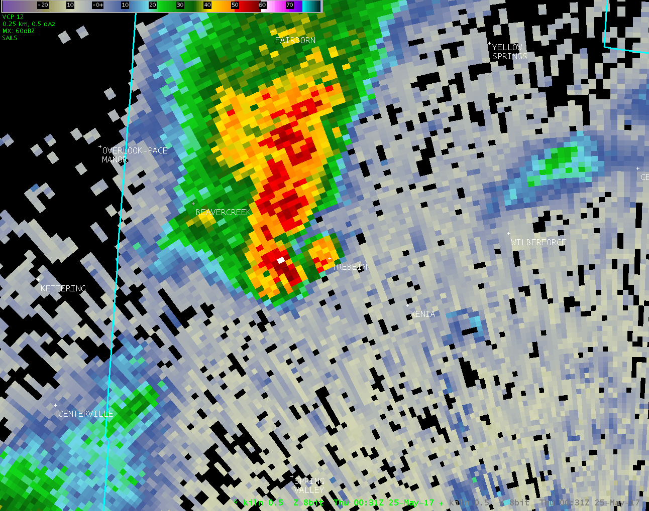
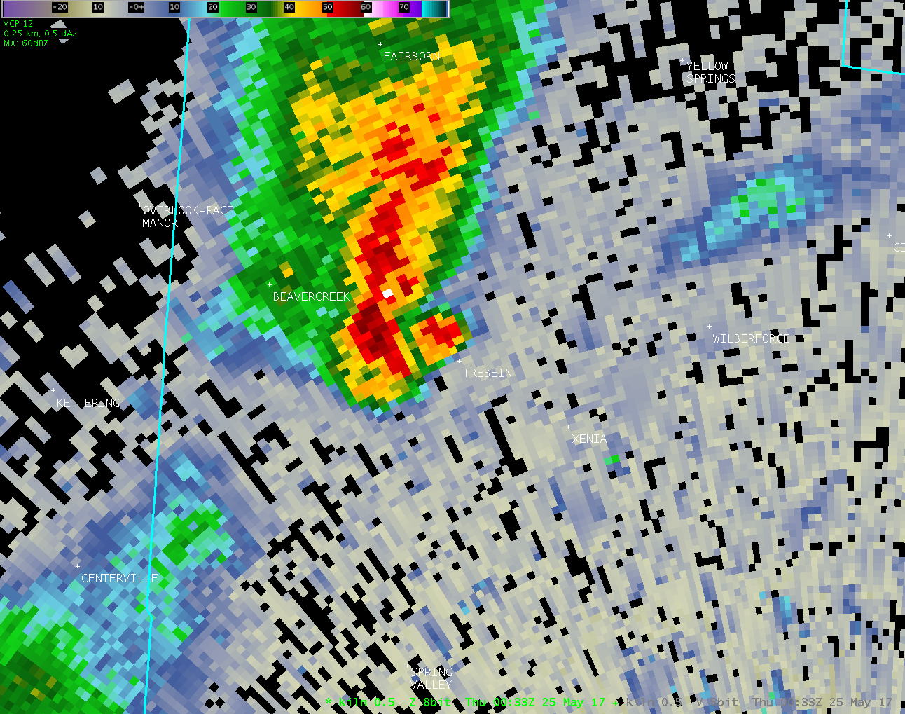
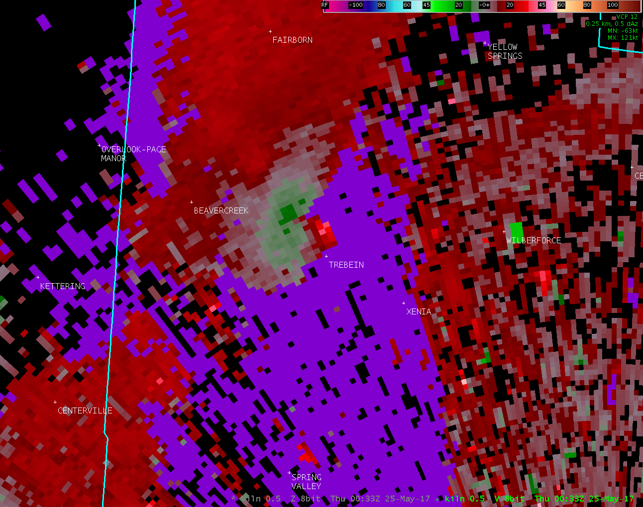
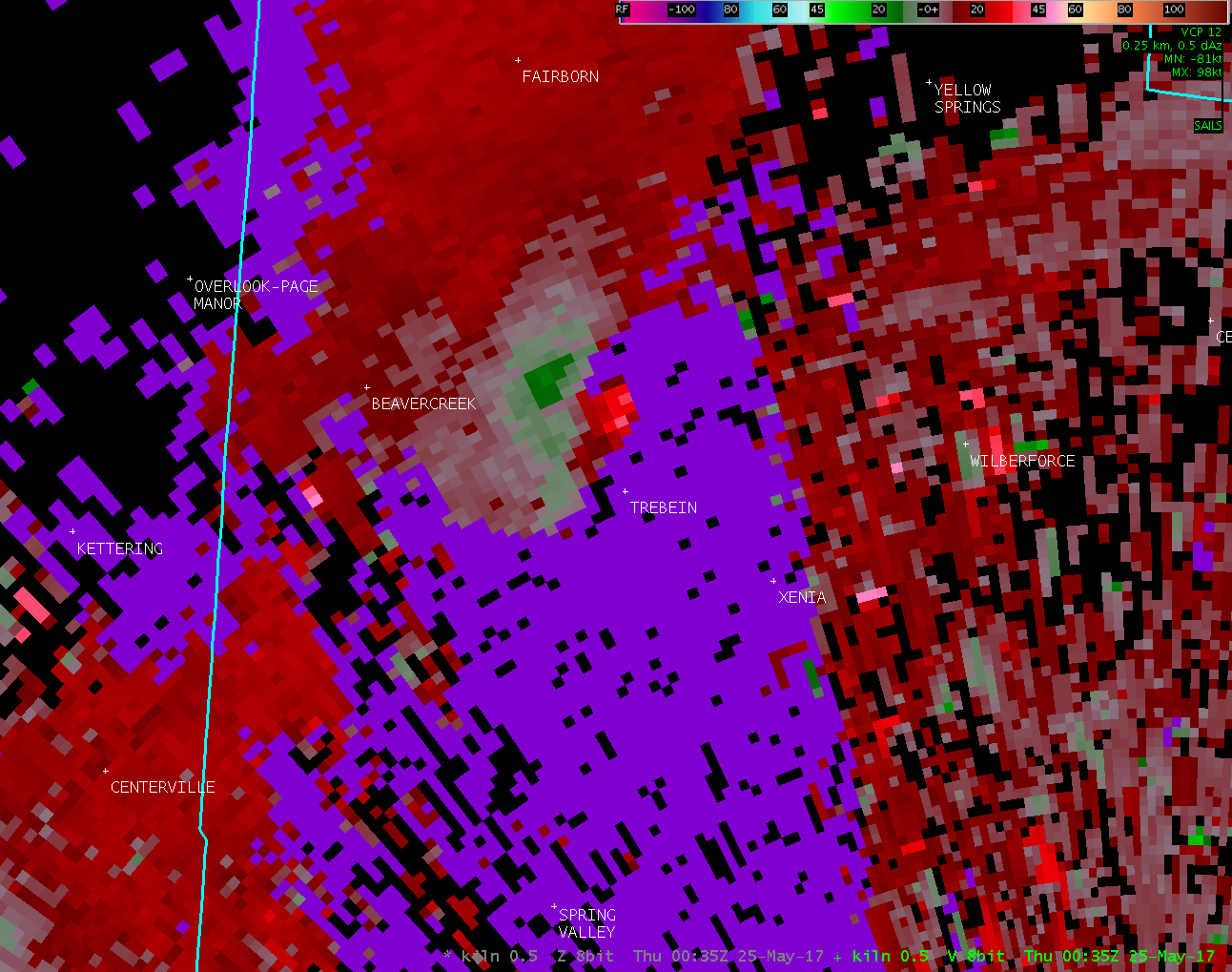
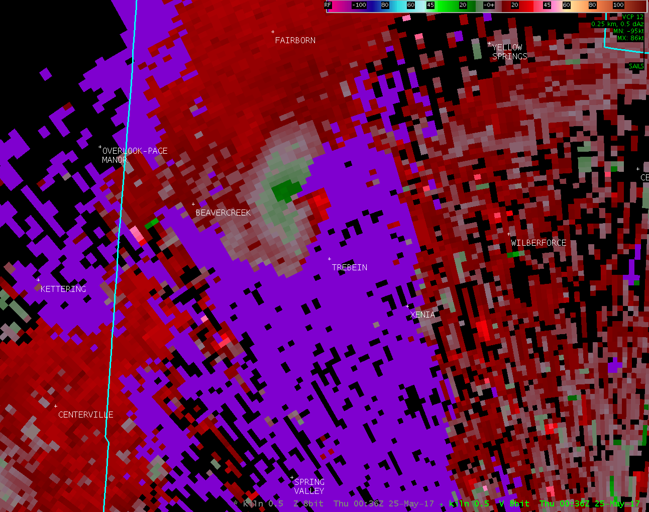
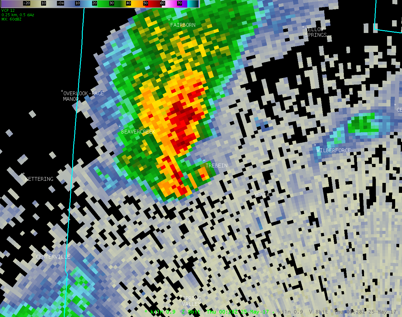
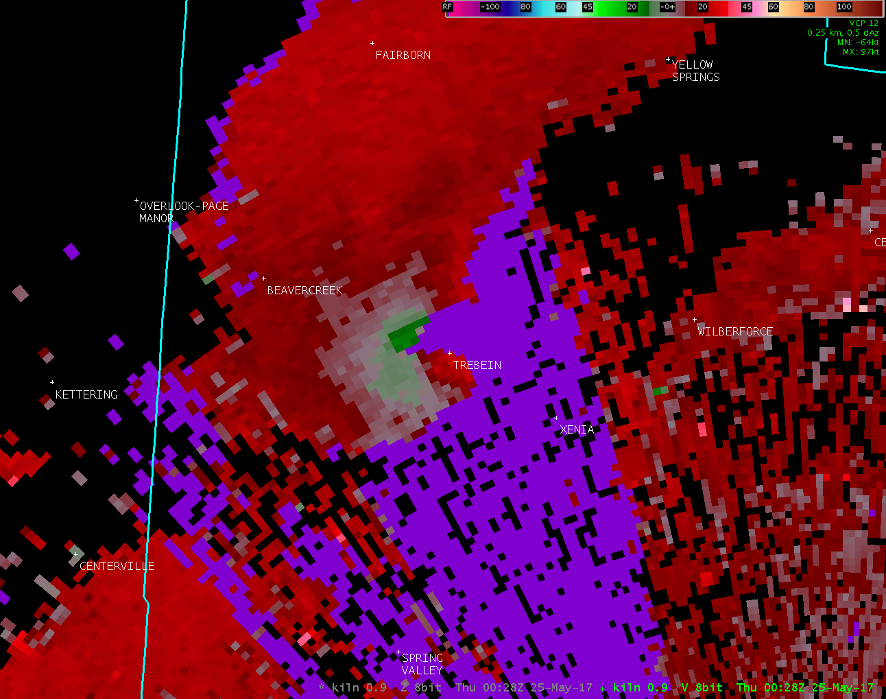
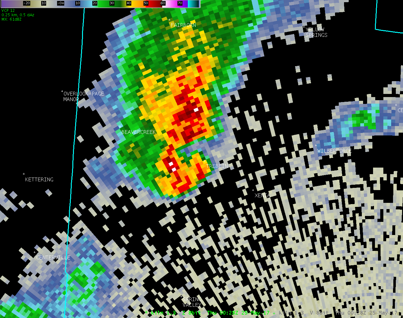
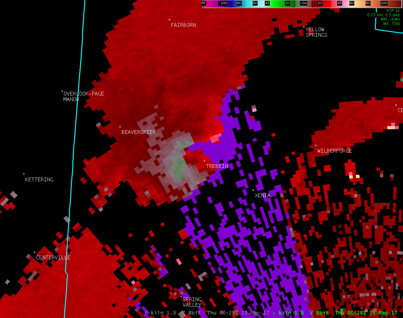
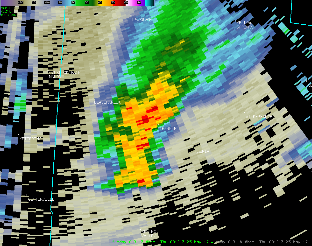
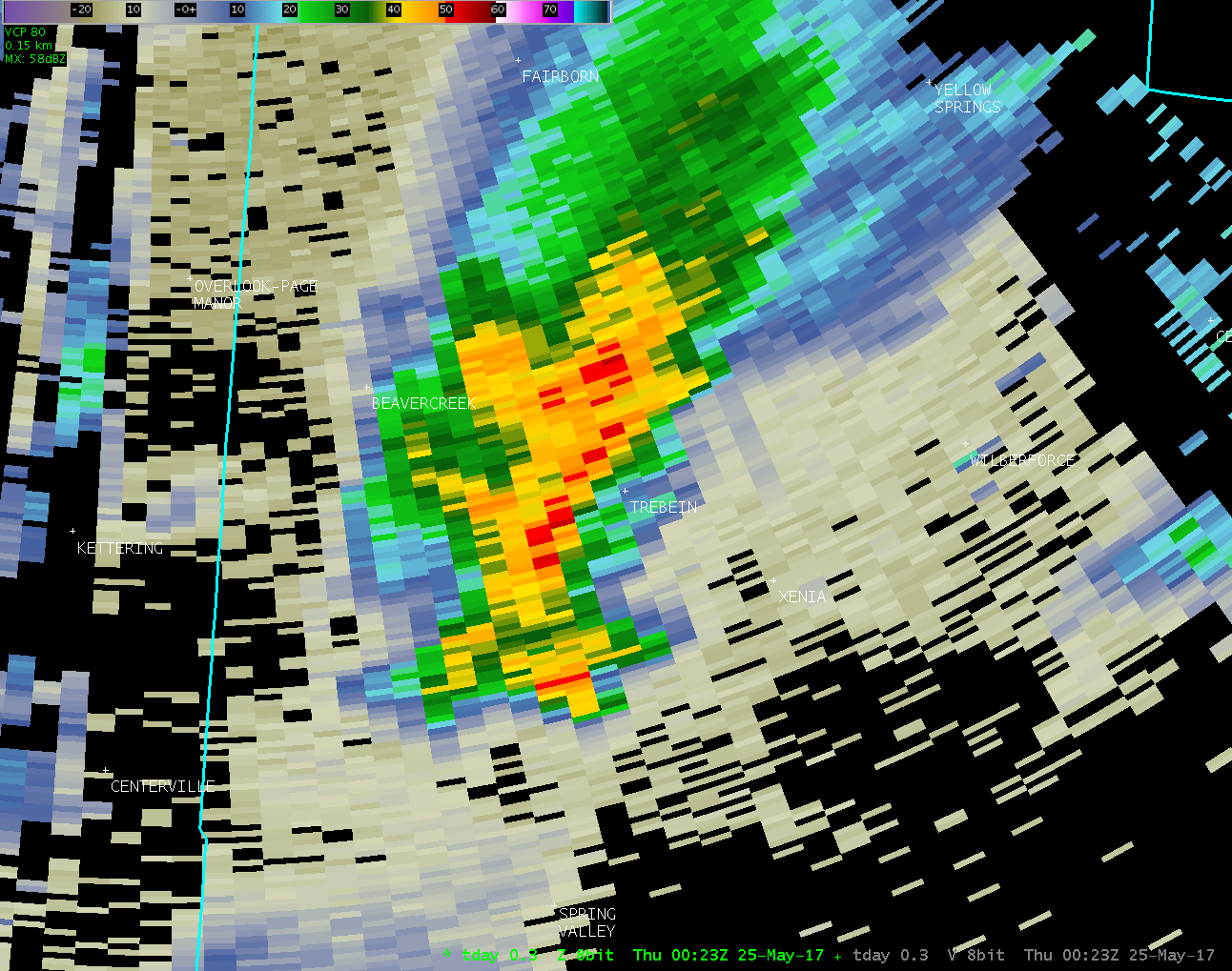
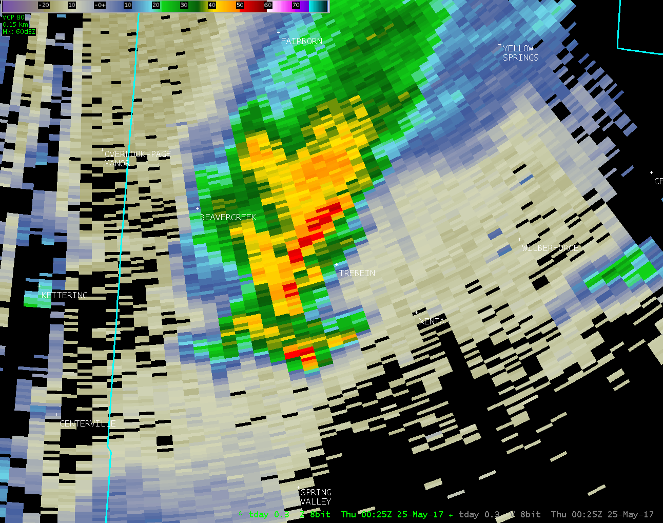
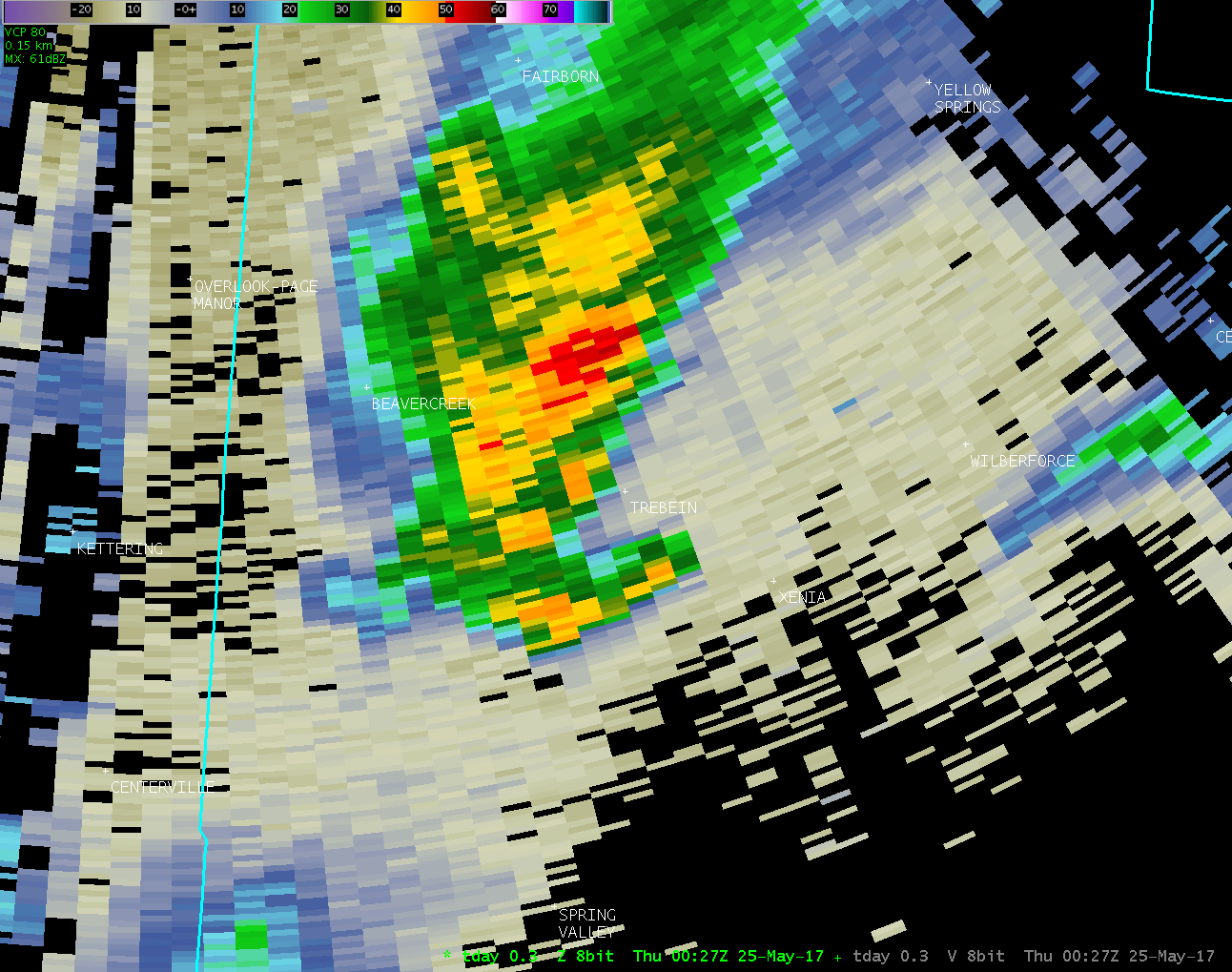
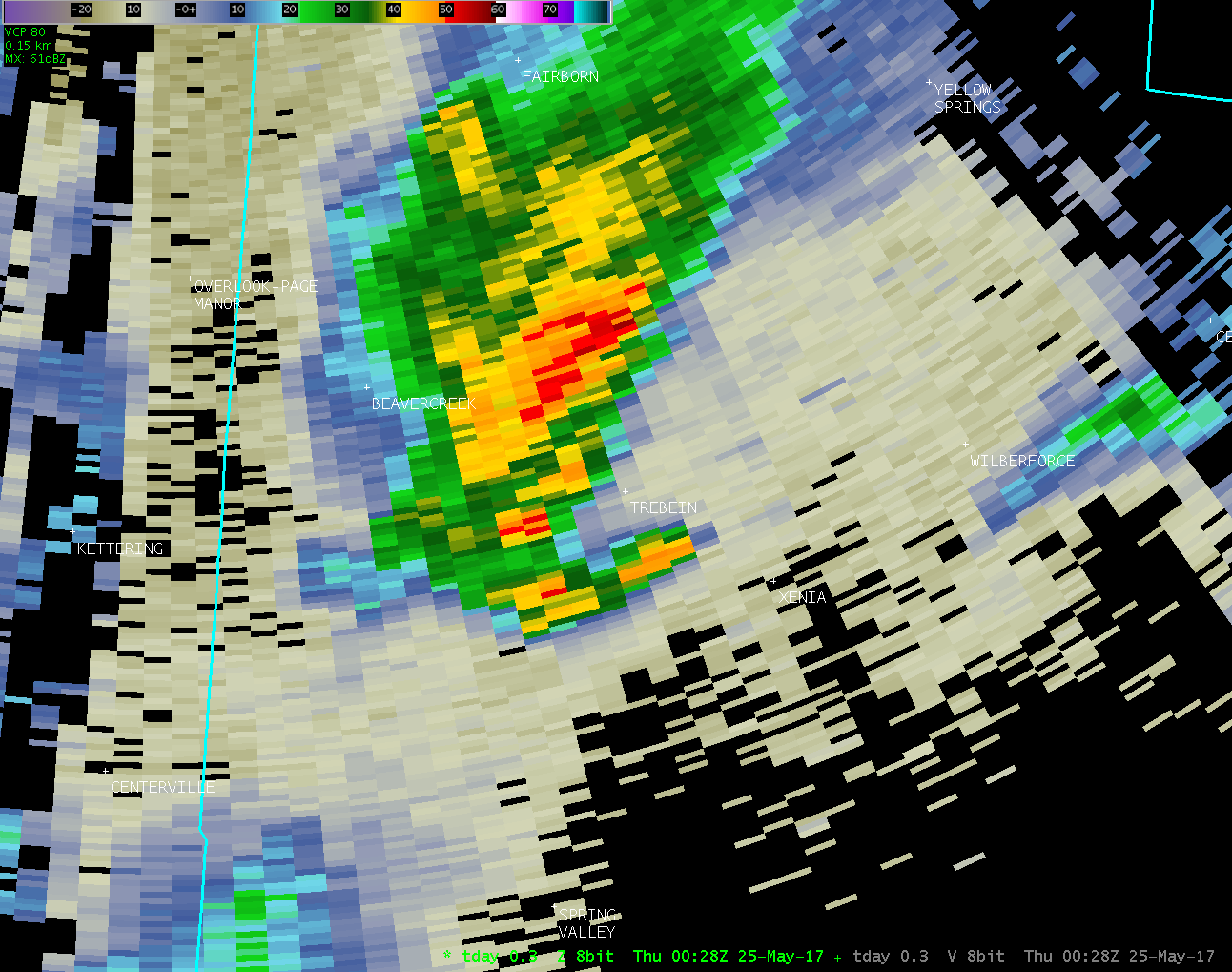
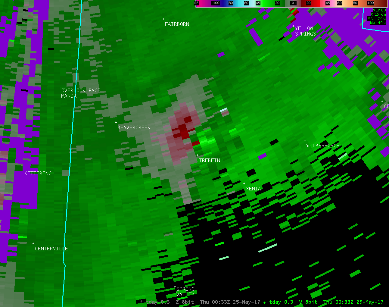
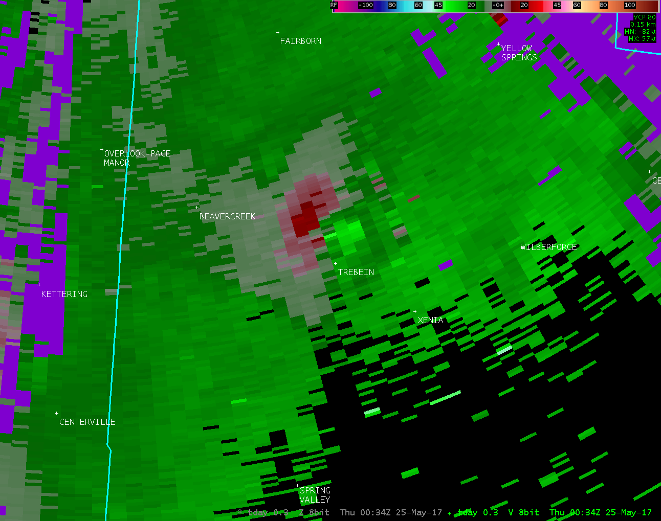
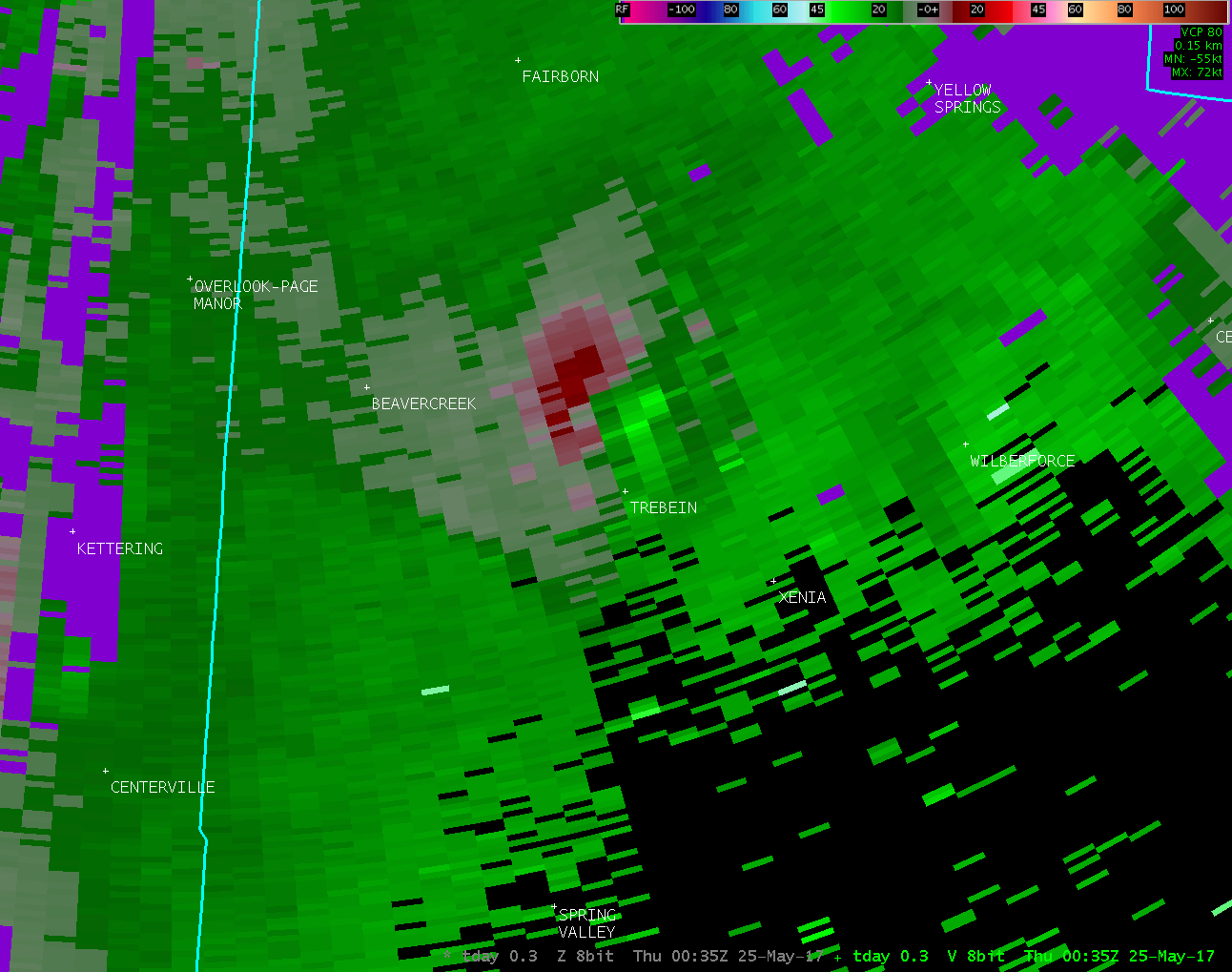
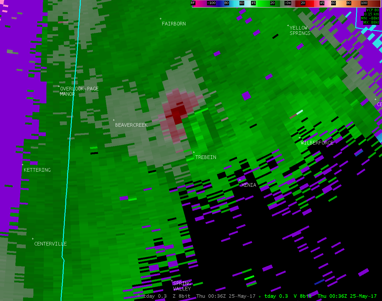
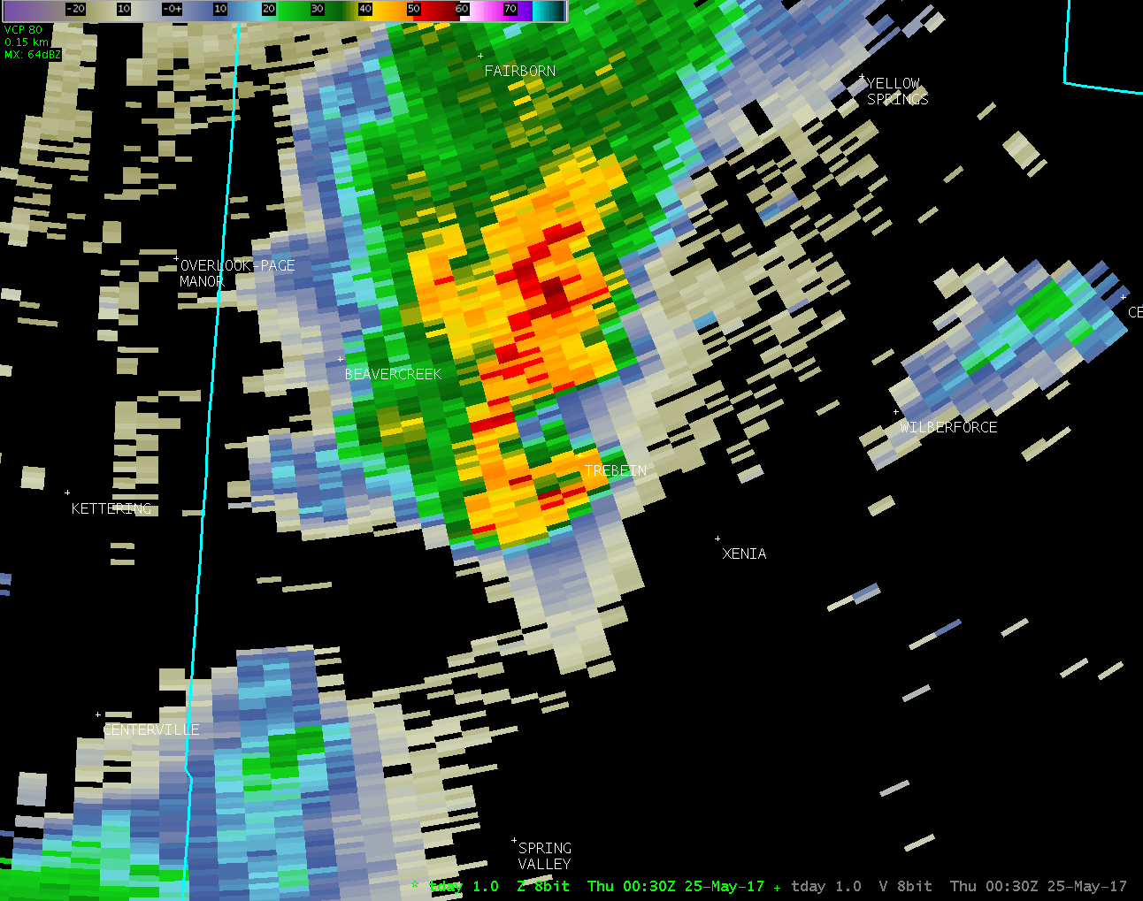
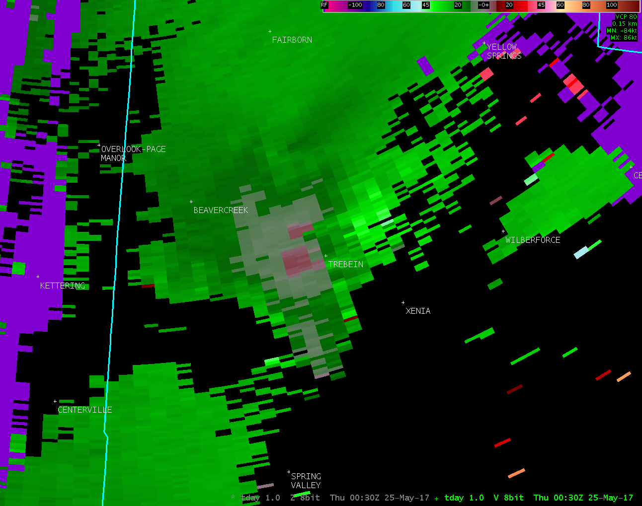
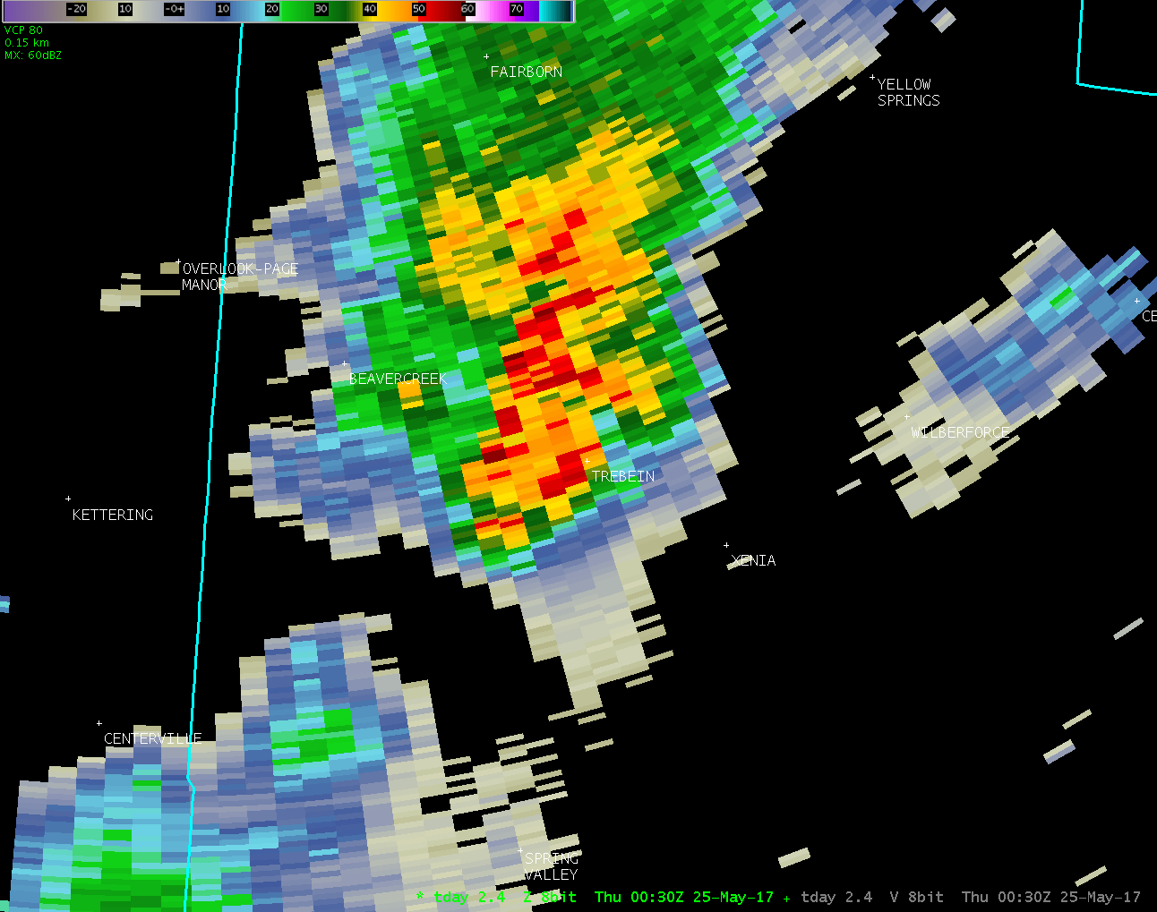
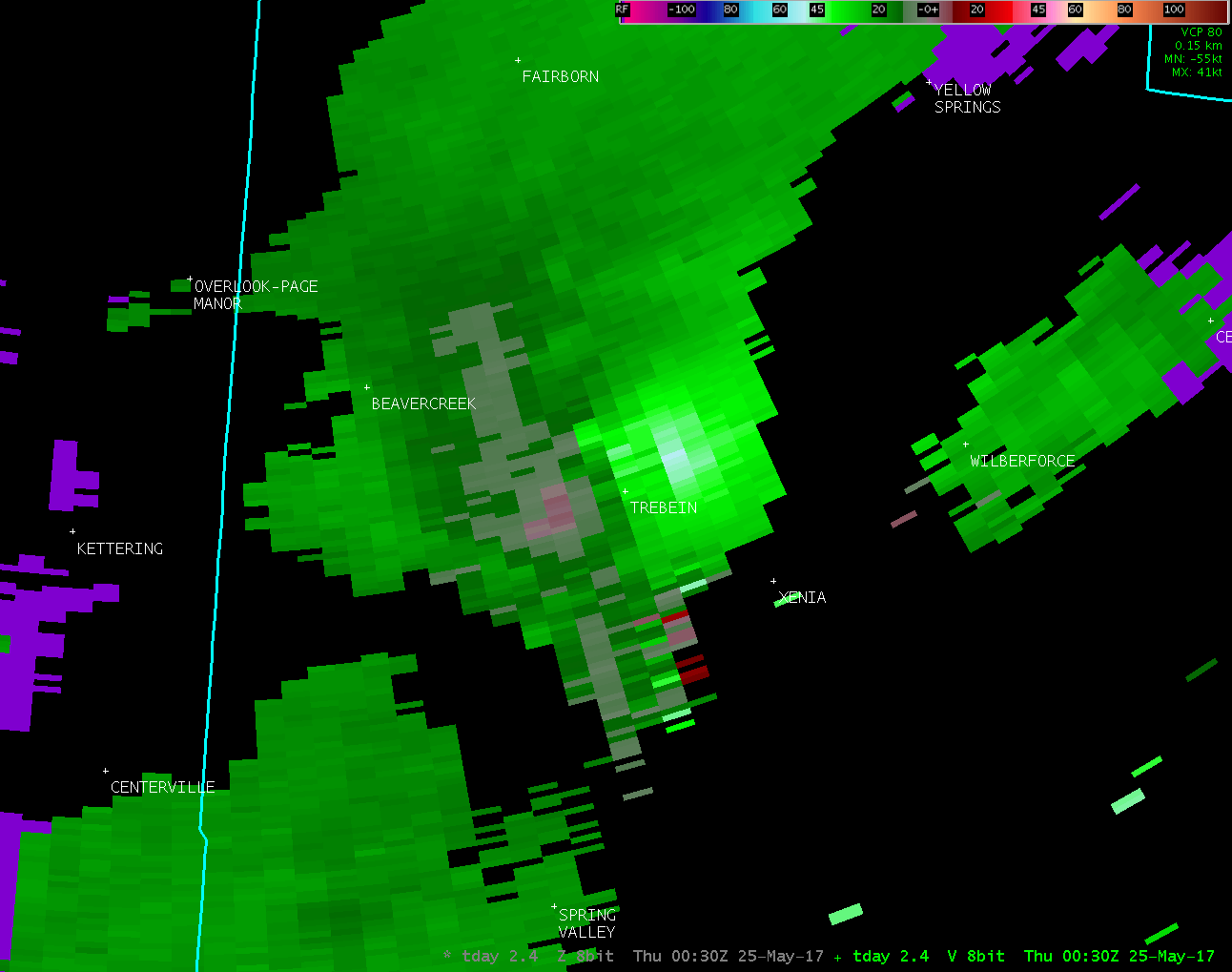
The National Weather Service in Wilmington OH has confirmed a
tornado west of Xenia and in Beavercreek Township in Greene
County Ohio on 05/24/2017.
With video evidence submitted and damage to small limbs and a
small tree, in addition to some power line damage and damage to a
power meter on a home in the 900 block of Trebein Road, this is
confirmation of another weak tornado from the storms of 5/24/2017.
The damage began along Colorado Drive with a small ornamental tree
uprooted. Additional small limb damage occurred. The tornado
traveled north, where public video was provided of a small tornado
crossing U.S. 35 just north of the Greene County Airport. The
video showed the tornado lifting upward shortly after crossing
north of Route 35, but damage had been reported at the
intersection of the Trebein and Dayton-Xenia Road intersection, as
well as slightly further north along Trebein Road.
For reference: the Enhanced Fujita Scale classifies tornadoes
into the following categories:
EF0...wind speeds 65 to 85 mph.
EF1...wind speeds 86 to 110 mph.
EF2...wind speeds 111 to 135 mph.
EF3...wind speeds 136 to 165 mph.
EF4...wind speeds 166 to 200 mph.
EF5...wind speeds greater than 200 mph.
$$
JDR
|

