
A significant heat wave is underway for the Intermountain West, Northern Plains, and Upper Great Lakes, peaking in intensity through midweek and lingering across parts of the Northern Plains and Midwest until this weekend. In southwest Texas, excessive rainfall may bring a risk for potentially life-threatening flash and arroyo flooding through Thursday. Read More >
|
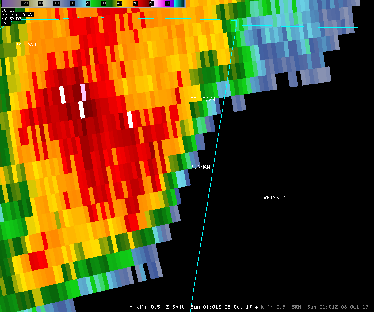
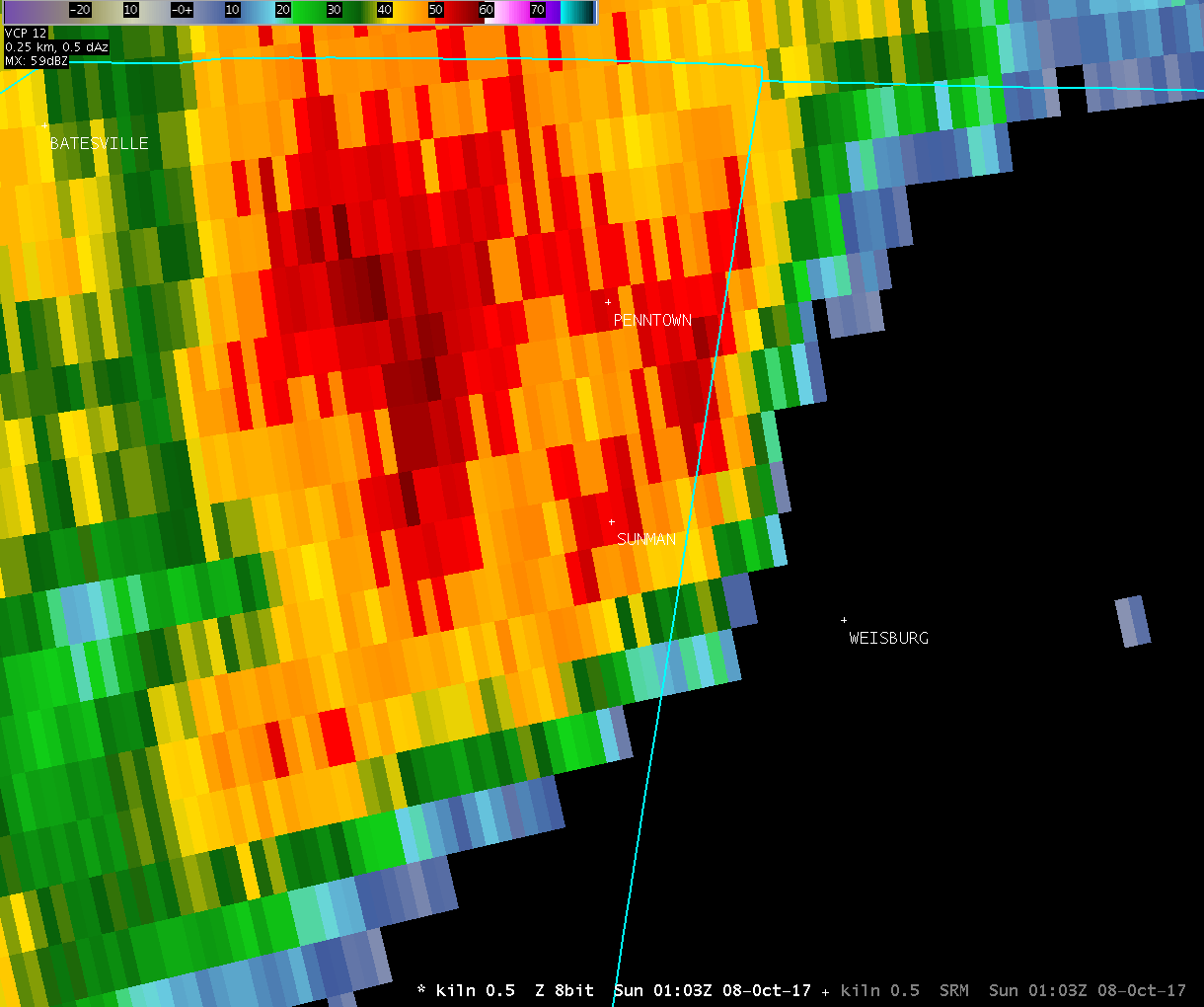
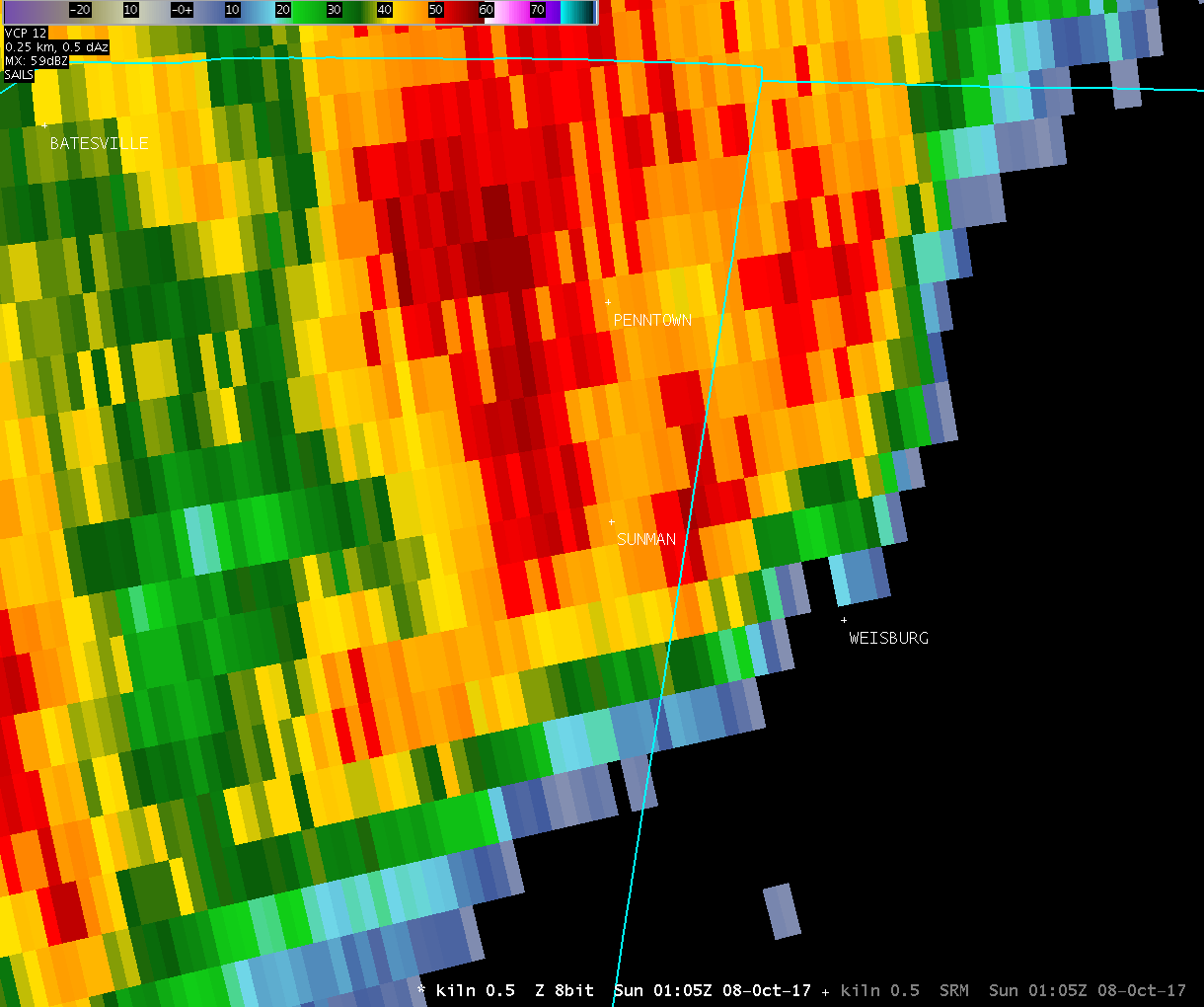
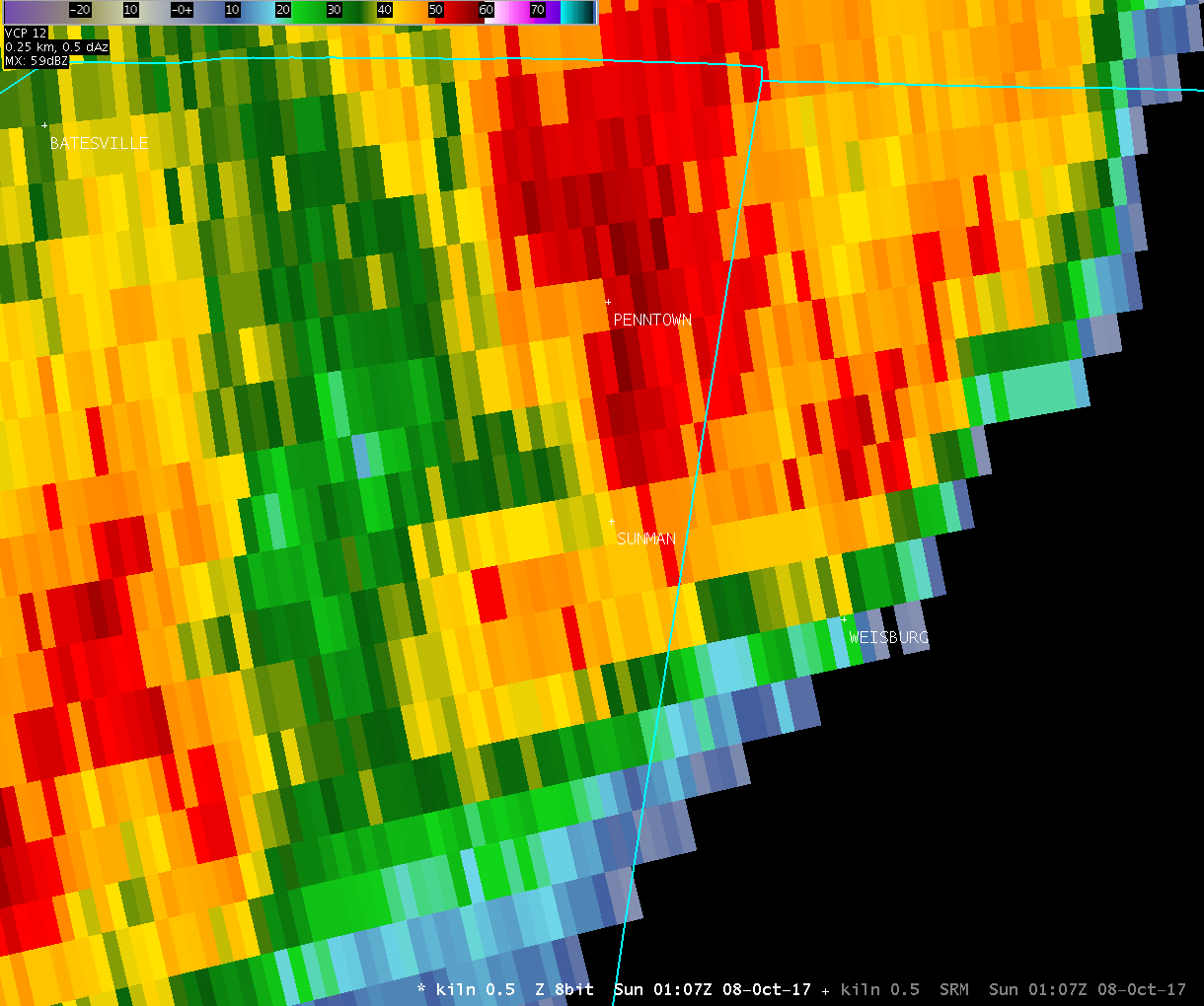
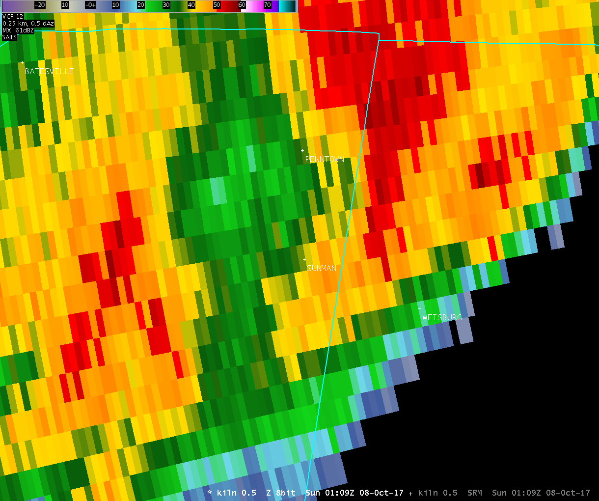
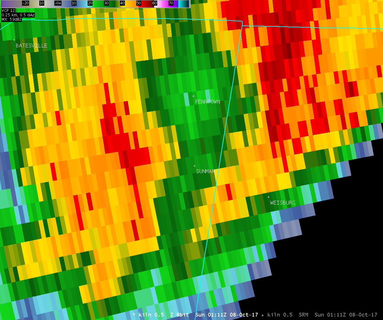
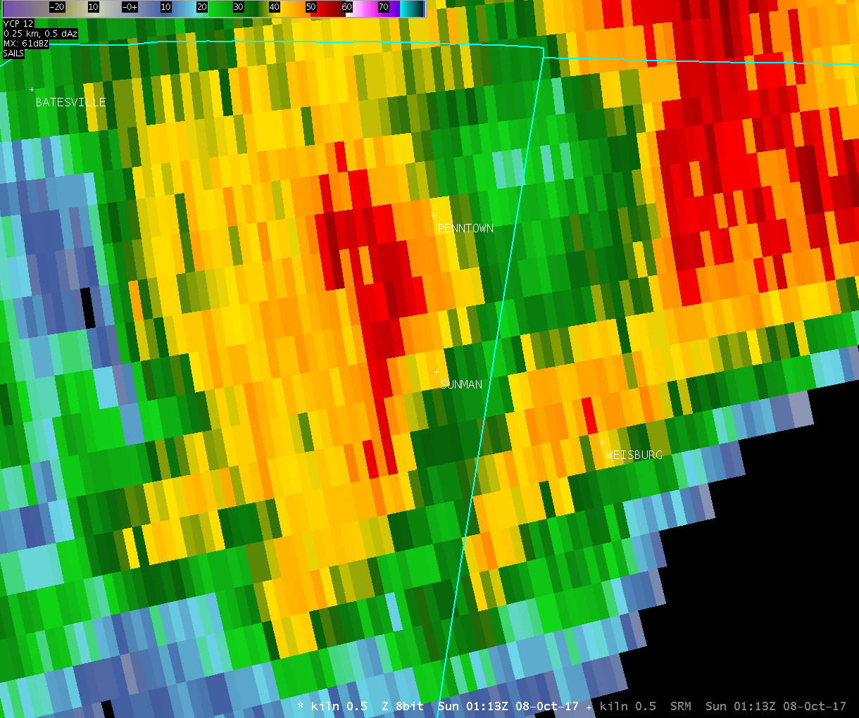
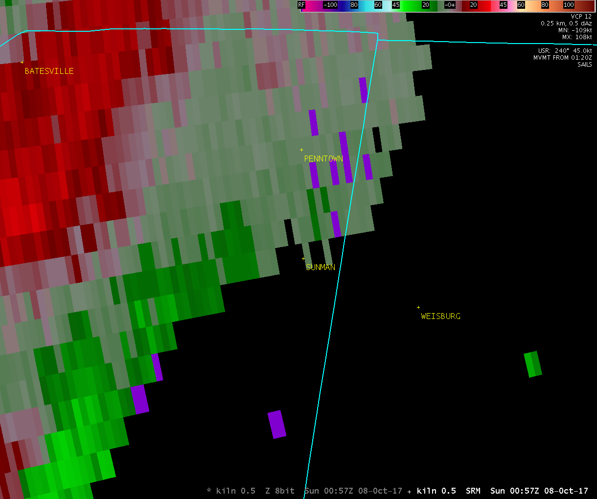
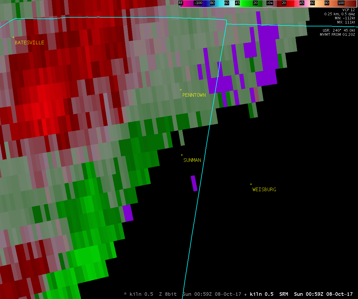
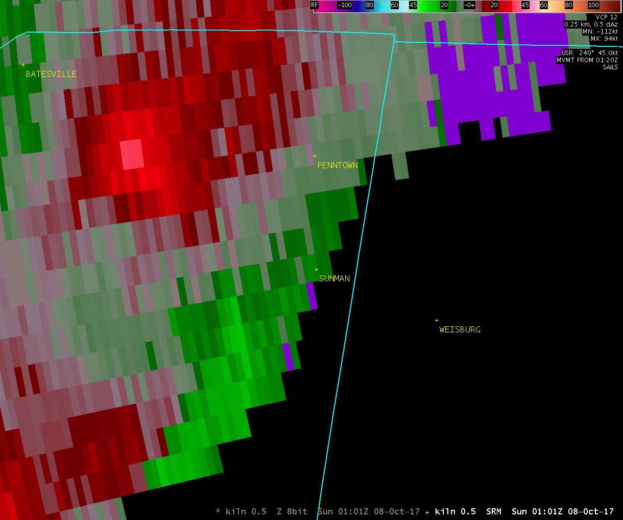
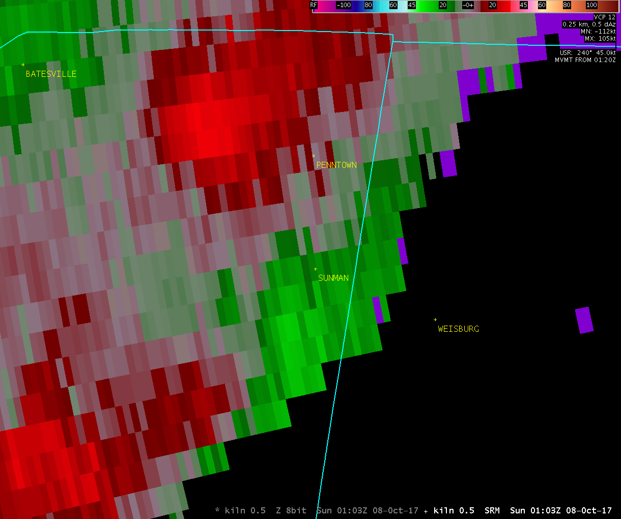
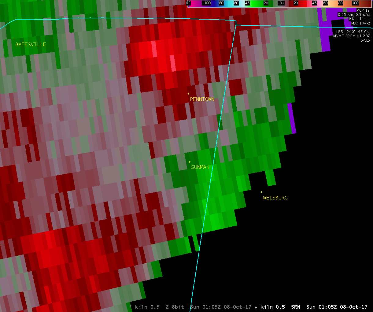
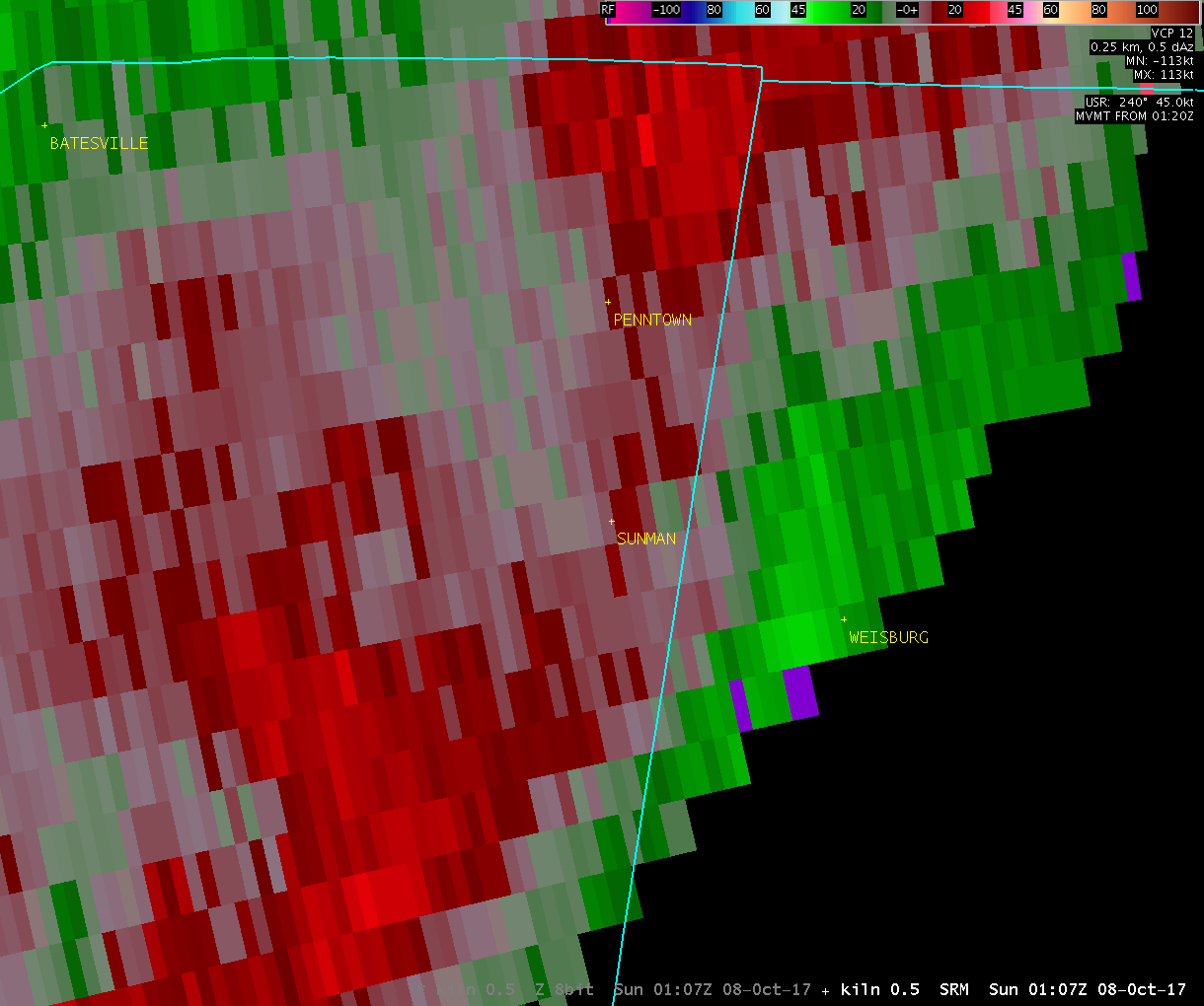
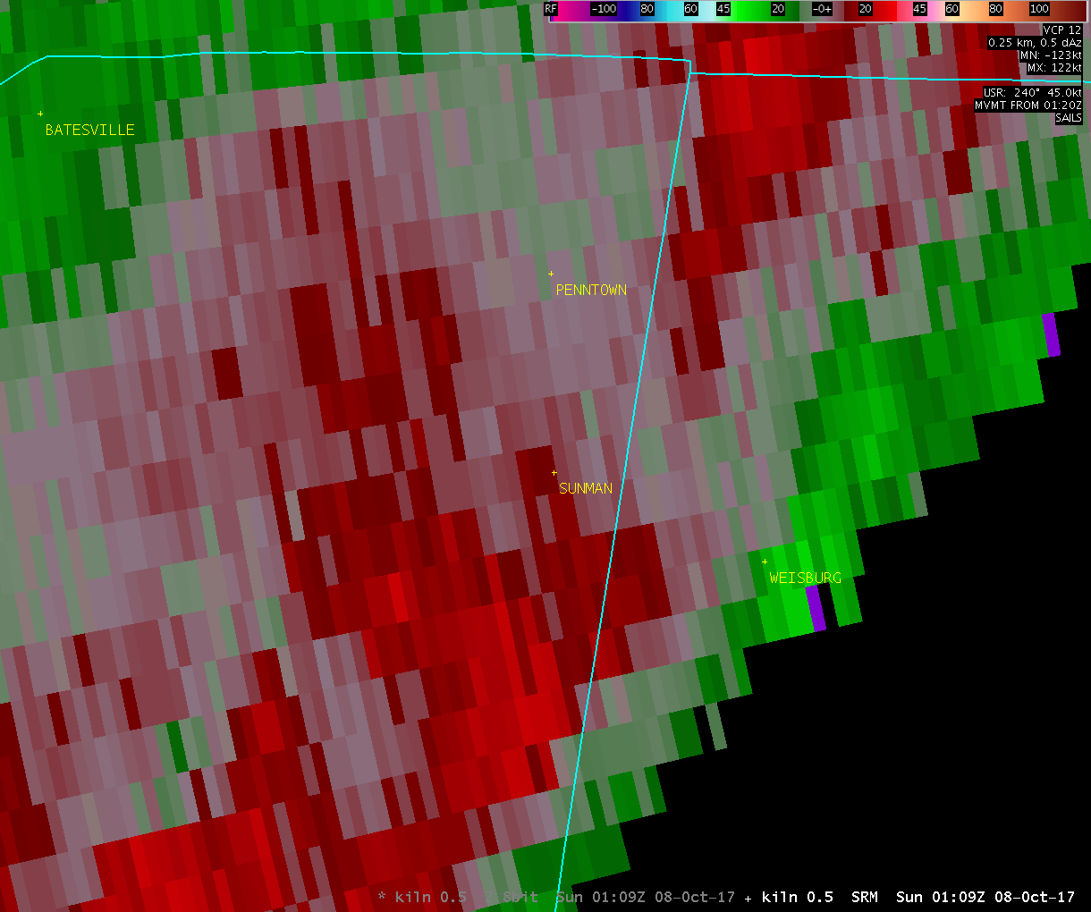
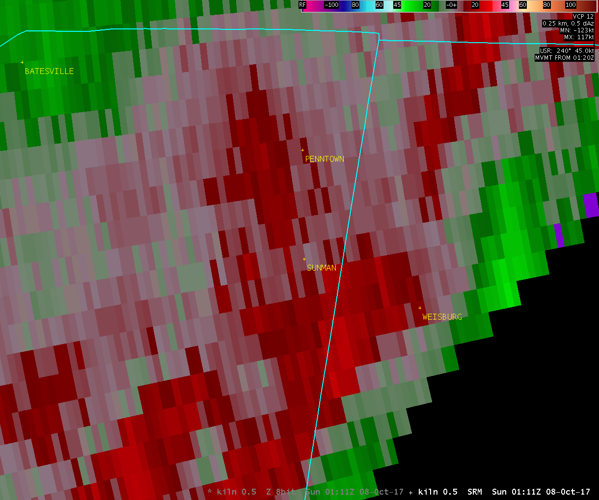
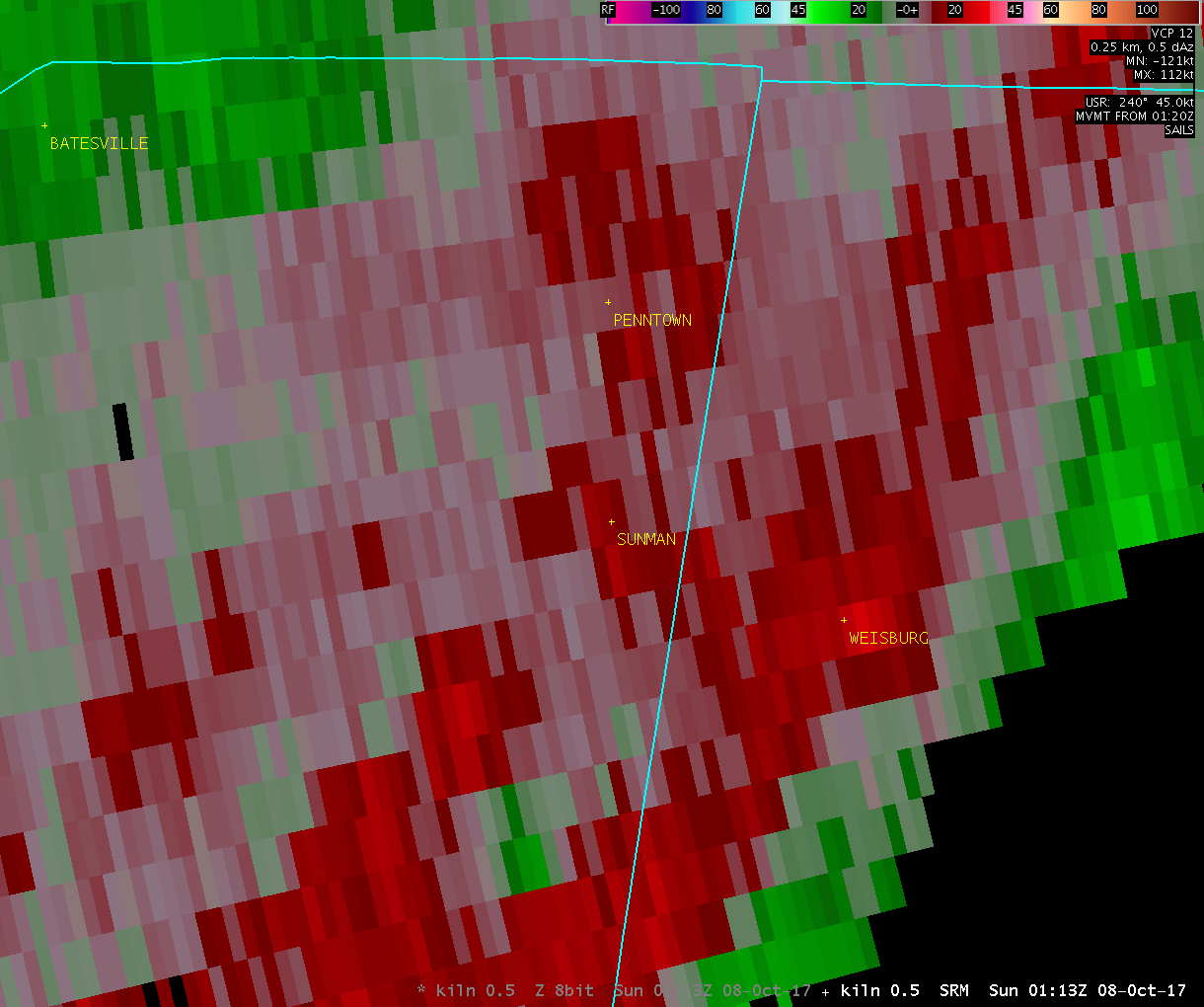
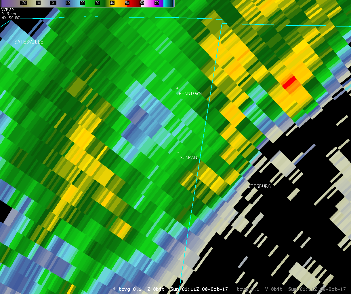
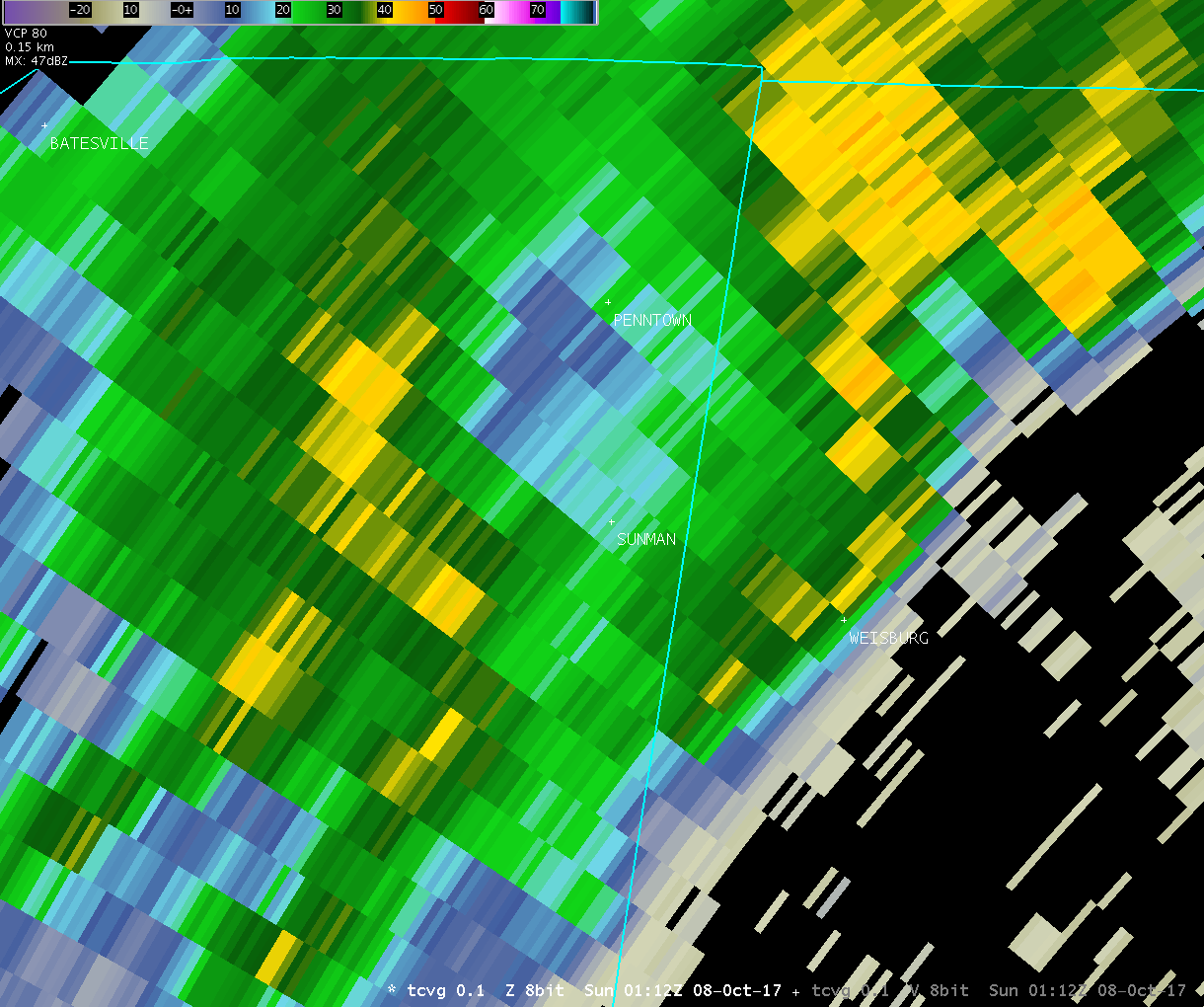
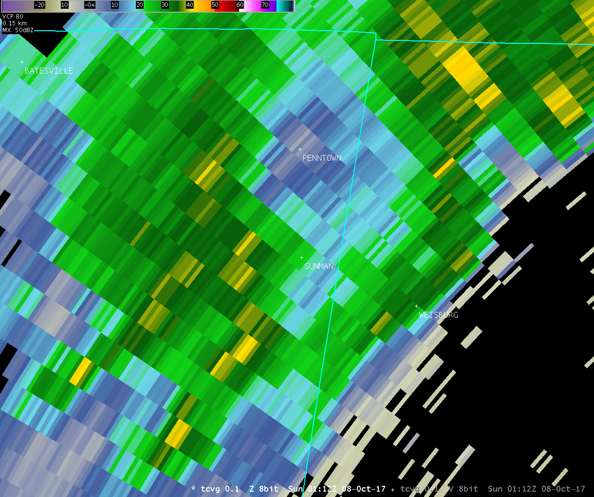
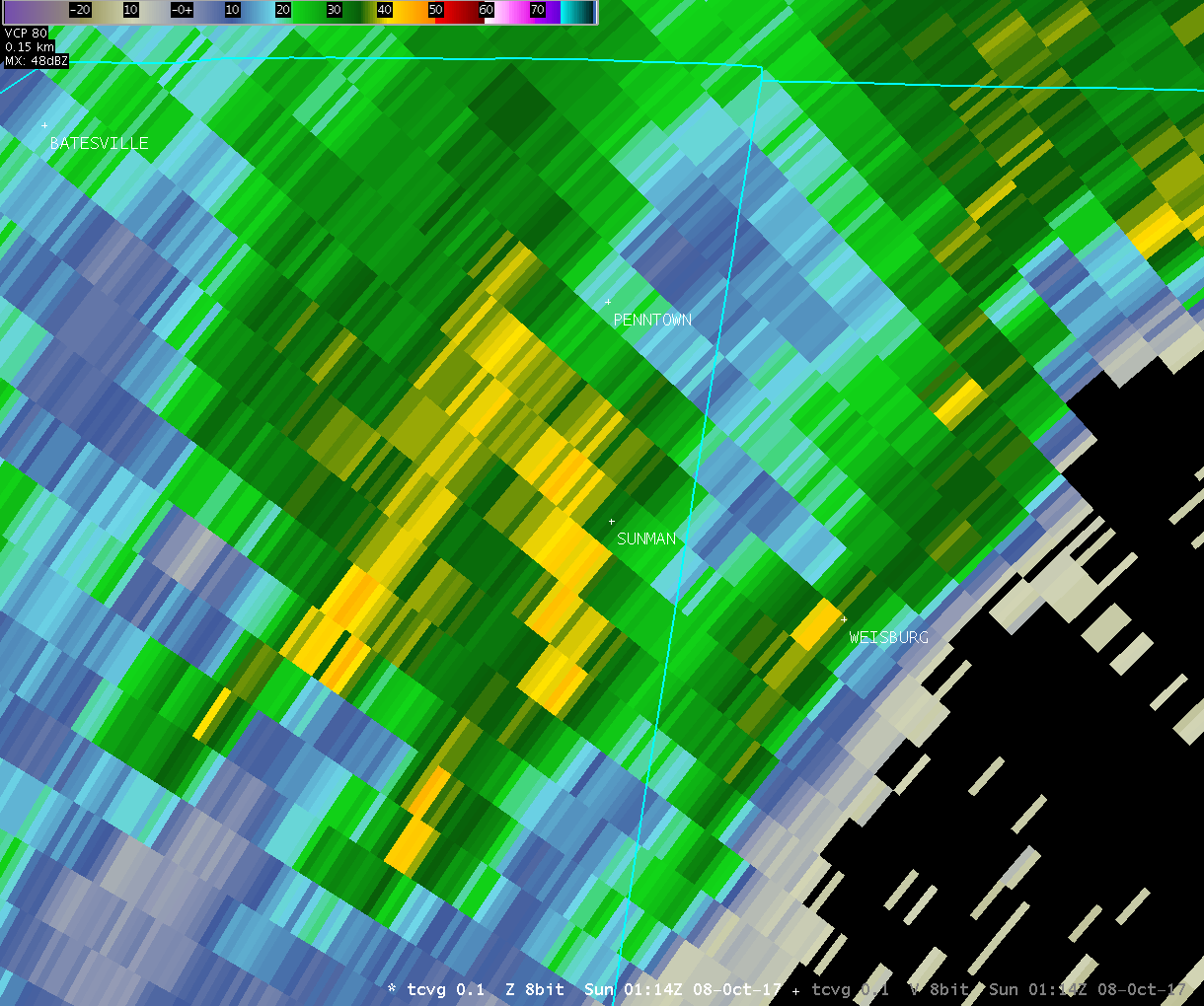
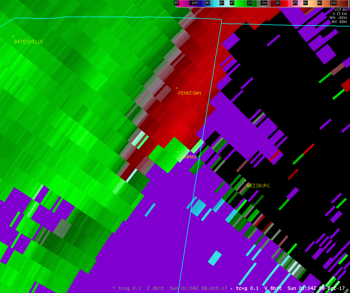
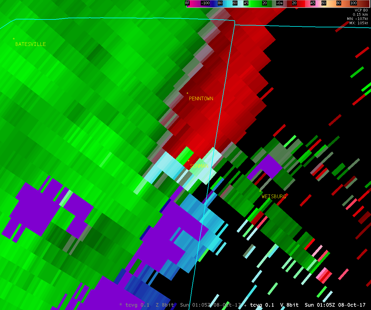
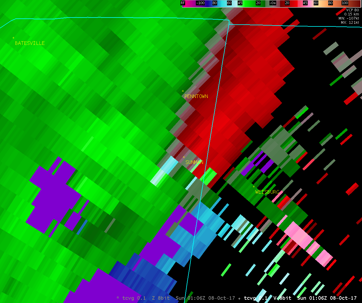
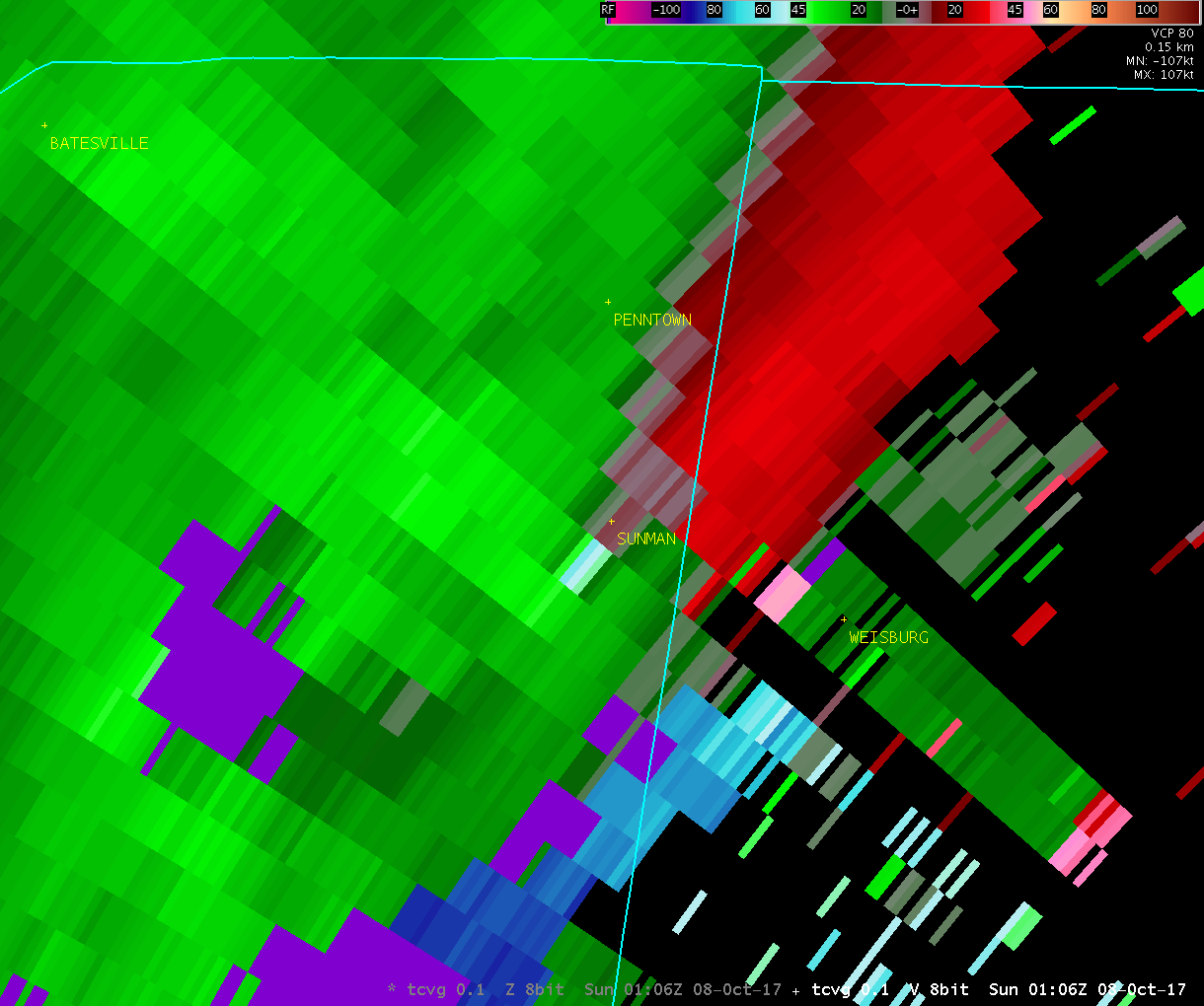
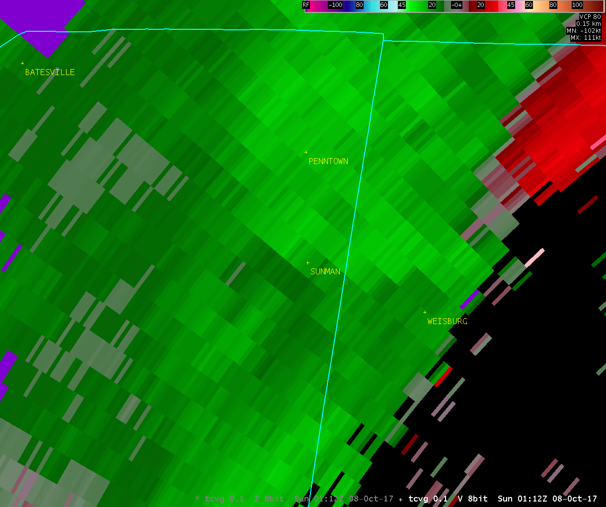
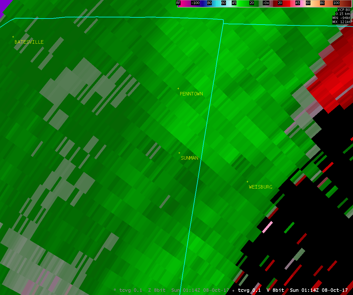
Tornado near Sunman, IN |
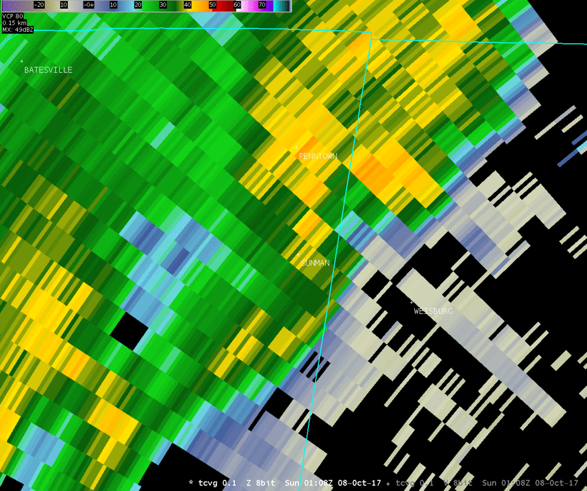
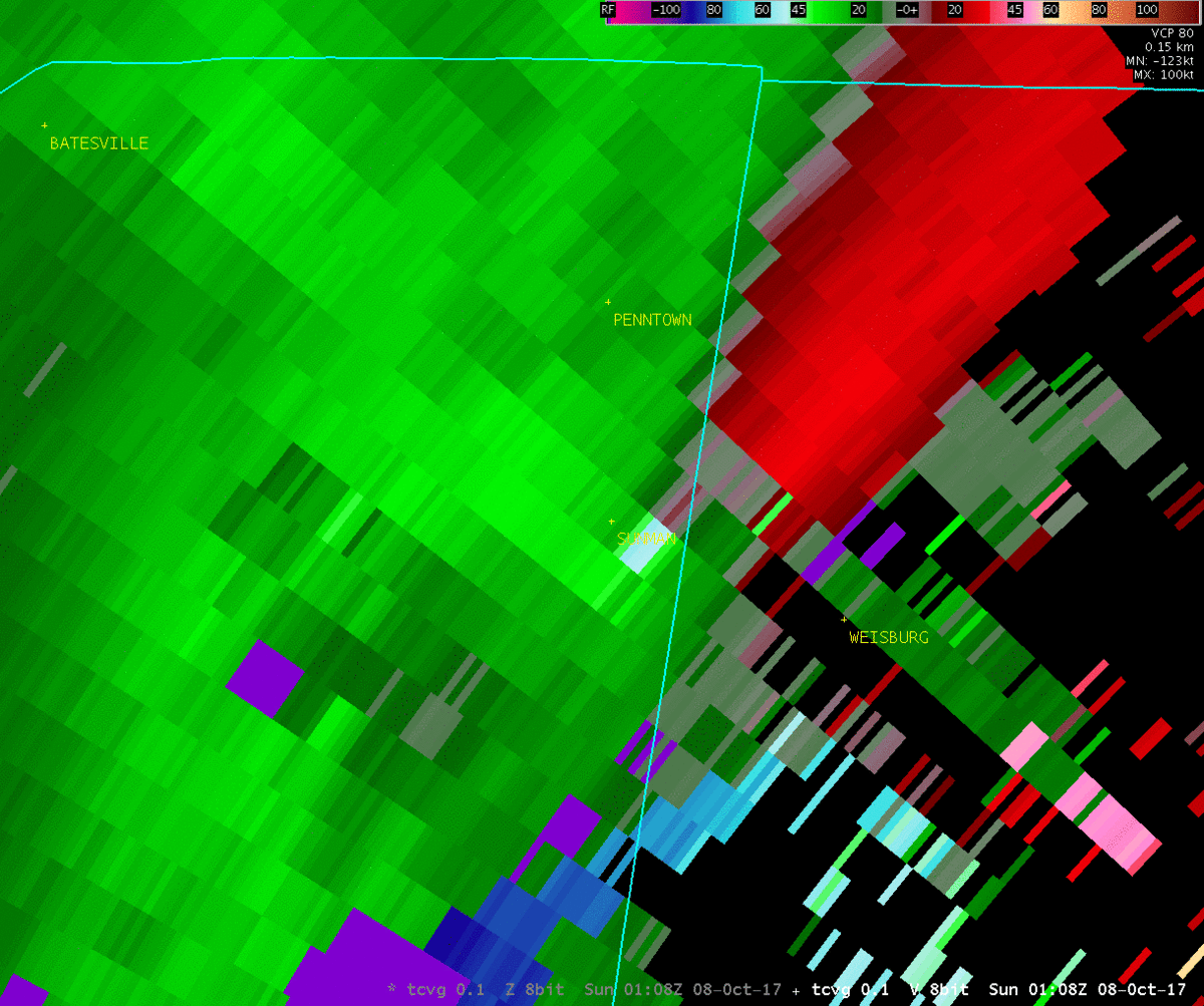
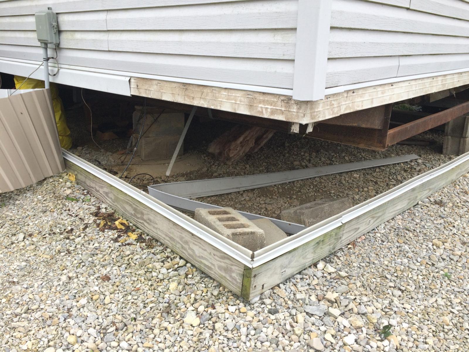
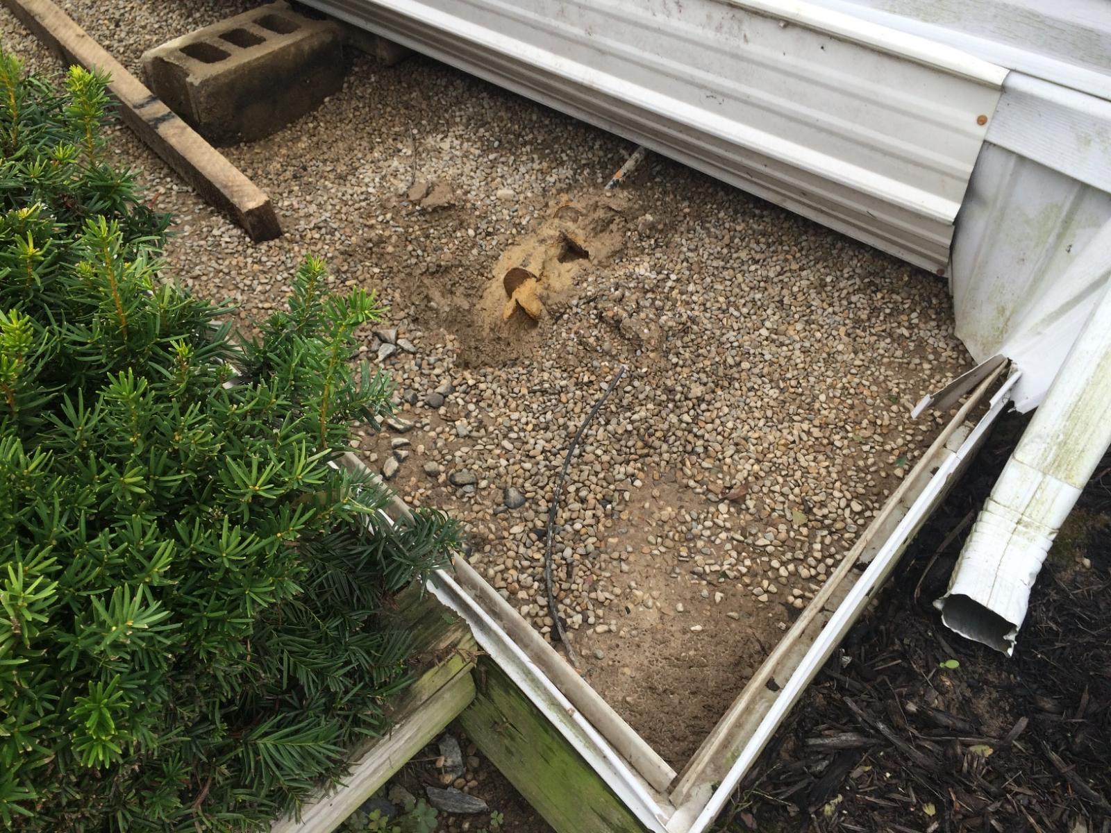
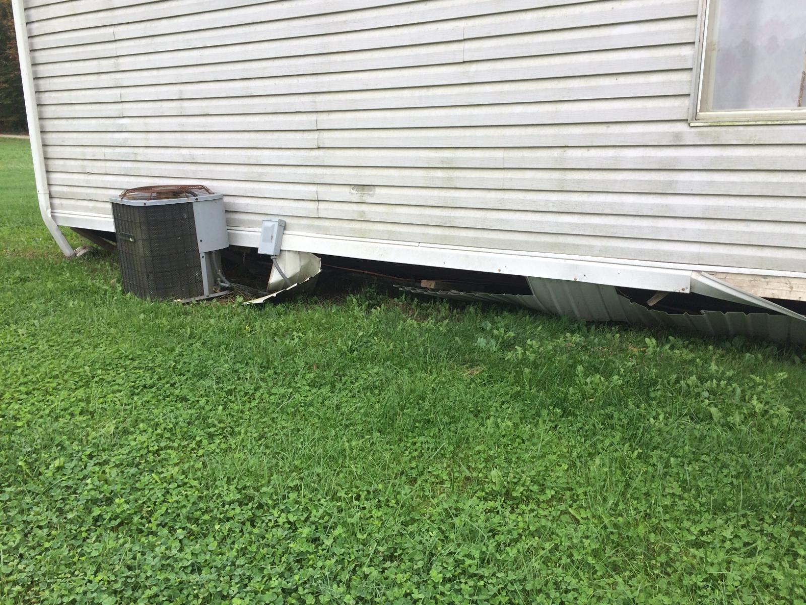
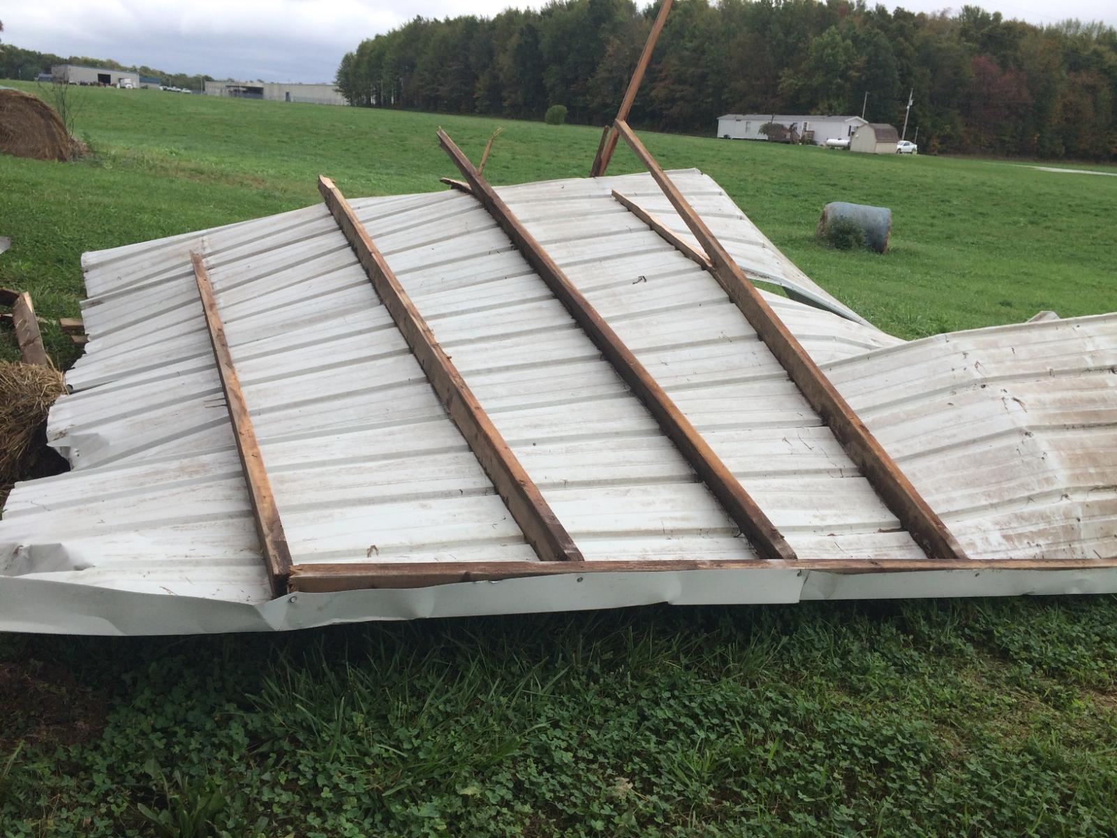
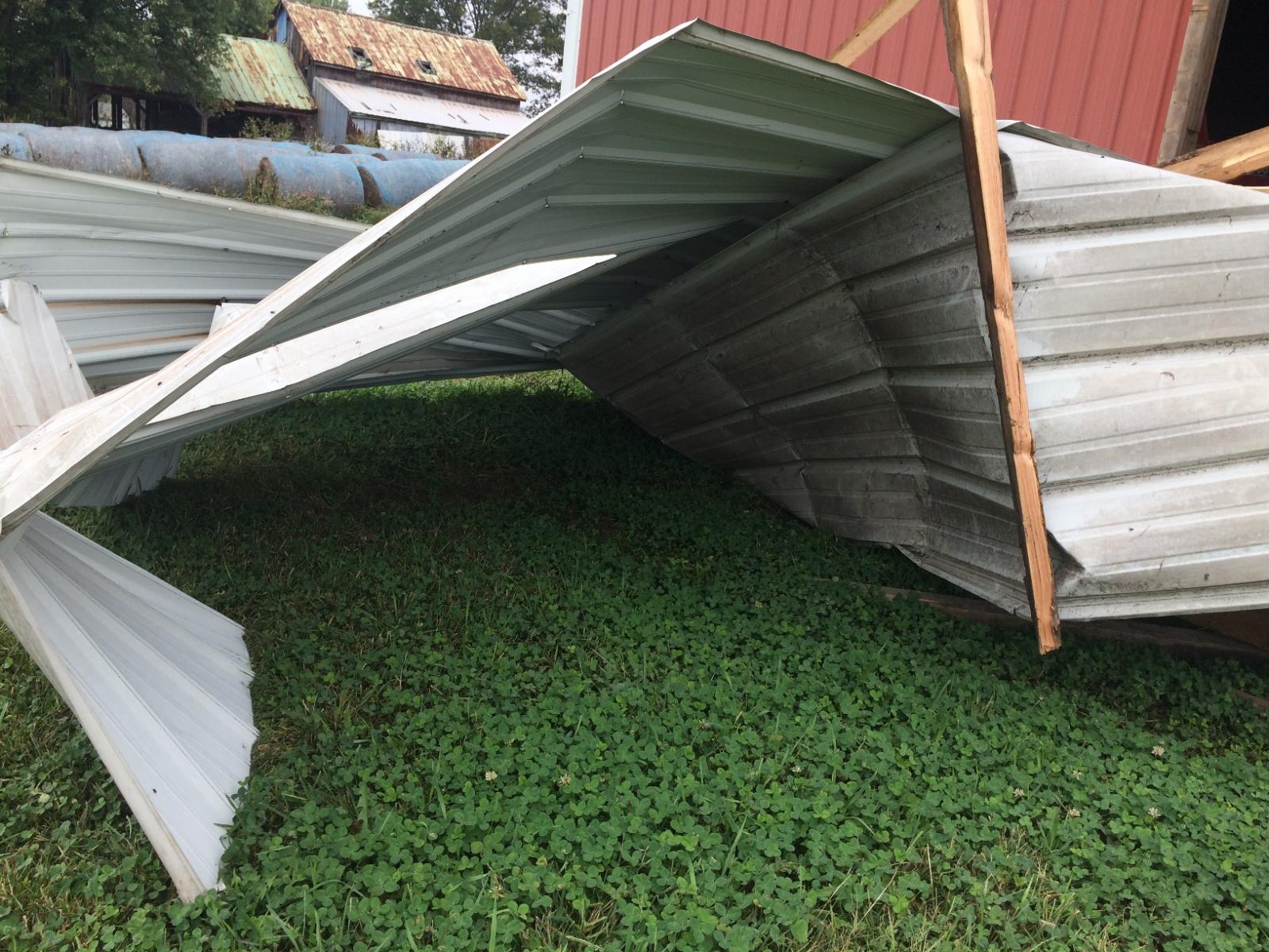
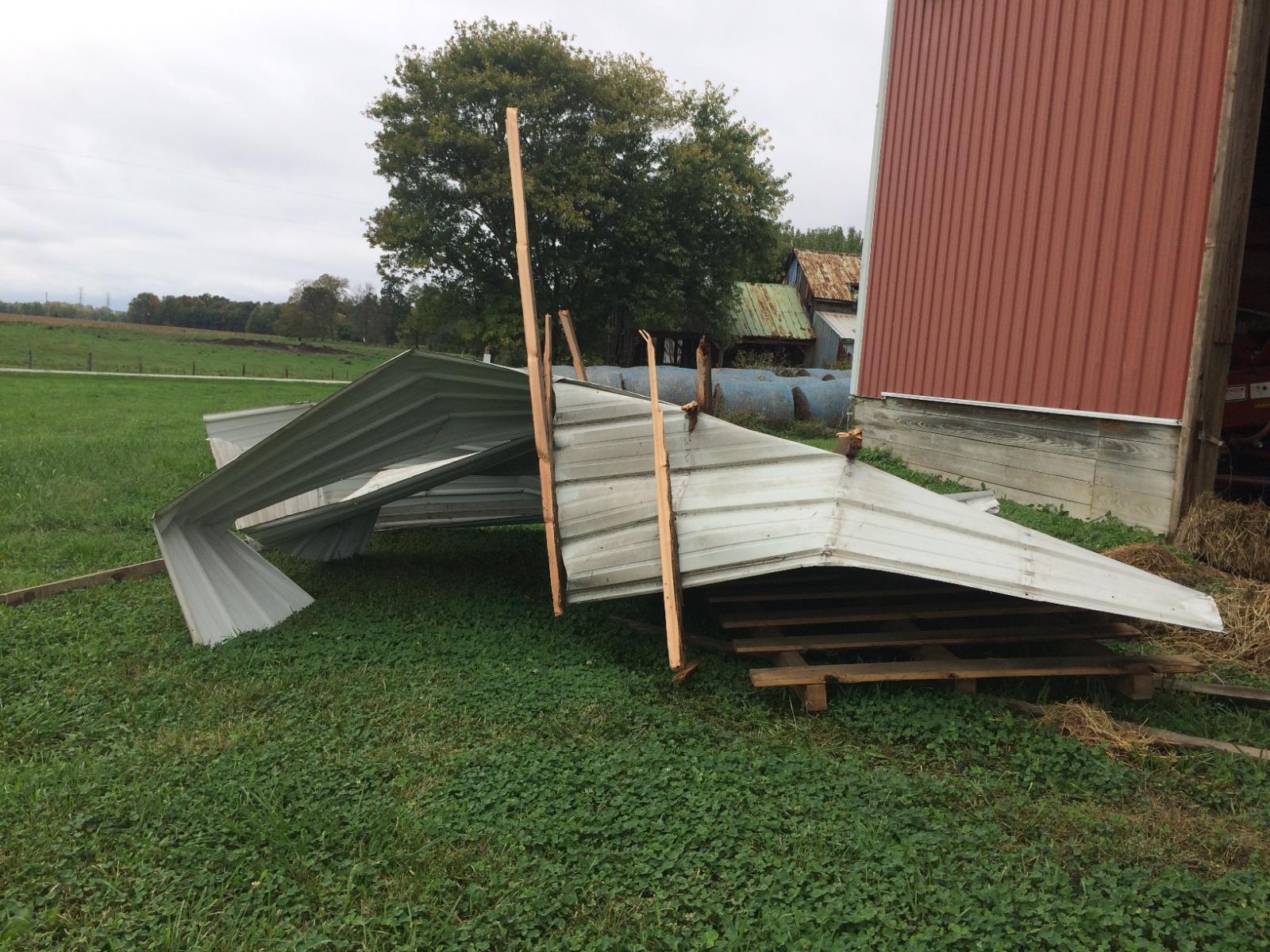
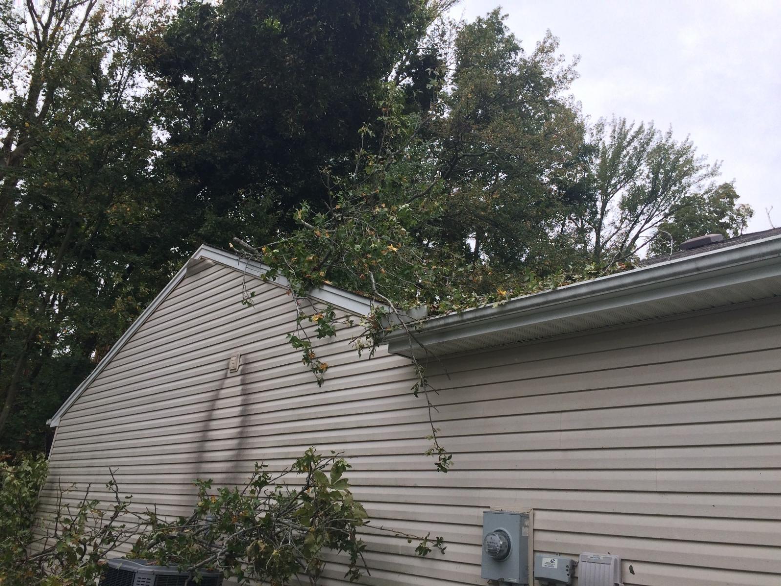
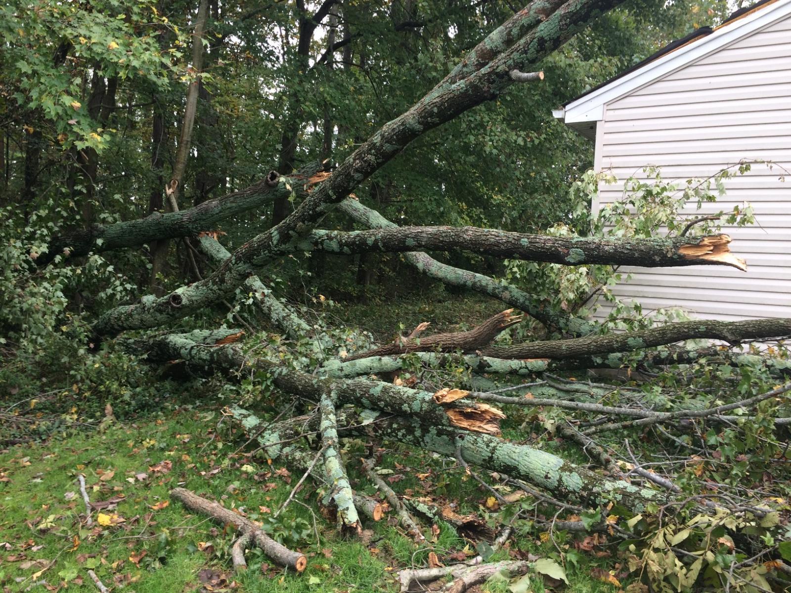
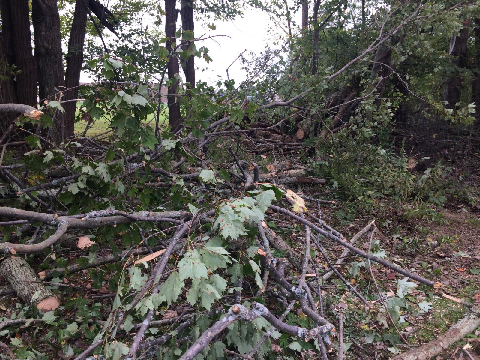
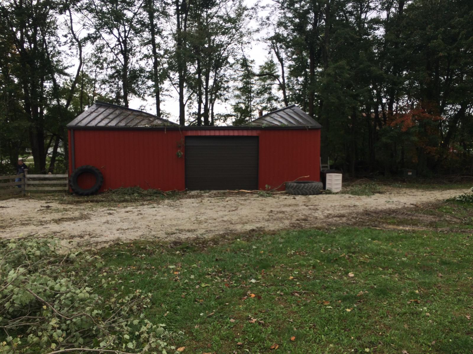
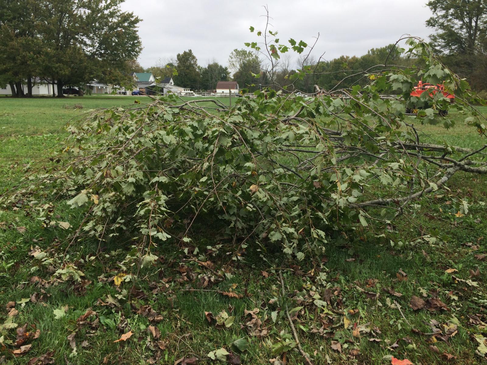
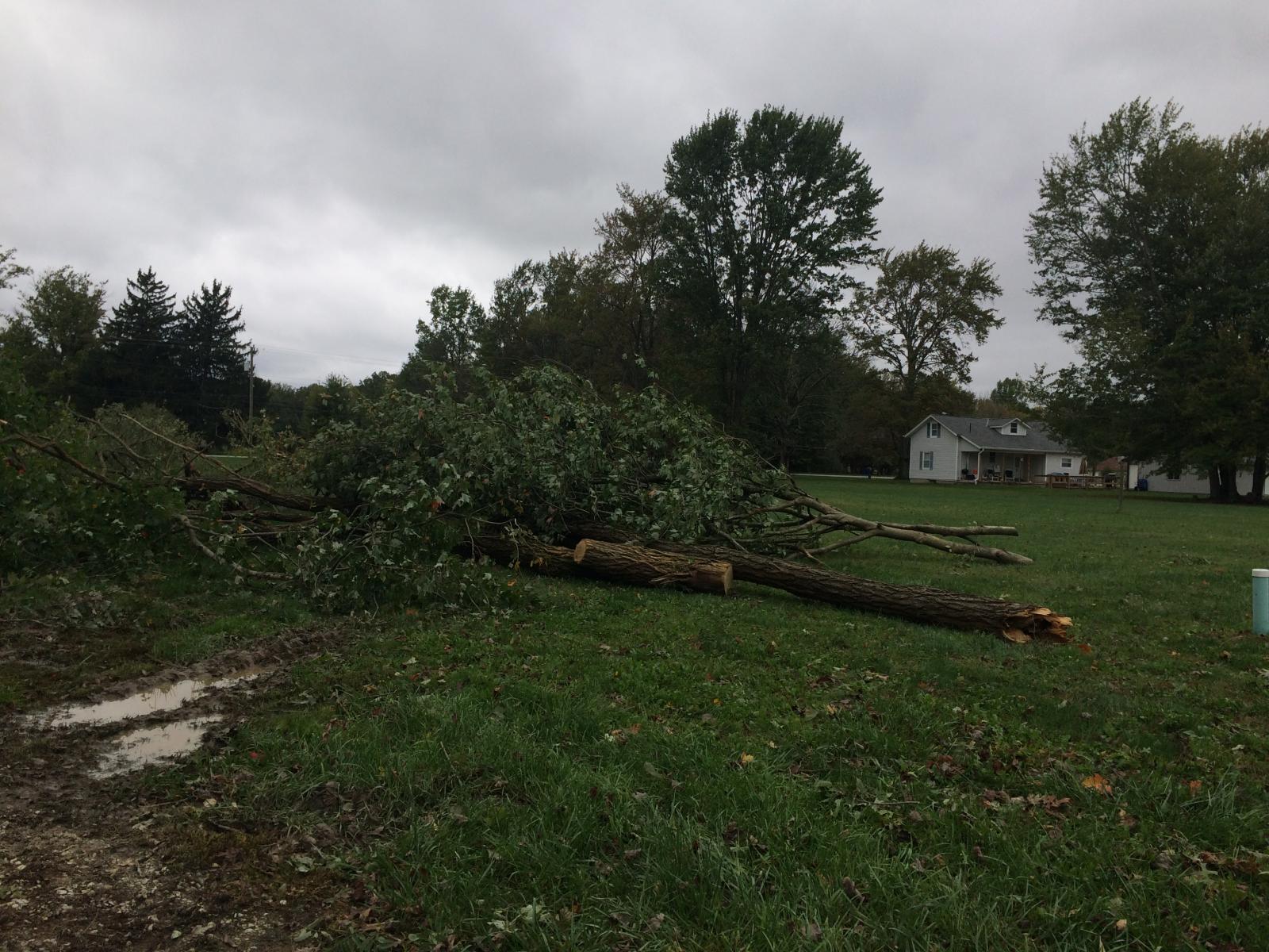
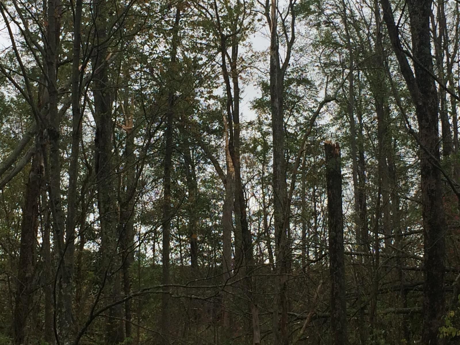
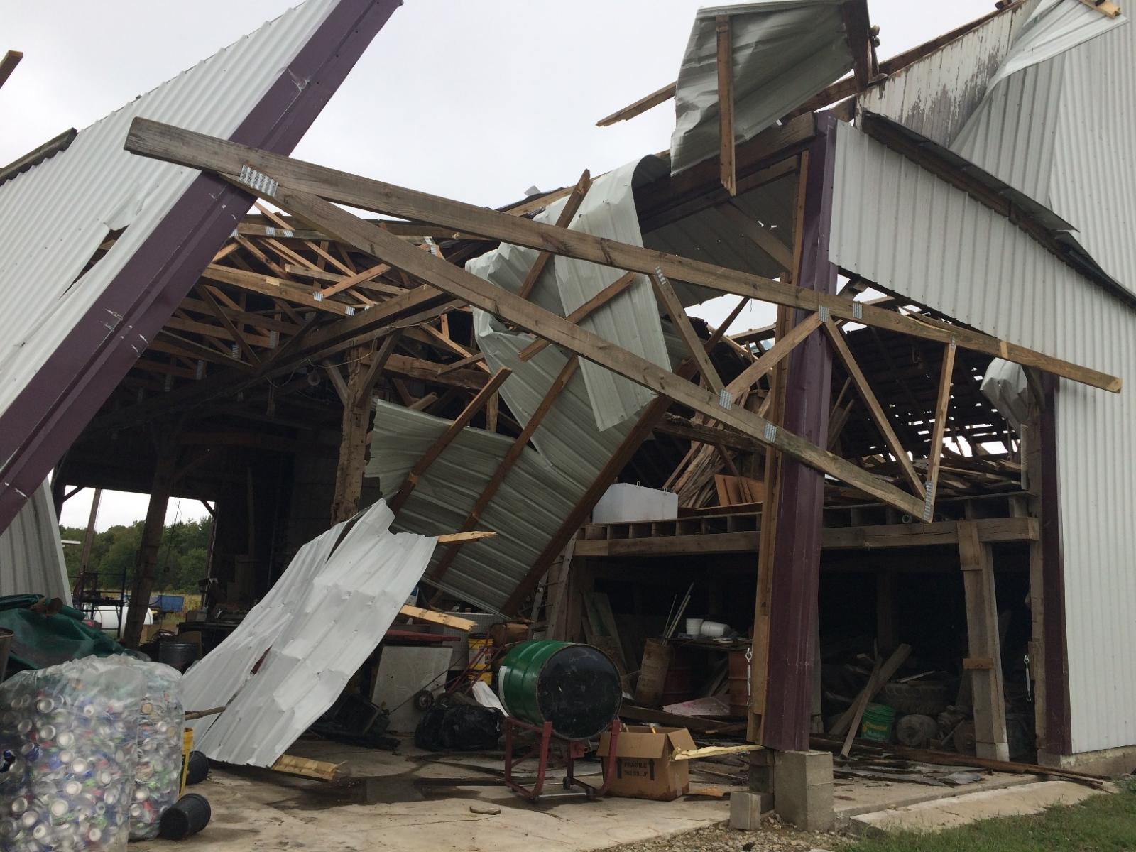
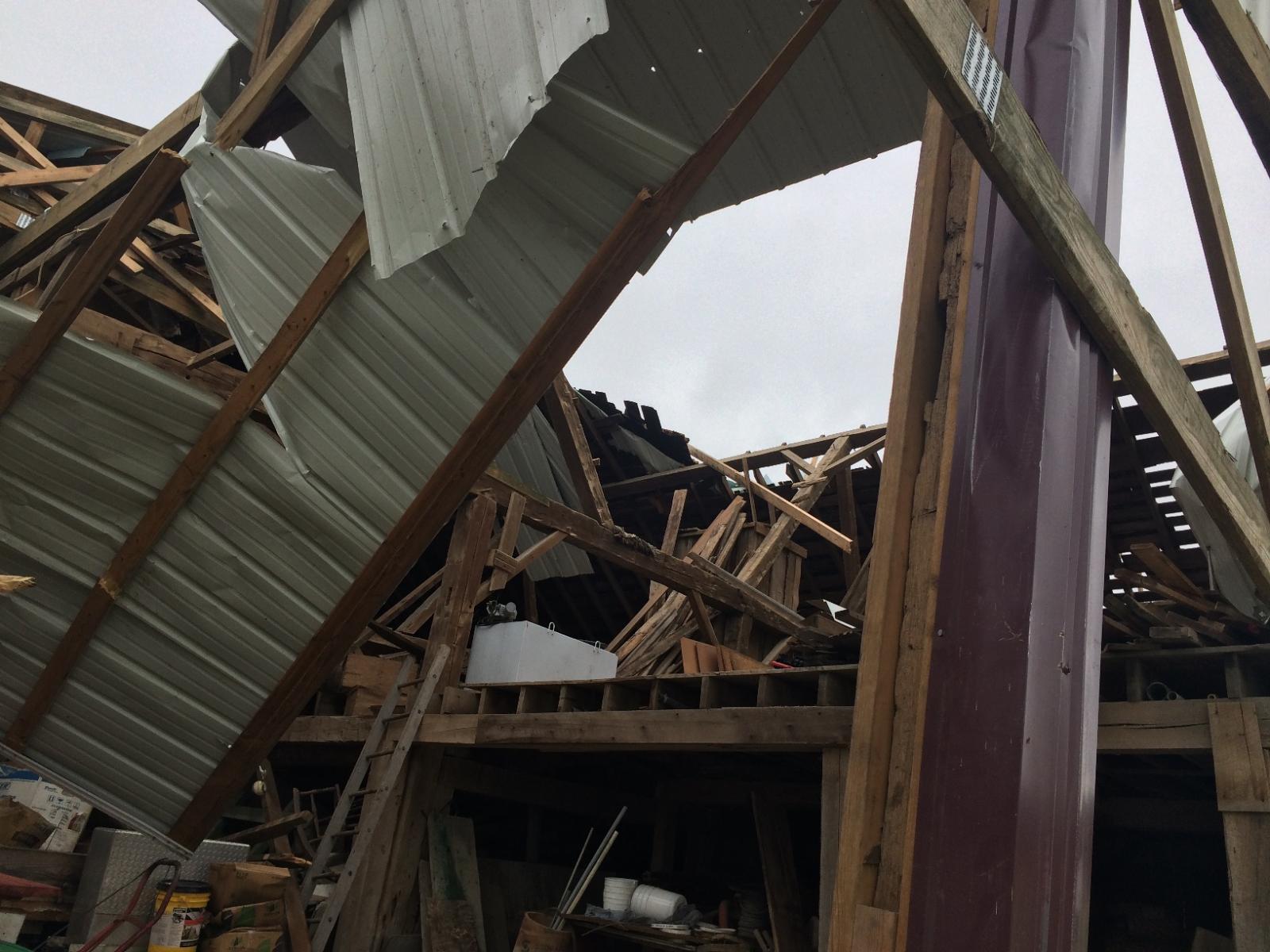
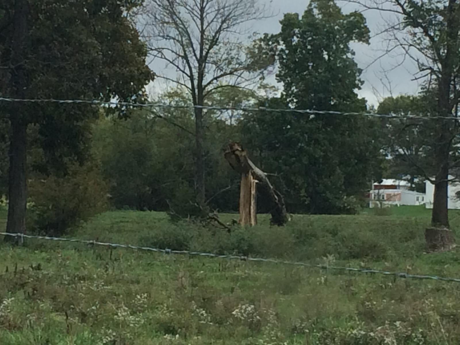
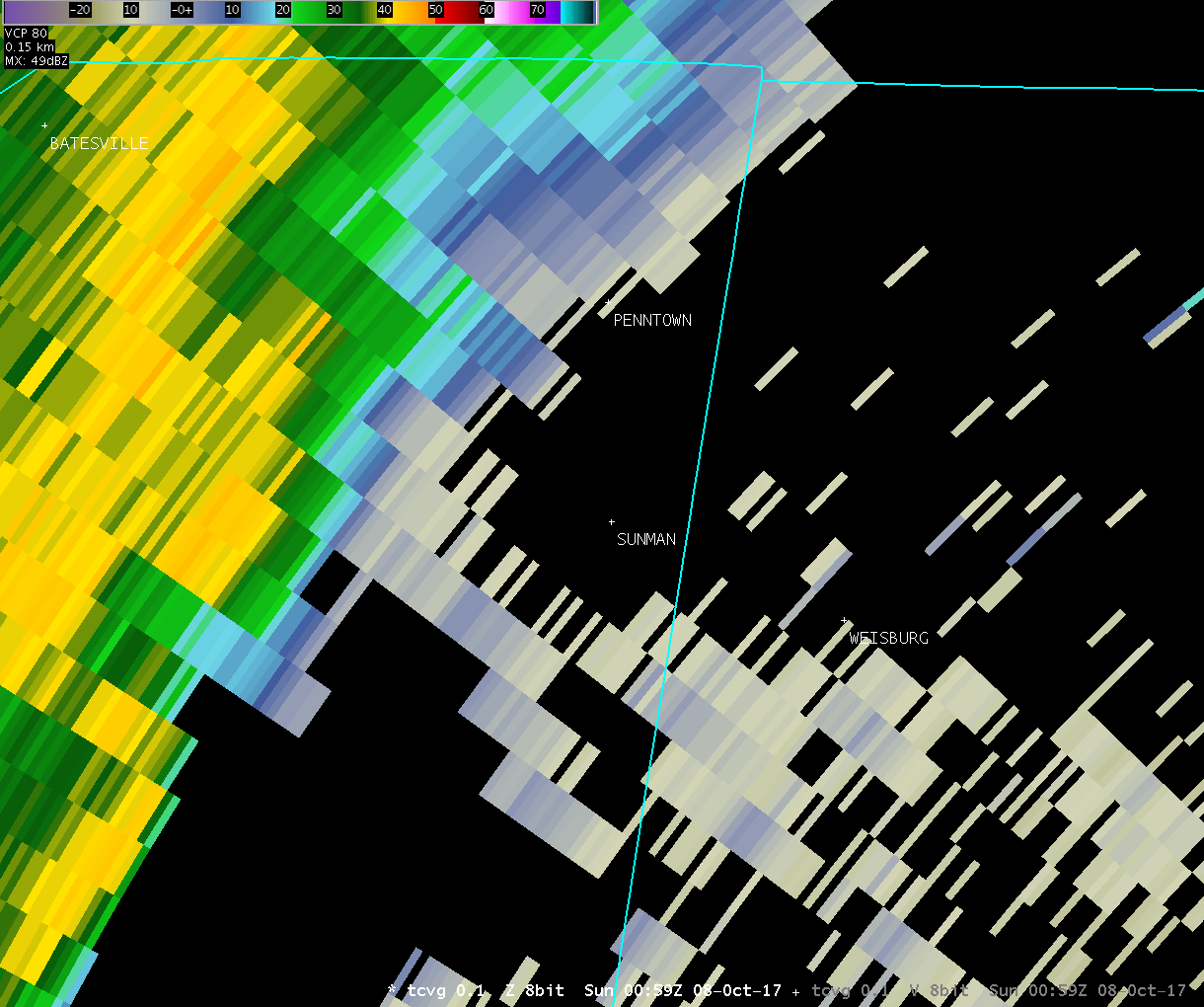
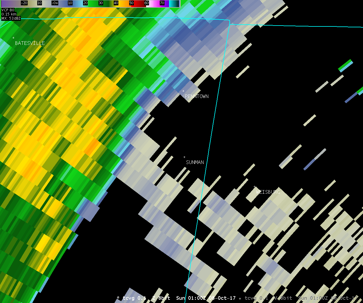
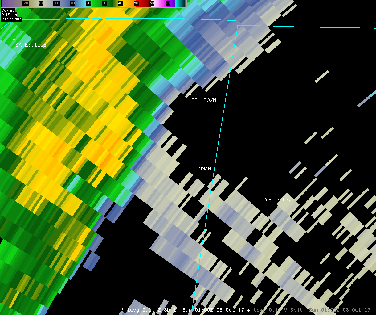
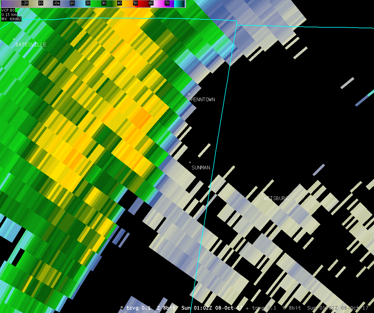
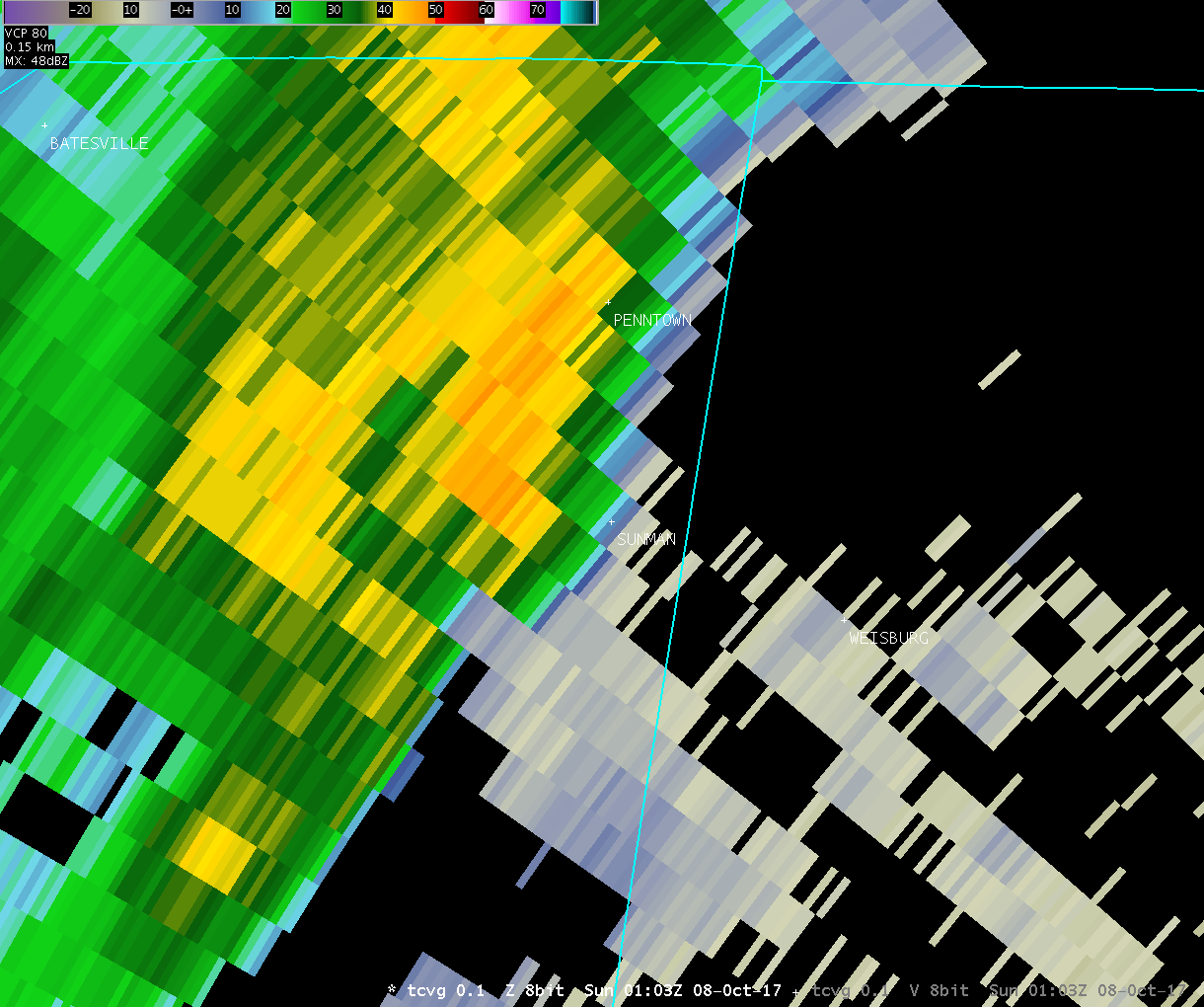
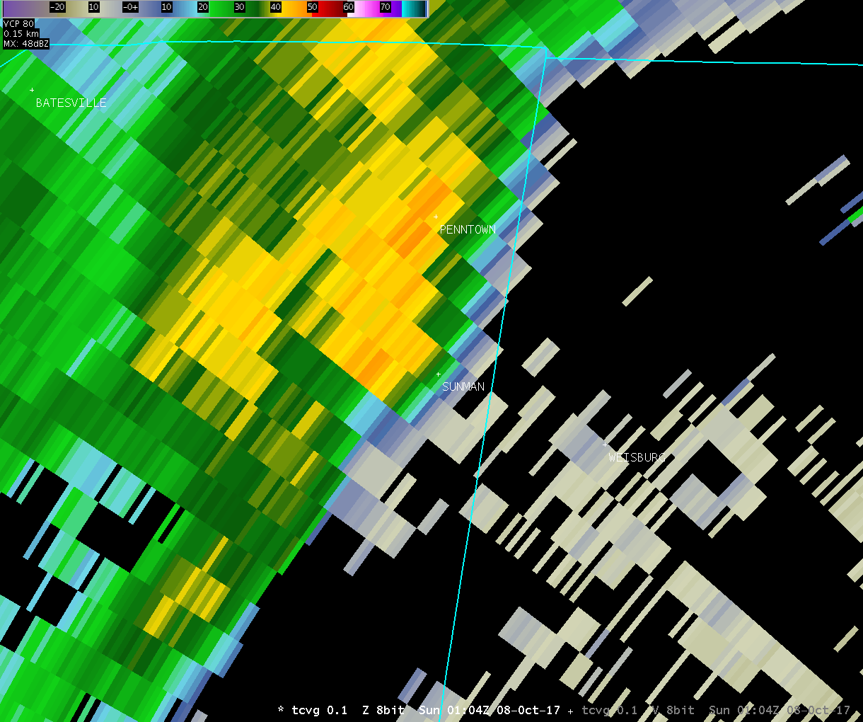
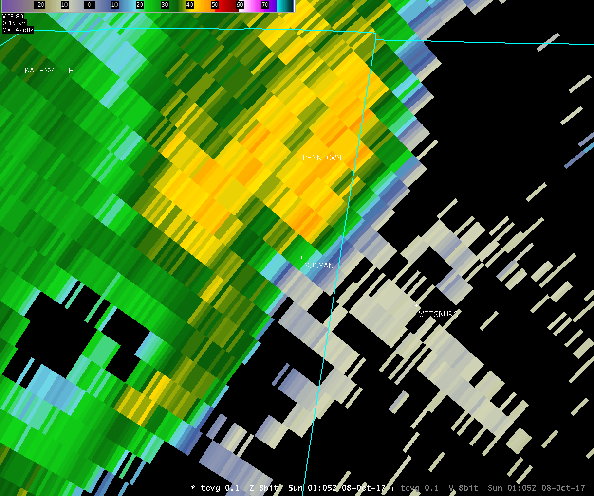
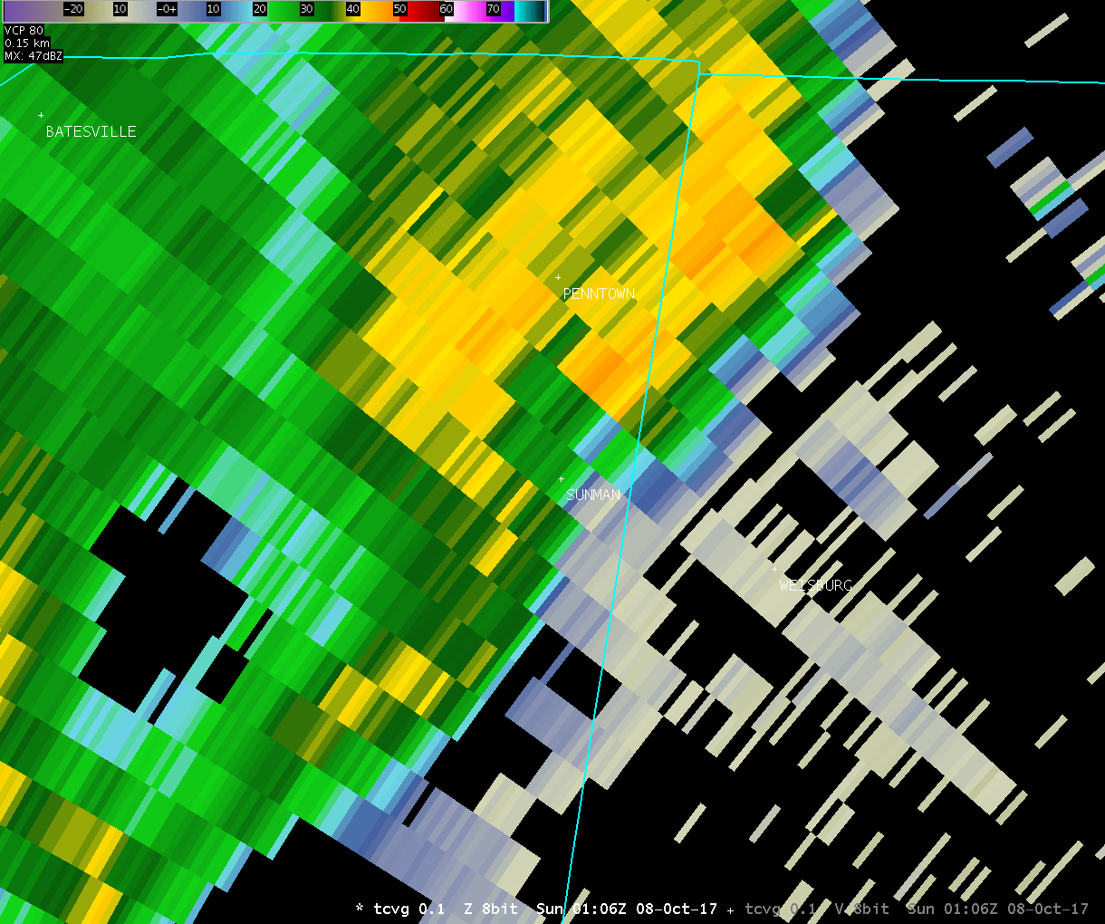
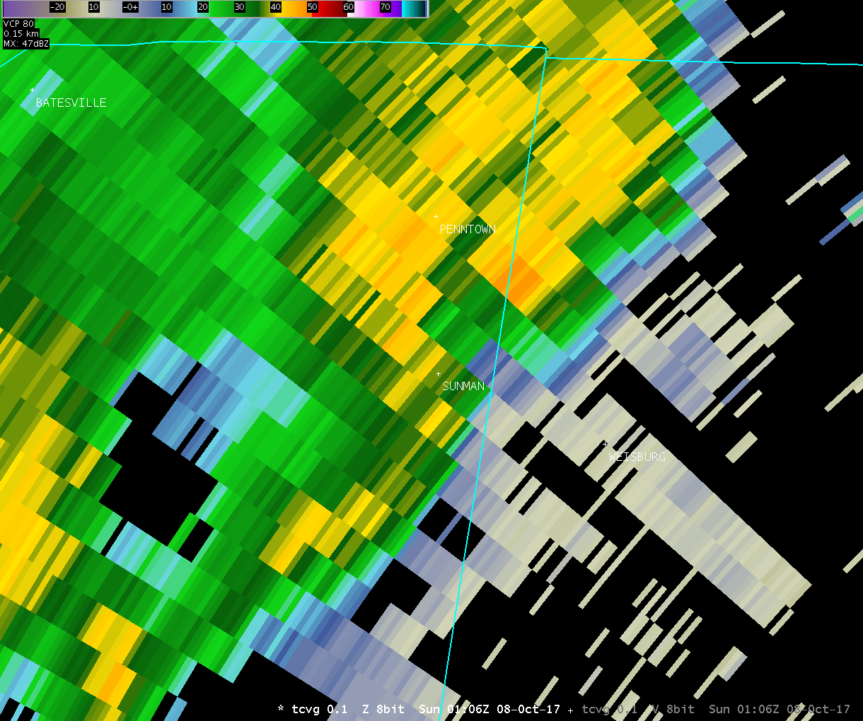
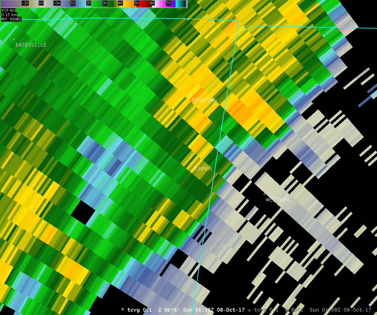
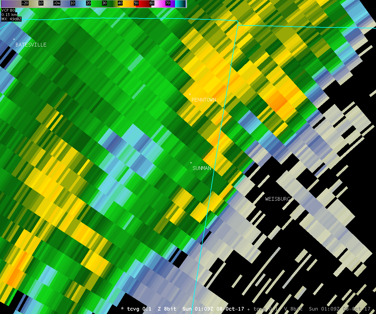
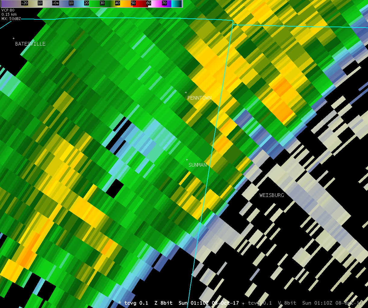
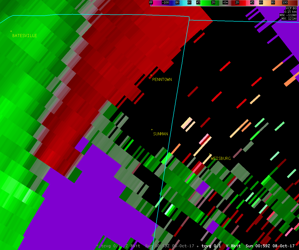
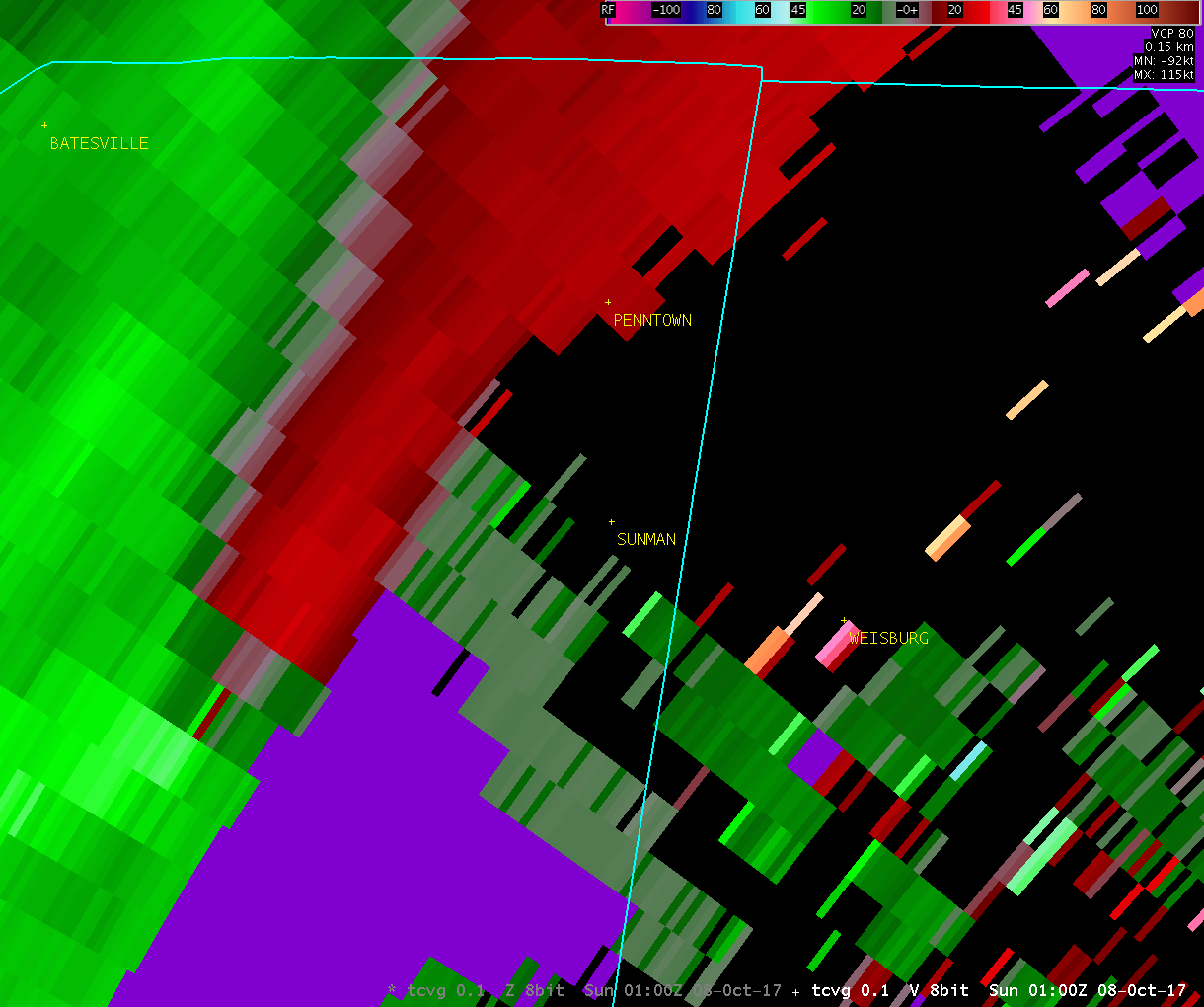
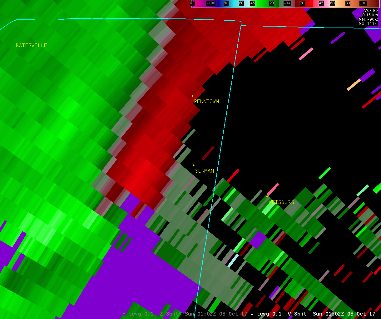
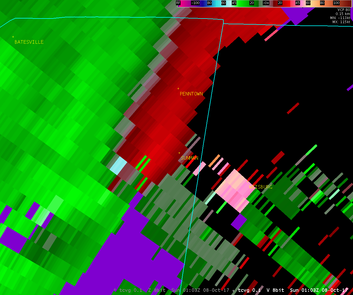
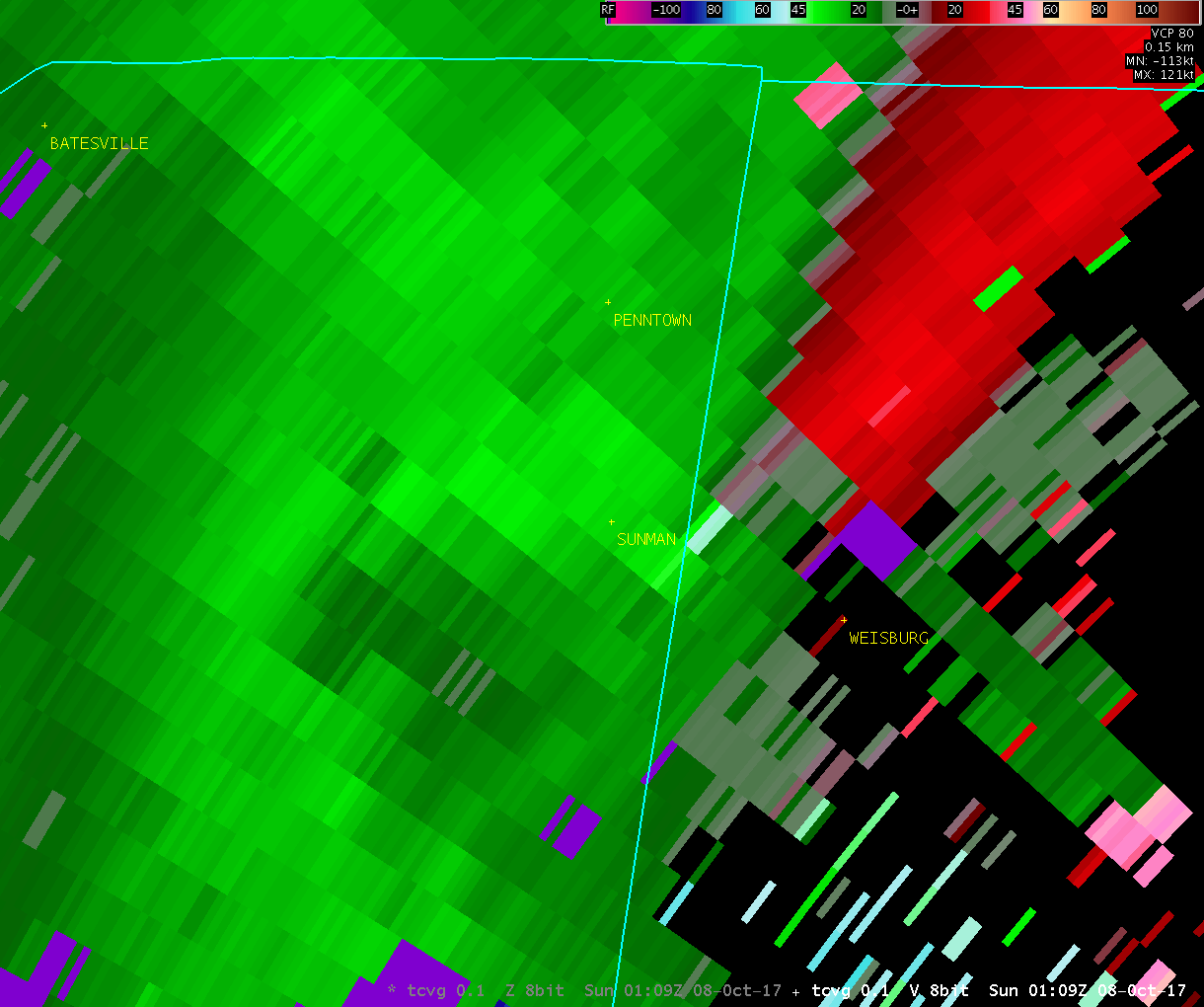
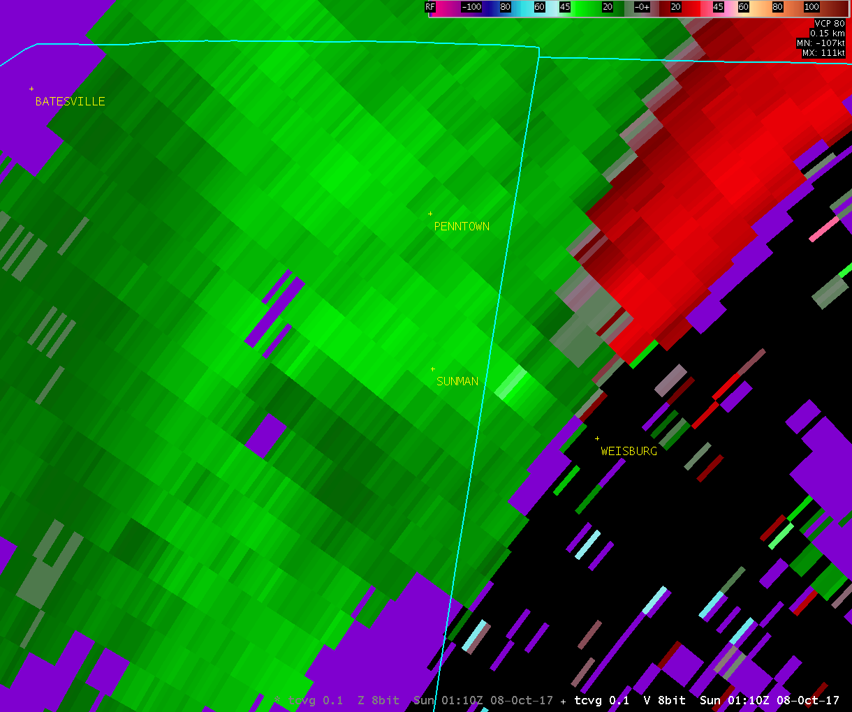
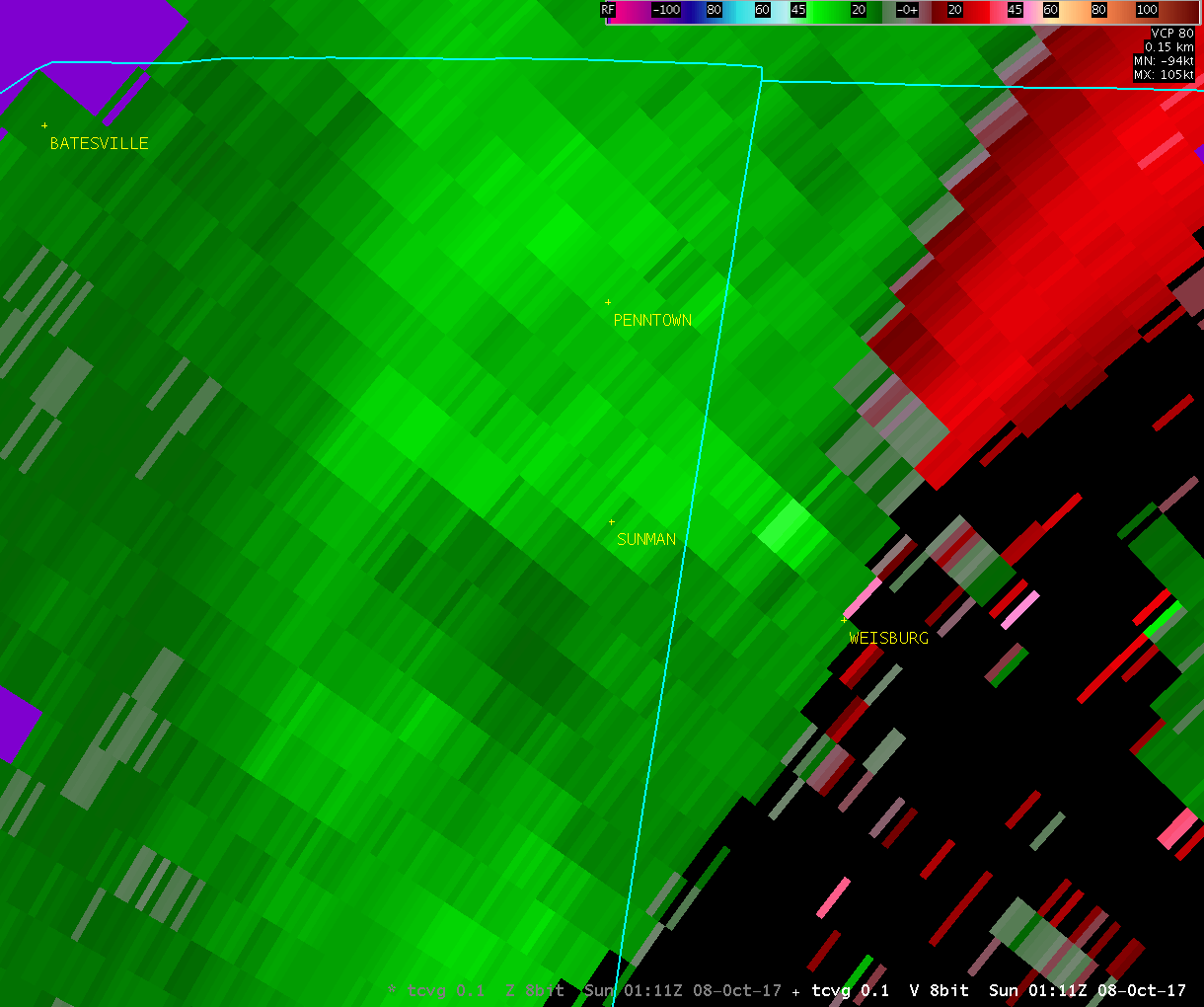
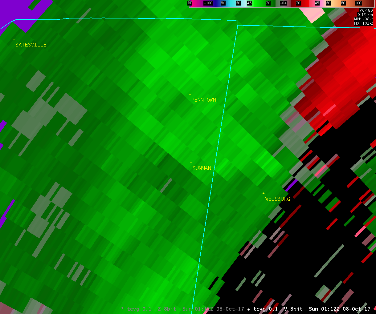
Public Information Statement - UPDATED National Weather Service Wilmington OH 0747 AM EDT Thu Oct 12 2017 ...TORNADO CONFIRMED NEAR SUNMAN INDIANA... Location...Near Sunman in Ripley and Dearborn counties in Indiana Date...October 7 2017 Estimated Start Time...905 PM EDT Estimated End Time...909 PM EDT Maximum EF-Scale Rating...EF0 Estimated Maximum Wind Speed...65-70 MPH Maximum Path Width...100 Yards Path Length...2.8 Miles Beginning Lat/Lon...39.2261 N / 85.1080 W Ending lat/Lon...39.2383 N / 85.0570 W * Fatalities...0 * Injuries...0 * The information in this statement is preliminary and subject to change pending final review of the event(s) and publication in NWS Storm Data. ...Summary... The National Weather Service in Wilmington OH has confirmed a tornado near Sunman in Ripley and Dearborn counties in Indiana on October 7 2017. The first evidence of damage and therefore the determined start of the tornado touch down was just west of the westernmost end of Industrial Drive southwest of Sunman. Two trees were snapped approximately halfway up the trunks. Further east, at a property at the western end of Industrial Drive, an anchored mobile home was pushed approximately 3 to 4 feet off its foundation (up against a back porch). No visible damage was observed to the siding or roof of the mobile home. At the same property, two large sheet metal doors were blown off a barn. No other visible damage was observed to barn structure. Further to the east-northeast, a large tree was downed, along with other miscellaneous limbs near the cul-de-sac of Brick Yard Drive. The large tree that was downed fell partially through the roof of an unoccupied home. Other limbs of various sizes were downed on the property and nearby properties. A very small portion of siding was partially removed at an adjacent property. On the eastern end of Brick Yard Drive (approximately 100 feet west of Meridian Street), a large pine tree was snapped in half. A small tree limb was also downed just on the western side of Meridian street north of Brick Yard Drive. On the east side of Meridian street, just north of Edgewood Lane, a property sustained fairly extensive tree damage, including numerous large limbs downed. The tree damage caused the partial collapse of a garage/barn shelter roof. No visible damage was observed to the home on the property. Additional minor tree damage was observed on Edgewood Lane (small limbs downed). No evidence of any damage was observed from the easternmost portion of Edgewood Lane eastward through the remainder of Ripley County until near the Ripley/Dearborn County line demarcated by North County Line Road. Just on the western side of County Line Road (and therefore still in Ripley County), a tree limb was downed and a tractor trailer was partially tipped over (leaning against a tree). On the eastern side of County Line Road in the same vicinity (but in Dearborn County), in a wooded area about half of a dozen trees were sheared off approximately halfway up. Further northeast, extensive damage occurred to a barn on Kruse Lane. Although a few walls remained standing, the roof was partially removed and carried downwind. Power poles on the property were blown over. The garage of the house was partially blown inward. No visible damage was observed to the home itself. Although no tree damage was observed to the immediate east of the property on Kruse Lane, several large limbs were downed approximately 500 feet north of the intersection of North Dearborn Rd. and Fackler Rd on Fackler Rd. No other damage was observed at any point east and northeast of this location. Therefore, this is the presumed end of the track. This information can also be found on our website at weather.gov/iln. For reference: the Enhanced Fujita Scale classifies tornadoes into the following categories: EF0...wind speeds 65 to 85 mph. EF1...wind speeds 86 to 110 mph. EF2...wind speeds 111 to 135 mph. EF3...wind speeds 136 to 165 mph. EF4...wind speeds 166 to 200 mph. EF5...wind speeds greater than 200 mph. $$ Hatzos/KC/JDR |
| Radar Loops (8:59 PM - 9:14 PM) | |
| TCVG 0.1° Reflectivity | TCVG 0.1° Velocity |
 |
 |
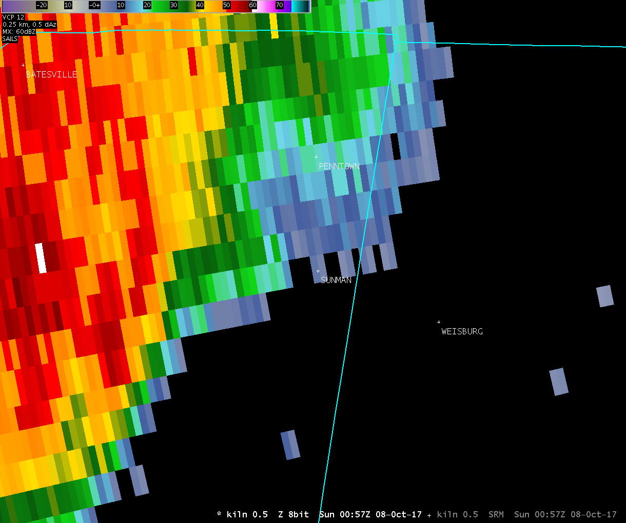
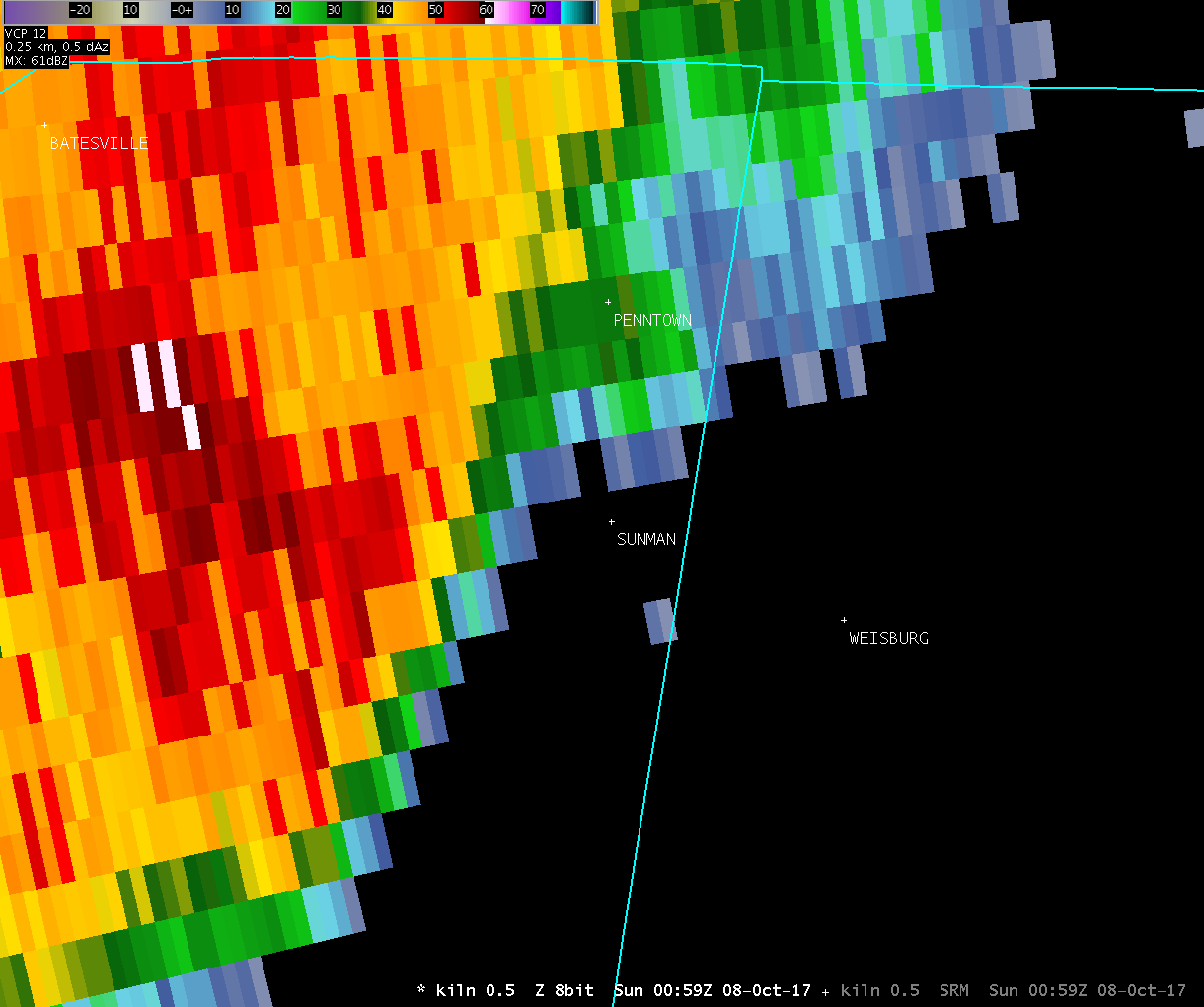
| Radar Loops from NWS Wilmington Ohio (8:57 PM - 9:13 PM) | |
| KILN 0.5° Reflectivity | KILN 0.5° Storm-Relative Motion |
| 1 2 3 4 5 6 7 8 9 Anim | 1 2 3 4 5 6 7 8 9 Anim |
| Radar Loops from the Cincinnati Terminal Doppler Radar (8:59 PM - 9:14 PM) | |
| TCVG 0.1° Reflectivity | TCVG 0.1° Velocity |
| 1 2 3 4 5 6 7 8 9 10 11 12 13 14 15 16 | 1 2 3 4 5 6 7 8 9 10 11 12 13 14 15 16 |
| Select Storm Survey Photos | |||
 |
 |
 |
 |
 |
 |
 |
 |
 |
 |
 |
 |
 |
 |
 |
 |
 |
 |
 |
 |
 |
 |
 |
 |

