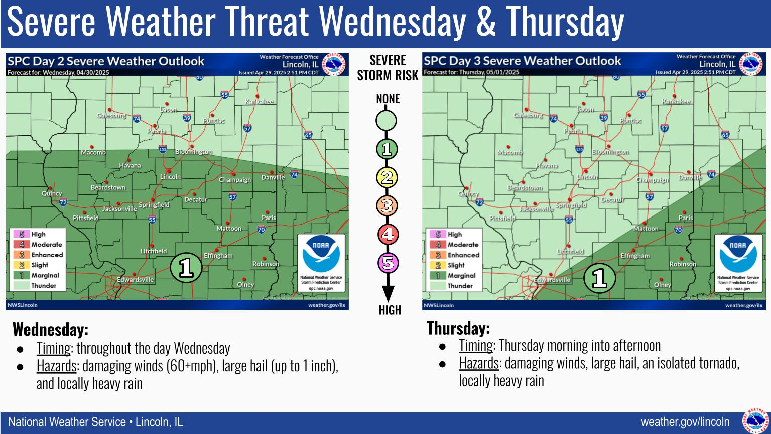
National Weather Service United States Department of Commerce

Snow showers will enter western IL overnight tonight, with widespread snow and stiff southeast winds during the day tomorrow. After a brief warm up and possible brief transition to rain/snow mix during the evening, winds will switch around to the west and gust to 35+ mph overnight into Sunday. Aside from a few isolated flurries, Sunday will be blustery but dry. There may still be drifting across some roadways, so use caution if driving even after the snow is finished falling.
A Winter Storm Warning has been issued for central IL from tonight through Saturday night where there is high confidence for impactful snow, and a Winter Weather Advisory has been issued for southeast IL where there will be portions of the storm falling as rain or a wet mix of rain and snow.
Traveling for the Thanksgiving holiday? Here is an approximate timeline of impacts with the impending winter storm.
Heavy snow of 6 to 12 inches is expected in much of west-central IL tonight through Saturday night. The higher amounts will be closer to the I-74 corridor. East-central IL has more uncertainty in amounts, with a heavier, wetter snow, and possible change to rain.