Overview
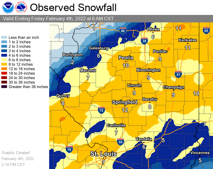
Preliminary observed snowfall map from the morning of February 1 through the morning of February 4
A long-duration winter storm brought a mixed bag of rain, freezing rain, sleet, and heavy snow to central and southeast Illinois between February 1-3. This paired with winds gusting up to 30-35 mph created blowing/drifting snow, which resulted in dangerous travel conditions. The highest snowfall totals ranged from 8-15" within a swath situated between the Illinois River and I-70. Daily snowfall records were broken at our climate sites in Peoria, Springfield, and Lincoln on February 2. Lesser yet still significant snowfall amounts were reported elsewhere. Ice amounts were brief for most, with the largest accumulations situated south of I-72 where one to three tenths of an inch were reported prior to the heavy snowfall.
Snow/Ice
Public Information Statement
National Weather Service Lincoln IL
1254 PM CST Fri Feb 4 2022

...3-DAY SNOWFALL REPORTS FEB 1-3...

Location                     Amount    Time/Date       Provider

...Illinois...

...Cass County...
3 SE Bluff Springs           12.8 in   0630 AM 02/04   COCORAHS

...Champaign County...
Tolono                       15.0 in   0635 PM 02/03   Broadcast Media
Champaign 2.5 SW             13.0 in   0700 AM 02/04   COCORAHS
Savoy                        12.5 in   0800 PM 02/03   Mesonet
Savoy 0.6 SSE                12.5 in   0700 AM 02/04   COCORAHS
2 SW Champaign               11.5 in   0800 PM 02/03   Mesonet
3 SE Urbana                  11.0 in   0700 PM 02/03   Mesonet
2 ENE Urbana                 10.7 in   0810 PM 02/03   Mesonet
Ogden                        9.8 in    0600 AM 02/04   COOP
Champaign County             8.6 in    0700 AM 02/04   COCORAHS
Savoy 0.9 N                  8.5 in    1000 AM 02/04   COCORAHS
Homer 2.0 N                  8.0 in    0700 AM 02/04   COCORAHS
St. Joseph 1.1 ENE           7.8 in    0549 AM 02/04   COCORAHS
Sidney 0.9 N                 7.7 in    0700 AM 02/04   COCORAHS
Champaign 0.6 NNE            6.8 in    0600 AM 02/04   COCORAHS

...Christian County...
2.5 W Taylorville            11.0 in   0700 AM 02/04   COOP
Pana                         10.7 in   0700 AM 02/04   COOP
Morrisonville 0.5 SSE        10.5 in   0730 AM 02/04   COCORAHS
Pana 6.2 NNE                 10.1 in   0700 AM 02/04   COCORAHS
3 W Edinburg                 9.5 in    0430 PM 02/03   Cocorahs
Edinburg 3.0 W               8.6 in    0700 AM 02/04   COCORAHS

...Clark County...
Casey                        5.0 in    0730 AM 02/04   COOP

...Clay County...
Flora                        5.0 in    0300 PM 02/03   Mesonet
Clay City 6 SSE              4.8 in    0600 AM 02/04   COOP
Flora                        4.0 in    0630 AM 02/04   COOP

...Coles County...
0.8 SE Charleston            8.5 in    0604 PM 02/03   COOP
Charleston 4.7 SSW           6.0 in    0800 AM 02/04   COCORAHS

...Crawford County...
Hutsonville                  5.5 in    0700 AM 02/04   COCORAHS
2.0 W Robinson               4.5 in    0700 AM 02/04   COOP
Robinson                     3.5 in    0845 PM 02/03   Broadcast Media

...De Witt County...
Clinton 0.4 WSW              11.9 in   0700 AM 02/04   COCORAHS
Clinton 1SSW                 11.0 in   0700 AM 02/04   COOP
Lane                         10.0 in   0445 PM 02/03   Mesonet

...Douglas County...
Newman                       12.5 in   0600 PM 02/03   Cocorahs
Tuscola 2.3 WSW              10.0 in   0700 AM 02/04   COCORAHS
1 WSW Tuscola                9.5 in    0600 PM 02/03   CO-OP Observer
Tuscola                      9.5 in    0700 AM 02/04   COOP
Tuscola 0.5 WSW              9.5 in    0700 AM 02/04   COCORAHS

...Edgar County...
Brocton                      8.0 in    0740 PM 02/03   Mesonet
Paris                        6.5 in    0700 AM 02/04   COOP

...Effingham County...
Altamont                     8.0 in    0230 PM 02/03   Trained Spotter
2 NNW Effingham              8.0 in    0449 PM 02/03   Mesonet
Watson                       4.3 in    0730 AM 02/04   COCORAHS

...Fulton County...
Canton                      10.0 in    1200 PM 02/03   Mesonet
Astoria                      9.0 in    1200 PM 02/04   Mesonet
Avon                         6.0 in    0700 AM 02/04   COOP

...Jasper County...
1.1 W Newton                 6.8 in    1200 AM 02/04   COOP
Yale 0.1 SSW                 4.5 in    0700 AM 02/04   COCORAHS

...Knox County...
Yates City                   9.2 in    0705 AM 02/04   COOP
Knoxville 0.7 NW             6.1 in    0700 AM 02/04   COCORAHS
Galesburg                    6.0 in    0700 AM 02/04   COOP
Altona                       5.0 in    0600 AM 02/04   COOP

...Lawrence County...
1 W Lawrenceville            5.1 in    0700 AM 02/04   COCORAHS
1.7 W Lawrenceville          4.1 in    0800 AM 02/04   COOP
1 SW Bridgeport              3.5 in    0800 PM 02/03   Mesonet

...Logan County...
Mount Pulaski                11.5 in   0600 AM 02/04   COOP
NWS Lincoln                  11.0 in   0545 PM 02/03   Official NWS Obs

...Macon County...
Macon                        13.0 in   0615 PM 02/03   Trained Spotter
1 N Mount Zion               12.0 in   0310 PM 02/03   Trained Spotter
Warrensburg                  12.0 in   0900 PM 02/03   Mesonet
Forsyth                      11.8 in   0700 AM 02/04   Public
Decatur 1 SSE                9.9 in    1200 AM 02/04   COOP
Orena 1.3 S                  9.7 in    0800 AM 02/04   COCORAHS

...Marshall County...
Lacon                         8.0 in   0800 AM 02/03   COOP
Henry                         7.0 in   0600 AM 02/03   Mesonet

...McLean County...
2 N Downs                    13.5 in   0400 PM 02/03   Mesonet
Bloomington 2.7 NE           12.8 in   0700 AM 02/04   COCORAHS
2 N Towanda                  12.0 in   0330 PM 02/03   Mesonet
Arrowsmith 1.7 NNE           11.1 in   0800 AM 02/04   COCORAHS
Normal 1.1 SSE               10.8 in   0700 AM 02/04   COCORAHS
4 NE Normal                  9.0 in    0500 AM 02/04   COOP
Heyworth 0.6 E               8.6 in    0800 AM 02/04   COCORAHS
Chenoa                       8.0 in    0730 AM 02/04   UCOOP

...Menard County...
Petersburg 6.5 SSE           10.2 in   0700 AM 02/04   COCORAHS
Athens 4 WSW                 10.2 in   0700 AM 02/04   COOP
1 W Athens                   8.5 in    0600 AM 02/04   Public

...Morgan County...
2.0 E Jacksonville           8.9 in    0530 AM 02/04   COOP
Jacksonville                 7.0 in    0700 AM 02/04   COOP
Jacksonville 2.6 SE          6.9 in    0700 AM 02/04   COCORAHS

...Moultrie County...
Lovington                    9.9 in    0700 AM 02/04   COOP
Sullivan 3S                  5.8 in    0700 AM 02/04   COOP

...Peoria County...
Dunlap                      11.0 in    0600 AM 02/03   Mesonet
Peoria                      10.6 in    0600 AM 02/03   Official NWS Obs
Peoria 2 NW                 10.0 in    0600 AM 02/03   Mesonet
Peoria 3.4 WNW               9.8 in    0700 AM 02/04   COCORAHS
Peoria 5 NW                  8.6 in    0800 AM 02/04   COOP

...Piatt County...
2 NE Cisco                   9.5 in    0825 PM 02/03   Mesonet
Mansfield 3.0 WSW            6.8 in    0700 AM 02/04   COCORAHS

...Richland County...
Olney 2 S                    5.9 in    0600 AM 02/04   COOP

...Sangamon County...
Springfield 4.4 W            13.5 in   0700 AM 02/04   COCORAHS
3.0 NW Springfield           13.5 in   0800 AM 02/04   COCORAHS
Sherman                      12.2 in   0516 PM 02/03   Public
Springfield                  12.0 in   0550 PM 02/03   Official NWS Obs
2 W Riverton                 11.7 in   0700 AM 02/04   COCORAHS
3 S Southern View            10.5 in   0541 PM 02/03   Mesonet
Buffalo                      9.0 in    0700 AM 02/04   COOP
2 SE Auburn                  8.3 in    0630 PM 02/03   Mesonet

...Schuyler County...
Rushville                    10.0 in   0457 PM 02/03   Mesonet

...Shelby County...
Windsor                      10.0 in   0630 AM 02/04   COOP
4 NW Mode                    7.5 in    0700 AM 02/04   COCORAHS
Moweaqua 2 S                 6.7 in    0600 AM 02/04   COOP
1.5 E Shelbyville            6.0 in    0900 AM 02/04   HADS

...Tazewell County...
3 SSE Germantown Hills       10.0 in   0800 AM 02/04   COCORAHS
Pekin 3.6 SSE                9.7 in    0900 AM 02/04   COCORAHS
Morton 1.0 S                 9.1 in    0550 AM 02/04   COCORAHS
Mackinaw 2NE                 9.0 in    0700 AM 02/04   COOP
Morton                       8.6 in    0700 AM 02/04   COOP

...Vermilion County...
Danville                     15.0 in   0635 PM 02/03   Broadcast Media
Georgetown 0.1 NNW           13.1 in   0700 AM 02/04   COCORAHS
Danville                     11.6 in   0630 AM 02/04   COCORAHS
Henning 3.4 SE               11.5 in   0700 AM 02/04   COCORAHS
3 W Bismarck                 11.0 in   0800 AM 02/04   Mesonet
Sidell 4N                    9.6 in    0700 AM 02/04   COOP
Hoopeston 0.6 E              9.3 in    0500 AM 02/04   COCORAHS
Danville 4.2 NW              8.0 in    0600 AM 02/04   COCORAHS
1.6 W Danville               6.0 in    0500 PM 02/03   COOP

...Woodford County...
Minonk                       14.0 in   1000 AM 02/04   COOP
Roanoke                      10.0 in   0700 AM 02/04   COOP
Germantown Hills 0.5 SSW     9.1 in    0700 AM 02/04   COCORAHS

Observations are collected from a variety of sources with varying
equipment and exposures. We thank all volunteer weather observers
for their dedication. Not all data listed are considered official.

$$
------------------------------------------------------------------------------------------------------------------
Public Information Statement
National Weather Service Lincoln IL
1044 AM CST Thu Feb 3 2022

...FREEZING RAIN REPORTS...

Location                     Amount    Time/Date       Lat/Lon
Altamont                     0.30 in   0115 PM 02/02   39.06N/88.75W
2 SE Auburn                  0.20 in   1000 AM 02/02   39.57N/89.72W
Ogden                        0.20 in   0200 PM 02/02   40.11N/87.96W
Effingham                    0.15 in   1230 PM 02/02   39.12N/88.54W
1 NNW Billett                0.10 in   1212 AM 02/03   38.67N/87.66W

Observations are collected from a variety of sources with varying
equipment and exposures. We thank all volunteer weather observers
for their dedication. Not all data listed are considered official.

$$
Meteorology
 |
 |
 |
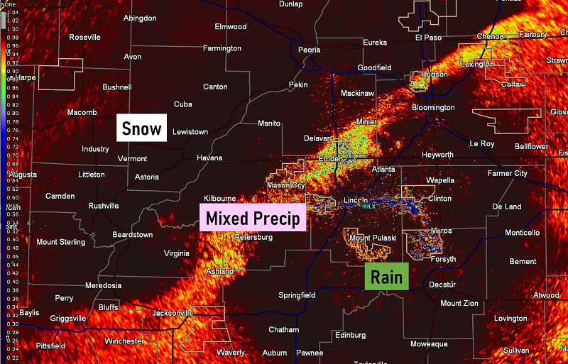
| Radar imagery showing the transition from rain to wintry mix and then finally snow across northwest portions of the forecast area on the evening of Tuesday February 1. | Correlation coefficient from the KILX radar showing the distinctive line between snow, mixed wintry precipitation, and rain during the late evening of Feb 1. | February 2, 6 AM CST KILX weather balloon sounding from our office here in Lincoln, IL. This sounding reveals a deeply saturated layer all the way up to nearly 200 mb with all levels below 0 degrees Celsius. A good portion of this layer is situated in the dendritic growth zone, which supported snowflake development that morning. Strong winds in the upper levels of the atmosphere were signs of a strong jet, which assisted in synoptic scale lift for widespread precipitation. |
A strong cold front moved through the area on Tuesday February 1, stalling out near the I-70 corridor by the evening hours. Rain started falling ahead of the front Tuesday morning and continued into the early evening hours as the front moved toward I-70. An upper wave lifting north along the front Tuesday night into Wednesday morning paired with a coupled upper-level jet created plentiful lift and steep mid-level lapse rates. This resulted in a ripe environment for efficient snow production. Cold air filtered in on the backside of the cold front on Tuesday night and transitioned rain to a wintry mix, and then eventually snow from northwest to southeast. By the morning hours of Wednesday, February 2 several inches of snow had fallen mainly along and north of I-72, with light ice accumulations along and south of I-72. Precipitation remained mostly rain south of I-70. Additional snow fell through the morning and afternoon hours on Wednesday, February 2 before a brief lull in precipitation occurred by evening. By 6 PM CST on Wednesday, February 2, 10.6” had been observed in Peoria with 8.7” in Lincoln and 7.9” in Springfield.
The front remained stalled out near I-70 Wednesday night as a second upper wave tracked northward along it, bringing our next round of precipitation late in the night. Additional snow fell mainly along and east of I-55 going into Thursday, February 3, with a wintry mix well south of I-70 to start. Areas south of I-70 finally switched to snow by mid-morning on Thursday, continuing into the evening hours. Snow totals when all said and done at our 3 climate sites were as follows: 10.6" in Peoria, 12" in Springfield, and 11" in Lincoln.
Records set at our 3 climate sites (Peoria, Springfield, & Lincoln):
Photos
 |
 |
 |
 |
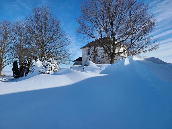
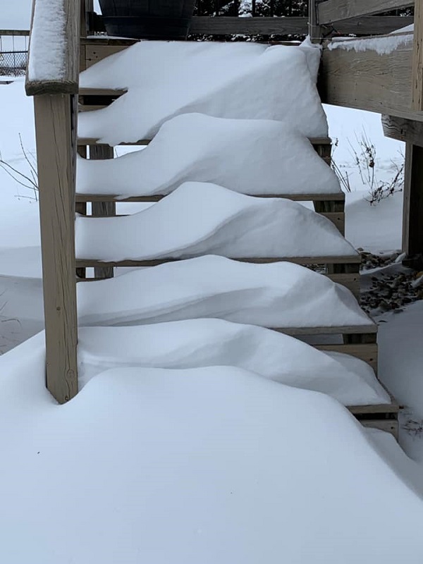
| Drifts up to 6 ft in Stanford, IL (Photo by Patricia Becker) |
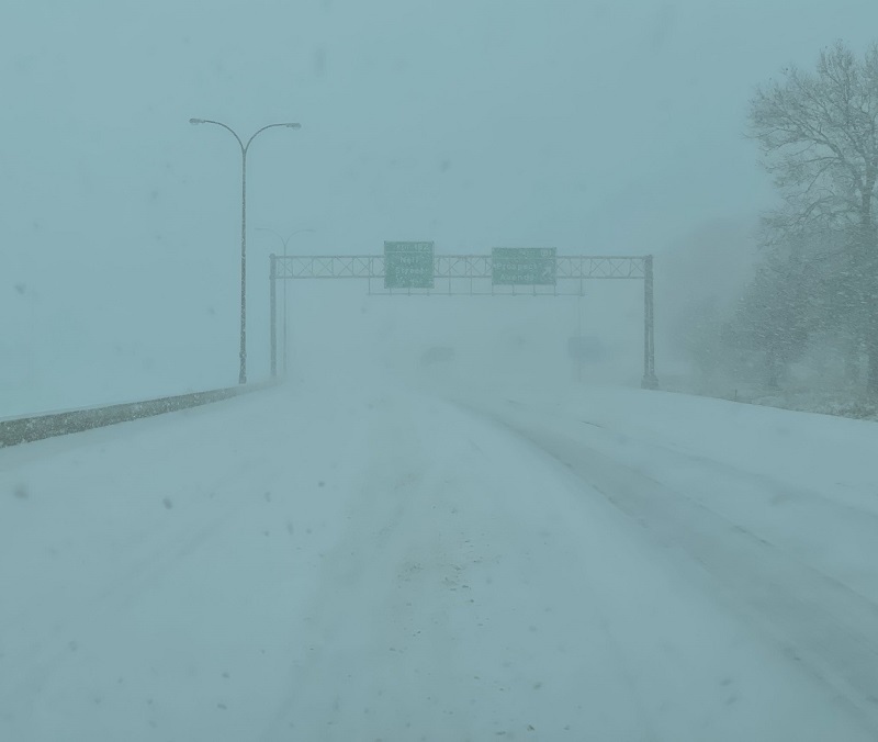
Champaign, IL Feb 2 (Photo by Kevin Lighty) |
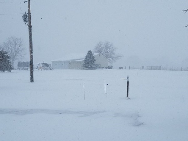
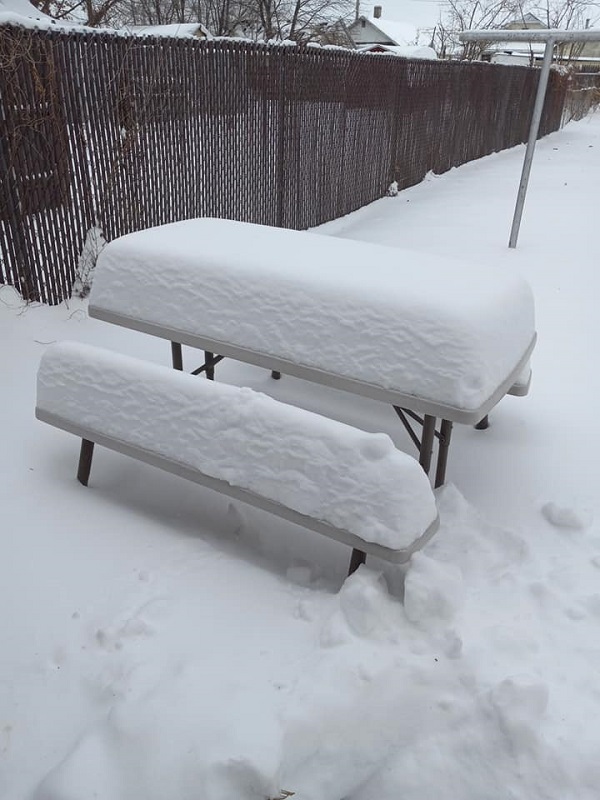
Homer Lake, IL where 8.0" fell (Photo by Steve Hilberg) |
Ice and snow in Oconee, IL (Photo by Donja Small) |
 |
 |
 |
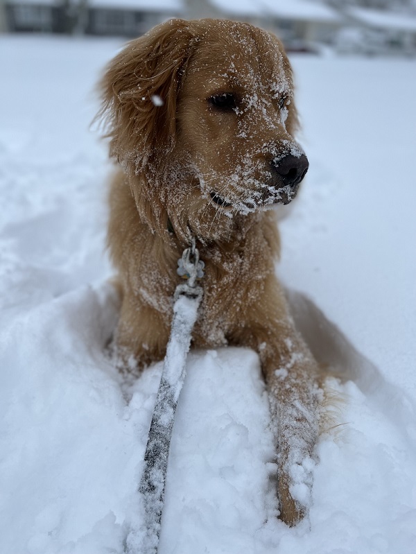 |
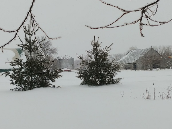
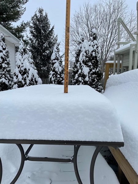
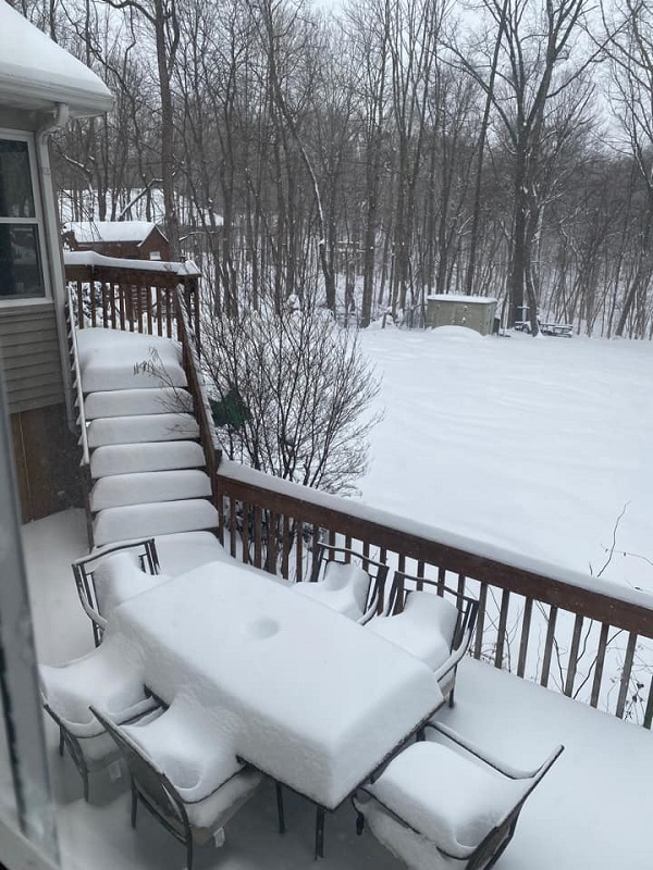
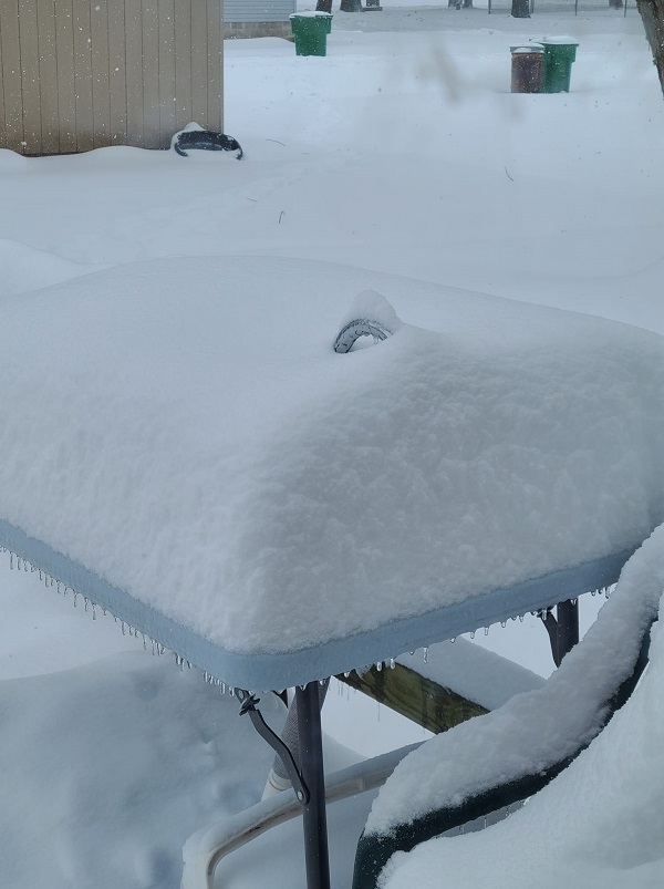
| Nearly a foot of snow in Canton, IL (Photo by Jared Mayall) |
Germantown Hills, IL (Photo by Stephanie Adams) |
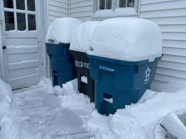
Ice accumulation & heavy snow in Pana, IL (Photo by Sheri Grotts) |
Furry friend enjoying the snow in Lincoln, IL (Photo by Nicole Batzek) |
 |
 |
 |
 |
| Chenoa, IL (Photo by Nikki Ruthenberg Jackson) |
Peoria, IL (Photo by Cathy Crusen Rose) |
Pekin, IL (Photo by Lola Arnett) |
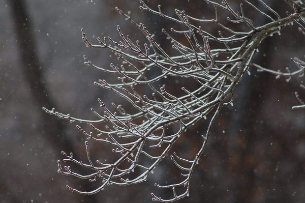
Ice accumulation on trees Litchfield, IL (Photo by Nicole Scanlan Wilson) |
Additional Information
Service
 |
 |
 |
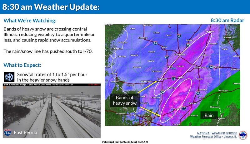 |
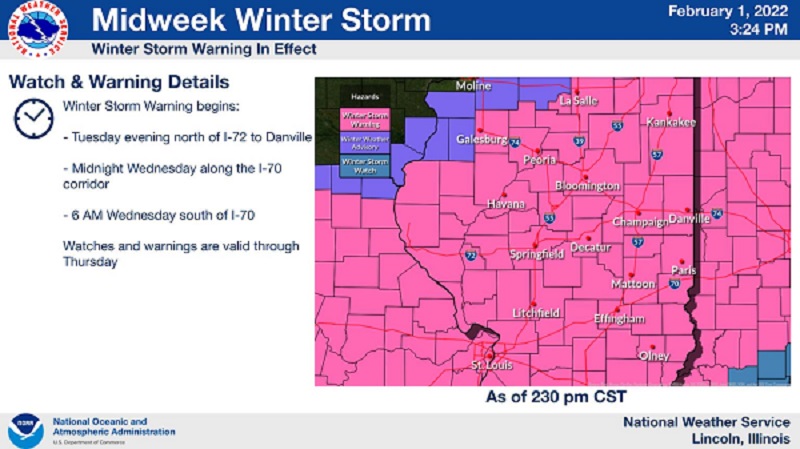
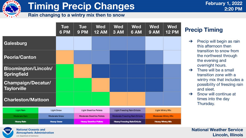
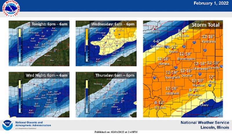
| Headline map with every one of our 35 counties in a Winter Storm Warning (NOTE - this is not current) | Timing of precipitation changes across the entire area issued during the afternoon of Feb 1 | Forecast snow amounts issued during the afternoon of Feb 1 | One of many informational graphics covering the conditions issued on the morning of Feb 2 |
Summaries from other NWS Offices
 |
Media use of NWS Web News Stories is encouraged! Please acknowledge the NWS as the source of any news information accessed from this site. |
|

