Overview
|
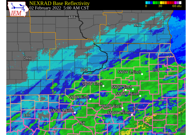
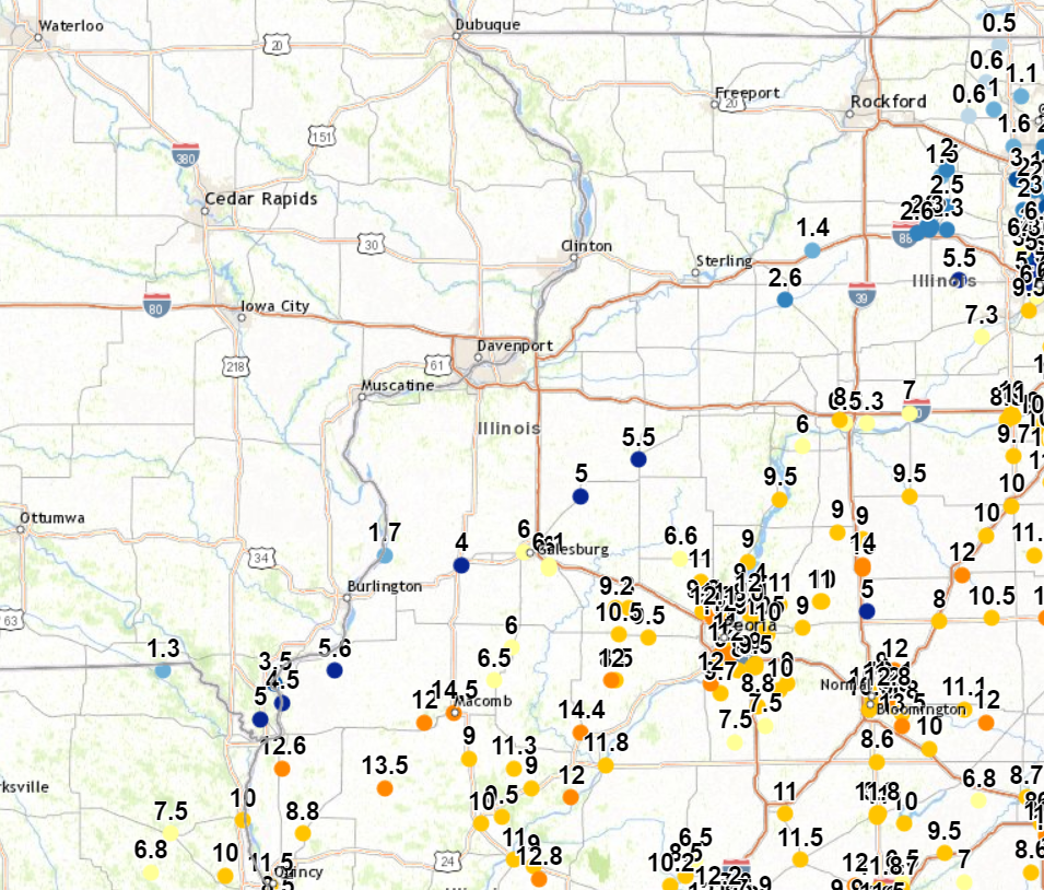
While not a very strong storm, this storm had open access to moist Gulf air, which ended up dropping large snowfall totals through part of the Midwest. This storm started out as rain early on 2/1, which quickly switched to snow after 6:00 PM and remained snow through the duration of the event. In our forecast area, our southeastern counties saw the brunt of the storm, while totals quickly fell off as you travel north, owing to too much dry air early in the event. Where heavy snow fell, totals ranged between 8-14 inches, with blowing/drifting snow that led to deeper drifts and roads that kept getting covered over again.
NWS Official Totals Moline: 0.8"
|
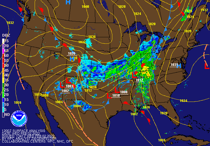 Weather Prediction Center Surface Analysis/Fronts 6 AM Feb. 2, 2022 |
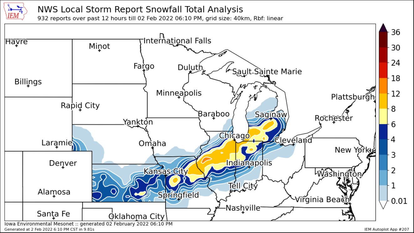
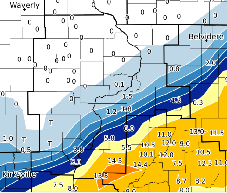
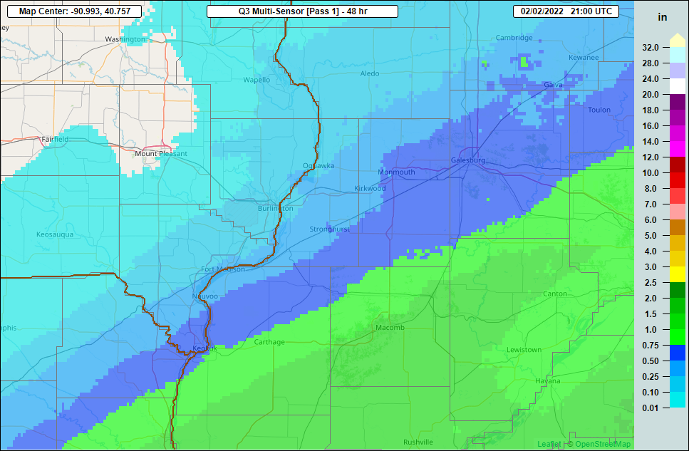
Preliminary Snow and Precipitation Maps from February 1 - 2, 2022
| Regional Snow Map (courtesy IEM) |
Local Snow Analysis (courtesy IEM) |
Liquid Equivalent Map |
 |
 |
 |
Storm Reports and Photos
|
|
|
.jpg) |
| Storm Reports Map Courtesy IEM |
Mark, IL Courtesy of Amanda Shevokas |
Kewanee, IL Courtesy of Lee Bailleu |
|
PRELIMINARY LOCAL STORM REPORT...SUMMARY ..TIME... ...EVENT... ...CITY LOCATION... ...LAT.LON... 1000 AM SNOW 1 SSW KEWANEE 41.23N 89.93W UPDATED STORM TOTAL. 1029 AM HEAVY SNOW 1 WNW MARK 41.27N 89.27W AT LEAST 6 INCHES. STILL SNOWING. 1030 AM SNOW 3 ENE CHARLIE HEATH MEM 40.59N 91.84W UPDATED SNOWFALL AMOUNT. 1142 AM SNOW NAUVOO 40.55N 91.39W 1145 AM SNOW INDUSTRY 40.32N 90.61W UPDATED SNOWFALL REPORT. STILL SNOWING. 1153 AM SNOW 4 SSE NAUVOO 40.49N 91.36W SO FAR. 0153 PM SNOW OQUAWKA 40.94N 90.95W 0200 PM HEAVY SNOW 1 NW BUSHNELL 40.56N 90.51W 0230 PM SNOW 1 SSW MOOAR 40.44N 91.45W EVENT TOTAL. 0241 PM HEAVY SNOW COLCHESTER 40.43N 90.79W EVENT TOTAL. 0300 PM SNOW 2 NE COLUSA 40.59N 91.15W 0410 PM HEAVY SNOW AUGUSTA 40.23N 90.95W EVENT TOTAL. 0423 PM SNOW 1 SE MACOMB 40.46N 90.67W |
||
 |
Media use of NWS Web News Stories is encouraged! Please acknowledge the NWS as the source of any news information accessed from this site. |
|


.jpg)