Dangerous and extreme heat will remain across portions of the southern U.S. through the weekend. A heat wave over the Southwest U.S. will intensify this week, peaking and expanding into the Intermountain West and northern High Plains this weekend. Multiple rounds of thunderstorms will produce heavy to excessive rainfall with significant flash flooding across portions of southern New England. Read More >
|
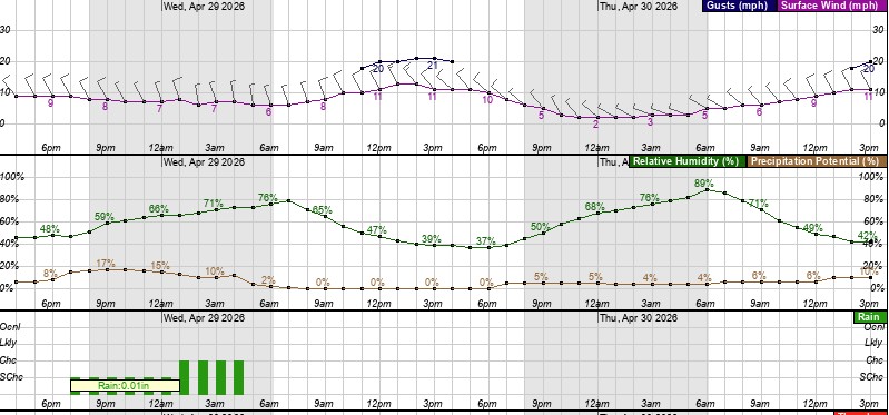
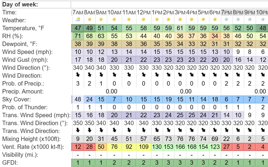
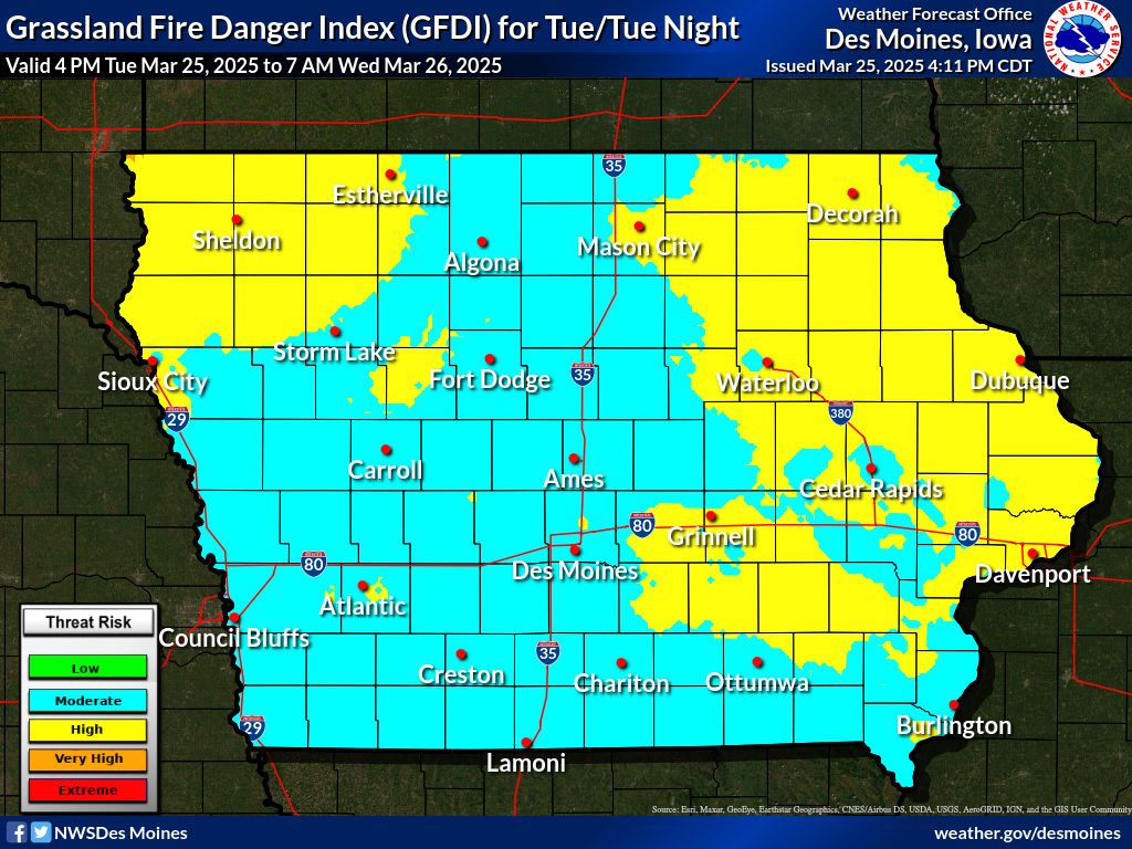
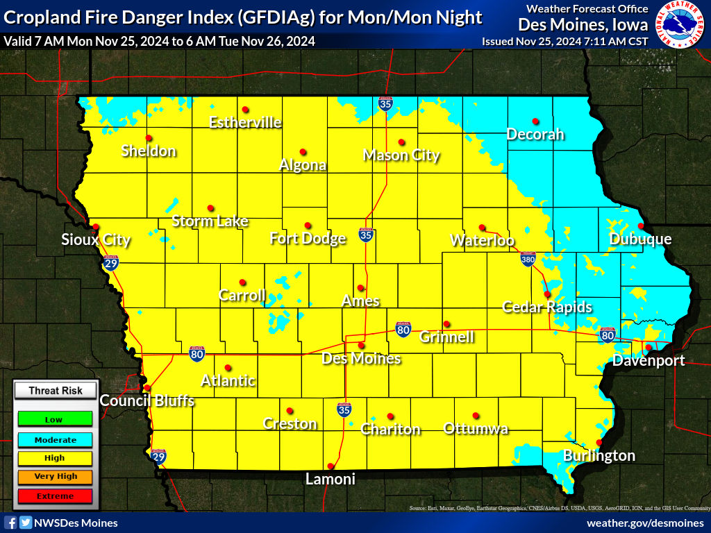
The National Weather Service in the Quad Cities is responsible for providing fire weather forecasts for eastern Iowa, northwest Illinois and northeast Missouri. The fire weather service program provides spot forecast services for the prevention, suppression, and management of forest and rangeland fires.
NWS Fire Weather Forecasts
National Fire Wx Forecast Information
Observations
Additional Fire Weather Information
Requesting a Spot Forecast (FOR OFFICIAL USE BY GOVERNMENT AGENCIES ONLY!) Note: When submitting a SPOT forecast, please request on the day of the burn (not the day prior) and include a proximity weather observation. |
|||||||||||||||||||||||||||||||||||||||||||||||||||||||||||||||||||||||||||||||||||||||||||||||||||||||||||||||||||||||||||||||||||||||||||||||||||||||||||||||||||||||||||||||||||||||||||||||||||||||||||||||||||||||||||