Indianapolis, IN
Weather Forecast Office
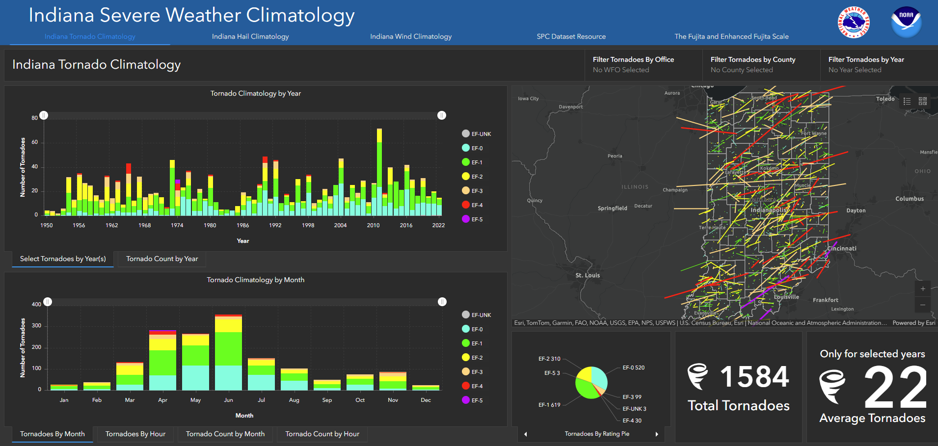
The Indiana Severe Weather Climatology has been developed for users to query the year, month, hour, and strength of severe weather events that have occurred in Indiana. The database of events uses the Storm Prediction Center Severe GIS database which starts at 1950 for Tornadoes and 1955 for Hail/Wind reports. You can also filter the events by County or the forecast warning area from the National Weather Service Offices that are responsible for parts of Indiana. The data is hosted on ESRI Servers via the ArcGIS Online interface.
Any questions or issues that you encounter please contact us and let us know!
Click on the Image Below to take you to the webpage.
Hazards
Spotter Information
Outdoor Event Watcher
Hazardous Weather Outlook
Drought Information
NOAA All Hazards Radio
Graphical Hazards Outlook
Local forecasts
Local Area
Aviation
Computer Model Forecasts
Fire Weather
Graphical
Precipitation
Air Quality
Text River Forecasts
Area Forecast Discussion
Central Indiana Weather Brief
US Dept of Commerce
National Oceanic and Atmospheric Administration
National Weather Service
Indianapolis, IN
6900 West Hanna Avenue
Indianapolis, IN 46241-9526
317-856-0664
Comments? Questions? Please Contact Us.

