Overview
Thunderstorms brought a tornado as well as isolated damaging winds to central Indiana on July 29.Tornadoes
|
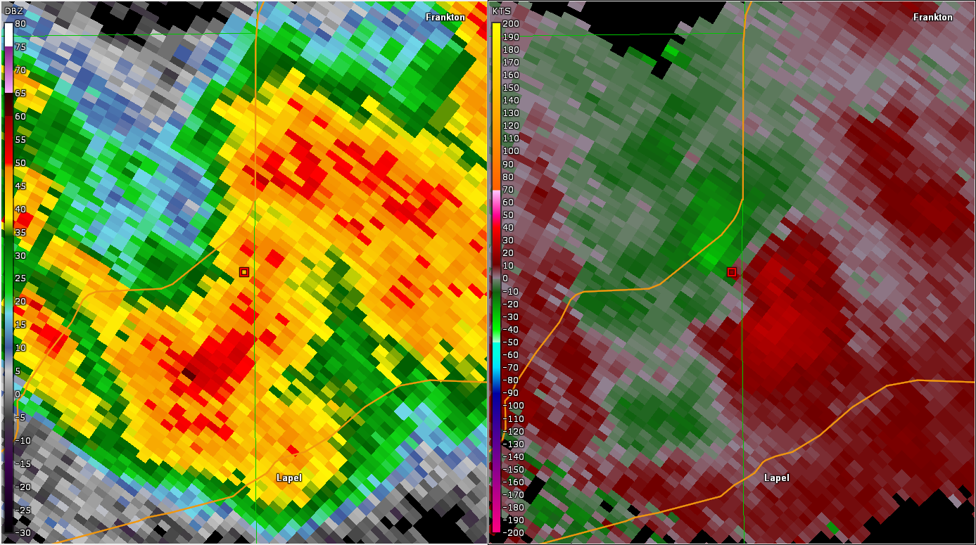
Tornado - Near Lapel
Track Map  
|
||||||||||||||||
|
||||||||||||||||
The Enhanced Fujita (EF) Scale classifies tornadoes into the following categories:
| EF0 Weak 65-85 mph |
EF1 Moderate 86-110 mph |
EF2 Significant 111-135 mph |
EF3 Severe 136-165 mph |
EF4 Extreme 166-200 mph |
EF5 Catastrophic 200+ mph |
 |
|||||
Radar
Radar Loop
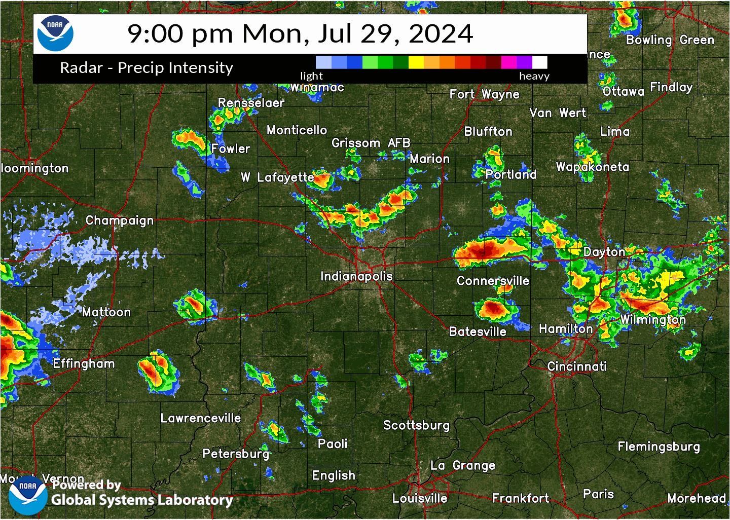 |
| Radar Loop. Click for a Larger Version. |
Storm Reports
Preliminary Local Storm Report...Summary
National Weather Service Indianapolis IN

0826 PM     Tstm Wnd Dmg     New Castle              39.92N 85.36W
07/29/2024                   Henry              IN   911 Call Center

            Several reports of downed trees in the New
            Castle area.

0836 PM     Funnel Cloud     1 E New Castle          39.92N 85.34W
07/29/2024                   Henry              IN   Trained Spotter

            Possible brief tornado touchdown just east
            of New Castle viewed by trained spotter
            approximately 2 miles SW of location.

0941 PM     Tornado          5 NNW Lapel             40.14N 85.87W
07/29/2024                   Hamilton           IN   NWS Storm Survey

            NWS Survey determined an EF2 tornado with
            peak winds of 130 mph and a path length of
            3.04 miles began at this location.


1033 PM     Tstm Wnd Dmg     2 SE Daleville          40.10N 85.52W
07/29/2024                   Delaware           IN   Public

            Limbs down and scattered over 100ft. A 4.5
            ton AC unit lifted off of base and found
            lying on its side, AC unit components found
            35 feet away.


1033 PM     Tstm Wnd Dmg     Daleville               40.12N 85.56W
07/29/2024                   Delaware           IN   Public

            mPing report of minor wind damage.

1048 PM     Tstm Wnd Dmg     Spencer                 39.29N 86.77W
07/29/2024                   Owen               IN   911 Call Center

            Several trees down.

1055 PM     Tstm Wnd Dmg     1 NNE Heltonville       38.94N 86.36W
07/29/2024                   Lawrence           IN   911 Call Center

            Several trees downed on Pleasant Run.

1145 PM     Tstm Wnd Dmg     4 NW Solsberry          39.13N 86.81W
07/29/2024                   Greene             IN   Public

            Tree downed near CR 735R and CR 715N.

1236 AM     Tstm Wnd Dmg     2 SW Oolitic            38.87N 86.55W
07/30/2024                   Lawrence           IN   911 Call Center

            Trees downed near the intersection of CR 158
            and CR 458.

1240 AM     Tstm Wnd Dmg     2 S Bedford             38.83N 86.49W
07/30/2024                   Lawrence           IN   911 Call Center

            Several trees downed south of Bedford. Time
            estimated from radar.
Environment
CAPE, low level shear, and low LCLs aided in the tornado formation. The CAPE and overall shear combined to produce the strong to severe storms.
 |
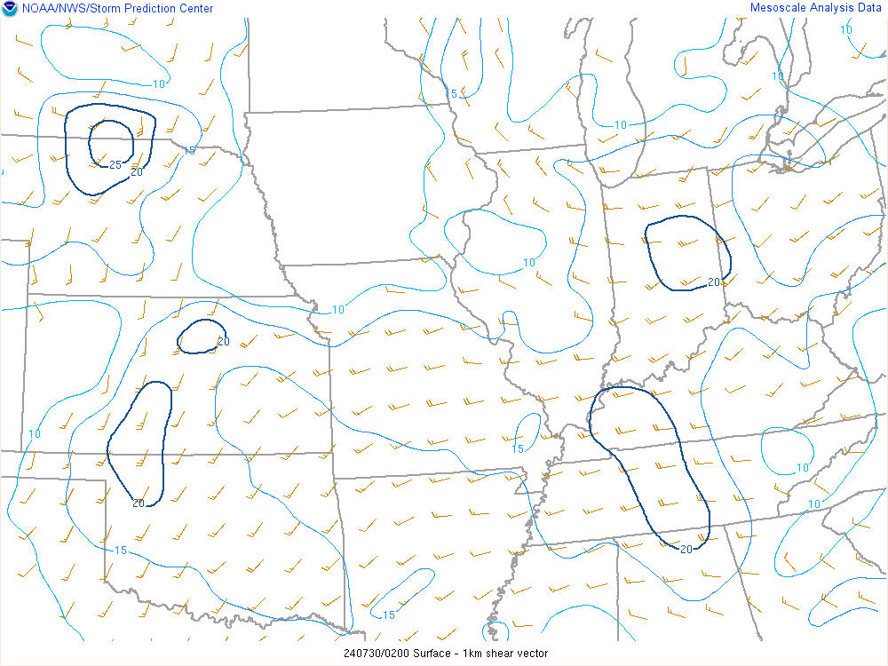 |
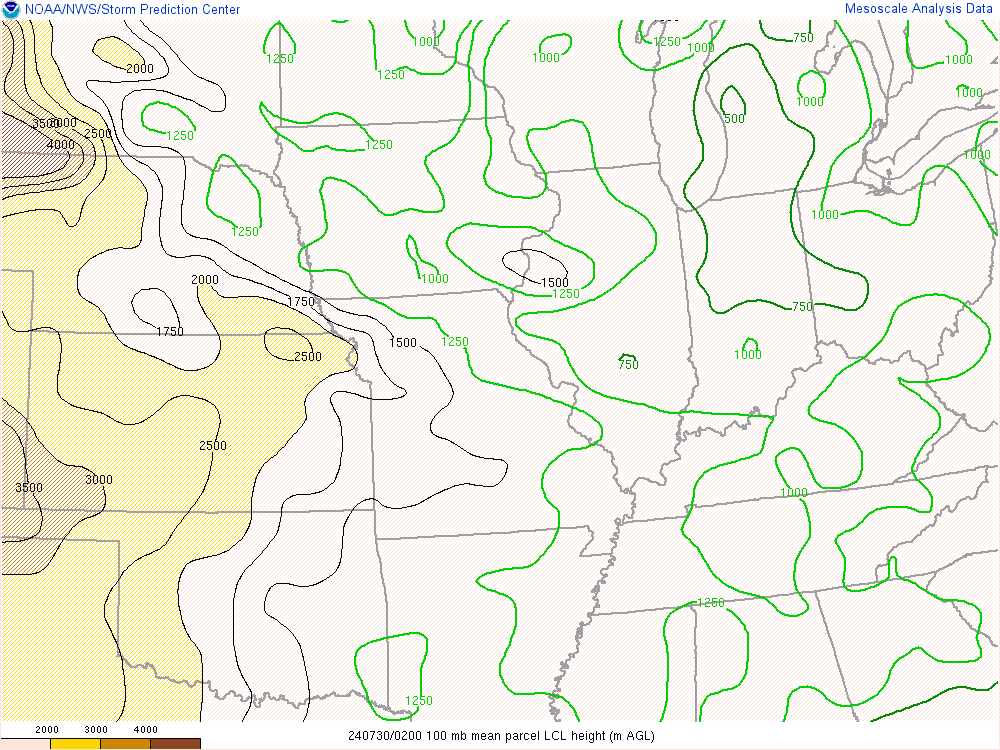 |
| Figure 1: Mixed Layer CAPE at 10 PM EDT | Figure 2: 0-1km Bulk Shear at 10 PM EDT | Figure 3: LCL Heights at 10 PM EDT |
A surface warm front was near the location of the tornado.
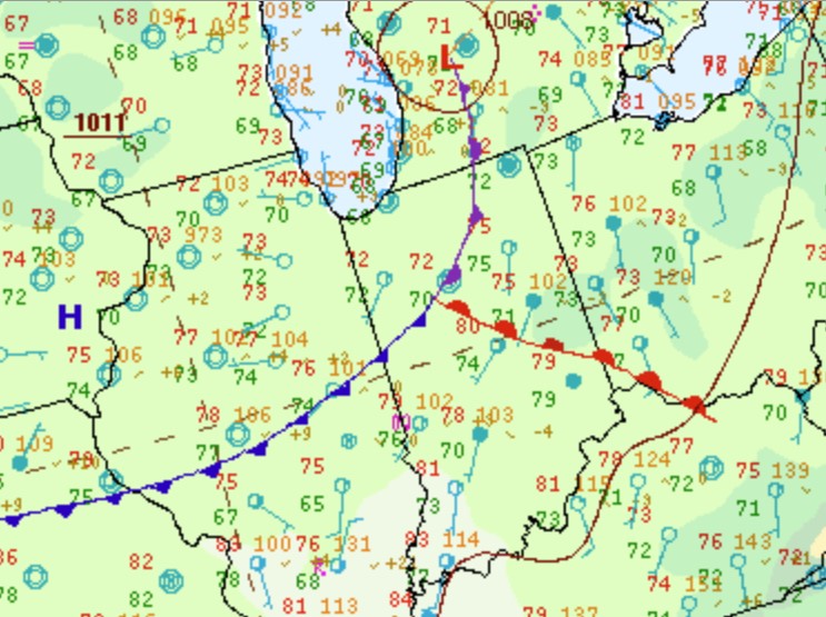 |
| Figure 4: Zoomed in Surface Map at 10 PM EDT |
 |
Media use of NWS Web News Stories is encouraged! Please acknowledge the NWS as the source of any news information accessed from this site. |
|