Indianapolis, IN
Weather Forecast Office
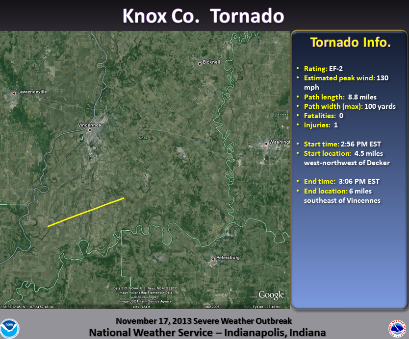
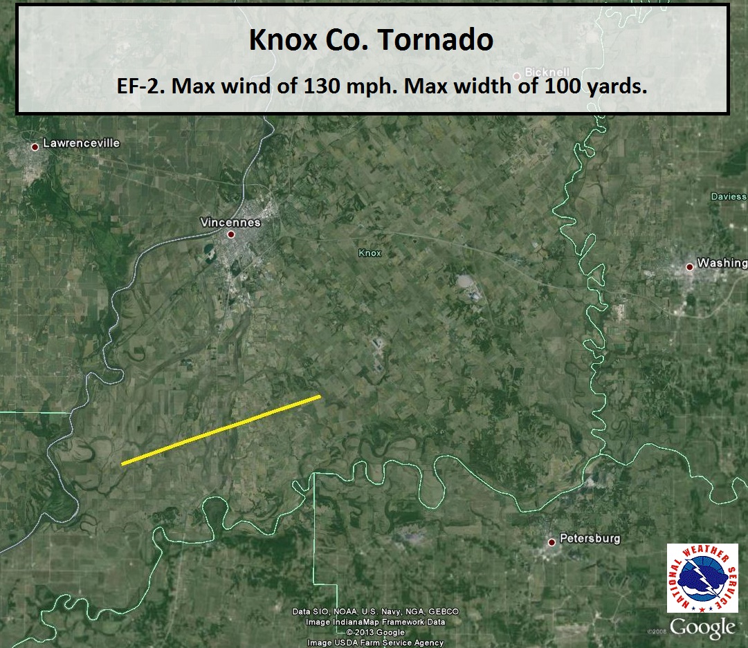
Damage Path (Click to enlarge):
Tornado Information:
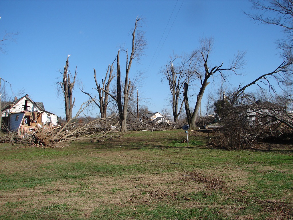
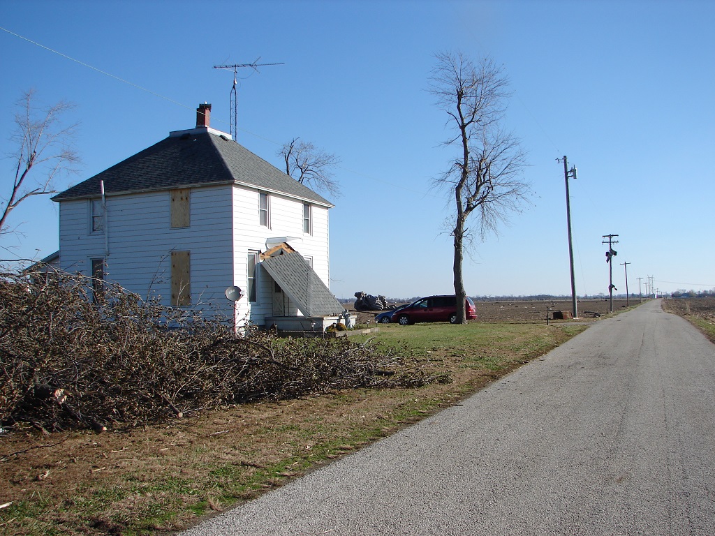
RATING: EF-2 ESTIMATED PEAK WIND: 130 MPH PATH LENGTH /STATUTE/: 8.8 MILES PATH WIDTH /MAXIMUM/: 100 YARDS FATALITIES: 0 INJURIES: 1 START DATE: NOVEMBER 17 2013 START TIME: 256 PM EST START LOCATION: 4.5 MILES WEST-NORTHWEST OF DECKER START LAT/LON: 38.5374/-87.6121 END DATE: NOVEMBER 17 2013 END TIME: 306 PM EST END LOCATION: 6 MILES SOUTHEAST OF VINCENNES END LAT/LON: 38.5798/-87.4583 THE MOST EXTENSIVE DAMAGE WAS FOUND NORTH OF DECKER ALONG OLD DECKER ROAD JUST TO THE EAST OF US ROUTE 41. THE SECOND STORY OF A HOME WAS REMOVED WITH THE EXTERIOR WALLS COLLAPSED. THIS TORNADO CONTINUED UNTIL JUST WEST OF MONROE CITY. |
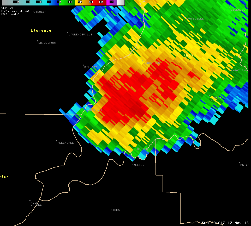
Radar Imagery:(Click to enlarge)
 |
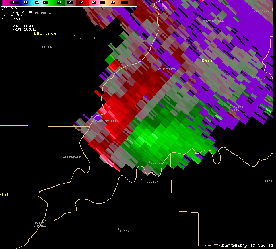 |
| Radar image at 3:01 PM EST centered on Knox County. | Storm Relative Motion image from 3:01 PM EST for the same area. Radar is off to the north east of this location. Green indicates winds toward the radar while reds indicate winds away from the radar. At this distance, the radar is seeing mainly the mid levels of the storm. |
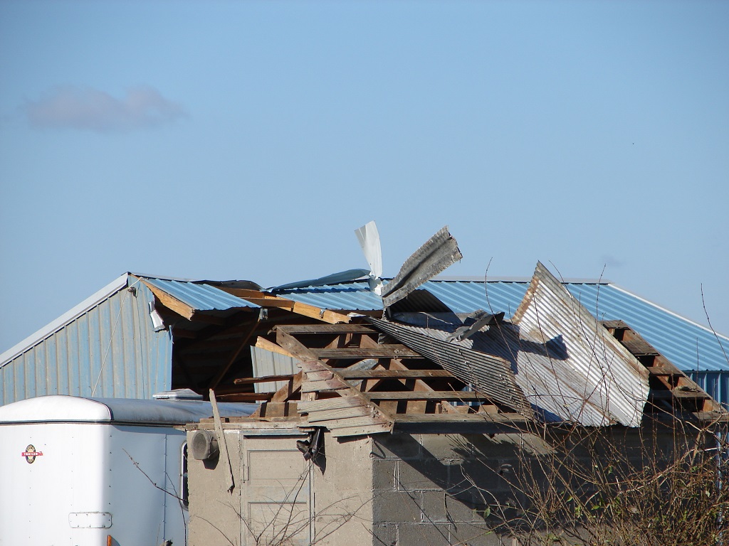
Damage Pictures: (click to enlarge)
 |
 |
|
|
|
||
Hazards
NOAA All Hazards Radio
Graphical Hazards Outlook
Spotter Information
Outdoor Event Watcher
Hazardous Weather Outlook
Drought Information
Local forecasts
Local Area
Aviation
Computer Model Forecasts
Fire Weather
Graphical
Precipitation
Air Quality
Text River Forecasts
Area Forecast Discussion
Central Indiana Weather Brief
US Dept of Commerce
National Oceanic and Atmospheric Administration
National Weather Service
Indianapolis, IN
6900 West Hanna Avenue
Indianapolis, IN 46241-9526
317-856-0664
Comments? Questions? Please Contact Us.

