Indianapolis, IN
Weather Forecast Office
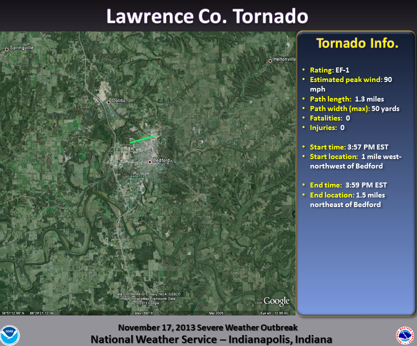
Damage Path (Click to enlarge):
Tornado Information:
RATING: EF-1 ESTIMATED PEAK WIND: 90 MPH PATH LENGTH /STATUTE/: 1.3 MILES PATH WIDTH /MAXIMUM/: 50 YARDS FATALITIES: 0 INJURIES: 0 START DATE: NOVEMBER 17 2013 START TIME: 357 PM EST START LOCATION: 1 MILE WEST-NORTHWEST OF BEDFORD START LAT/LON: 38.8741/-86.5057 END DATE: NOVEMBER 17 2013 END TIME: 359 PM EST END LOCATION: 1.5 MILES NORTHEAST OF BEDFORD END LAT/LON: 38.8785/-86.4827 A TORNADO TRACKED ACROSS THE NORTH SIDE OF BEDFORD. MOST OF THE FUNNEL WAS ALOFT...BUT INTERMITTENTLY TOUCHED DOWN SEVERAL TIMES WHICH SPLIT AND UPROOTED TREES...KNOCKED DOWN POWER LINES...AND CAUSED SOME ROOF AND STRUCTURAL DAMAGE TO SEVERAL HOMES. THE WORST OF THE DAMAGE WAS ALONG M...N AND O STREETS ON THE NORTH SIDE OF BEDFORD. SEVERAL WITNESSES OBSERVED ONE OR TWO SMALL NARROW FUNNELS DROPPING UP AND DOWN FROM A WIDE WALL CLOUD. MANY WITNESSES DESCRIBED A STRONG PRESSURE CHANGE...A GREEN SKY AND A ROAR AS THE TORNADO WENT THROUGH. WE WANT TO THANK NWS LOUISVILLE FOR CONDUCTING THIS SURVEY. |
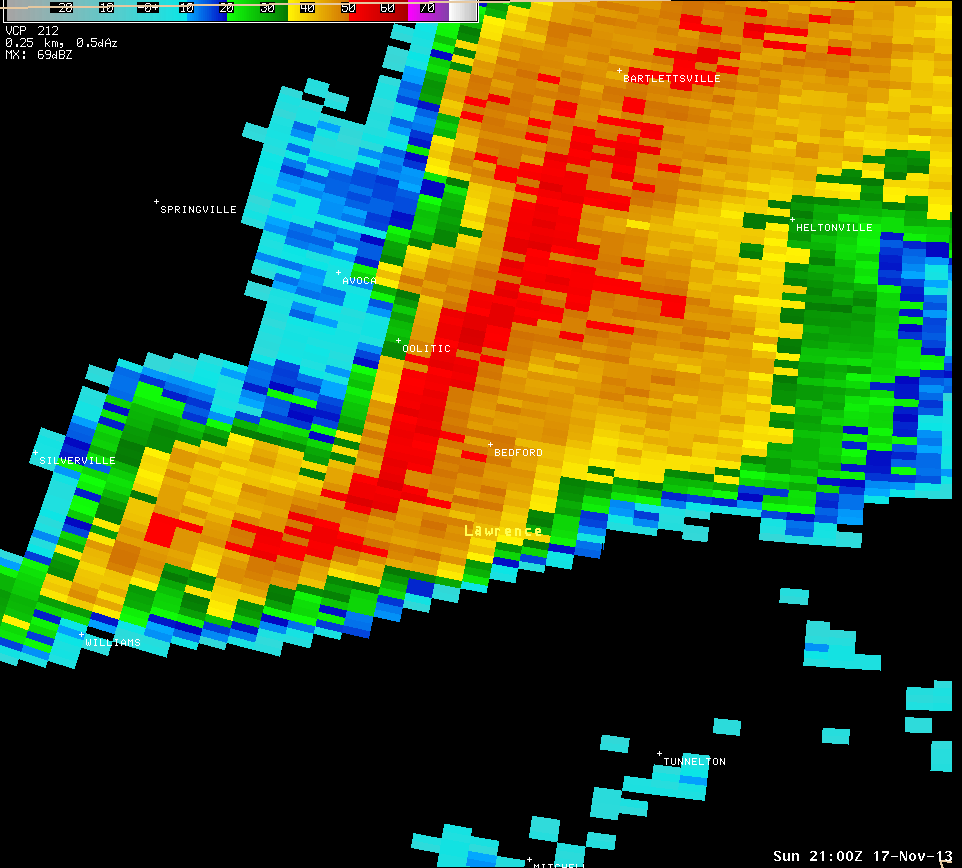
Radar Imagery: (Click to enlarge)
 |
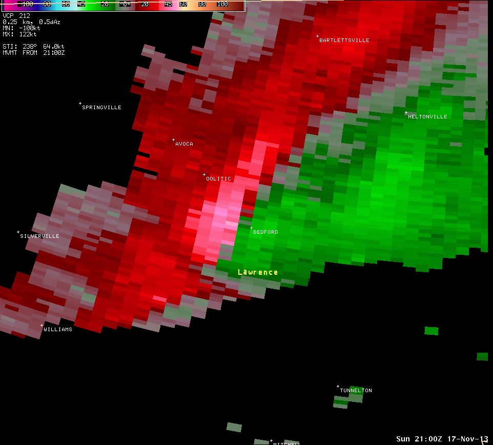 |
| Radar image from 4:00 PM centered in Lawrence County. | Storm Relative Motion image from 4:00 PM for the same area. Radar is off to the north of this location. Green indicates winds toward the radar while reds indicate winds away from the radar. |
Hazards
Graphical Hazards Outlook
Spotter Information
Outdoor Event Watcher
Hazardous Weather Outlook
Drought Information
NOAA All Hazards Radio
Local forecasts
Local Area
Aviation
Computer Model Forecasts
Fire Weather
Graphical
Precipitation
Air Quality
Text River Forecasts
Area Forecast Discussion
Central Indiana Weather Brief
US Dept of Commerce
National Oceanic and Atmospheric Administration
National Weather Service
Indianapolis, IN
6900 West Hanna Avenue
Indianapolis, IN 46241-9526
317-856-0664
Comments? Questions? Please Contact Us.

