National Weather Service United States Department of Commerce

Fast moving storms will move from Illinois into western portions of central Indiana. Additional TS will continue across northern portions. Some of these storms will be capable of hail to 2 inches in diameter and frequent cloud to ground lightning.
A line of storms is expected to form north of I-70 this evening and move to the southeast into the early overnight. Large hail and damaging winds are the main threats with the potential for hail as large as 2 inches in the strongest storms of the day.
Sunday afternoon just after 330 PM, the all-time record high temperature for March at Indianapolis was broken with a high temperature of 88. The previous record high temperature for March was 85 on March 31, 1981. High temperatures tomorrow will be about 35 degrees cooler.
2026 has had an active start for the Indianapolis Area, with nine daily records set through the year’s first 10 weeks. 9.1 inches of snowfall on 1/25 shattered the old 1978 record, while 2/18’s records highs for both max and min temperatures exceeded old marks by at least 5 degrees; 3/10’s minimum temperature surpassed 1876’s old record high by 7 degrees. Sunday’s record high is 82, 83 is currently forecast for Indy.
Forecast information for the next 12 hour forecast. Graphic displays temperatures, precipitation chances, wind direction, and wind speeds for the 0-12 hour period of the forecast.
Forecast information for the 12-24 hour forecast. Graphic displays temperatures, precipitation chances, wind direction, and wind speeds for the 12-24 hour period of the forecast.
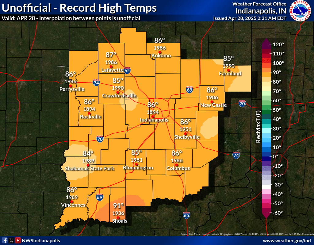
These images contain the daily records and averages across central Indiana. The data is an estimation and interpolation between the various points that have a long enough record across Central Indiana. Additional daily climate information available here including a full listing of all the points used to generate the maps: https://www.weather.gov/ind/Climate_Maps