
Tropical Storm Isaias is forecast to track toward the central Gulf Coast while strengthening into a hurricane on Thursday. There is an increasing risk of damaging hurricane-force winds and life-threatening storm surge impacts along portions of the northern Gulf Coast Friday into Saturday. Isaias will bring heavy rainfall to the central Gulf Coast and much of the Southeast Friday into the weekend. Read More >
Overview
|
An outbreak of wildfires severely impacted northwestern North Dakota on Saturday, October 5, 2024. A powerful cold front moved across the state early in the day, producing northwesterly winds gusting as high as 78 mph. The combination of very high winds with a very dry air mass and dry fuels contributed to the rapid spread of wildfires across Williams and McKenzie counties.
|
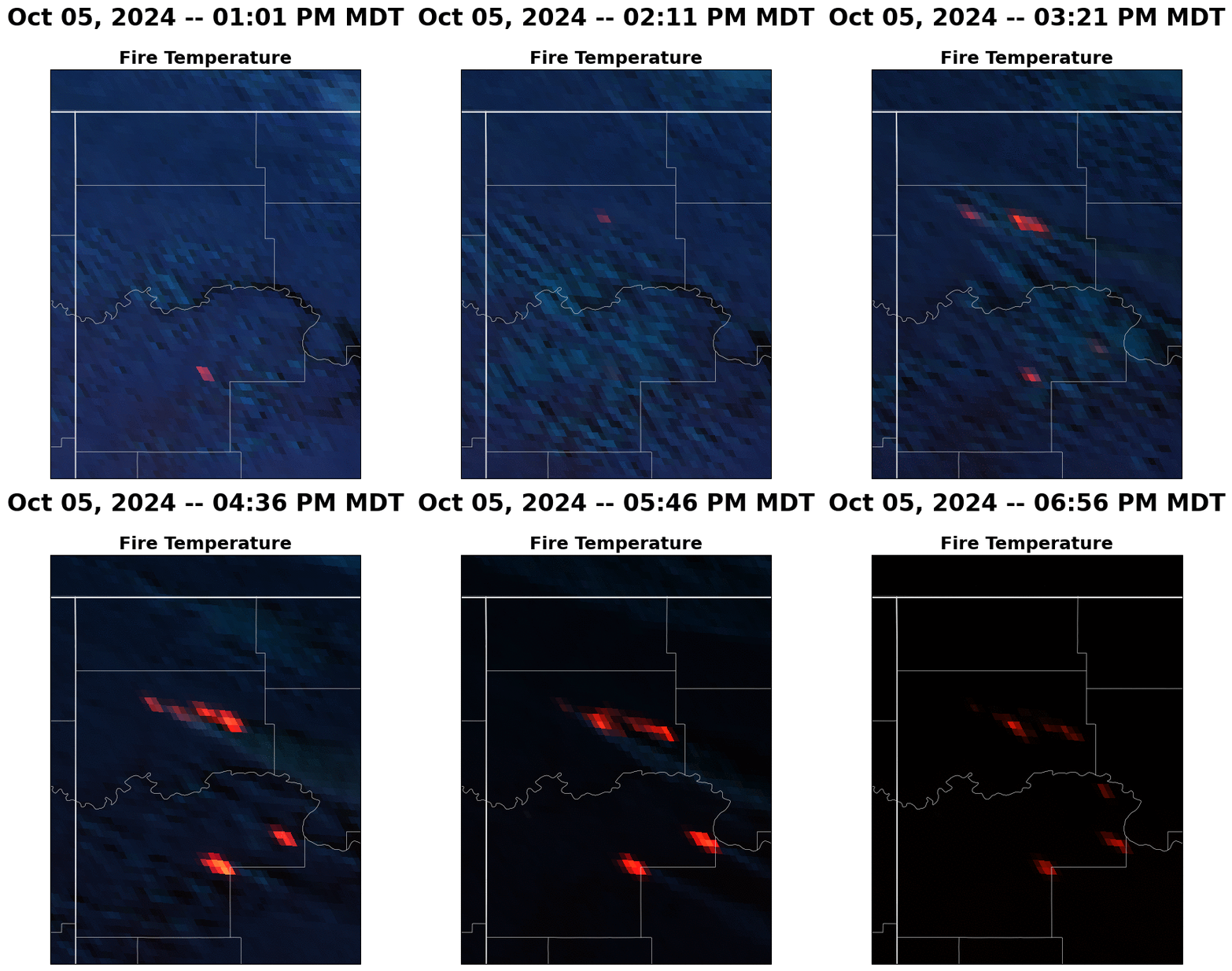 Satellite loop of large wildfires in northwest North Dakota on the afternoon and early evening of October 5, 2024. (Courtesy of Chauncy Schultz) |
 |
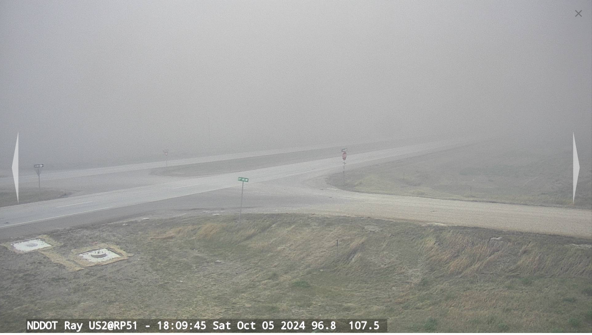 |
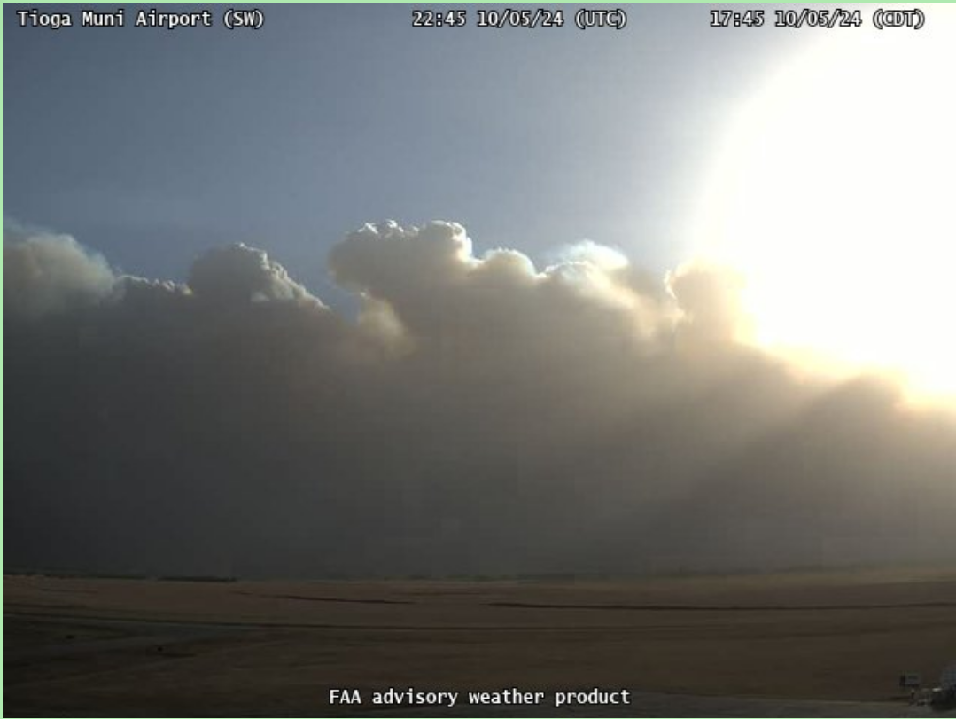
| Webcam image taken from the Tioga Airport at 5:45 PM CDT. (Courtesy of the Federal Aviation Administration) | Webcam image taken from near Ray at 6:10 PM CDT. (Courtesy of the North Dakota Department of Transportation) |
Fires
 |
 |
 |
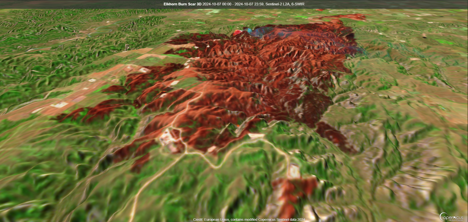
| 3D Satellite Depiction of the Elkhorn Fire Burn Scar. (Courtesy of the European Union Copernicus Sentinel Satellite Viewer) |
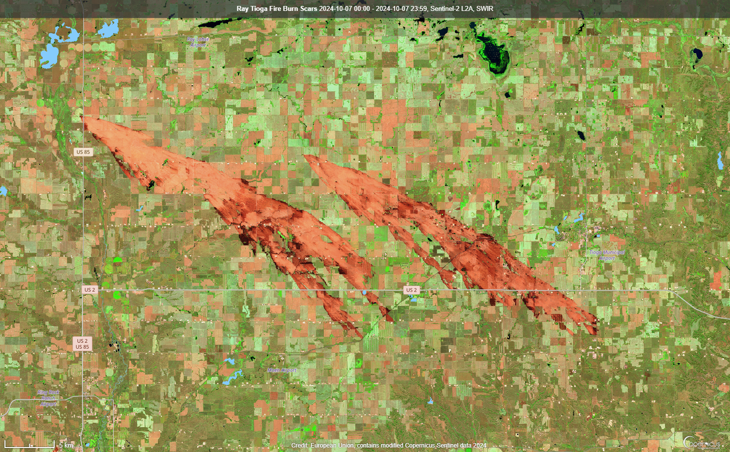
Satellite Image of the Ray/Tioga Fire Burn Scar. (Courtesy of the European Union Copernicus Sentinel Satellite Viewer) |
Satellite Image of the Bear Den and Elkhorn Fire Burn Scars. (Courtesy of the European Union Copernicus Sentinel Satellite Viewer) |
Photos
 |
 |
 |
 |
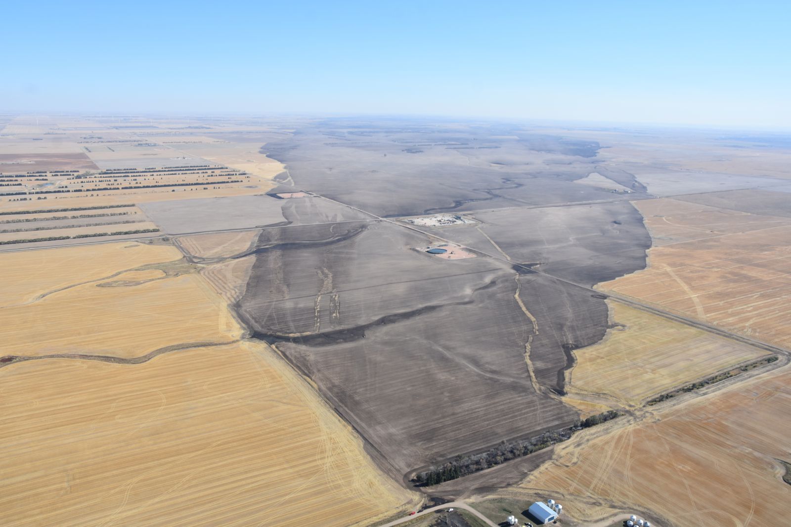
| Ray/Tioga Fire Burn Scar from Above. (Courtesy of the ND Civil Air Patrol) |
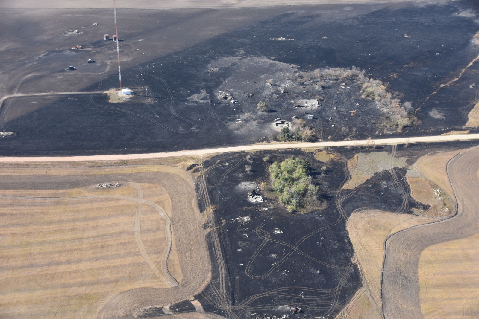
Ray/Tioga Fire Damage. (Courtesy of the ND Civil Air Patrol) |
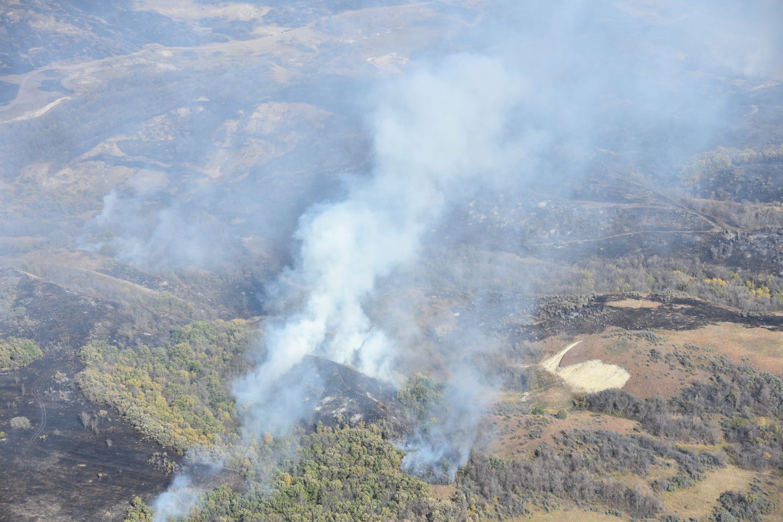
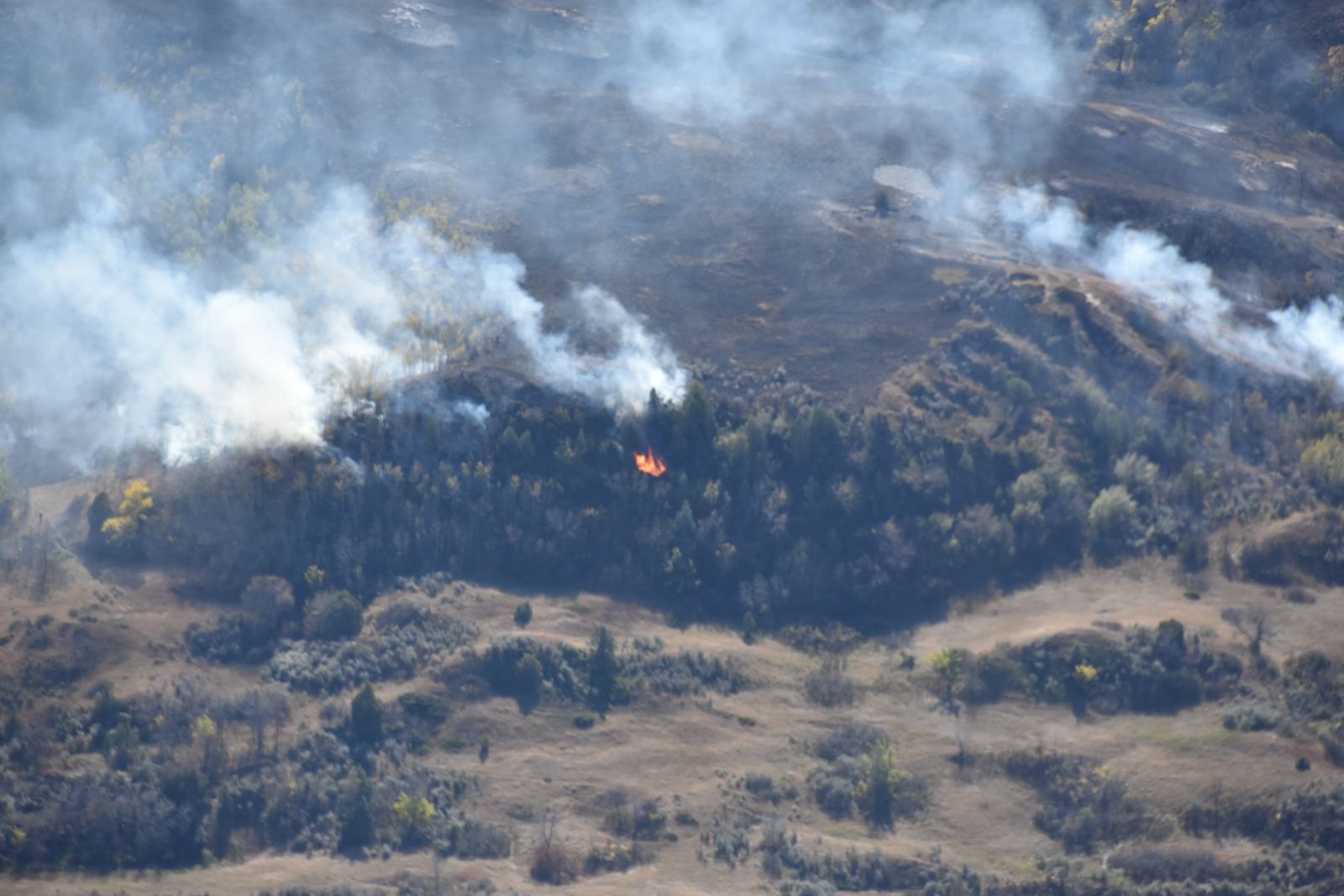
Bear Den Fire. (Courtesy of the ND Civil Air Patrol) |
Elkhorn Fire. (Courtesy of the ND Civil Air Patrol) |
Radar and Satellite
 |
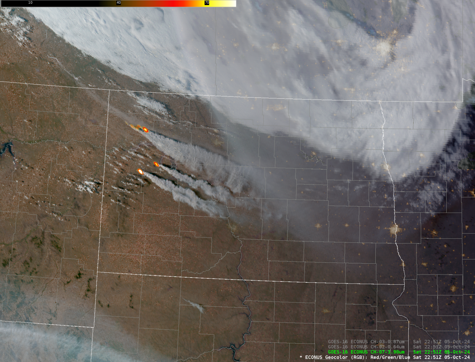 |
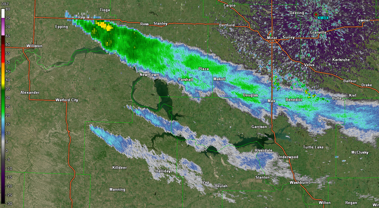
| Radar Imagery of smoke plumes from Minot radar, KMBX on 10/5/2024. | Satellite Imagery of Fire Hotspots and Smoke Plumes on 10/5/2024. |
Wind Reports
HIGHEST WIND REPORTS ON 10/5/2024

Location                     Speed     Time/Date
Minot Air Force Base         78 MPH    1254 PM 10/05
Williston Airport            78 MPH    0230 PM 10/05
Beach                        76 MPH    0215 AM 10/05
Tioga                        75 MPH    0335 PM 10/05
Garrison                     75 MPH    0428 PM 10/05
Minot Airport                74 MPH    0349 PM 10/05
5 NW Alkabo                  72 MPH    1256 PM 10/05
Blaisdell                    71 MPH    1240 PM 10/05
2 WSW Arnegard               70 MPH    0210 AM 10/05
3 W Palermo                  68 MPH    0240 PM 10/05
1 S Max                      68 MPH    0256 PM 10/05
4 N Fortuna                  66 MPH    0120 PM 10/05
3 W Hartland                 66 MPH    0332 PM 10/05
Stanley                      66 MPH    0335 PM 10/05
10 S Antler                  66 MPH    0443 PM 10/05
8 N Grenora                  65 MPH    1243 PM 10/05
7 S Sawyer                   64 MPH    1200 PM 10/05
5 W Coulee                   64 MPH    1202 PM 10/05
8 S Alkabo (NDAWN)           64 MPH    0155 PM 10/05
Carrington ND AWOS           64 MPH    0435 PM 10/05
Bismarck Airport             64 MPH    0442 PM 10/05
Minot                        63 MPH    1154 AM 10/05
Crosby                       63 MPH    0155 PM 10/05
7 N Emmet                    63 MPH    0326 PM 10/05
4 W Parshall                 63 MPH    0344 PM 10/05
New Town                     62 MPH    1240 PM 10/05
3 N Ray (NDAWN)              62 MPH    0340 PM 10/05
Lostwood                     61 MPH    1257 PM 10/05
4 SW Tolley                  61 MPH    0149 PM 10/05
Keene                        61 MPH    0225 PM 10/05
1 WSW Bowbells               61 MPH    0410 PM 10/05
Harvey ND AWOS               61 MPH    0555 PM 10/05
4 SW Belcourt                61 MPH    0622 PM 10/05
2 W South Fairfield          60 MPH    0227 AM 10/05
11 N Sentinel Butte          60 MPH    0301 AM 10/05
Fortuna                      60 MPH    1130 AM 10/05
3 SE Moffit                  60 MPH    1147 AM 10/05
J. Clark Salyer              60 MPH    0146 PM 10/05
2 S Alamo (NDAWN)            60 MPH    0155 PM 10/05
3 SSE Bismarck               60 MPH    0246 PM 10/05
Hazen                        60 MPH    0255 PM 10/05
Rolla ND AWOS                60 MPH    0315 PM 10/05
Raub                         60 MPH    0345 PM 10/05
Dickinson Airport            60 MPH    0358 PM 10/05
Mandan                       60 MPH    0415 PM 10/05
3 W Mohall                   60 MPH    0428 PM 10/05
Long Lake NWR                60 MPH    0447 PM 10/05
9 S Alkabo                   59 MPH    1140 AM 10/05
10 SW Ross (NDAWN)           59 MPH    0145 PM 10/05
Hettinger Airport            59 MPH    0348 PM 10/05
Stanton                      59 MPH    0350 PM 10/05
6 SSW Fryburg                58 MPH    0320 AM 10/05
11 SE Wheelock               58 MPH    0321 AM 10/05
9 NW Williston               58 MPH    1151 AM 10/05
6 NNW Charbonneau (NDAWN)    57 MPH    0245 AM 10/05
10 NNW Plaza                 57 MPH    1035 AM 10/05
3 NNW Robinson               57 MPH    1145 AM 10/05
4 N Ray                      56 MPH    0943 AM 10/05
Environment
During the early morning hours of Saturday, October 5, a strong cold front moved across the state, causing a sharp shift in wind direction from south to west-northwest and producing gusts around 60 to 75 mph. Gusts this strong were short-lived with the frontal passage in the morning, but became much more common and persistent during the afternoon due to a tight pressure gradient associated with strong low low pressure over Manitoba.
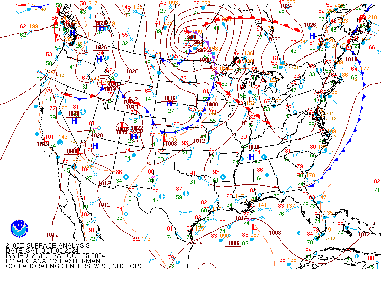 |
| Surface analysis at 4 PM CDT Saturday, October 5. (Courtesy of the Weather Prediction Center) |
 |
Media use of NWS Web News Stories is encouraged! Please acknowledge the NWS as the source of any news information accessed from this site. |
|



 Follow us on X
 Follow us on Facebook
 Follow us on YouTube
 BIS RSS Feed