
Heavy to excessive rainfall will continue today from the Texas Big Bend region into southern Oklahoma. Locally considerable flash and urban flooding is possible, and river flooding will continue in central Oklahoma. Scattered severe thunderstorms are possible in parts of the Mid-Atlantic Friday. A Typhoon Watch has been issued for Guam and CNMI. Read More >
Int. Tsunami Information Center Caribbean Office
National Program
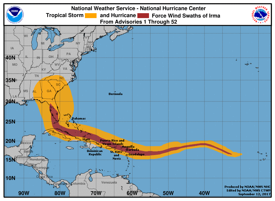
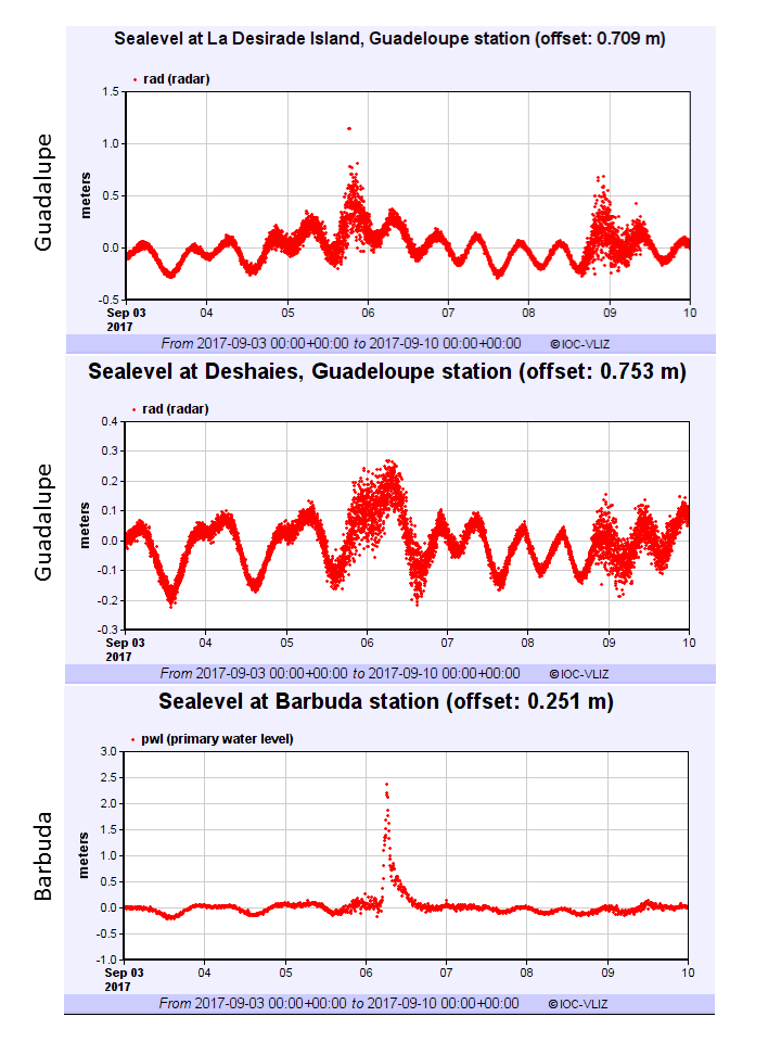
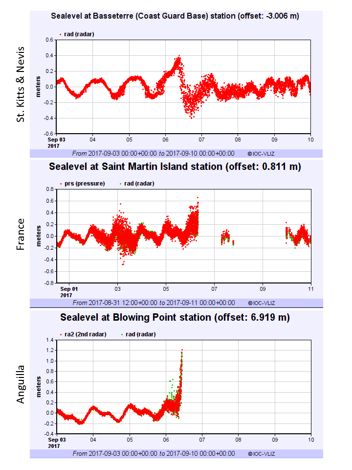
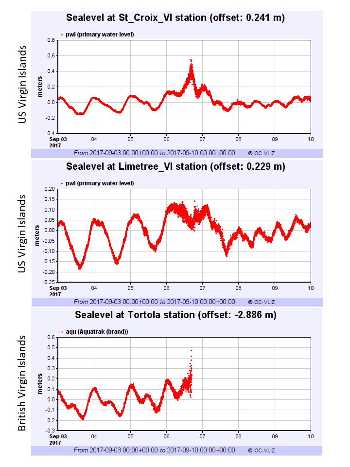
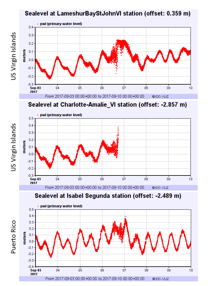
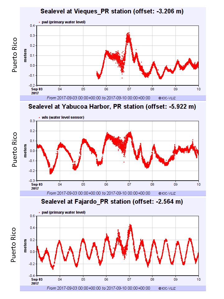
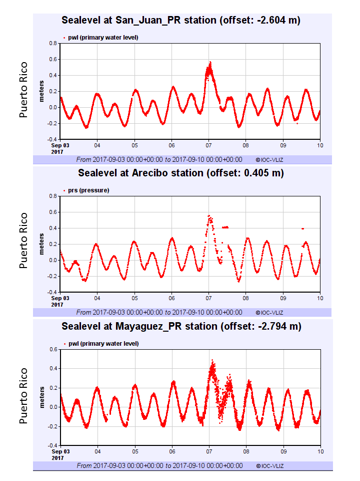
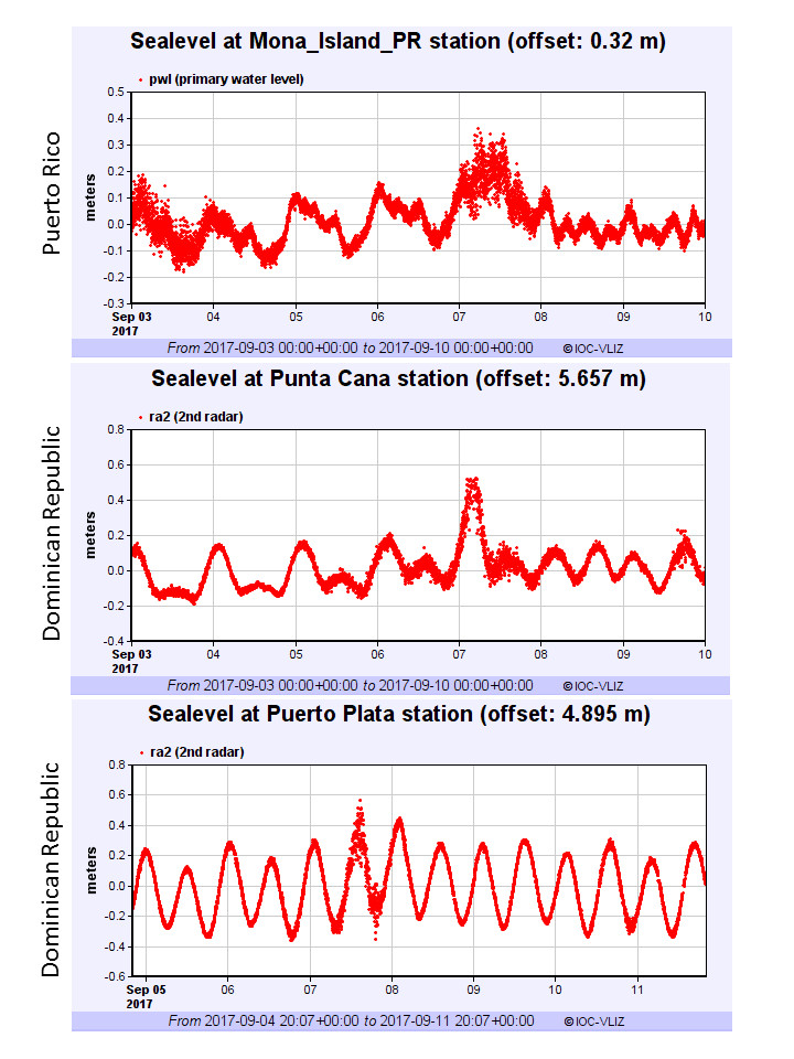
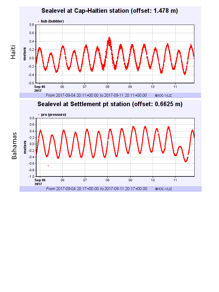
UNESCO IOC CARIBE EWS SEA LEVEL STATIONS NETWORK RECORDED THE EFFECT OF HURRICANE IRMA ACROSS THE NORTHERN CARIBBEAN AND ADJACENT REGIONS (September 5-11, 2017)
Data accessed from UNESCO IOC Sea Level Station Monitoring Facility

US Dept of Commerce
National Oceanic and Atmospheric Administration
National Weather Service
Int. Tsunami Information Center Caribbean Office
c/o Puerto Rico Seismic Network, Building D
259 Boulevard Alfonso Valdés
Mayagüez, PR 00680
787-832-4040
Comments? Questions? Please Contact Us.


 ITIC-CAR RSS Feed