Jackson, Mississippi
Weather Forecast Office
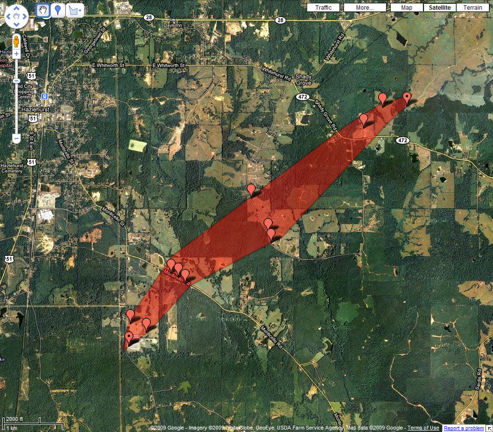
Severe Storms Produce Tornado Near Hazlehurst
|
|
Tornado started along James Road, where several chicken houses were significantly damaged, including one collapsing. Other outbuildings were damaged and a number of trees and power lines were downed. Debris was carried for hundreds of yards along the path. The tornado traveled northeast, and reached its maximum intensity and width as it crossed Monticello Road. Hundreds of trees in this area were snapped or uprooted, including a number of large hardwoods. Convergence in the damage path was very apparent here. A barn was leveled and at least two power poles were snapped. A couple of other outbuildings were heavily damaged. The tornado continued northeast from there, crossing Perrett Road and Highway 472. Numerous trees continued to be snapped and uprooted along its path, and several outbuildings were damaged or destroyed. The tornado dissipated shortly after crossing Highway 472.
US Dept of Commerce
National Oceanic and Atmospheric Administration
National Weather Service
Jackson, Mississippi
234 Weather Service Dr.
Flowood, MS 39232
601-936-2189
Comments? Questions? Please Contact Us.