Jackson, Mississippi
Weather Forecast Office

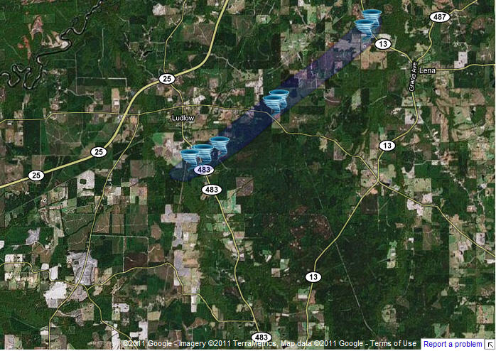
Scott/Leake Counties Tornado
|
Event Summary The tornado first touched down in a wooded area west of Highway 483 south of Ludlow downing numerous trees in a convergent pattern. As it crossed Highway 483, it destroyed a barn and downed numerous trees, at least two of which fell on homes damaging the roofs. The tornado continued northeast, downing trees and damaging a mobile home along Hillsboro-Ludlow Road. The tornado lifted as it crossed Highway 13 just nortwest of Lena, where a few trees were knocked down. |
|
 |
 |
 |
 |
US Dept of Commerce
National Oceanic and Atmospheric Administration
National Weather Service
Jackson, Mississippi
234 Weather Service Dr.
Flowood, MS 39232
601-936-2189
Comments? Questions? Please Contact Us.

