March 2, 2012 Lamar and Forrest County Tornado
|
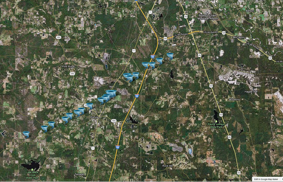
Event Summary This tornado initially touched down along Beach Road, where it overturned two trailers, took part of the roof off a home, destroyed a shed and caused some tree damage. From there the tornado weakened and seemed to skip along for several miles as it crossed Boggy Hollow Road and Coaltown Road. The tornado strengthened again as it crossed Purvis to Columbia Road. There the tornado caused damage to the roof and siding of a home and snapped several trees. The tornado them weakened again as it moved through the northwest sections of Purvis with only sporadic tree damage. The tornado strengthened again as it crossed Highway 11 and Sherlock Herrington Road. There numerous trees were snapped, the roof and siding of a home were damaged, a large storage shed was heavily damaged, and 3 mobile home sustained heavy damage. The tornado then reached its peak intensity as it crossed Harold Tucker Road. A strapped down mobile home was blown off its foundation and heavily damaged, two other mobile homes were damaged, and a single family home had part of the roof blown off. Numerous trees were snapped at this location as well. This location had both the maximum winds of 100 mph and the maximum width of 300 yards. The tornado then crossed White Chapel Road causing extensive tree damage. It then moved into Forrest County and crossed over Interstate 59 knocking over several trees at a rest stop. The tornado then crossed Browns Bridge Road and Frye Road snapping numerous trees, one of which fell on a house. The tornado lifted shortly after crossing Frye Road. |
|

