Jackson, Mississippi
Weather Forecast Office

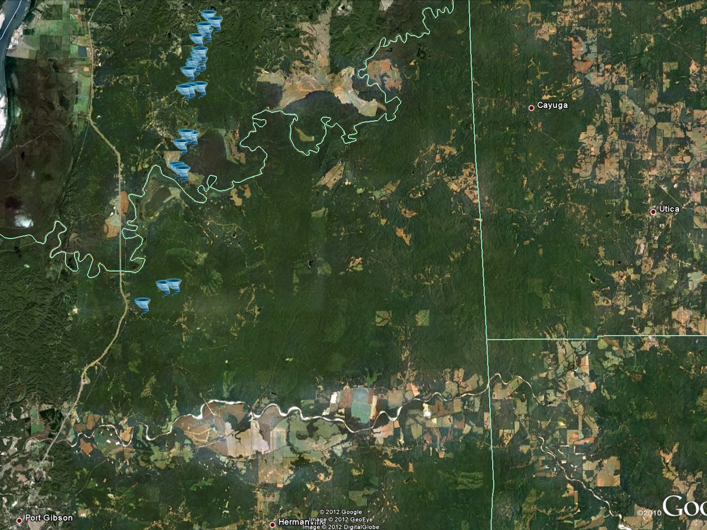
March 21, 2012 Claiborne-Warren County Tornado
Click on Map Below to Zoom In/Out and View Damage Notation
|
Event Summary This tornado first touched down in northern Claiborne County downing trees along Floyd Road. It then crossed the Big Black River into southern Warren County. It impacted a hunting camp, destroying 2 mobile homes, snapping 4 power poles and snapping numerous trees. It then moved across Gullett Road where it destroyed 3 large outbuildings, heavily damaged the roof of a brick home, and snapped numerous trees. The tornado next crossed Campbell Swamp Road where it reached its maximum width and snapped hundreds of trees. The tornado then moved nearly parallel to Price Hill Road again snapping and uprooting many trees. One of the trees fell on a house causing significant damage. The tornado continued downing more trees, but then lifted as it crossed Jeff Davis Road. |
|
US Dept of Commerce
National Oceanic and Atmospheric Administration
National Weather Service
Jackson, Mississippi
234 Weather Service Dr.
Flowood, MS 39232
601-936-2189
Comments? Questions? Please Contact Us.

