Jackson, Mississippi
Weather Forecast Office

Event Summary
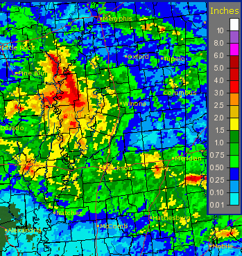
During the late afternoon and evening hours of June 11, a sprawling linear complex of storms moved southward across the Jackson, MS forecast area. Widespread tree and power line damage occurred and 60-70 mph winds impacted the area. At the height of the storm, roughly 45,000 Entergy customers were without power. There were also pockets of more significant winds and damage. Locations in Sunflower County, around Ruleville and Indianola, were especially hard hit. Winds were likely around 80 mph and caused significant roof damage to the North Sunflower Medical Center in Ruleville and a couple of other buildings in Indianola. Additionally, an 81 mph gust was measured in Isola, which is in northern Humphreys County. Wind was not the only severe weather hazard during this event. Lightning was extreme and some homes were struck causing damage. One home, in Brandon, MS, was significantly burned after a lightning strike caused a fire. Heavy rain and flash flooding also occurred with a few locations receiving 3 to 6 inches. The worst flooding occurred in Cleveland and in Jackson.
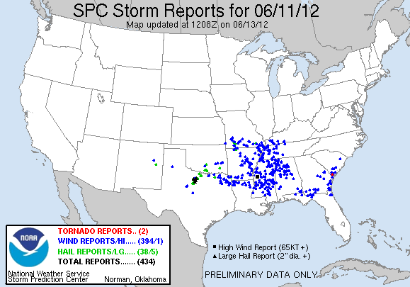
Storm Prediction Center Summary of Reports
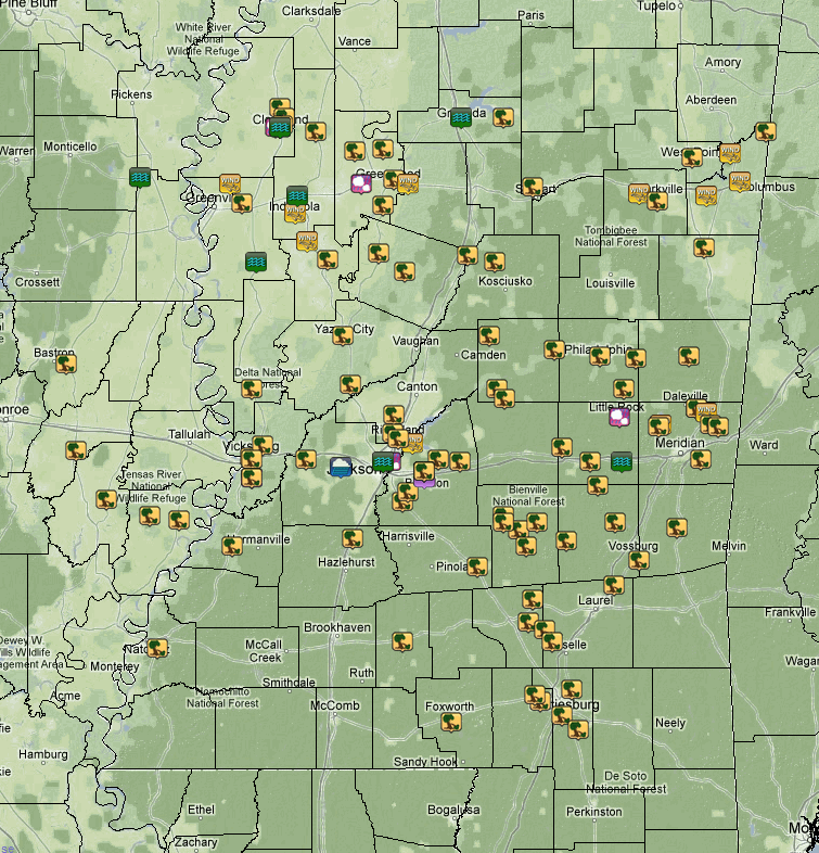
View of Severe Reports Across the ArkLaMiss Area

Rainfall Amounts
US Dept of Commerce
National Oceanic and Atmospheric Administration
National Weather Service
Jackson, Mississippi
234 Weather Service Dr.
Flowood, MS 39232
601-936-2189
Comments? Questions? Please Contact Us.

