August 19, 2012 Ross Barnett Reservoir Waterspout
On the evening of August 19th, a very rare waterspout developed over the Ross Barnett Reservoir. According to pictures and eyewitness accounts, the waterspout occurred over the upper end of the reservoir just to the west of the Goshen Springs community and southwest of the MS Highway 43 Pearl River crossing. The waterspout was associated with a developing rain shower, and initially there was little or no precipitation occurring in the area when it developed around 6:45pm. The waterspout remained nearly stationary for about 10 to 15 minutes before dissipating.
There are two types of waterspouts - tornadic waterspouts and fair weather waterspouts. The waterspout which occurred on August 19th was of the "fair weather" variety of waterspouts. These types of waterspouts typically occur in light wind conditions, and due to this they frequently move very slowly if at all. They are also typically associated with developing cumulus clouds which may not even be producing precipitation yet. These waterspouts are usually not associated with severe thunderstorms. However, they can move ashore and be strong enough to produce damage.
On the other hand, tornadic waterspouts are associated with a severe thunderstorm and have all of the same characteristics as a tornado; they just happen to move across water. They are often accompanied by large hail and very high winds away from the vortex. A notable recent example of a tornadic waterspout occurred on April 15, 2011. The same supercell thunderstorm that produced a damaging tornado in Clinton and Jackson also produced a tornadic waterspout over Ross Barnett Reservoir. This waterspout eventually moved ashore, becoming a tornado.
Waterspout Pictures
This waterspout was seen and photographed by many people in the Ross Barnett Reservoir area. Here are some of the pictures that were sent to us. If you'd like to submit your picture, you may email us at sr-jan.webmaster@noaa.gov, post your picture to our Facebook page, or send us a tweet @NWSJacksonMS.
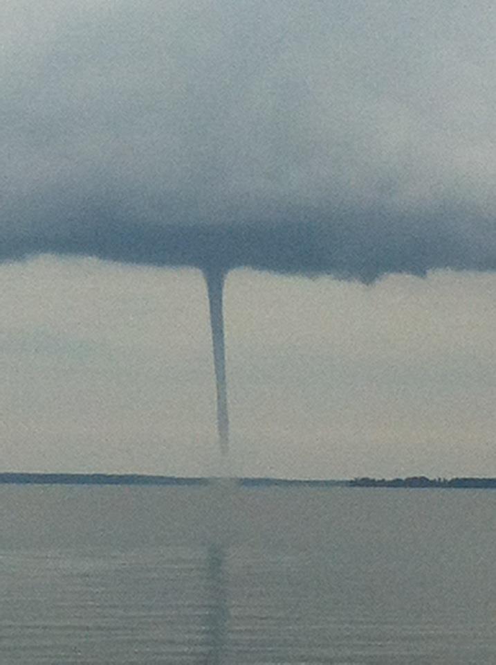
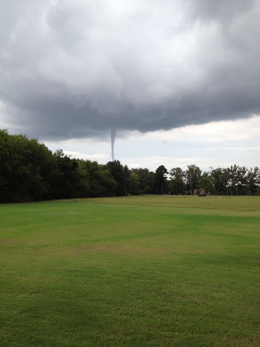
Taken by Lisa Gerard
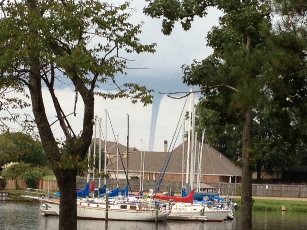
Sent by Twitter user @Ho0psThereItIs
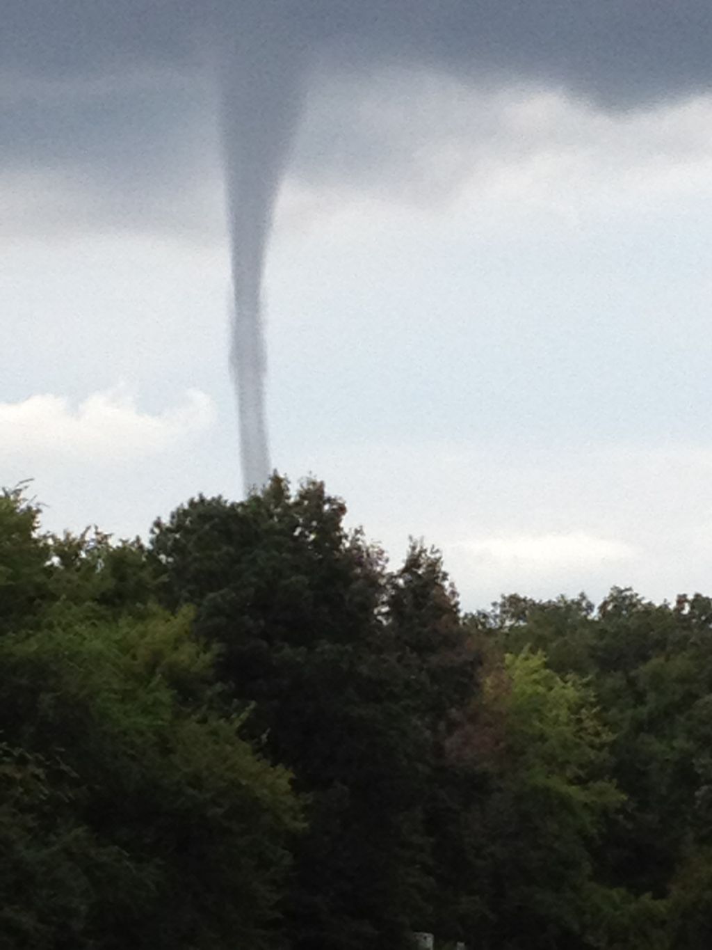
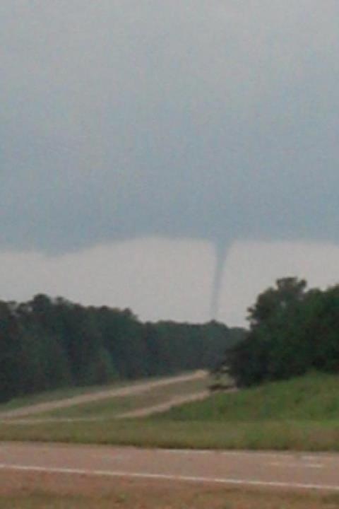
Taken by Christi Lyle, forwarded by Jason Brand
Taken by Christi Lyle, forwarded by Jason Brand
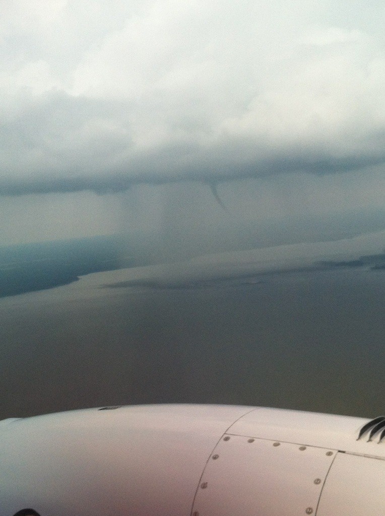
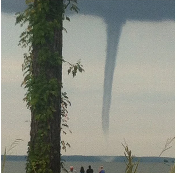
Taken by Tom Mullen, forwarded by Jason Brand
Forwarded by Twitter user @SgtAndyNorris from a friend
Fowarded by Twitter user @MayLowe
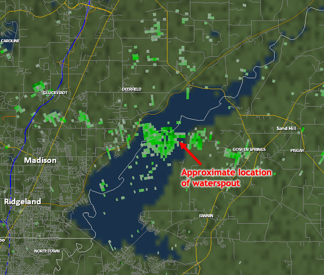
Radar
Here is a radar image of the reservoir area just before the waterspout began. A boundary of weak radar echoes extended from west to east across the area at the time, but no heavy precipitation was occurring in the area.