Jackson, Mississippi
Weather Forecast Office
Bolivar County Tornado
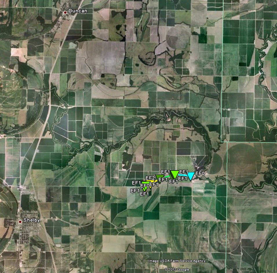
Click on the map above for a detailed, interactive track map and damage pictures.
|
Event Summary Concentrated damage occurred along a short path length northeast of Shelby. One mobile home was destroyed with heavy damage occurring to a few other homes and buildings. A radio tower was snapped and a grain silo destroyed. In addition, several sheds were destroyed and multiple power poles snapped. |
|
US Dept of Commerce
National Oceanic and Atmospheric Administration
National Weather Service
Jackson, Mississippi
234 Weather Service Dr.
Flowood, MS 39232
601-936-2189
Comments? Questions? Please Contact Us.

