 |
A near record-long duration of wet weather brought widespread flooding and two winter storms to the ArkLaMiss during the period from January 6th through January 17th. There were three key ingredients that allowed this very active weather pattern to take shape.
And now here is a more detailed look at the individual winter weather events.
Ice Storm – January 14-16, 2013
A strong cold front brought a shallow and very chilly air mass southward into the ArkLaMiss the night of January 13th. The cold air undercut relatively mild air aloft, thus setting the stage for freezing rain over northwest portions of the ArkLaMiss. A couple of episodes of moderate freezing rain accompanied by thunder occurred in this time frame with temperatures hovering near or just below 32 deg F.
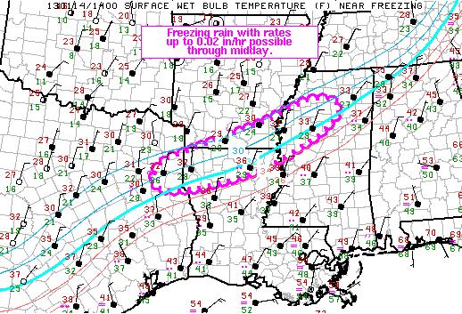
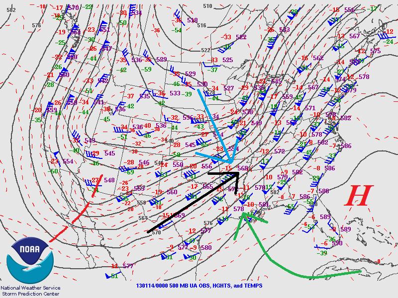
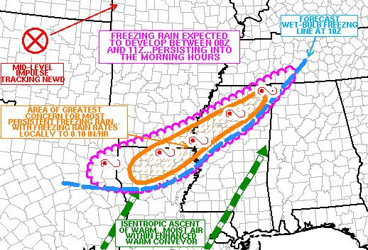
These weather maps from the Storm Prediction Center, analyzed during the ice storm, depict the general set-up and potential area for heavier ice accumulation.
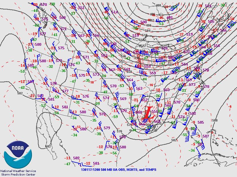
Just as the ice storm was ending in the “Delta” region, an upper level low was moving steadily east toward the region and this ultimately brought the heavy snow that fell over much of the ArkLaMiss.
Heavy Snow – January 17, 2013
The very cold air aloft associated with the upper low made the atmosphere more favorable for snow as we into the early morning hours of Thursday, January 17th. Strong lift caused widespread light to moderate rain to develop during the evening of the 16th as surface temperatures held just above freezing. Late that night rain transitioned briefly to sleet before switching to all snow from west to east. In far eastern portions of Mississippi…rain did not switch to snow until after daybreak.
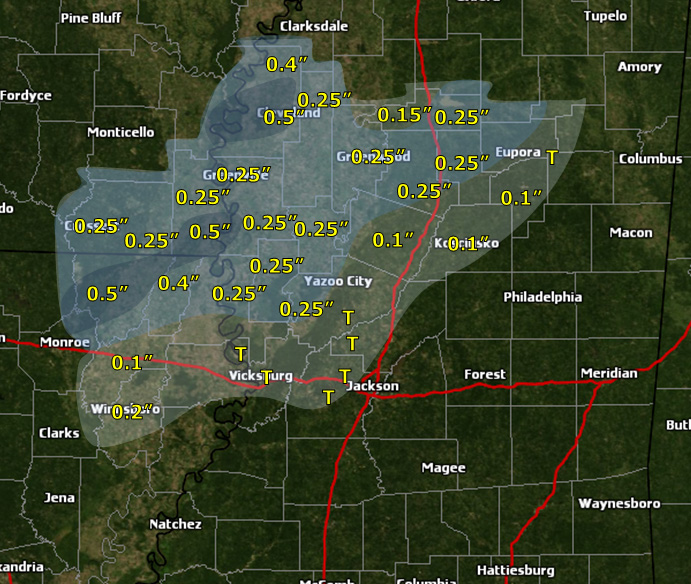
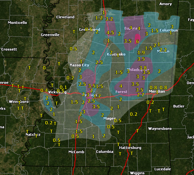
Highest reported ice totals January 14th through the morning of January 16th and snow accumulation totals from the evening of January 16th through January 17th(right). Click to enlarge.
|
Ice Accumulation Map
|
Snow Accumulation Map
|
There were two main bouts of freezing rain causing icing over portions of northeast Louisiana, southeast Arkansas, and northwestern portions of central Mississippi - one during the daytime hours of January 14th and another during the daytime and evening hours of January 15th. In many areas, temperatures remained below freezing during this entire time period, and thus, there was no melting between the two icing events. The above ice accumulation map represents the greatest reported storm total ice accumulation at any given location, which for some locations includes cumulative amounts over the 2 to 3 day period. The greatest accumulation amounts of around or just above 1/2" of ice were in a corridor from near Bastrop, LA to Cleveland, MS. Most icing occurred on elevated surfaces, such as trees and other vegetation, cars, utility lines, and bridges. However, there was also some icing on roadways, causing several traffic accidents.
Snowfall totals were generally around 2-3" from the I-55 corridor between Grenada and Jackson eastward to the Alabama state line. Because of the nature of this system, there were multiple heavier north-to-south oriented snow bands, creating great variations in snow accumulations over short distances. For instance, there were snow accumulation amounts as great as 3.5" along the Pearl River in the Jackson area, while accumulations of as little as 1" were reported just to the west in Raymond and as little as 1.5" just to the east in Goshen Springs. The greatest reported snowfall accumulation in the NWS Jackson forecast area occurred under a heavier snow band over portions of Webster, Choctaw, western Clay, and western Oktibbeha counties. 6 inches of snow was reported just to the east of Ackerman. Conditions along Highway 82 were very treacherous in this area.
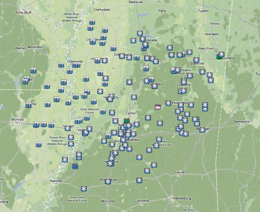
Local Storm Reports of snow and ice received between January 14th and 17th, 2013.