Jackson, Mississippi
Weather Forecast Office
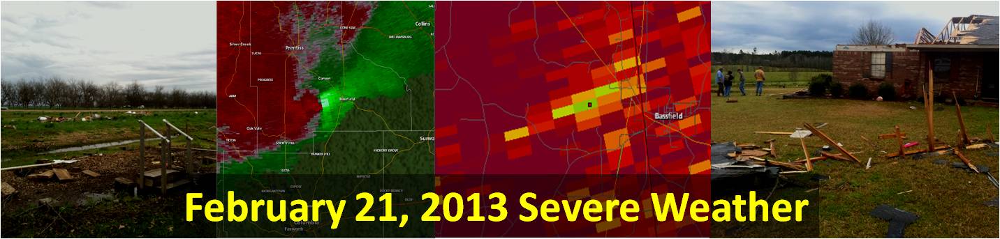
Jefferson Davis County Tornado

Click on map above to see entire event tracks and damage point notation
|
Event Summary The tornado started along Smith Lane just north of Stowey Parkman Road. The tornado moved northeast, snapping and uprooting a number of trees and causing some minor damage to structures as it passed across Wiley Dyess Road and TW Bass Road. The tornado reached its maximum intensity as it moved along and across Green Creek Road and Carson-Bunker Hill Road. Here two well built brick frame homes were heavily damaged, power poles were snapped, a well built farm building was destroyed, another outbuilding was destroyed, extensive tree damage occurred and several other homes and buildings suffered minor to moderate damage. The tornado weakened and crossed Hunnicut Road snapping a few trees where it crossed the road and dissipated before reaching State Highway 42 west of Bassfield. |
|
||||||||||||||
|
|
|||||||||||||||
US Dept of Commerce
National Oceanic and Atmospheric Administration
National Weather Service
Jackson, Mississippi
234 Weather Service Dr.
Flowood, MS 39232
601-936-2189
Comments? Questions? Please Contact Us.

