
Jones County EF-2 Tornado
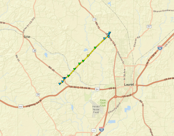
Click on map above to see entire damage point notation and damage pictures at select points.
|
Event Summary
This tornado started along Maxey Rd and tracked northeast for a little over 5 miles. Initially the damage was light with only a tree or two snapped and large limbs broken. As the tornado crossed State Highway 28, the width of the tornado increased as well as the intensity. Here, several large pine trees were uprooted and snapped along with a few portions of wooden fence torn down. Along Gardner Rd, more trees were damaged along with some minor roof damage to some homes. A large barn had most of the roof removed with the tin scattered along the path. Similar tree damage occurred as the tornado crossed Hines Rd, Tim Holifield Rd and Service Rd. The tornado reached peak intensity as it crossed Mullican Rd. Here three homes sustained moderate roof damage with dozens of trees snapped/uprooted. A mobile home at this location was totally destroyed and unrecognizable with the undercarriage thrown a considerable distance. Two fatalities occurred in the mobile home. Next to the mobile home was a small wood frame home on a slab. This structure was removed off the foundation. A large wooden storage shed was totally destroyed as well at this location. Peak winds here were at 125-130 mph (EF2). From this point, the tornado narrowed and weakened as it moved northeast and tracked across Bush Dairy Rd and then State Highway 15 where it eventually lifted.
|
Rating:
(Click for EF Scale) |
EF-2 |
| Estimated Maximum Wind: |
125 mph |
| Fatalities/Injuries: |
2 deaths |
| Damage Path Length: |
5 miles |
| Maximum Path Width: |
350 yards |
| Approximate Start Point/Time: |
5 W Laurel
3:22 pm
|
| Approximate End Point/Time: |
5 N Laurel
3:27
|
|

