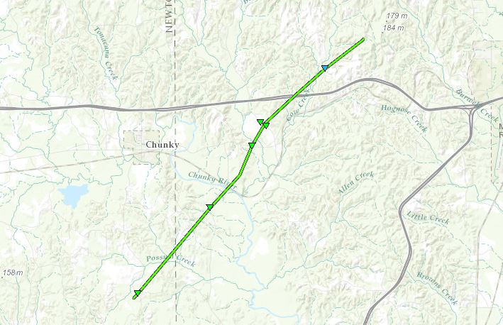
Southeast Newton to Meehan EF-1 Tornado

Click on map above to see entire damage point notation and damage pictures at select points.
Event Summary
The tornado began in southeast Newton County along Griffis Fountain Road, where numerous trees were snapped. It continued northeastward into western Lauderdale County, snapping trees as it crossed Point Wanita Lake Road, the Chunky River, and US Highway 80. It then caused roof damage to a house and damaged an outbuilding as it crossed Suqualena Meehan Road. Additional trees were snapped and uprooted as the tornado crossed I-20, then a few trees were snapped along Suqualena Graham Road shortly before the tornado lifted.
|
Rating:
(Click for EF Scale) |
EF-1 |
Estimated Maximum Wind: |
110 mph |
Fatalities/Injuries: |
none |
Damage Path Length: |
9.9 miles |
Maximum Path Width: |
100 yards |
Approximate Start Point/Time: |
4 S Chunky
3:24 pm
|
Approximate End Point/Time: |
3 WSW Nellieburg
3:36 pm
|
|