
Rose Hill EF-2 Tornado
Click on map above to see entire damage point notation and damage pictures at select points.
|
Event Summary
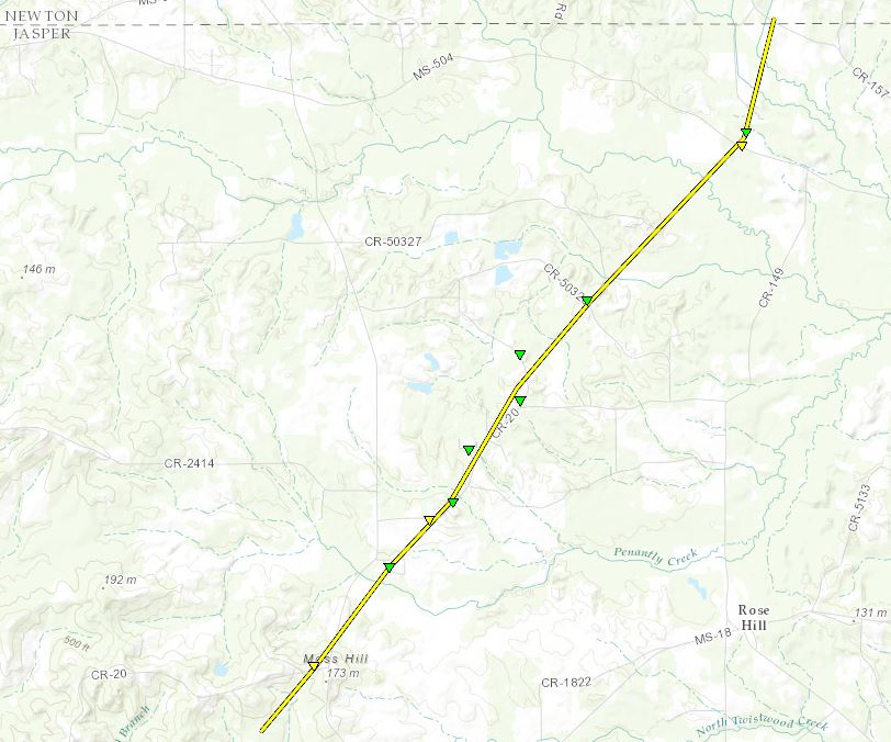
The tornado developed about a half mile southeast of the intersection of MS Highway 503 and County Road 20, quickly strengthening as it moved northeast toward the intersection. The storm was at its strongest at this point, destroying five mobile homes, snapping several utility poles, and causing extensive tree damage. It continued northeast along the east side of Highway 503, downing trees near County Road 50323 and then began to parallel the eastern segment of County Road 20. Along this roadway, much of the roof was removed from a home, several trees were snapped or uprooted and minor damage occurred to another home. The tornado then crossed County Road 2026, where a mobile home was destroyed, and County Road 50325, where more trees were snapped. Farther northeast an outbuilding was destroyed near the intersection of MS Highway 504 and County Road 2420. The tornado damaged utility poles just across the newton county line where it finally lifted. In all ten homes were destroyed along the path of the tornado.
|
Rating:
(Click for EF Scale) |
EF-2 |
| Estimated Maximum Wind: |
130 mph |
| Fatalities/Injuries: |
none |
| Damage Path Length: |
8.1 miles |
| Maximum Path Width: |
200 yards |
| Approximate Start Point/Time: |
5 WSW Rose Hill
3:04 pm
|
| Approximate End Point/Time: |
6 N Rose Hill
3:17 pm
|
|

