August 30, 2017 'Harvey' Tornadoes
Tornado Track Map
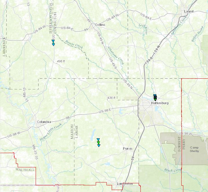
Local Storm Reports
Click on the map for additional details.

Click on the location in the table for additional maps and details below.
| Location | Start/ End Time |
Event Type | Fatalities/ Injuries |
Path Length | Path Width |
| Lamar County 7 W Purvis to 8 WNW Purvis |
10:04 AM - 10:07 AM |
EF-1 Tornado 105 mph |
none | 1.71 miles | 100 yards |
| Forrest County 1 W Petal to 2 NW Petal |
11:41 AM - 11:45 AM |
EF-1 Tornado 90 mph |
none | 1.26 miles | 160 yards |
| Jefferson Davis County 5 N Bassfield to 6 N Bassfield |
12:35 PM - 12:37 PM |
EF-0 Tornado 80 mph |
none | 1.08 miles | 50 yards |
Central Lamar County EF-1 Tornado
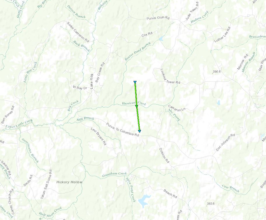
Click on map above to see entire damage point notation and damage pictures at select points.
|
Track Summary This tornado touched down in a wooded area just north of Purvis to Columbia Road, near the intersection of B Young Road. The tornado tracked through an area with fairly young, long leaf pines (10-20ft tall) and managed to uproot/snap several near the trail where the property was accessed. As the tornado crossed the transmission line clearing, several more trees were damaged along with a V based truss tower taken down. Information from the power crew engineers noted that these sort of V truss towers are rated for 100 mph winds. The collapse of this tower, with 100 mph winds, was supported by similar tree damage in and around that location. A TDS from both KLIX/KDGX was noted with a well defined signature. Of note, the presence of the clear TDS seemed to be aided by the tornado traveling through the long leaf pine forest and those extra long needles offering a larger variety of oddly shaped targets for the CC product to indicate. |
|
Radar Imagery
These images from the Slidell, LA Doppler radar show the storm at 10:05 am shortly after the tornado began. The image on the left shows 0.5° base reflectivity data, and the image on the right shows 0.5° storm relative velocity data. Click on the thumbnail below for a higher resolution image.

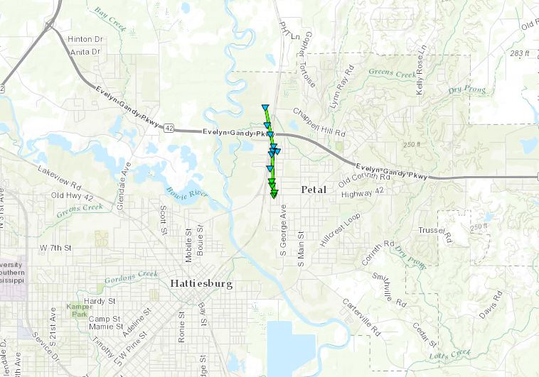
Click on map above to see entire damage point notation and damage pictures at select points.
|
Track Summary |
|
Radar Imagery
These images from the Brandon, MS Doppler radar show the storm at 11:44 am as the tornado tracked near Petal. The image on the left shows 0.5° base reflectivity data, and the image on the right shows 0.5° storm relative velocity data. Click on the thumbnail below for a higher resolution image.

Jefferson Davis County EF-0 Tornado
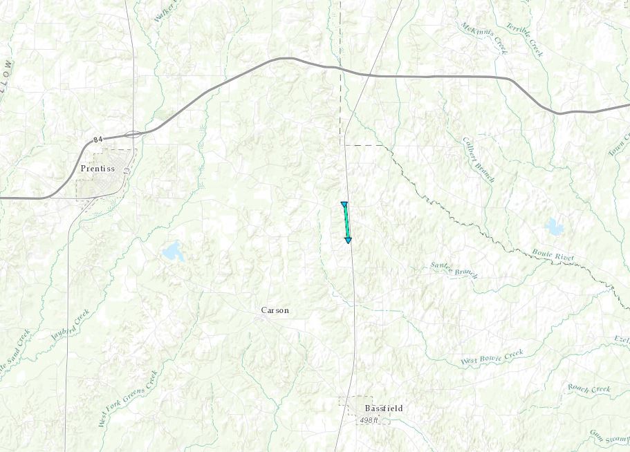
Click on map above to see entire damage point notation and damage pictures at select points.
|
Track Summary This brief tornado touched down at Williams Ln, just off Highway 35, and tracked north for about 1 mile. At Williams Ln, a large tree was blown down onto a truck, the tree was laid to the west. Other large limbs and tree debris was also blown down here and laid to the west. The tornado broke off several limbs a Granby Road where it then dissipated. Maximum winds were around 80 mph. |
|
Radar Imagery
These images from the Brandon, MS Doppler radar show the storm at 12:36 pm as the tornado tracked north of Bassfield. The image on the left shows 0.5° base reflectivity data, and the image on the right shows 0.5° storm relative velocity data. Click on the thumbnail below for a higher resolution image.


