
Additional rounds of thunderstorms are expected Thursday and Thursday night across Oklahoma and north Texas, with risks for both large hail and flash flooding. Strong winds may accompany any storms from east Texas northeast through the lower Great Lakes. Read More >
Last Map Update: Wed, Apr 30, 2025 at 10:18:16 pm PDT

|
Text Product Selector (Selected product opens in current window)
|
|


 Social Media - Click to view more
 Elko Radar
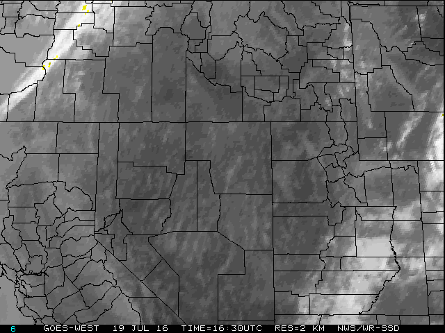 Regional Infrared Satellite Image
 National Weather Map - Click to enlarge
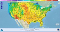 Gridded Forecast Image
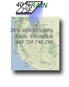 Forecast Weather Tables
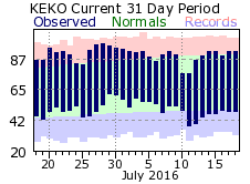 Recent LKN Temperatures
 Satellite-GOES
 Winter Weather