Overview
|
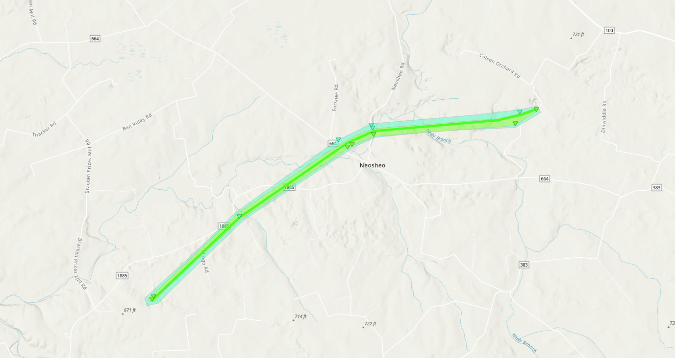
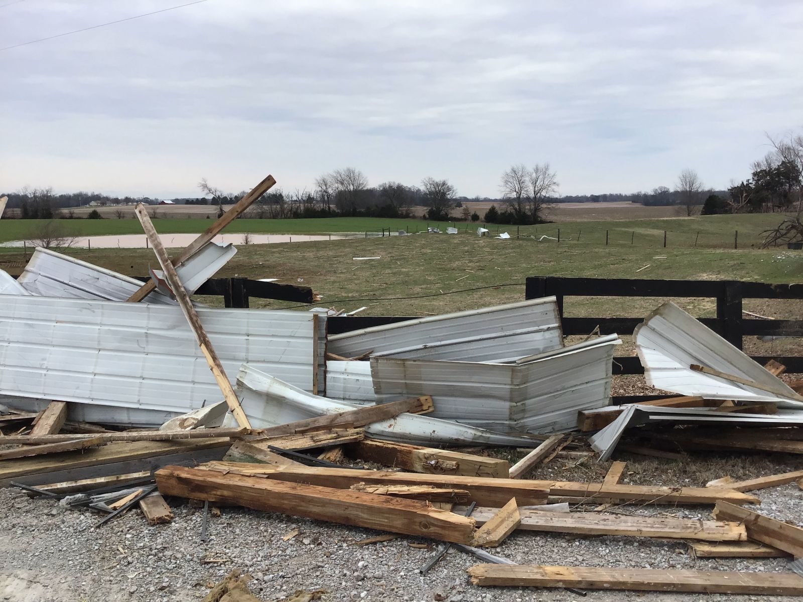
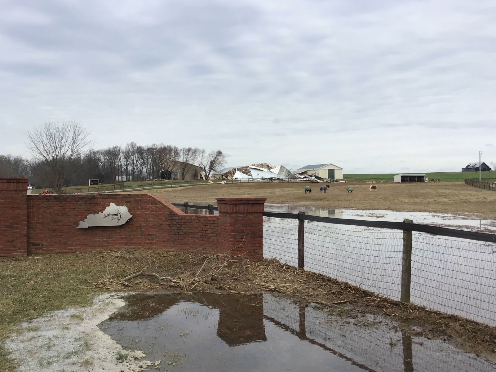
A prolonged period of heavy rain brought widespread flooding to Kentucky during the weekend of February 15th and 16th 2025. Widespread rainfall totals ranging from 2 to 6+ inches occurred, with the highest amounts found from southwest to central portions of the state. There was also a strong bowing line of storms that moved through the southern Kentucky border bringing a tornado to Simpson County. |
 Collapsed Barn |
Tornadoes
|
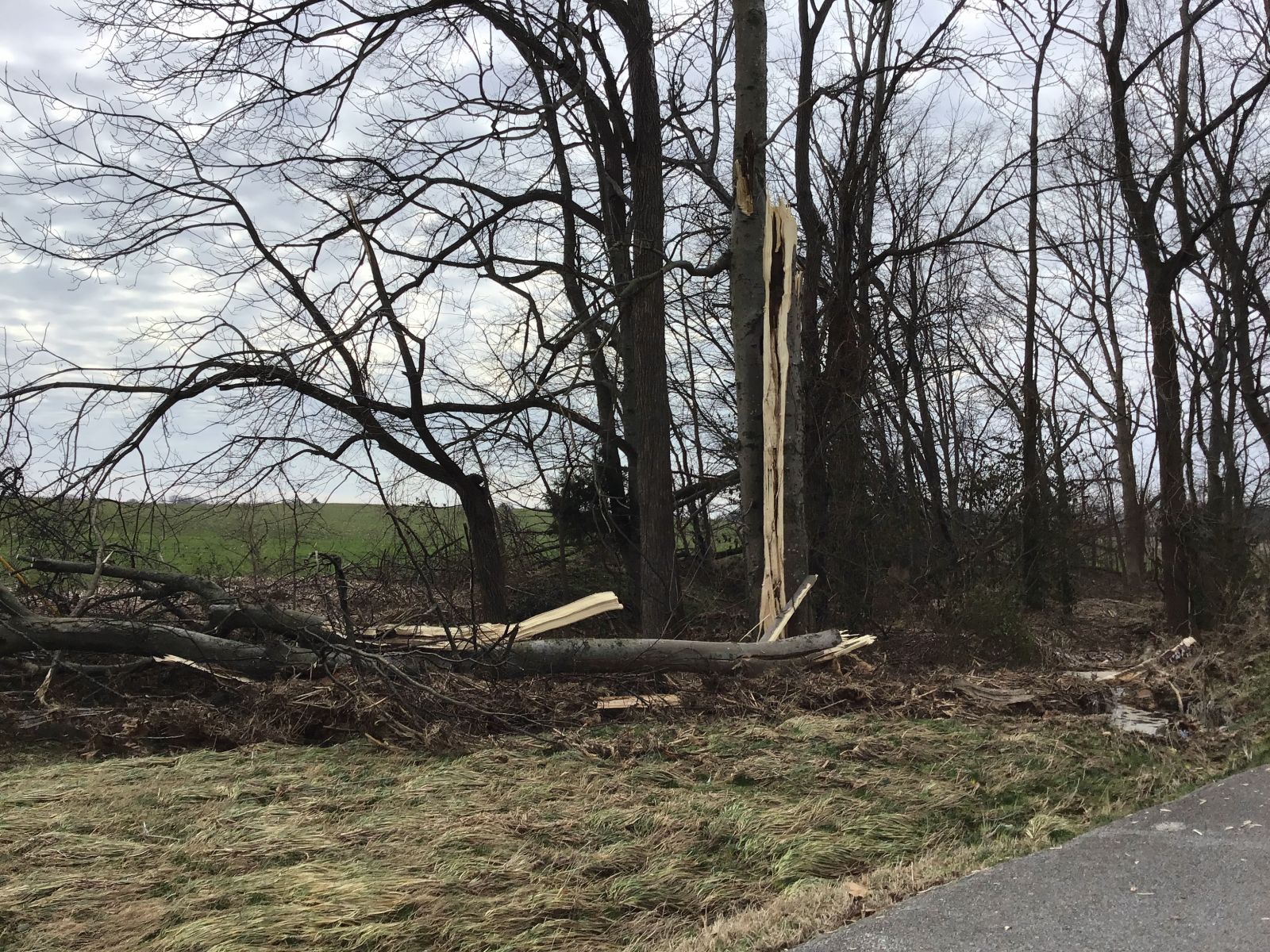
Tornado - Neosheo, KY
|
||||||||||||||||
|
||||||||||||||||
The Enhanced Fujita (EF) Scale classifies tornadoes into the following categories:
| EF0 Weak 65-85 mph |
EF1 Moderate 86-110 mph |
EF2 Significant 111-135 mph |
EF3 Severe 136-165 mph |
EF4 Extreme 166-200 mph |
EF5 Catastrophic 200+ mph |
 |
|||||
Rain Reports
To see the full report on this significant Kentucky Flooding Event, visit this webpage: https://www.weather.gov/lmk/KYFlooding
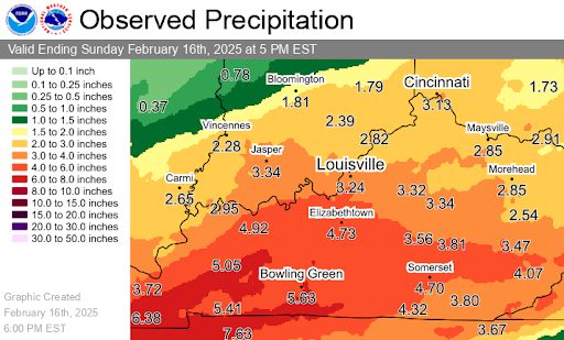 |
| Total Rainfall Map |
 |
Media use of NWS Web News Stories is encouraged! Please acknowledge the NWS as the source of any news information accessed from this site. |
|


 Weather Story
 Weather Map
 Local Radar