Begin Time: 3:38 PM EST
End Time: 3:53 PM EST
Begin Point: 4.5 Miles South Southwest of Hawesville.
End Point: 9.5 miles East of Cloverport.
EF Scale: EF-2
Wind Speed: Maximum 120 MPH
Path Length: 17.4 miles (intermittent touchdowns)
Path Width: Maximum 200 yds
Injuries: 0
Fatalities: 0
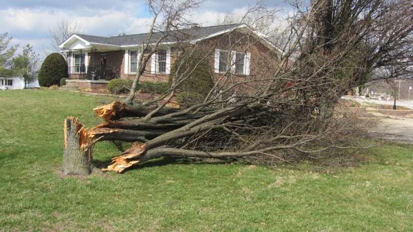
Aerial photos were matched perfectly with radar signatures to determine that the initial start point of the tornado occurred 4.5 miles south southwest of Hawesville in Hancock County along route 2181. Vinyl siding was ripped off a home and small outbuildings were damaged. The tornado continued east across route 69 toward Cloverport, intermittently touching down and doing damage to small outbuildings. 4 miles west of Cloverport, additional minor damage was done to a group of homes along 2169. Minor damage to buildings occurred just on the western outskirts of Cloverport, then the tornado lifted over the town, touching down again less than a mile east of the community, where numerous hardwood trees were observed to be uprooted from aerial photos. All of the damage was consistent with EF-0 wind speeds between 70 and 80 mph.
The National Weather Service would like to thank volunteer general aviation pilots Mark Powers and Josh Kieffer for flying the damage path in N16NA and Austin Lassell for aerial photography. The pilots are associated with the Kentuckiana Volunteer Aviators.
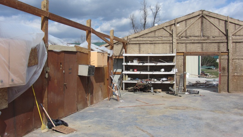
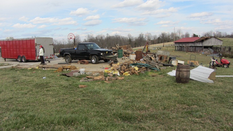
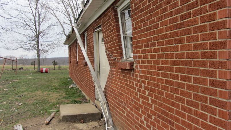
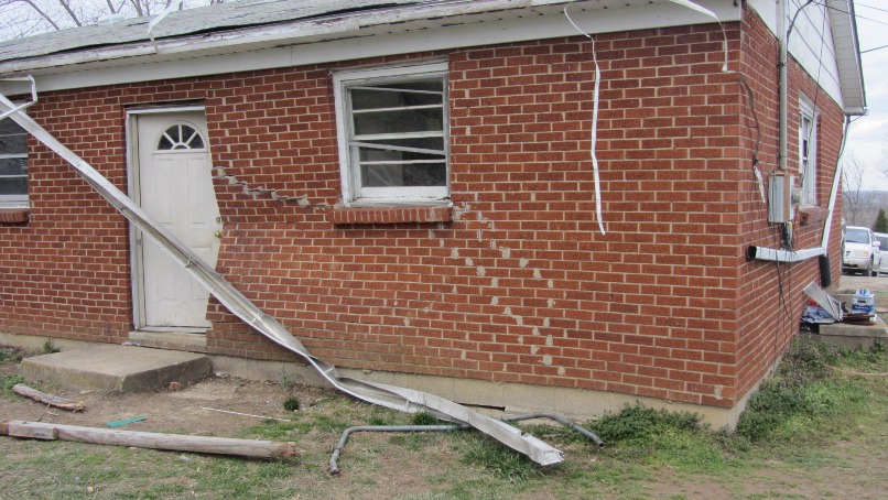
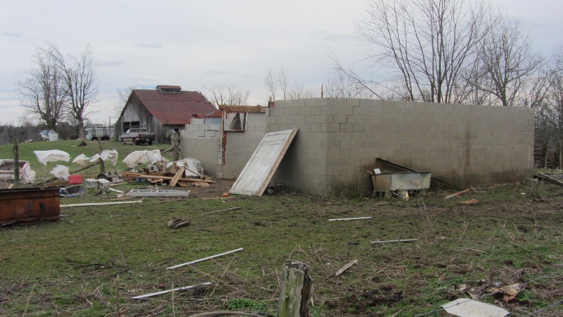
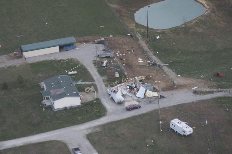
The tornado track continued at a residence on New Bethel Cloverport Rd. where 2 structures were destroyed. This damage is consistent with an EF-2 tornado and 110 to 115 mph winds. The tornado continued east to near B Flood road with additional structural damage consistent with EF-1 damage and 90 mph winds.
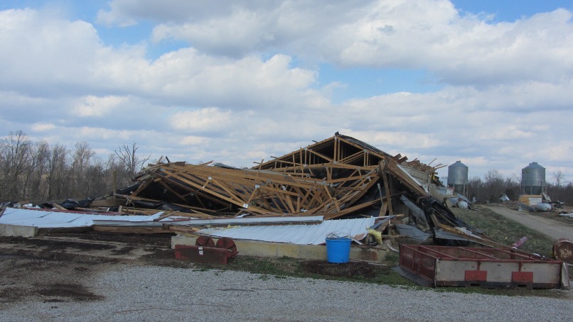
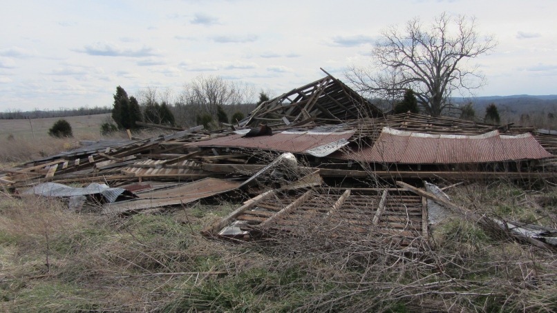
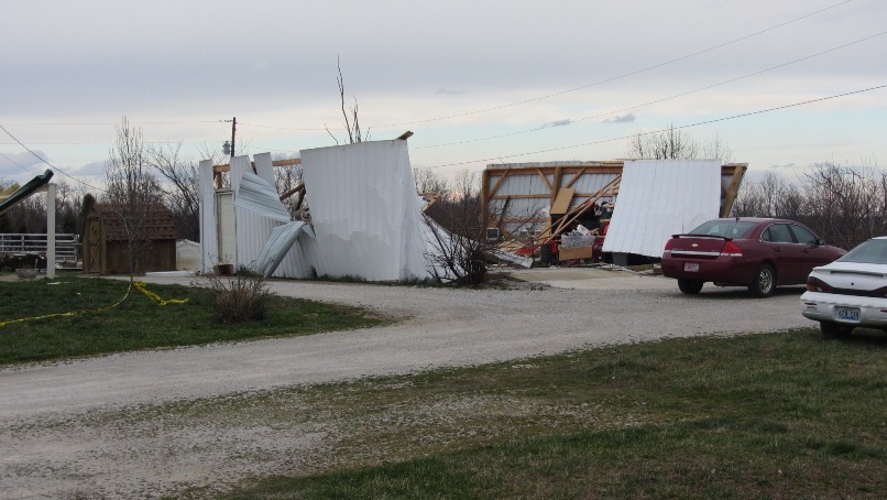
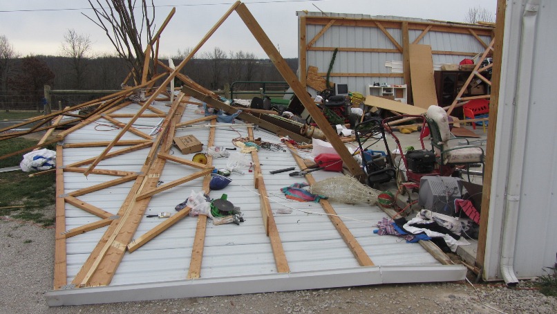
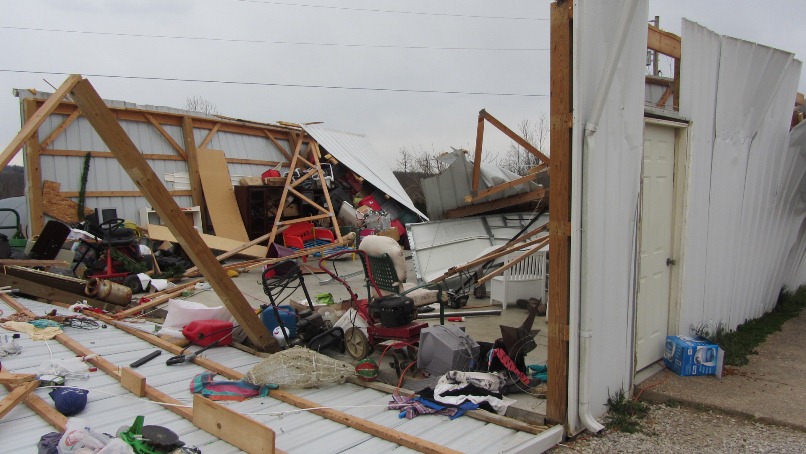
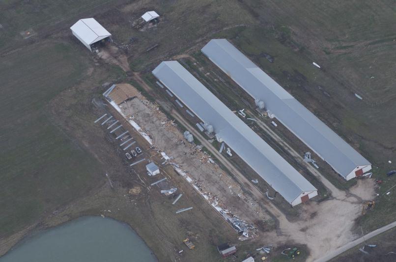
Tree damage continued along the path with additional EF-2 damage occurring at two chicken farms where a 200 yd long chicken barn was destroyed and hundreds of chickens were killed and/or lost. This is consistent with EF-2 damage and 120 mph wind. An additional smaller chicken coop also sustained damage at the end of Silas Miller Road, consistent with EF-1 damage.
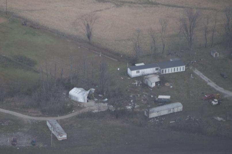
The end of the path was surveyed east at Hwy 259 where another metal structure was damaged and several trees where downed. This damage was consistent with EF-1 damage and 90 mph winds.
Hancock and Breckinridge, KY Photos
 |
 |
 |
 |
 |
 |
 |
 |
 |
 |
 |
 |
 |
 |
|
Hancock and Breckinridge, KY Aerial Photos Courtesy Mark Powers, Josh Kiefer, and Austin Lassell of Kentuckiana Volunteer Aviators
 |
 |
 |
2 miles southwest of Cloverport |


 Weather Story
 Weather Map
 Local Radar