Louisville, KY
Weather Forecast Office
Begin Time: 3:30 PM EST
End Time: 3:36 PM EST
Begin Point: 6 WSW Henryville
End Point: 0.5 E Henryville
Wind Speed: Maximum 110 mph
Injuries: 0
Fatalities: 0
Photographs taken during a Civil Air Patrol flight corroborate interviews with residents along the damage path that there were intermittent touchdowns of a weaker tornado with the second supercell to pass over the area Friday afternoon.
The second storm, which pummeled the recently devastated area with hail up to the size of softballs, followed nearly the same path as the first supercell. At least three locations along the path of this storm support the occurrence of a tornado of EF-1 intensity, with maximum winds approaching 110 mph, an intermittent path length of 6.5 miles, and a damage path width of 60 yards.
The first observed damage was near Round Knob in the Clark State Forest. Damage was again observed along and west of Speith Road, 1/4 of a mile north of Henryville-Blue Lick Road just southwest of Henryville. Finally, the tornado lifted after doing damage from the south side of Henryville near Robyn Avenue to the east side of Henryville at the intersection of Highway 160 and Haddox Road.
|
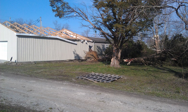
South Ferguson Street, about 600 feet south of the edge of the earlier EF4 tornado. |
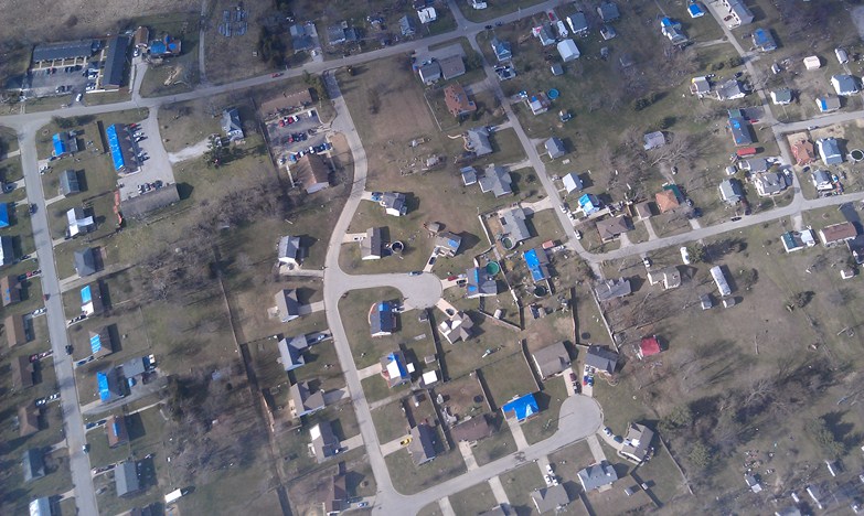
Above the south side of Henryville |
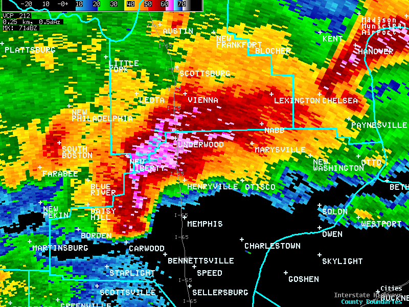
A radar image of the second tornado of the day about to strike Henryville:
Current Hazards
Hazardous Weather Outlook
Storm Prediction Center
Submit a Storm Report
Advisory/Warning Criteria
Radar
Fort Knox
Evansville
Fort Campbell
Nashville
Jackson
Wilmington
Latest Forecasts
El Nino and La Nina
Climate Prediction
Central U.S. Weather Stories
1-Stop Winter Forecast
Aviation
IDSS Forecast Points
Air Quality
Fire Weather
Recreation Forecasts
1-Stop Drought
Event Ready
1-Stop Severe Forecast
Past Weather
Climate Graphs
1-Stop Climate
CoCoRaHS
Local Climate Pages
Tornado History
Past Derby/Oaks/Thunder Weather
Football Weather
Local Information
About the NWS
Forecast Discussion
Items of Interest
Spotter Training
Regional Weather Map
Decision Support Page
Text Products
Science and Technology
Outreach
LMK Warning Area
About Our Office
Station History
Hazardous Weather Outlook
Local Climate Page
Tornado Machine Plans
Weather Enterprise Resources
US Dept of Commerce
National Oceanic and Atmospheric Administration
National Weather Service
Louisville, KY
6201 Theiler Lane
Louisville, KY 40229-1476
502-969-8842
Comments? Questions? Please Contact Us.


 Weather Story
 Weather Map
 Local Radar