Overview
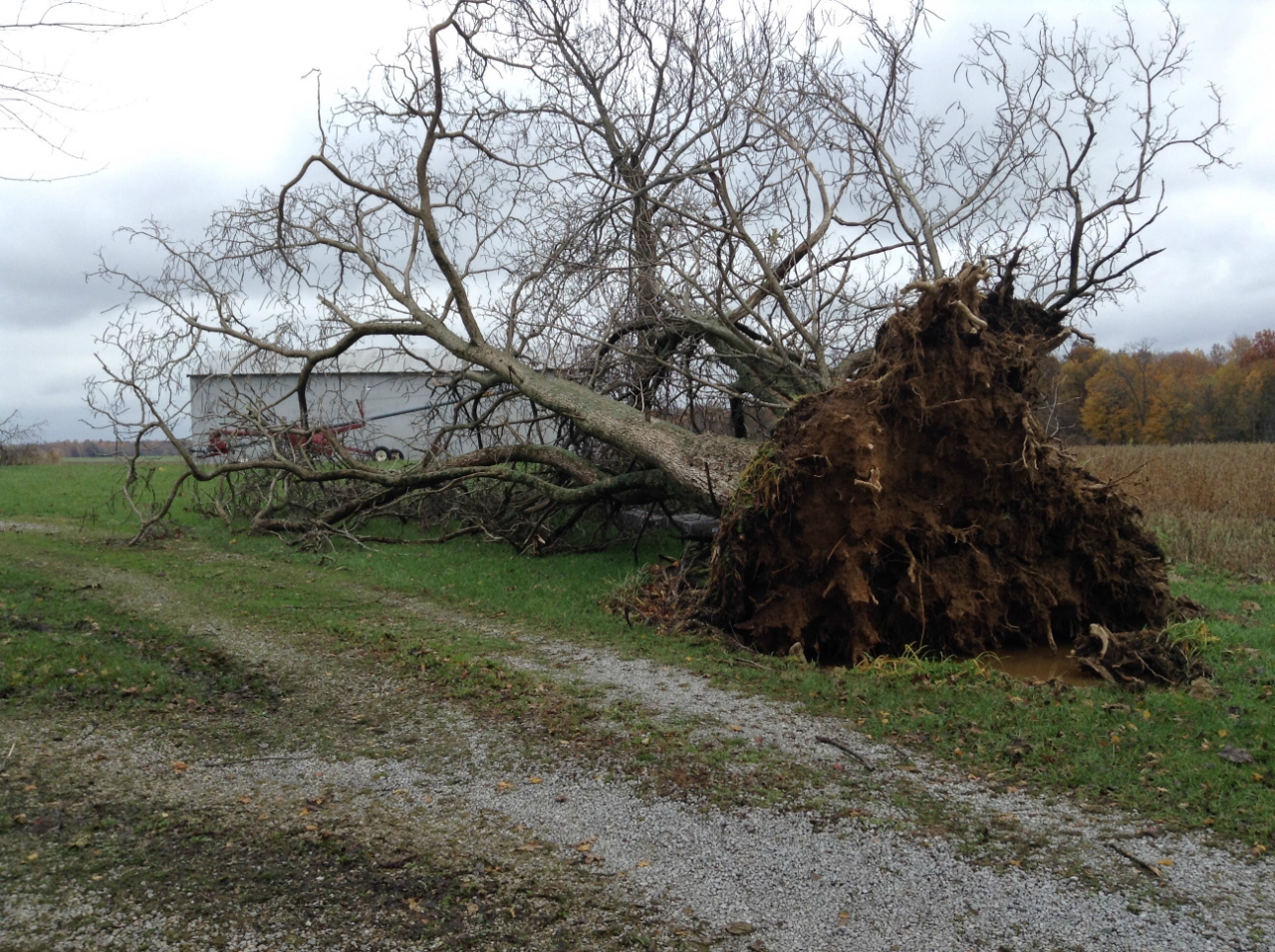
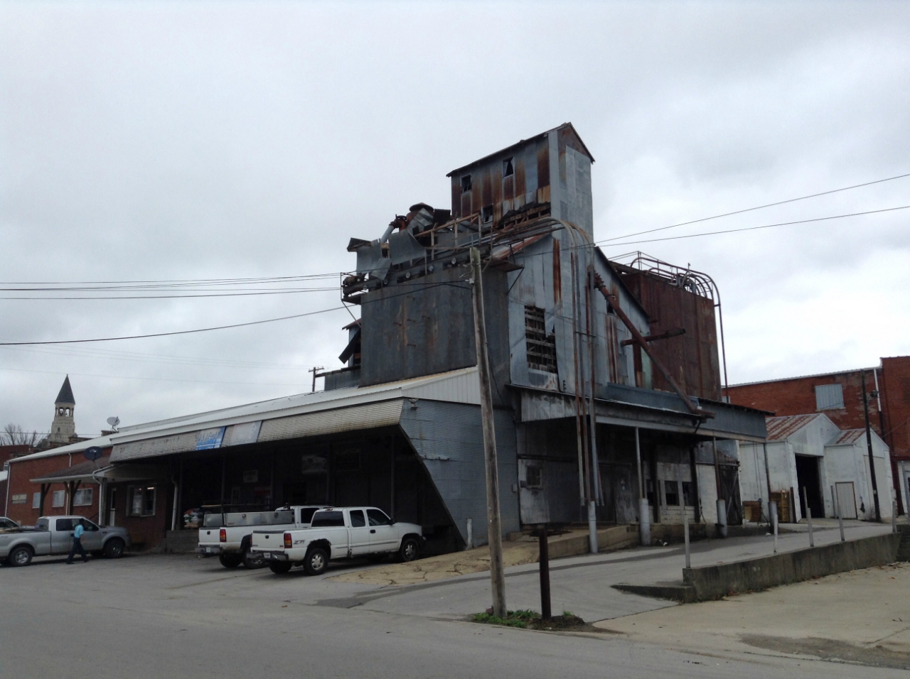
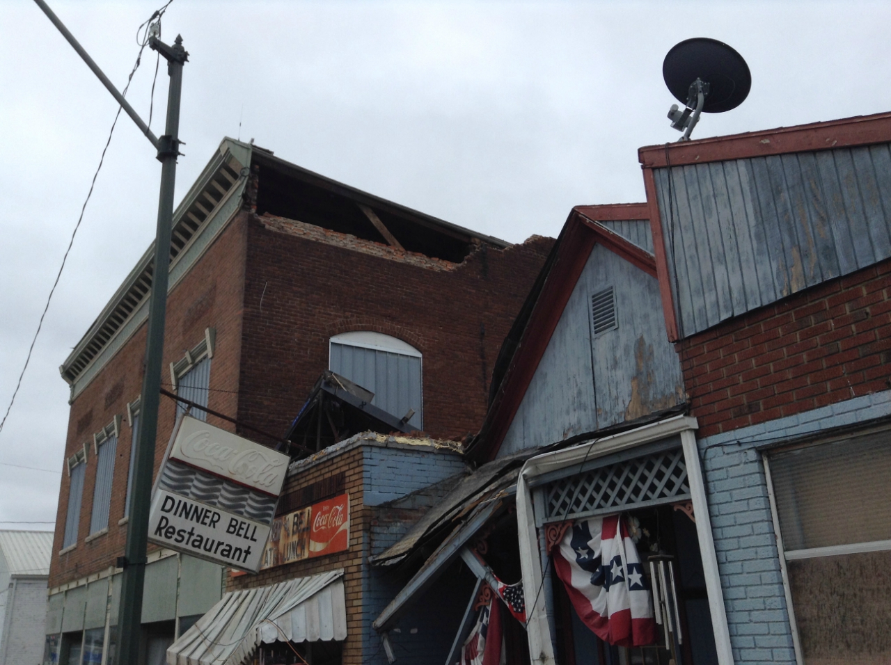
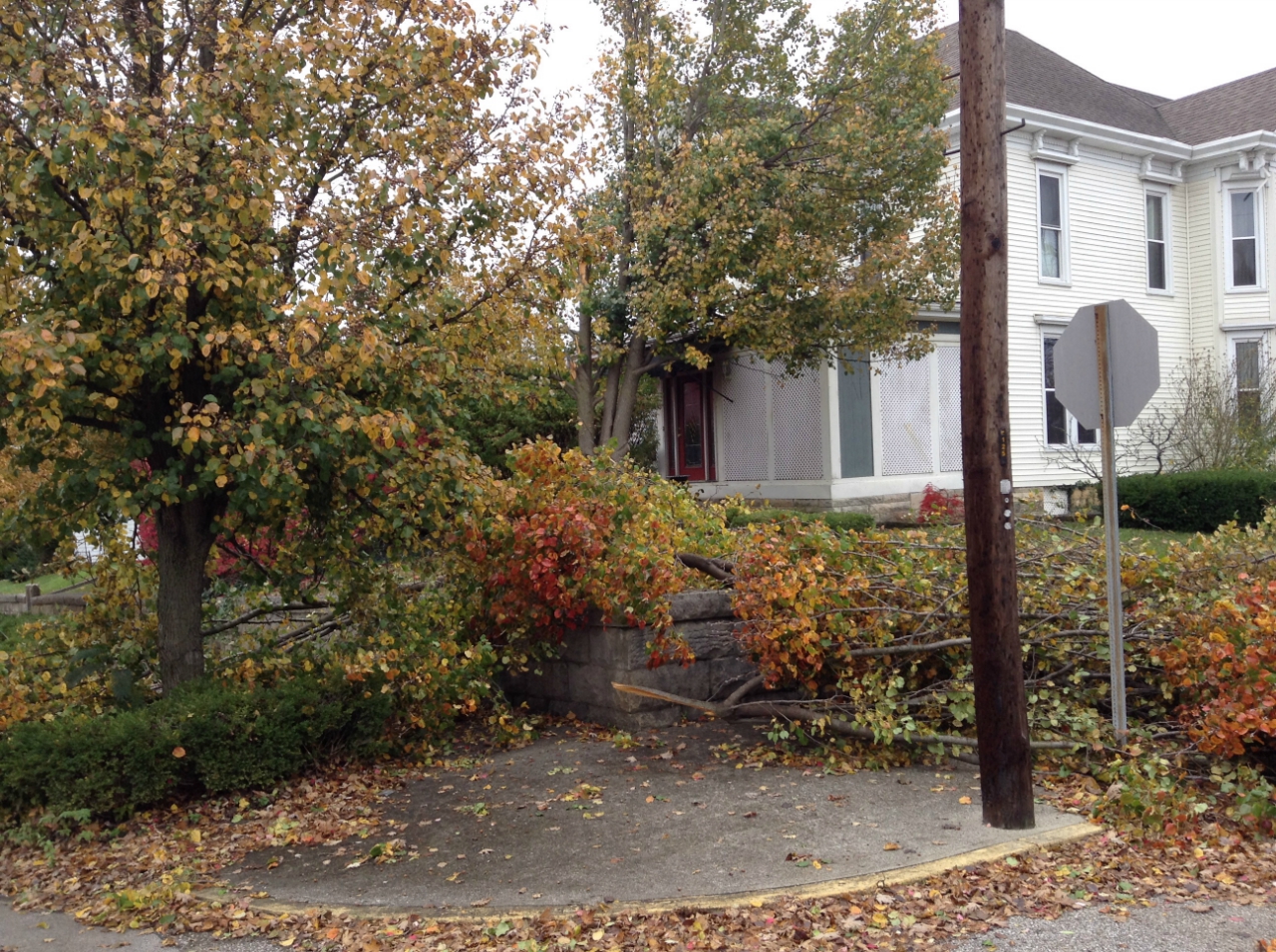
3 Tornadoes were confirmed in Washington County, IN from storms on 11/05/17. All storm surveys are complete.
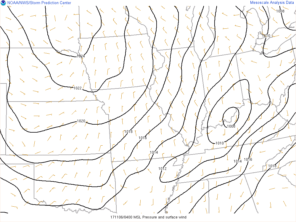
A strong cold front moved through the area overnight from November 5-6. Ahead of this front strong storms moved into southern Indiana resulting in 3 tornadoes in Washington County, IN. In addition to the tornadoes, strong winds aloft were able to mix down to the surface across central Kentucky. A broad swath of 40-55 mph winds resulted in numerous power outages across the region.
|
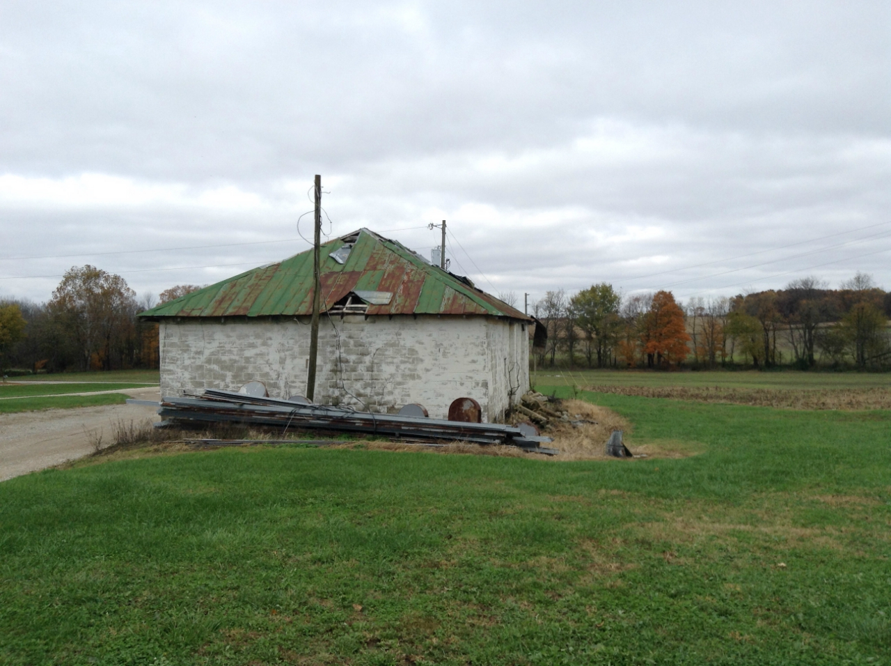
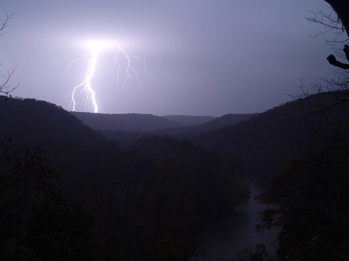
Credit: Bobby Carson |
Tornadoes:
|
|
||||||||||
|
||||||||||
|
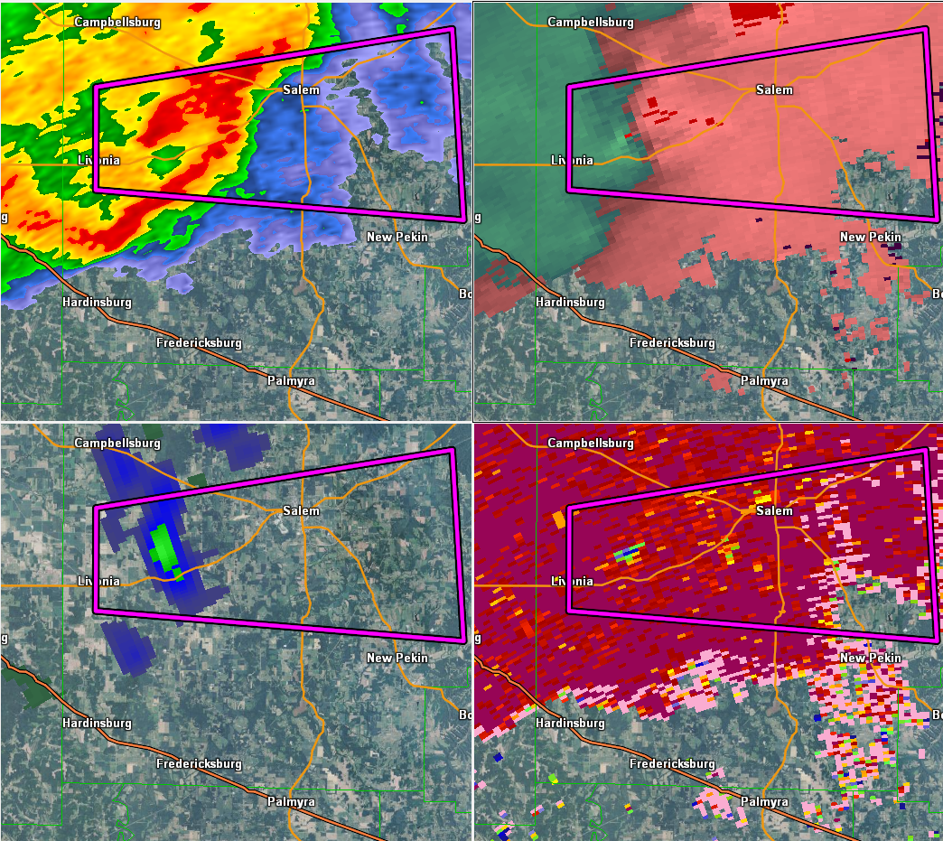
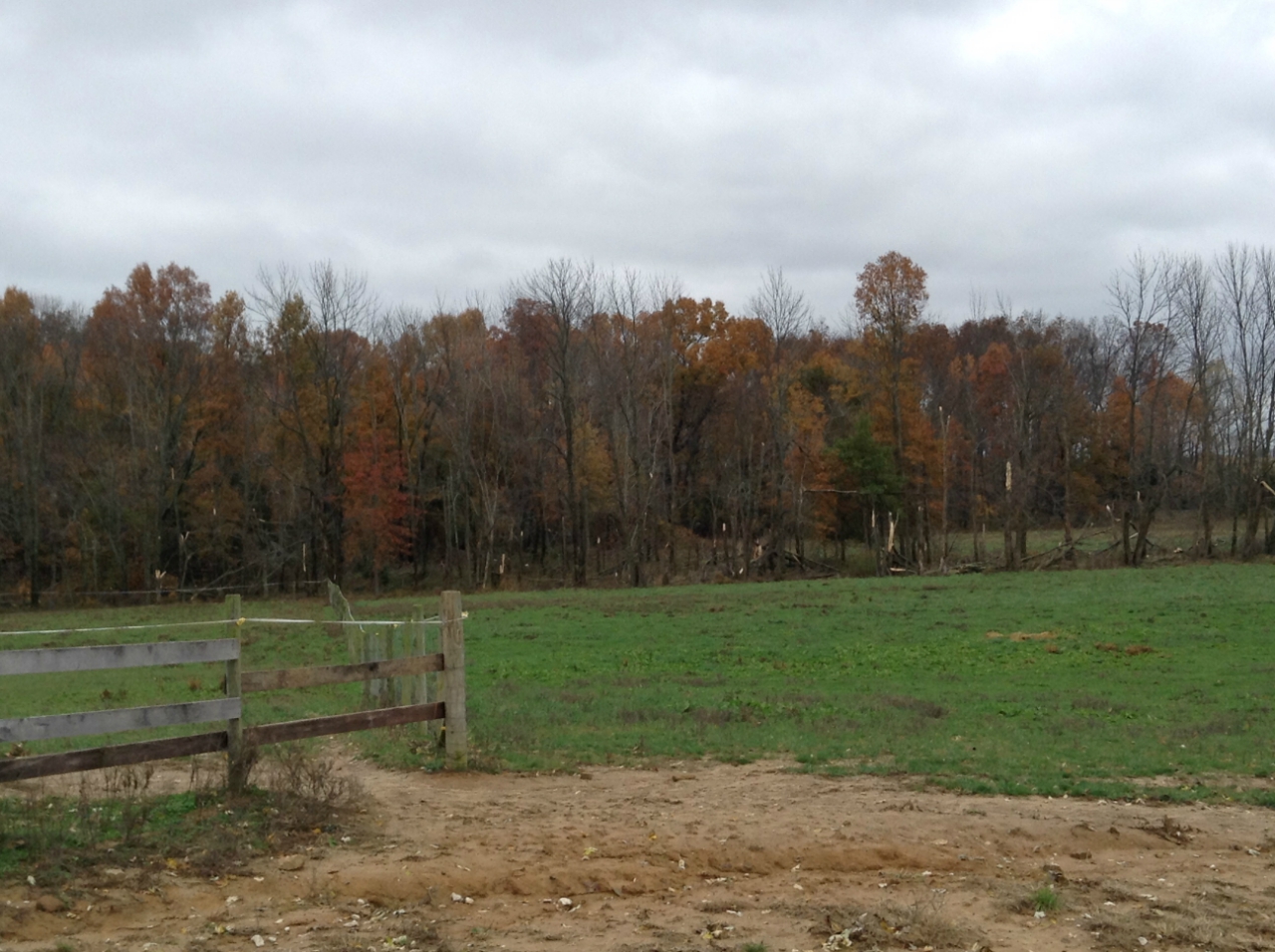
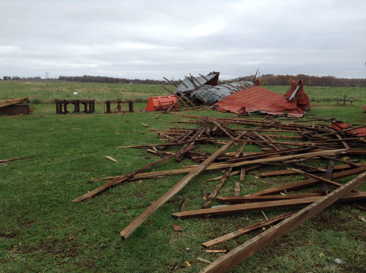
Tornado - 7 W Salem, IN
Track Map 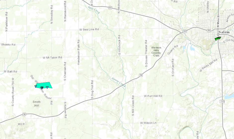 
|
||||||||||||||||
|
||||||||||||||||
|
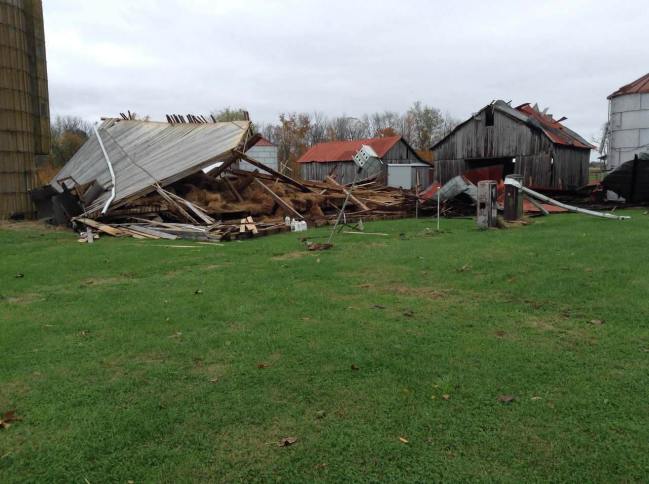
Tornado - Salem, IN
Track Map 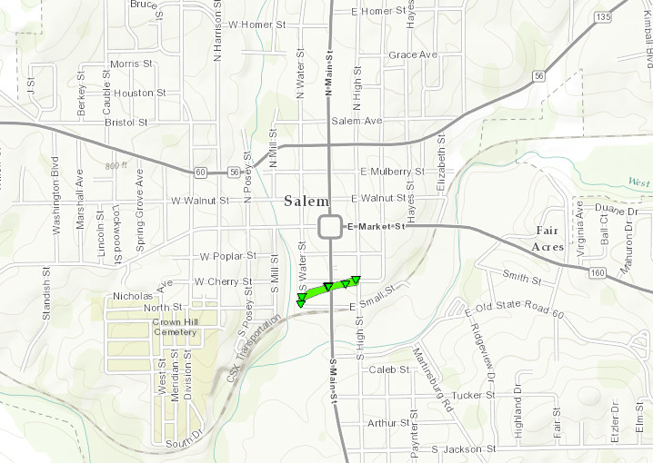
|
||||||||||||||||
|
||||||||||||||||
|
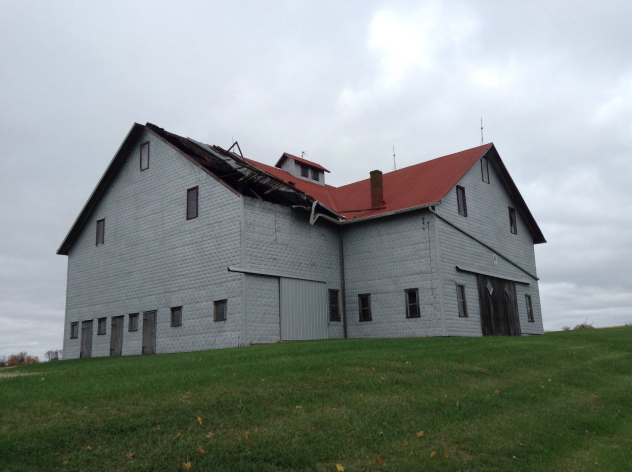
Tornado - 4 E Salem, IN
Track Map 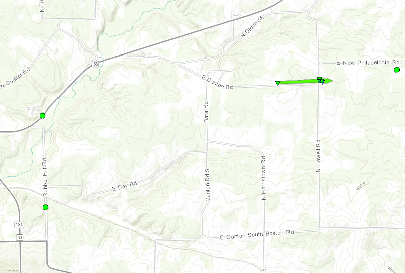
|
||||||||||||||||
|
||||||||||||||||
The Enhanced Fujita (EF) Scale classifies tornadoes into the following categories:
| EF0 Weak 65-85 mph |
EF1 Moderate 86-110 mph |
EF2 Significant 111-135 mph |
EF3 Severe 136-165 mph |
EF4 Extreme 166-200 mph |
EF5 Catastrophic 200+ mph |
 |
|||||
Wind
Stronger winds aloft were able to mix down to the surface outside of the thunderstorms across central Kentucky. A broad swath of 40-55 mph winds were recorded in this region. In addition, some scattered wind damage was noted in addition to the tornadoes in Washington county, IN.
.png) |
 |
 |
|
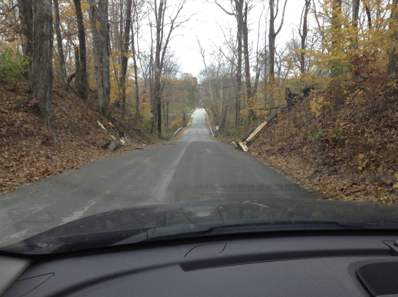
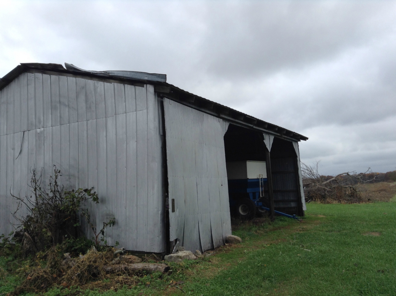
| Highest wind gusts overnight Nov. 5-6. | Tree damage approx. 2 mi. east of Salem. | Roof damage approx. 5 mi. east of Salem. |
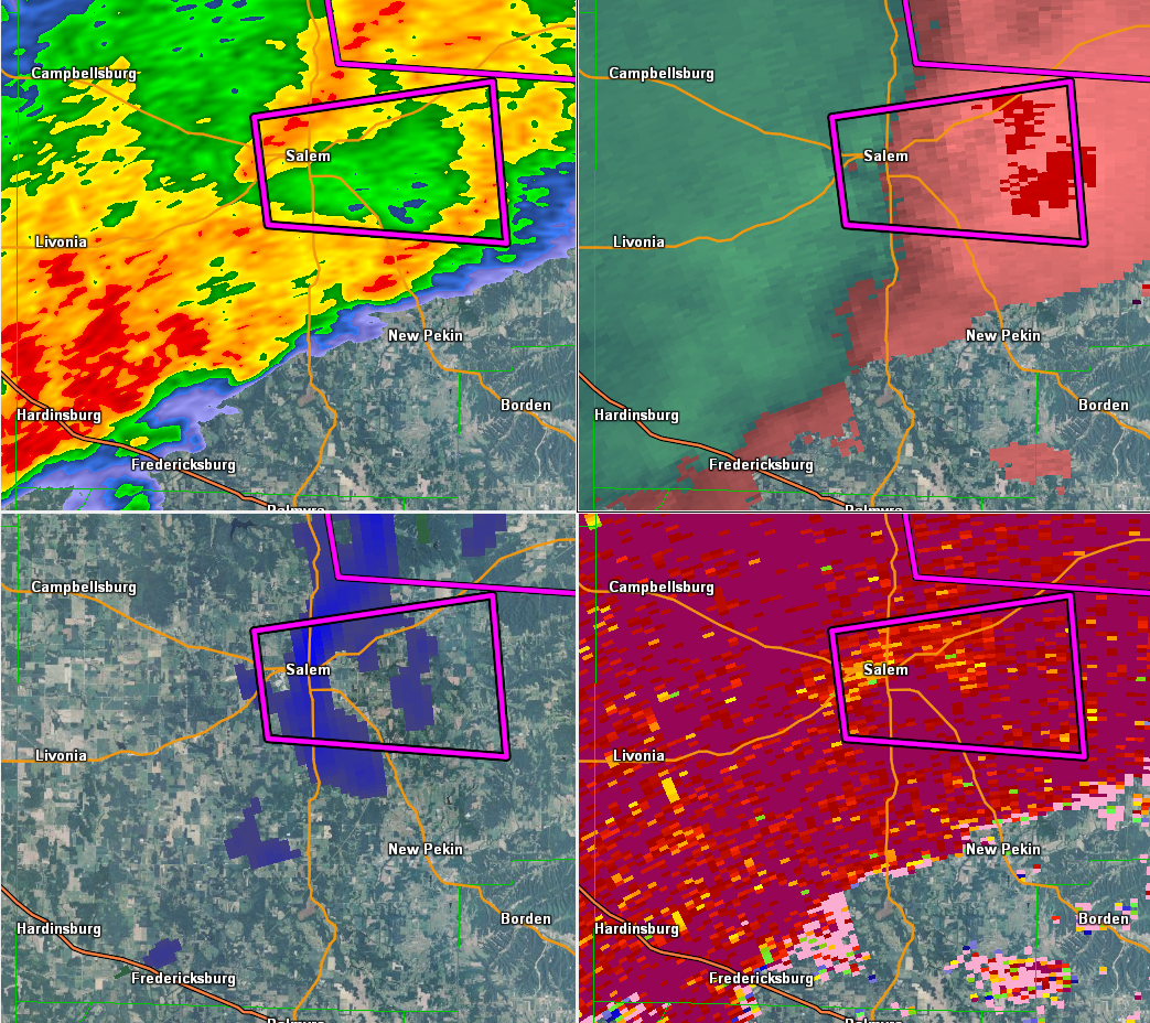
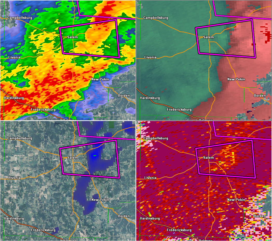
Radar:
Header
 |
 |
 |
|
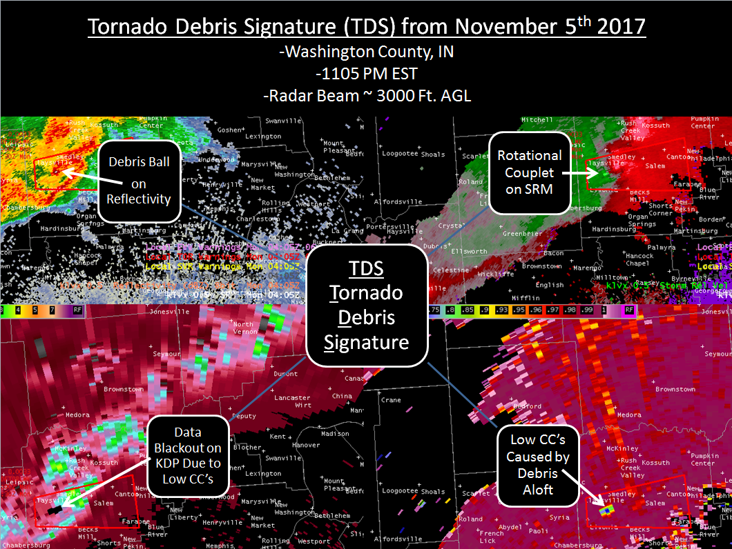
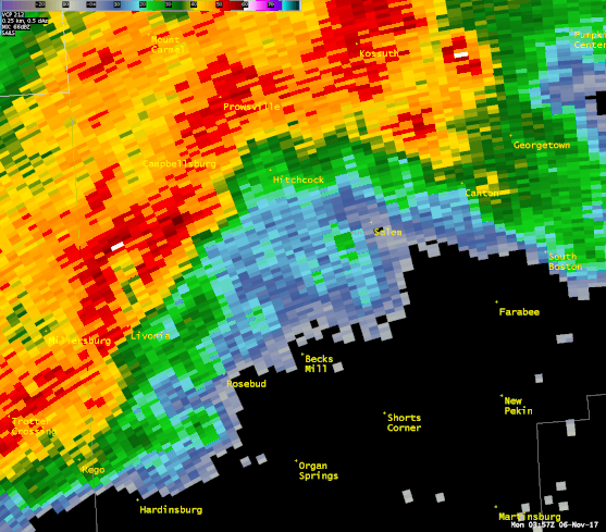
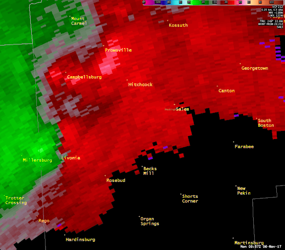
| Tornado Debris Signature in Washington County, IN | Radar reflectivity animation | Storm relative velocity animation |
Environment
 |
 |
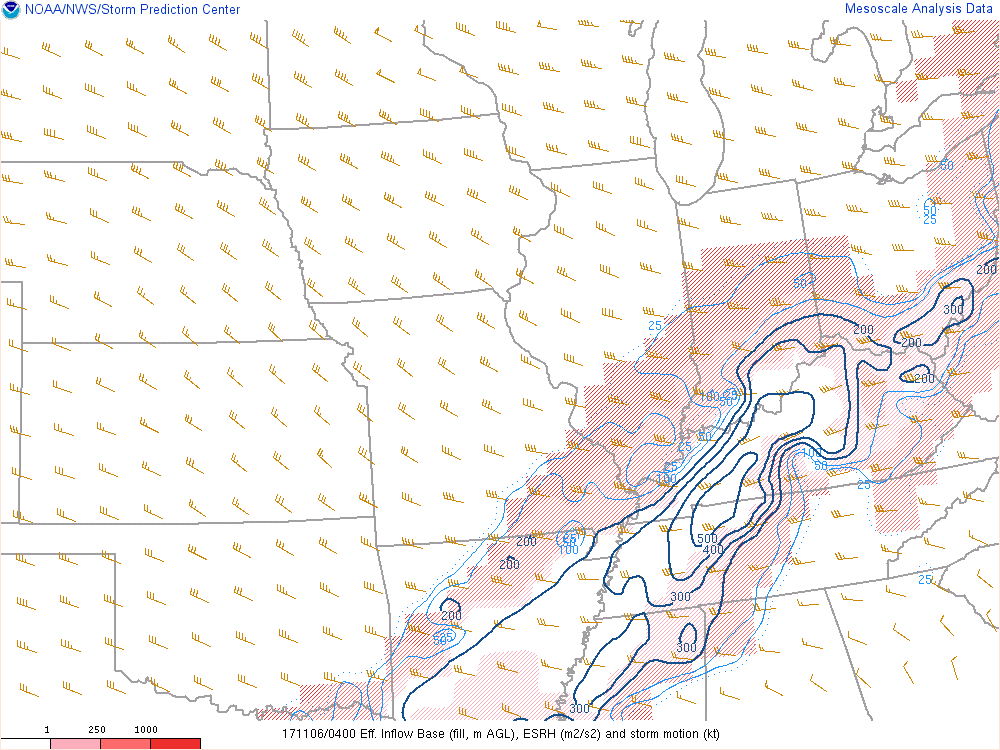 |
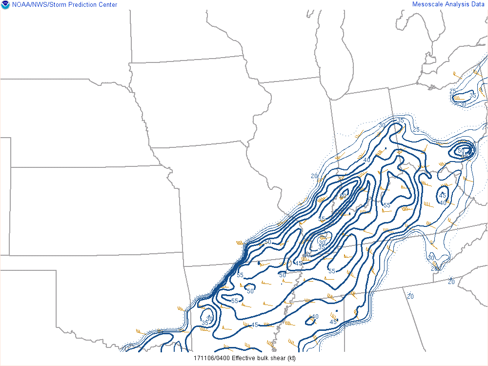
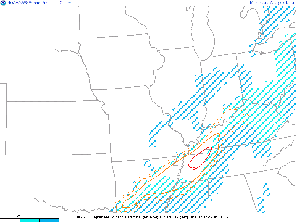
| Figure 1: MSLP at 11pm 11/5 | Figure 2: Effective Bulk Shear at 11pm 11/5 | Figure 3: Effective SRH at 11pm 11/5 |
 |
 |
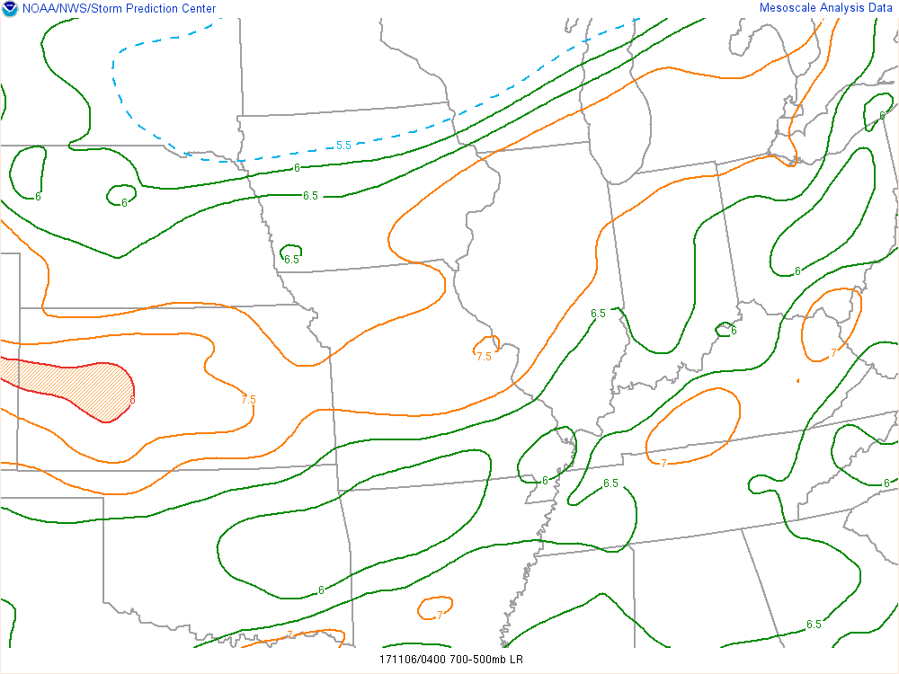 |
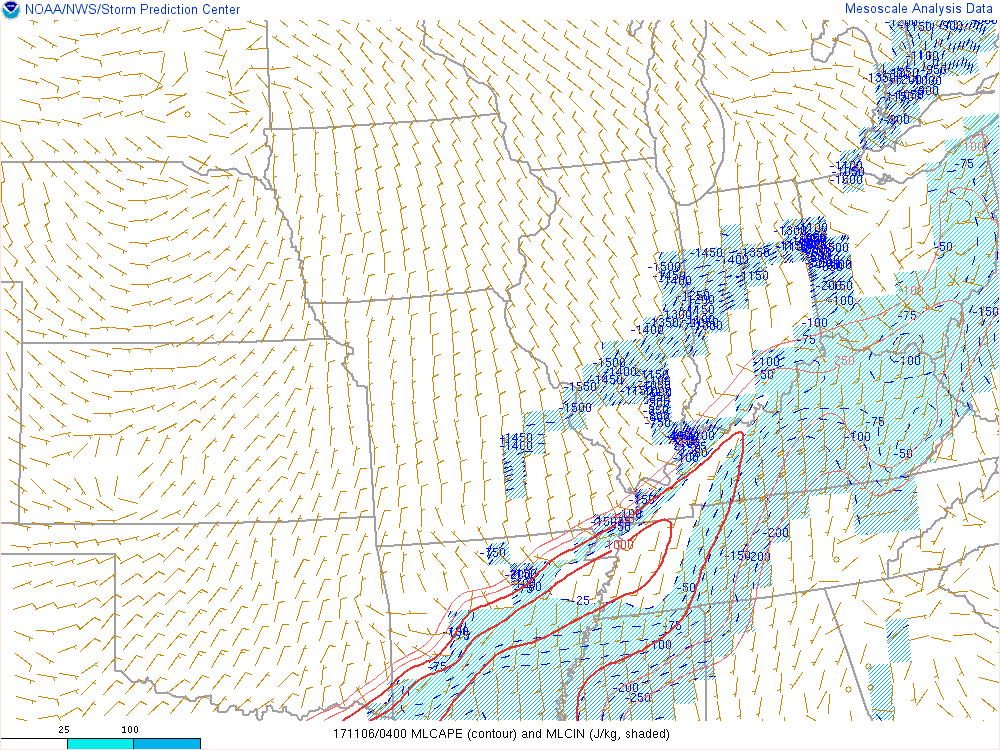
| Figure 4: MLCAPE at 11pm 11/5 | Figure 5: SigTor at 11pm 11/5 | Figure 6: Mid Level Lapse Rates at 11pm 11/5 |
 |
Media use of NWS Web News Stories is encouraged! Please acknowledge the NWS as the source of any news information accessed from this site. |
|


 Weather Story
 Weather Map
 Local Radar